Download tiles to a local tile cache file stored on the device.
Use case
Field workers with limited network connectivity can use exported tiles as a basemap for use offline.
How to use the sample
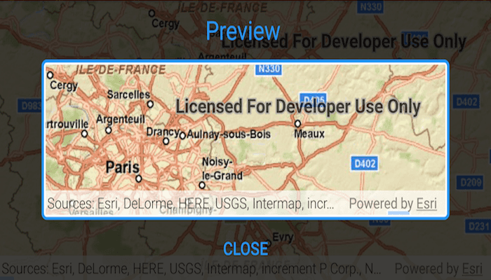
Pan and zoom into the desired area, making sure the area is within the red boundary. Tap the 'Export tiles' button to start the process. On successful completion you will see a preview of the downloaded tile package.
How it works
- Create a map and set its
minScaleto 10,000,000. Limiting the scale in this sample limits the potential size of the selection area, thereby keeping the exported tile package to a reasonable size. - Create an
ExportTileCacheTask, passing in the URI of the tiled layer. - Create default
ExportTileCacheParametersfor the task, specifying extent, minimum scale and maximum scale. - Use the parameters and a path to create an
ExportTileCacheJobfrom the task. - Start the job, and when it completes successfully, get the resulting
TileCache. - Use the tile cache to create an
ArcGISTiledLayer, and display it in the map.
Relevant API
- ArcGISTiledLayer
- ExportTileCacheJob
- ExportTileCacheParameters
- ExportTileCacheTask
- TileCache
Additional information
ArcGIS tiled layers do not support reprojection, query, select, identify, or editing. See the Layer types discussion in the developers guide to learn more about the characteristics of ArcGIS tiled layers.
Tags
cache, download, offline
Sample Code
MainActivity.java
/* Copyright 2017 Esri
*
* Licensed under the Apache License, Version 2.0 (the "License");
* you may not use this file except in compliance with the License.
* You may obtain a copy of the License at
*
* http://www.apache.org/licenses/LICENSE-2.0
*
* Unless required by applicable law or agreed to in writing, software
* distributed under the License is distributed on an "AS IS" BASIS,
* WITHOUT WARRANTIES OR CONDITIONS OF ANY KIND, either express or implied.
* See the License for the specific language governing permissions and
* limitations under the License.
*
*/
package com.esri.arcgisruntime.sample.exporttiles;
import java.util.concurrent.ExecutionException;
import android.app.ProgressDialog;
import android.content.DialogInterface;
import android.os.Bundle;
import android.util.Log;
import android.view.View;
import android.widget.Button;
import android.widget.Toast;
import androidx.appcompat.app.AppCompatActivity;
import androidx.constraintlayout.widget.ConstraintLayout;
import com.esri.arcgisruntime.ArcGISRuntimeEnvironment;
import com.esri.arcgisruntime.concurrent.ListenableFuture;
import com.esri.arcgisruntime.data.TileCache;
import com.esri.arcgisruntime.geometry.Envelope;
import com.esri.arcgisruntime.geometry.Point;
import com.esri.arcgisruntime.layers.ArcGISTiledLayer;
import com.esri.arcgisruntime.mapping.ArcGISMap;
import com.esri.arcgisruntime.mapping.Basemap;
import com.esri.arcgisruntime.mapping.BasemapStyle;
import com.esri.arcgisruntime.mapping.Viewpoint;
import com.esri.arcgisruntime.mapping.view.MapView;
import com.esri.arcgisruntime.tasks.tilecache.ExportTileCacheJob;
import com.esri.arcgisruntime.tasks.tilecache.ExportTileCacheParameters;
import com.esri.arcgisruntime.tasks.tilecache.ExportTileCacheTask;
public class MainActivity extends AppCompatActivity {
private final String TAG = MainActivity.class.getSimpleName();
private Button mExportTilesButton;
private ConstraintLayout mTileCachePreviewLayout;
private View mPreviewMask;
private MapView mMapView;
private MapView mTileCachePreview;
private ExportTileCacheJob mExportTileCacheJob;
private ExportTileCacheTask mExportTileCacheTask;
@Override
protected void onCreate(Bundle savedInstanceState) {
super.onCreate(savedInstanceState);
setContentView(R.layout.activity_main);
// get references to ui elements
mTileCachePreviewLayout = findViewById(R.id.mapPreviewLayout);
mPreviewMask = findViewById(R.id.previewMask);
mTileCachePreview = findViewById(R.id.previewMapView);
mMapView = findViewById(R.id.mapView);
// authentication with an API key or named user is required
// to access basemaps and other location services
ArcGISRuntimeEnvironment.setApiKey(BuildConfig.API_KEY);
// set the basemap of the map
ArcGISMap map = new ArcGISMap();
map.setBasemap(new Basemap(BasemapStyle.ARCGIS_IMAGERY));
// set a min scale to avoid instance of downloading a tile cache that is too big
map.setMinScale(10000000);
mMapView.setMap(map);
mMapView.setViewpoint(new Viewpoint(35.0, -117.0, 10000000.0));
mExportTilesButton = findViewById(R.id.exportTilesButton);
mExportTilesButton.setOnClickListener(v -> initiateDownload());
Button previewCloseButton = findViewById(R.id.closeButton);
previewCloseButton.setOnClickListener(v -> clearPreview());
clearPreview();
}
/**
* Uses the current MapView to define an Envelope larger on all sides by one MapView in the relevant dimension.
* ____________________
* | |
* | downloaded |
* | ________ |
* | | | t |
* | | tile | i |
* | |cache | l |
* | |preview e |
* | | View | |
* | -------- |
* | cache area |
* | |
* | |
* --------------------
*
* @return an Envelope three times as high and three times as wide as the main MapView.
*/
private Envelope viewToExtent() {
// upper left corner of the downloaded tile cache area
android.graphics.Point minScreenPoint = new android.graphics.Point(mMapView.getLeft() - mMapView.getWidth(),
mMapView.getTop() - mMapView.getHeight());
// lower right corner of the downloaded tile cache area
android.graphics.Point maxScreenPoint = new android.graphics.Point(minScreenPoint.x + mMapView.getWidth() * 3,
minScreenPoint.y + mMapView.getHeight() * 3);
// convert screen points to map points
Point minPoint = mMapView.screenToLocation(minScreenPoint);
Point maxPoint = mMapView.screenToLocation(maxScreenPoint);
// use the points to define and return an envelope
return new Envelope(minPoint, maxPoint);
}
/**
* Clear preview window.
*/
private void clearPreview() {
// make map preview invisible
mTileCachePreview.getChildAt(0).setVisibility(View.INVISIBLE);
mMapView.bringToFront();
// show red preview mask
mPreviewMask.bringToFront();
mExportTilesButton.setVisibility(View.VISIBLE);
}
/**
* Using scale defined by the main MapView and the TiledLayer and an extent defined by viewToExtent() as parameters,
* downloads a TileCache locally to the device.
*/
private void initiateDownload() {
ArcGISTiledLayer tiledLayer = (ArcGISTiledLayer) mMapView.getMap().getBasemap().getBaseLayers().get(0);
// initialize the export task
mExportTileCacheTask = new ExportTileCacheTask(tiledLayer.getUri());
final ListenableFuture<ExportTileCacheParameters> parametersFuture = mExportTileCacheTask
.createDefaultExportTileCacheParametersAsync(viewToExtent(), mMapView.getMapScale(), mMapView.getMapScale() * 0.1);
parametersFuture.addDoneListener(() -> {
try {
// export tile cache to directory
ExportTileCacheParameters parameters = parametersFuture.get();
mExportTileCacheJob = mExportTileCacheTask
.exportTileCache(parameters, getCacheDir() + "/file.tpkx");
} catch (InterruptedException e) {
Log.e(TAG, "TileCacheParameters interrupted: " + e.getMessage());
} catch (ExecutionException e) {
Log.e(TAG, "Error generating parameters: " + e.getMessage());
}
mExportTileCacheJob.start();
createProgressDialog(mExportTileCacheJob);
mExportTileCacheJob.addJobDoneListener(() -> {
if (mExportTileCacheJob.getResult() != null) {
TileCache exportedTileCacheResult = mExportTileCacheJob.getResult();
showMapPreview(exportedTileCacheResult);
} else {
Log.e(TAG, "Tile cache job result null. File size may be too big.");
Toast.makeText(this,
"Tile cache job result null. File size may be too big. Try zooming in before exporting tiles",
Toast.LENGTH_LONG).show();
}
});
});
}
/**
* Show progress UI elements.
*
* @param exportTileCacheJob used to track progress and cancel when required
*/
private void createProgressDialog(ExportTileCacheJob exportTileCacheJob) {
ProgressDialog progressDialog = new ProgressDialog(this);
progressDialog.setTitle("Export Tile Cache Job");
progressDialog.setProgressStyle(ProgressDialog.STYLE_HORIZONTAL);
progressDialog.setCanceledOnTouchOutside(false);
progressDialog.setButton(DialogInterface.BUTTON_NEGATIVE, "Cancel",
(dialogInterface, i) -> exportTileCacheJob.cancelAsync());
progressDialog.show();
exportTileCacheJob.addProgressChangedListener(() -> progressDialog.setProgress(exportTileCacheJob.getProgress()));
exportTileCacheJob.addJobDoneListener(progressDialog::dismiss);
}
/**
* Show tile cache preview window including MapView.
*
* @param result Takes the TileCache from the ExportTileCacheJob.
*/
private void showMapPreview(TileCache result) {
ArcGISTiledLayer newTiledLayer = new ArcGISTiledLayer(result);
ArcGISMap map = new ArcGISMap(new Basemap(newTiledLayer));
mTileCachePreview.setMap(map);
mTileCachePreview.setViewpoint(mMapView.getCurrentViewpoint(Viewpoint.Type.CENTER_AND_SCALE));
mTileCachePreview.setVisibility(View.VISIBLE);
mTileCachePreviewLayout.bringToFront();
mTileCachePreview.getChildAt(0).setVisibility(View.VISIBLE);
mExportTilesButton.setVisibility(View.GONE);
}
@Override
protected void onPause() {
mMapView.pause();
mTileCachePreview.pause();
super.onPause();
}
@Override
protected void onResume() {
super.onResume();
mMapView.resume();
mTileCachePreview.resume();
}
@Override
protected void onDestroy() {
mMapView.dispose();
mTileCachePreview.dispose();
super.onDestroy();
}
}