Update a feature's location in an online feature service.
Use case
Sometimes users may want to edit features in an online feature service by moving them.
How to use the sample
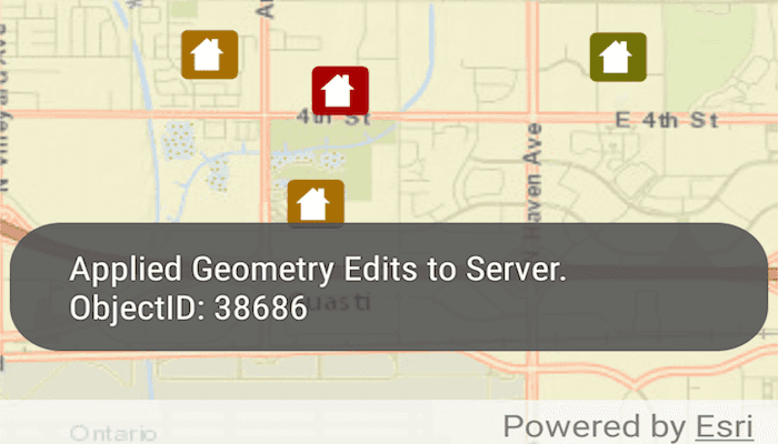
Tap a feature to select it. Tap again to set the updated location for that feature. An alert will be shown confirming success or failure.
How it works
- Create a
ServiceFeatureTableobject from a URL. - Create a
FeatureLayerobject from theServiceFeatureTable. - Identify layers from the feature layer to find features, and select a feature with
selectFeatures(identifiedFeature). - Change the selected feature's location using
identifiedFeature.setGeometry(...). - After the change, update the table on the server using
applyEditsAsync().
Relevant API
- Feature
- FeatureLayer
- ServiceFeatureTable
Tags
editing, feature layer, feature table, moving, service, updating
Sample Code
MainActivity.java
/* Copyright 2016 ESRI
*
* All rights reserved under the copyright laws of the United States
* and applicable international laws, treaties, and conventions.
*
* You may freely redistribute and use this sample code, with or
* without modification, provided you include the original copyright
* notice and use restrictions.
*
* See the Sample code usage restrictions document for further information.
*
*/
package com.esri.arcgisruntime.samples.featurelayerupdategeometry;
import java.util.List;
import java.util.concurrent.ExecutionException;
import android.os.Bundle;
import android.util.Log;
import android.view.MotionEvent;
import android.widget.Toast;
import androidx.appcompat.app.AppCompatActivity;
import com.esri.arcgisruntime.ArcGISRuntimeEnvironment;
import com.esri.arcgisruntime.concurrent.ListenableFuture;
import com.esri.arcgisruntime.data.ArcGISFeature;
import com.esri.arcgisruntime.data.FeatureTableEditResult;
import com.esri.arcgisruntime.data.ServiceFeatureTable;
import com.esri.arcgisruntime.data.ServiceGeodatabase;
import com.esri.arcgisruntime.geometry.GeometryEngine;
import com.esri.arcgisruntime.geometry.Point;
import com.esri.arcgisruntime.layers.FeatureLayer;
import com.esri.arcgisruntime.mapping.ArcGISMap;
import com.esri.arcgisruntime.mapping.BasemapStyle;
import com.esri.arcgisruntime.mapping.GeoElement;
import com.esri.arcgisruntime.mapping.Viewpoint;
import com.esri.arcgisruntime.mapping.view.DefaultMapViewOnTouchListener;
import com.esri.arcgisruntime.mapping.view.IdentifyLayerResult;
import com.esri.arcgisruntime.mapping.view.MapView;
public class MainActivity extends AppCompatActivity {
private static final String TAG = MainActivity.class.getSimpleName();
private MapView mMapView;
private FeatureLayer mFeatureLayer;
private boolean mFeatureSelected = true;
// objects that implement Loadable must be class fields to prevent being garbage collected before loading
private ArcGISFeature mIdentifiedFeature;
@Override
protected void onCreate(Bundle savedInstanceState) {
super.onCreate(savedInstanceState);
setContentView(R.layout.activity_main);
// authentication with an API key or named user is required to access basemaps and other
// location services
ArcGISRuntimeEnvironment.setApiKey(BuildConfig.API_KEY);
// get a reference to the map view
mMapView = findViewById(R.id.mapView);
// create a map with the streets basemap
ArcGISMap map = new ArcGISMap(BasemapStyle.ARCGIS_STREETS);
// set the map to be displayed in the MapView
mMapView.setMap(map);
// set an initial viewpoint
mMapView.setViewpoint(new Viewpoint(34.057386, -117.191455, 100000000));
// create and load the service geodatabase
ServiceGeodatabase serviceGeodatabase = new ServiceGeodatabase(getString(R.string.sample_service_url));
serviceGeodatabase.loadAsync();
serviceGeodatabase.addDoneLoadingListener(() -> {
// create a feature layer using the first layer in the ServiceFeatureTable
ServiceFeatureTable serviceFeatureTable = serviceGeodatabase.getTable(0);
// create a feature layer from table
mFeatureLayer = new FeatureLayer(serviceFeatureTable);
// add the layer to the map
mMapView.getMap().getOperationalLayers().add(mFeatureLayer);
});
Toast.makeText(getApplicationContext(), "Tap on a feature to select it.", Toast.LENGTH_LONG).show();
// set an on touch listener to listen for click events
mMapView.setOnTouchListener(new DefaultMapViewOnTouchListener(this, mMapView) {
@Override
public boolean onSingleTapConfirmed(MotionEvent motionEvent) {
if (mFeatureSelected) {
android.graphics.Point screenCoordinate = new android.graphics.Point(Math.round(motionEvent.getX()),
Math.round(motionEvent.getY()));
double tolerance = 20;
// identify Layers to find features
final ListenableFuture<IdentifyLayerResult> identifyFuture = mMapView
.identifyLayerAsync(mFeatureLayer, screenCoordinate, tolerance, false, 1);
identifyFuture.addDoneListener(() -> {
try {
// call get on the future to get the result
IdentifyLayerResult layerResult = identifyFuture.get();
List<GeoElement> resultGeoElements = layerResult.getElements();
if (!resultGeoElements.isEmpty()) {
if (resultGeoElements.get(0) instanceof ArcGISFeature) {
mIdentifiedFeature = (ArcGISFeature) resultGeoElements.get(0);
// select the identified feature
mFeatureLayer.selectFeature(mIdentifiedFeature);
mFeatureSelected = false;
Toast.makeText(getApplicationContext(), "Feature Selected. Tap on map to update its geometry.",
Toast.LENGTH_LONG).show();
} else {
Toast.makeText(getApplicationContext(), "No Features Selected. Tap on a feature.", Toast.LENGTH_LONG)
.show();
}
}
} catch (InterruptedException | ExecutionException e) {
Log.e(TAG, "Update feature failed: " + e.getMessage());
}
});
} else {
Point movedPoint = mMapView.screenToLocation(new android.graphics.Point(Math.round(motionEvent.getX()), Math.round(motionEvent.getY())));
final Point normalizedPoint = (Point) GeometryEngine.normalizeCentralMeridian(movedPoint);
mIdentifiedFeature.addDoneLoadingListener(() -> {
mIdentifiedFeature.setGeometry(normalizedPoint);
final ListenableFuture<Void> updateFuture = mFeatureLayer.getFeatureTable().updateFeatureAsync(mIdentifiedFeature);
updateFuture.addDoneListener(() -> {
try {
// track the update
updateFuture.get();
// apply edits once the update has completed
if (updateFuture.isDone()) {
applyEditsToServer();
mFeatureLayer.clearSelection();
mFeatureSelected = true;
} else {
Log.e(TAG, "Update feature failed!");
}
} catch (InterruptedException | ExecutionException e1) {
Log.e(TAG, "Update feature failed: " + e1.getMessage());
}
});
});
mIdentifiedFeature.loadAsync();
}
return super.onSingleTapConfirmed(motionEvent);
}
});
}
/**
* Applies edits to the FeatureService
*/
private void applyEditsToServer() {
final ListenableFuture<List<FeatureTableEditResult>> applyEditsFuture = ((ServiceFeatureTable) mFeatureLayer
.getFeatureTable()).getServiceGeodatabase().applyEditsAsync();
applyEditsFuture.addDoneListener(() -> {
try {
// get results of edit
List<FeatureTableEditResult> featureEditResultsList = applyEditsFuture.get();
Toast.makeText(this,
"Applied Geometry Edits to Server. ObjectID: " + featureEditResultsList.get(0).getEditResult().get(0).getObjectId(),
Toast.LENGTH_SHORT).show();
} catch (InterruptedException | ExecutionException e) {
Log.e(TAG, "Update feature failed: " + e.getMessage());
}
});
}
@Override
protected void onPause() {
mMapView.pause();
super.onPause();
}
@Override
protected void onResume() {
super.onResume();
mMapView.resume();
}
@Override protected void onDestroy() {
mMapView.dispose();
super.onDestroy();
}
}