Add OpenStreetMap as a basemap layer.
Use case
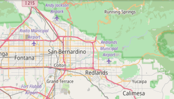
OpenStreetMap is a free community-edited basemap.
How to use the sample
When the sample opens, it will automatically display the map with the OpenStreetMap basemap. Pan and zoom to observe the basemap.
How it works
- Instantiate an
ArcGISMapwith aBasemapStyle.OSM_STANDARD - Show the map in a map view using
MapView.setMap(map).
Relevant API
- Map
- MapView
Additional information
The attribution text will be set to the required OpenStreetMap attribution automatically.
Apps that expect to make many requests to OpenStreetMap should consider using an alternative tile server via the WebTiledLayer class.
Esri now hosts an OpenStreetMap vector layer on ArcGIS Online that uses recent OpenStreetMap data in conjunction with a style matching the default OpenStreetMap style. This layer is not subject to the tile access restrictions that apply to tiles fetched from OpenStreetMap.org.
Tags
basemap, layers, map, open, OpenStreetMap, OSM, street
Sample Code
/* Copyright 2017 Esri
*
* Licensed under the Apache License, Version 2.0 (the "License");
* you may not use this file except in compliance with the License.
* You may obtain a copy of the License at
*
* http://www.apache.org/licenses/LICENSE-2.0
*
* Unless required by applicable law or agreed to in writing, software
* distributed under the License is distributed on an "AS IS" BASIS,
* WITHOUT WARRANTIES OR CONDITIONS OF ANY KIND, either express or implied.
* See the License for the specific language governing permissions and
* limitations under the License.
*
*/
package com.esri.arcgisruntime.sample.openstreetmaplayer;
import android.os.Bundle;
import androidx.appcompat.app.AppCompatActivity;
import com.esri.arcgisruntime.ArcGISRuntimeEnvironment;
import com.esri.arcgisruntime.mapping.ArcGISMap;
import com.esri.arcgisruntime.mapping.BasemapStyle;
import com.esri.arcgisruntime.mapping.Viewpoint;
import com.esri.arcgisruntime.mapping.view.MapView;
public class MainActivity extends AppCompatActivity {
private MapView mMapView;
@Override
protected void onCreate(Bundle savedInstanceState) {
super.onCreate(savedInstanceState);
setContentView(R.layout.activity_main);
// authentication with an API key or named user is required to access basemaps and other
// location services
ArcGISRuntimeEnvironment.setApiKey(BuildConfig.API_KEY);
// access MapView from layout
mMapView = findViewById(R.id.mapView);
// instantiate an ArcGISMap with OpenStreetMap Basemap
ArcGISMap map = new ArcGISMap(BasemapStyle.OSM_STANDARD);
mMapView.setMap(map);
mMapView.setViewpoint(new Viewpoint(34.056295, -117.195800, 10000));
}
@Override
protected void onPause() {
super.onPause();
mMapView.pause();
}
@Override
protected void onResume() {
super.onResume();
mMapView.resume();
}
@Override
protected void onDestroy() {
super.onDestroy();
mMapView.dispose();
}
}