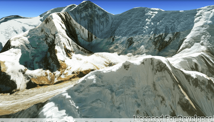
Display a scene with a terrain surface and some imagery.
Use case
Scene views are 3D representations of real-world areas and objects. Scene views are helpful for visualizing complex datasets where 3D relationships, topography, and elevation of elements are important factors.
How to use the sample
When loaded, the sample will display a scene. Pan and zoom to explore the scene.
How it works
- Create an
ArcGISSceneobject with theBasemapStyle.ARCGIS_IMAGERYbasemap. - Create an
ArcGISTiledElevationSourceobject and add it to the scene's base surface. - Create a
SceneViewobject to display the map. - Set the scene to the scene view.
Relevant API
- ArcGISScene
- ArcGISTiledElevationSource
- SceneView
Tags
3D, basemap, elevation, scene, surface
Sample Code
MainActivity.java
/* Copyright 2017 Esri
*
* Licensed under the Apache License, Version 2.0 (the "License");
* you may not use this file except in compliance with the License.
* You may obtain a copy of the License at
*
* http://www.apache.org/licenses/LICENSE-2.0
*
* Unless required by applicable law or agreed to in writing, software
* distributed under the License is distributed on an "AS IS" BASIS,
* WITHOUT WARRANTIES OR CONDITIONS OF ANY KIND, either express or implied.
* See the License for the specific language governing permissions and
* limitations under the License.
*
*/
package com.esri.arcgisruntime.sample.displayscene;
import android.os.Bundle;
import androidx.appcompat.app.AppCompatActivity;
import com.esri.arcgisruntime.ArcGISRuntimeEnvironment;
import com.esri.arcgisruntime.mapping.ArcGISScene;
import com.esri.arcgisruntime.mapping.ArcGISTiledElevationSource;
import com.esri.arcgisruntime.mapping.Basemap;
import com.esri.arcgisruntime.mapping.BasemapStyle;
import com.esri.arcgisruntime.mapping.view.Camera;
import com.esri.arcgisruntime.mapping.view.SceneView;
public class MainActivity extends AppCompatActivity {
private SceneView mSceneView;
@Override
protected void onCreate(Bundle savedInstanceState) {
super.onCreate(savedInstanceState);
setContentView(R.layout.activity_main);
// authentication with an API key or named user is required to access basemaps and other
// location services
ArcGISRuntimeEnvironment.setApiKey(BuildConfig.API_KEY);
// create a scene and add a basemap to it
ArcGISScene scene = new ArcGISScene(BasemapStyle.ARCGIS_IMAGERY);
//[DocRef: Name=Display Scene-android, Category=Work with 3D, Topic=Display a scene]
// create SceneView from layout
mSceneView = findViewById(R.id.sceneView);
mSceneView.setScene(scene);
//[DocRef: END]
//[DocRef: Name=Add elevation to base surface-android, Category=Work with 3D, Topic=Display a scene,
// RemoveChars=getResources().getString(R.string.elevation_image_service),
// ReplaceChars=http://elevation3d.arcgis.com/arcgis/rest/services/WorldElevation3D/Terrain3D/ImageServer]
// create an elevation source, and add this to the base surface of the scene
ArcGISTiledElevationSource elevationSource = new ArcGISTiledElevationSource(
getResources().getString(R.string.elevation_image_service));
scene.getBaseSurface().getElevationSources().add(elevationSource);
//[DocRef: END]
// add a camera and initial camera position
Camera camera = new Camera(28.4, 83.9, 10010.0, 10.0, 80.0, 0.0);
mSceneView.setViewpointCamera(camera);
}
@Override
protected void onPause() {
super.onPause();
// pause SceneView
mSceneView.pause();
}
@Override
protected void onResume() {
super.onResume();
// resume SceneView
mSceneView.resume();
}
@Override protected void onDestroy() {
super.onDestroy();
// dispose SceneView
mSceneView.dispose();
}
}