Find features in a feature table which match an SQL query.
Use case
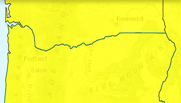
Query expressions can be used in ArcGIS to select a subset of features from a feature table. This is most useful in large or complicated data sets. A possible use case might be on a feature table marking the location of street furniture through a city. A user may wish to query by a TYPE column to return "benches". In this sample, we query a U.S. state by STATE_NAME from a feature table containing all U.S. states.
How to use the sample
Input the name of a U.S. state into the text field. When you tap "GO", a query is performed and the matching features are highlighted or an error is returned.
How it works
- Create a
ServiceFeatureTableusing the URL of a feature service. - Create a
QueryParameterswith a where clause specified usingsetWhereClause(). - Perform the query using
queryFeaturesAsync(query)on the service feature table. - When complete, the query will return a
FeatureQueryResultwhich can be iterated over to get the matching features.
About the data
This sample uses U.S. State polygon features from the USA 2016 Daytime Population feature service.
Relevant API
- FeatureLayer
- FeatureQueryResult
- QueryParameters
- ServiceFeatureTable
Tags
Search and Query
Sample Code
/* Copyright 2016 ESRI
*
* All rights reserved under the copyright laws of the United States
* and applicable international laws, treaties, and conventions.
*
* You may freely redistribute and use this sample code, with or
* without modification, provided you include the original copyright
* notice and use restrictions.
*
* See the Sample code usage restrictions document for further information.
*
*/
package com.esri.arcgisruntime.sample.featurelayerquery;
import java.util.Iterator;
import android.app.SearchManager;
import android.content.Context;
import android.content.Intent;
import android.graphics.Color;
import android.os.Bundle;
import android.util.Log;
import android.view.Menu;
import android.widget.Toast;
import androidx.appcompat.app.AppCompatActivity;
import androidx.appcompat.widget.SearchView;
import com.esri.arcgisruntime.ArcGISRuntimeEnvironment;
import com.esri.arcgisruntime.concurrent.ListenableFuture;
import com.esri.arcgisruntime.data.Feature;
import com.esri.arcgisruntime.data.FeatureQueryResult;
import com.esri.arcgisruntime.data.QueryParameters;
import com.esri.arcgisruntime.data.ServiceFeatureTable;
import com.esri.arcgisruntime.geometry.Envelope;
import com.esri.arcgisruntime.geometry.Point;
import com.esri.arcgisruntime.geometry.SpatialReferences;
import com.esri.arcgisruntime.layers.FeatureLayer;
import com.esri.arcgisruntime.mapping.ArcGISMap;
import com.esri.arcgisruntime.mapping.Basemap;
import com.esri.arcgisruntime.mapping.BasemapStyle;
import com.esri.arcgisruntime.mapping.view.MapView;
import com.esri.arcgisruntime.symbology.SimpleFillSymbol;
import com.esri.arcgisruntime.symbology.SimpleLineSymbol;
import com.esri.arcgisruntime.symbology.SimpleRenderer;
public class MainActivity extends AppCompatActivity {
private static final String TAG = MainActivity.class.getSimpleName();
private MapView mMapView;
private ServiceFeatureTable mServiceFeatureTable;
private FeatureLayer mFeatureLayer;
@Override
protected void onCreate(Bundle savedInstanceState) {
super.onCreate(savedInstanceState);
setContentView(R.layout.activity_main);
// authentication with an API key or named user is required to access basemaps and other
// location services
ArcGISRuntimeEnvironment.setApiKey(BuildConfig.API_KEY);
// get reference to map view
mMapView = findViewById(R.id.mapView);
// create a map with the topographic basemap
final ArcGISMap map = new ArcGISMap(BasemapStyle.ARCGIS_TOPOGRAPHIC);
// set the map to the map view
mMapView.setMap(map);
// create a service feature table and a feature layer from it
mServiceFeatureTable = new ServiceFeatureTable(getString(R.string.us_daytime_population_url));
// create the feature layer using the service feature table
mFeatureLayer = new FeatureLayer(mServiceFeatureTable);
mFeatureLayer.setOpacity(0.8f);
mFeatureLayer.setMaxScale(10000);
//override the renderer
SimpleLineSymbol lineSymbol = new SimpleLineSymbol(SimpleLineSymbol.Style.SOLID, Color.BLACK, 1);
SimpleFillSymbol fillSymbol = new SimpleFillSymbol(SimpleFillSymbol.Style.SOLID, Color.YELLOW, lineSymbol);
mFeatureLayer.setRenderer(new SimpleRenderer(fillSymbol));
// add the layer to the map
map.getOperationalLayers().add(mFeatureLayer);
// zoom to a view point of the USA
mMapView.setViewpointCenterAsync(new Point(-11000000, 5000000, SpatialReferences.getWebMercator()), 100000000);
}
/**
* Handle the search intent from the search widget
*/
@Override
protected void onNewIntent(Intent intent) {
setIntent(intent);
if (Intent.ACTION_SEARCH.equals(intent.getAction())) {
String searchString = intent.getStringExtra(SearchManager.QUERY);
searchForState(searchString);
}
}
private void searchForState(final String searchString) {
// clear any previous selections
mFeatureLayer.clearSelection();
// create objects required to do a selection with a query
QueryParameters query = new QueryParameters();
// make search case insensitive
query.setWhereClause("upper(STATE_NAME) LIKE '%" + searchString.toUpperCase() + "%'");
// call select features
final ListenableFuture<FeatureQueryResult> future = mServiceFeatureTable.queryFeaturesAsync(query);
// add done loading listener to fire when the selection returns
future.addDoneListener(() -> {
try {
// call get on the future to get the result
FeatureQueryResult result = future.get();
// check there are some results
Iterator<Feature> resultIterator = result.iterator();
if (resultIterator.hasNext()) {
// get the extent of the first feature in the result to zoom to
Feature feature = resultIterator.next();
Envelope envelope = feature.getGeometry().getExtent();
mMapView.setViewpointGeometryAsync(envelope, 10);
// select the feature
mFeatureLayer.selectFeature(feature);
} else {
Toast.makeText(this, "No states found with name: " + searchString, Toast.LENGTH_LONG).show();
}
} catch (Exception e) {
String error = "Feature search failed for: " + searchString + ". Error: " + e.getMessage();
Toast.makeText(this, error, Toast.LENGTH_LONG).show();
Log.e(TAG, error);
}
});
}
@Override
public boolean onCreateOptionsMenu(Menu menu) {
// inflate the menu; this adds items to the action bar if it is present.
getMenuInflater().inflate(R.menu.menu_main, menu);
// get the SearchView and set the searchable configuration
SearchManager searchManager = (SearchManager) getSystemService(Context.SEARCH_SERVICE);
SearchView searchView = (SearchView) menu.findItem(R.id.action_search).getActionView();
// assumes current activity is the searchable activity
searchView.setSearchableInfo(searchManager.getSearchableInfo(getComponentName()));
searchView.setIconifiedByDefault(false);
return true;
}
@Override
protected void onPause() {
mMapView.pause();
super.onPause();
}
@Override
protected void onResume() {
super.onResume();
mMapView.resume();
}
@Override protected void onDestroy() {
mMapView.dispose();
super.onDestroy();
}
}