Select features in a feature layer.
Use case
Selecting features, whether by query or identify, can be an important step both in editing data and visualizing results. One possible use case would be to query a feature layer containing street furniture. A query might look for type "bench" and return a list of bench features contained in the features with an attribute of type bench. These might be selected for further editing (see FeatureQueryResult) or may just be highlighted visually.
How to use the sample
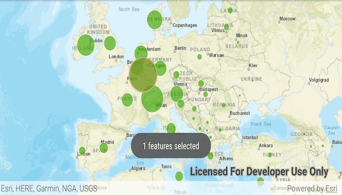
Tap on a feature in the map. All features within a given tolerance (in pixels) of the tap will be selected.
How it works
- Create a
ServiceFeatureTablefrom a feature service URL. - Create a
FeatureLayerfrom the service feature table. - Identify nearby features at the clicked location using
identifyLayerAsync(featureLayer, clickLocation, tolerance, returnPopupsOnly, maxResults)on the map view. - Select all identified features in the feature layer with
selectFeaturesAsync(query, FeatureLayer.SelectionMode.NEW).
Relevant API
- Feature
- FeatureLayer
- ServiceFeatureTable
About the data
This sample uses the Gross Domestic Product, 1960-2016 feature service. Only the 2016 GDP values are shown.
Tags
features, layers, select, selection, tolerance
Sample Code
/* Copyright 2016 ESRI
*
* All rights reserved under the copyright laws of the United States
* and applicable international laws, treaties, and conventions.
*
* You may freely redistribute and use this sample code, with or
* without modification, provided you include the original copyright
* notice and use restrictions.
*
* See the Sample code usage restrictions document for further information.
*
*/
package com.esri.arcgisruntime.sample.featurelayerselection;
import android.graphics.Color;
import android.graphics.Point;
import android.os.Bundle;
import android.util.Log;
import android.view.MotionEvent;
import android.widget.Toast;
import androidx.appcompat.app.AppCompatActivity;
import com.esri.arcgisruntime.ArcGISRuntimeEnvironment;
import com.esri.arcgisruntime.concurrent.ListenableFuture;
import com.esri.arcgisruntime.data.Feature;
import com.esri.arcgisruntime.data.ServiceFeatureTable;
import com.esri.arcgisruntime.geometry.Envelope;
import com.esri.arcgisruntime.geometry.SpatialReferences;
import com.esri.arcgisruntime.layers.FeatureLayer;
import com.esri.arcgisruntime.mapping.ArcGISMap;
import com.esri.arcgisruntime.mapping.BasemapStyle;
import com.esri.arcgisruntime.mapping.GeoElement;
import com.esri.arcgisruntime.mapping.Viewpoint;
import com.esri.arcgisruntime.mapping.view.DefaultMapViewOnTouchListener;
import com.esri.arcgisruntime.mapping.view.IdentifyLayerResult;
import com.esri.arcgisruntime.mapping.view.MapView;
import java.util.ArrayList;
import java.util.List;
public class MainActivity extends AppCompatActivity {
private static final String TAG = MainActivity.class.getSimpleName();
private MapView mMapView;
@Override
protected void onCreate(Bundle savedInstanceState) {
super.onCreate(savedInstanceState);
setContentView(R.layout.activity_main);
// authentication with an API key or named user is required to access basemaps and other
// location services
ArcGISRuntimeEnvironment.setApiKey(BuildConfig.API_KEY);
// get reference to map view
mMapView = findViewById(R.id.mapView);
mMapView.getSelectionProperties().setColor(Color.RED);
// create a map with the streets basemap
final ArcGISMap map = new ArcGISMap(BasemapStyle.ARCGIS_STREETS);
// set the map to be displayed in the MapView
mMapView.setMap(map);
// set an initial viewpoint
mMapView.setViewpoint(
new Viewpoint(new Envelope(-1131596.019761, 3893114.069099, 3926705.982140, 7977912.461790,
SpatialReferences.getWebMercator())));
// create service feature table and a feature layer from it
final ServiceFeatureTable serviceFeatureTable = new ServiceFeatureTable(
getString(R.string.gdp_per_capita_url));
final FeatureLayer featureLayer = new FeatureLayer(serviceFeatureTable);
// add the layer to the map
map.getOperationalLayers().add(featureLayer);
// set an on touch listener to listen for click events
mMapView.setOnTouchListener(new DefaultMapViewOnTouchListener(this, mMapView) {
@Override
public boolean onSingleTapConfirmed(MotionEvent motionEvent) {
featureLayer.clearSelection();
Point screenPoint = new Point(Math.round(motionEvent.getX()),
Math.round(motionEvent.getY()));
int tolerance = 10;
ListenableFuture<IdentifyLayerResult> identifyLayerResultFuture = mMapView
.identifyLayerAsync(featureLayer, screenPoint, tolerance, false, -1);
identifyLayerResultFuture.addDoneListener(() -> {
try {
// get the result from the identify
IdentifyLayerResult identifyLayerResult = identifyLayerResultFuture.get();
// create a list of features from the elements of the identify layer result
List<Feature> identifiedFeatures = new ArrayList<>();
for (GeoElement geoelement : identifyLayerResult.getElements()) {
if (geoelement instanceof Feature) {
identifiedFeatures.add((Feature) geoelement);
}
}
// select the features in the feature layer
featureLayer.selectFeatures(identifiedFeatures);
Toast.makeText(MainActivity.this, identifiedFeatures.size() + " features selected",
Toast.LENGTH_SHORT).show();
} catch (Exception e) {
String error = "Select features failed: " + e.getMessage();
Toast.makeText(MainActivity.this, error, Toast.LENGTH_SHORT).show();
Log.e(TAG, error);
}
});
return true;
}
});
}
@Override
protected void onPause() {
mMapView.pause();
super.onPause();
}
@Override
protected void onResume() {
super.onResume();
mMapView.resume();
}
@Override
protected void onDestroy() {
mMapView.dispose();
super.onDestroy();
}
}