Find features in a spatial table related to features in a non-spatial table.
Use case
The non-spatial tables contained by a map service may contain additional information about sublayer features. Such information can be accessed by traversing table relationships defined in the service.
How to use the sample
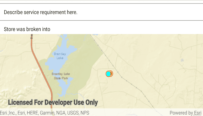
Once the map image layer loads, a list view will be populated with comment data from non-spatial features. Tap on one of the comments to query related spatial features and display the first result on the map.
How it works
- Create an
ArcGISMapImageLayerwith the URL of a map image service. - Load the layer and get one of its tables with
imageLayer.getTables().get(index). - To query the table, create a
QueryParametersobject. You can usequeryParameters.setWhereClause(sqlQueryString)to filter the requested features. - Use
table.queryFeaturesAsync(parameters)to get aFeatureQueryResultobject. - The
FeatureQueryResultis an iterable, so simply loop through it to get each resultFeature. - To query for related features, get the table's relationship info with
table.getLayerInfo().getRelationshipInfos(). This returns a list ofRelationshipInfoobjects. Choose which one to base your query on. - Now create
RelatedQueryParameterspassing in theRelationshipInfo. To query related features, usetable.queryRelatedFeaturesAsync(feature, relatedQueryParameters). - This returns a list of
RelatedFeatureQueryResultobjects, each containing a set of related features.
Relevant API
- ArcGISFeature
- ArcGISMapImageLayer
- Feature
- FeatureQueryResult
- QueryParameters
- RelatedFeatureQueryResult
- RelatedQueryParameters
- RelationshipInfo
- ServiceFeatureTable
Additional information
You can use arcGISMapImageLayer.loadTablesAndLayersAsync() to recursively load all sublayers and tables associated with a map image layer.
Tags
features, query, related features, search
Sample Code
MainActivity.java
/* Copyright 2018 Esri
*
* Licensed under the Apache License, Version 2.0 (the "License");
* you may not use this file except in compliance with the License.
* You may obtain a copy of the License at
*
* http://www.apache.org/licenses/LICENSE-2.0
*
* Unless required by applicable law or agreed to in writing, software
* distributed under the License is distributed on an "AS IS" BASIS,
* WITHOUT WARRANTIES OR CONDITIONS OF ANY KIND, either express or implied.
* See the License for the specific language governing permissions and
* limitations under the License.
*
*/
package com.esri.arcgisruntime.sample.mapimagelayertables;
import java.util.ArrayList;
import java.util.List;
import java.util.concurrent.ExecutionException;
import android.graphics.Color;
import android.os.Bundle;
import android.util.Log;
import android.widget.ArrayAdapter;
import android.widget.ListView;
import android.widget.Toast;
import androidx.appcompat.app.AppCompatActivity;
import com.esri.arcgisruntime.ArcGISRuntimeEnvironment;
import com.esri.arcgisruntime.arcgisservices.RelationshipInfo;
import com.esri.arcgisruntime.concurrent.ListenableFuture;
import com.esri.arcgisruntime.data.ArcGISFeature;
import com.esri.arcgisruntime.data.Feature;
import com.esri.arcgisruntime.data.FeatureQueryResult;
import com.esri.arcgisruntime.data.QueryParameters;
import com.esri.arcgisruntime.data.RelatedFeatureQueryResult;
import com.esri.arcgisruntime.data.RelatedQueryParameters;
import com.esri.arcgisruntime.data.ServiceFeatureTable;
import com.esri.arcgisruntime.geometry.Envelope;
import com.esri.arcgisruntime.geometry.Point;
import com.esri.arcgisruntime.layers.ArcGISMapImageLayer;
import com.esri.arcgisruntime.loadable.LoadStatus;
import com.esri.arcgisruntime.mapping.ArcGISMap;
import com.esri.arcgisruntime.mapping.Basemap;
import com.esri.arcgisruntime.mapping.BasemapStyle;
import com.esri.arcgisruntime.mapping.Viewpoint;
import com.esri.arcgisruntime.mapping.view.Graphic;
import com.esri.arcgisruntime.mapping.view.GraphicsOverlay;
import com.esri.arcgisruntime.mapping.view.MapView;
import com.esri.arcgisruntime.symbology.SimpleMarkerSymbol;
import com.esri.arcgisruntime.symbology.Symbol;
public class MainActivity extends AppCompatActivity {
private static final String TAG = MainActivity.class.getSimpleName();
private MapView mMapView;
private ListView mCommentListView;
// objects that implement Loadable must be class fields to prevent being garbage collected before loading
private ArcGISFeature mServiceRequestFeature;
@Override
protected void onCreate(Bundle savedInstanceState) {
super.onCreate(savedInstanceState);
setContentView(R.layout.activity_main);
// authentication with an API key or named user is required to access basemaps and other
// location services
ArcGISRuntimeEnvironment.setApiKey(BuildConfig.API_KEY);
// inflate views from layout
mMapView = findViewById(R.id.mapView);
mCommentListView = findViewById(R.id.comment_list);
// initialize list that will hold the comments
List<String> commentList = new ArrayList<>();
// initialize a feature list that will hold the corresponding features for each comment
List<Feature> featureList = new ArrayList<>();
// create a map with a topographic basemap
ArcGISMap map = new ArcGISMap(BasemapStyle.ARCGIS_STREETS);
// create a new ArcGISMapImageLayer with a Service Request Map Server and load tables and layers
ArcGISMapImageLayer serviceRequestMapImageLayer = new ArcGISMapImageLayer(getString(R.string.map_service));
serviceRequestMapImageLayer.loadTablesAndLayersAsync();
// initialize graphics overlay
GraphicsOverlay graphicsOverlay = new GraphicsOverlay();
serviceRequestMapImageLayer.addDoneLoadingListener(() -> {
if (serviceRequestMapImageLayer.getLoadStatus() == LoadStatus.LOADED) {
// set initial viewpoint
Envelope extent = serviceRequestMapImageLayer.getFullExtent();
mMapView.setViewpoint(new Viewpoint(extent));
// get the service request comments table from the map image layer
ServiceFeatureTable commentsTable = serviceRequestMapImageLayer.getTables().get(0);
// create query parameters to get all non-null service request comment records (features) from tables.
QueryParameters queryParameters = new QueryParameters();
queryParameters.setWhereClause("requestid <> '' AND comments <> ''");
// query the table to get non-null records
ListenableFuture<FeatureQueryResult> commentQueryResultFuture = commentsTable
.queryFeaturesAsync(queryParameters, ServiceFeatureTable.QueryFeatureFields.LOAD_ALL);
// get the feature query result when it is done
commentQueryResultFuture.addDoneListener(() -> {
try {
FeatureQueryResult commentQueryResult = commentQueryResultFuture.get();
// loop through the results to add the comments and features to the corresponding list
for (Feature feature : commentQueryResult) {
featureList.add(feature);
commentList.add(feature.getAttributes().get("comments").toString());
}
// create array adapter with the queried comments
ArrayAdapter<String> adapter = new ArrayAdapter<>(this, android.R.layout.simple_list_item_1, commentList);
// add the adapter to the List View
mCommentListView.setAdapter(adapter);
} catch (InterruptedException | ExecutionException e) {
Log.e(TAG, "Error getting feature query result: " + e.getMessage());
}
});
} else {
Log.e(TAG, "Service request failed to load");
Toast.makeText(this, "Service request failed to load", Toast.LENGTH_LONG).show();
}
});
mCommentListView.setOnItemClickListener((parent, view, position, id) -> {
// clear previous selections
graphicsOverlay.getGraphics().clear();
// get the comment clicked
Feature selectedComment = featureList.get(position);
// create a service feature table of the comments
ServiceFeatureTable commentsTable = serviceRequestMapImageLayer.getTables().get(0);
// get the relationship that defines related service request for features in the comments table
RelationshipInfo commentsRelationshipInfo = commentsTable.getLayerInfo().getRelationshipInfos().get(0);
// create query parameters to get the service request for features in the comments table
RelatedQueryParameters relatedQueryParameters = new RelatedQueryParameters(commentsRelationshipInfo);
relatedQueryParameters.setReturnGeometry(true);
// query the comments table for related features
ListenableFuture<List<RelatedFeatureQueryResult>> relatedRequestResult = commentsTable
.queryRelatedFeaturesAsync((ArcGISFeature) selectedComment, relatedQueryParameters);
relatedRequestResult.addDoneListener(() -> {
try {
// get the first result
RelatedFeatureQueryResult result = relatedRequestResult.get().get(0);
// get the first feature from the result and make sure it has a valid geometry
mServiceRequestFeature = null;
for (Feature relatedFeature : result) {
if (!relatedFeature.getGeometry().isEmpty()) {
mServiceRequestFeature = (ArcGISFeature) relatedFeature;
break;
}
}
// if a valid related feature is not found, warn the user and return
if (mServiceRequestFeature == null) {
Toast.makeText(this, "Related Feature not found", Toast.LENGTH_SHORT).show();
return;
}
// load the related service feature request (so geometry is available)
mServiceRequestFeature.loadAsync();
mServiceRequestFeature.addDoneLoadingListener(() -> {
if (mServiceRequestFeature.getLoadStatus() == LoadStatus.LOADED) {
// get the service request geometry
Point serviceRequestPoint = (Point) mServiceRequestFeature.getGeometry();
// create a marker symbol to display the related feature
Symbol selectedRequestedSymbol = new SimpleMarkerSymbol(SimpleMarkerSymbol.Style.CIRCLE,
Color.CYAN, 14);
// create a graphic using the service request point and marker symbol
Graphic requestGraphic = new Graphic(serviceRequestPoint, selectedRequestedSymbol);
// add graphic to the map and zoom the map view
graphicsOverlay.getGraphics().add(requestGraphic);
mMapView.setViewpointCenterAsync(serviceRequestPoint, 150000);
}
});
} catch (InterruptedException | ExecutionException e) {
Log.e(TAG, "Related Request Failure: " + e.getMessage());
}
});
});
//add the map layer to the map
map.getOperationalLayers().add(serviceRequestMapImageLayer);
// add graphics overlay to map view
mMapView.getGraphicsOverlays().add(graphicsOverlay);
// set the map to be displayed in this view
mMapView.setMap(map);
}
@Override
protected void onPause() {
super.onPause();
mMapView.pause();
}
@Override
protected void onResume() {
super.onResume();
mMapView.resume();
}
@Override
protected void onDestroy() {
super.onDestroy();
mMapView.dispose();
}
}