Load a raster from a service, then apply a function to it.
Use case
Raster functions allow processing operations that can be applied to one or more rasters on the fly. Functions can be applied to rasters that come from a service. A land survey agency may apply hillshade and aspect functions to rasters with elevation data in order to better determine the topography of a landscape and to make further planning decisions.
How to use the sample
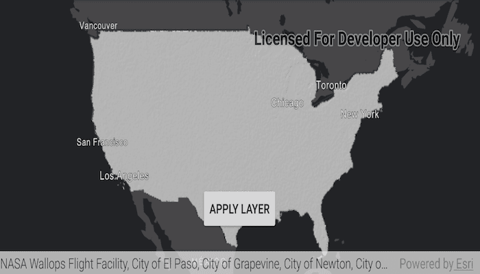
Tap the "Apply Layer" button to apply the raster function and display the result.
How it works
- Create the
ImageServiceRasterreferring to the image server URL. - Create the
RasterFunctionfrom a JSON string. - Get the arguments of the raster function with
rasterFunction.getArguments(). - Get the names of the raster arguments with
rasterFunctionArguments.getRasterNames(). - Set the raster argument with
rasterFunction.setRaster(rasterName, imageServiceRaster). - Create a new
Rasterreferring to the raster function. - Create a
RasterLayerto visualize the computed raster. - Display the raster.
Relevant API
- ImageServiceRaster
- Raster
- RasterFunction
- RasterFunctionArguments
- RasterLayer
About the data
The sample applies a hillshade function to a raster produced from the National Land Cover Database, NLCDLandCover2001. You can learn more about the hillshade function in the ArcMap documentation.
Additional information
The raster function computation happens locally on the client device.
Tags
function, layer, raster, raster function, service
Sample Code
/* Copyright 2018 Esri
*
* Licensed under the Apache License, Version 2.0 (the "License");
* you may not use this file except in compliance with the License.
* You may obtain a copy of the License at
*
* http://www.apache.org/licenses/LICENSE-2.0
*
* Unless required by applicable law or agreed to in writing, software
* distributed under the License is distributed on an "AS IS" BASIS,
* WITHOUT WARRANTIES OR CONDITIONS OF ANY KIND, either express or implied.
* See the License for the specific language governing permissions and
* limitations under the License.
*
*/
package com.esri.arcgisruntime.sample.rasterfunctionservice;
import java.util.List;
import android.os.Bundle;
import android.util.Log;
import android.widget.Button;
import android.widget.Toast;
import androidx.appcompat.app.AppCompatActivity;
import com.esri.arcgisruntime.ArcGISRuntimeEnvironment;
import com.esri.arcgisruntime.geometry.Point;
import com.esri.arcgisruntime.layers.RasterLayer;
import com.esri.arcgisruntime.loadable.LoadStatus;
import com.esri.arcgisruntime.mapping.ArcGISMap;
import com.esri.arcgisruntime.mapping.BasemapStyle;
import com.esri.arcgisruntime.mapping.view.MapView;
import com.esri.arcgisruntime.raster.ImageServiceRaster;
import com.esri.arcgisruntime.raster.Raster;
import com.esri.arcgisruntime.raster.RasterFunction;
import com.esri.arcgisruntime.raster.RasterFunctionArguments;
public class MainActivity extends AppCompatActivity {
private final String TAG = MainActivity.class.getSimpleName();
private MapView mMapView;
private Button mRasterFunctionButton;
@Override
protected void onCreate(Bundle savedInstanceState) {
super.onCreate(savedInstanceState);
setContentView(R.layout.activity_main);
// authentication with an API key or named user is required to access basemaps and other
// location services
ArcGISRuntimeEnvironment.setApiKey(BuildConfig.API_KEY);
// inflate views from layout
mMapView = findViewById(R.id.mapView);
mRasterFunctionButton = findViewById(R.id.rasterButton);
mRasterFunctionButton.setEnabled(false);
// create a map with the Basemap Style topographic
ArcGISMap map = new ArcGISMap(BasemapStyle.ARCGIS_DARK_GRAY);
final ImageServiceRaster imageServiceRaster = new ImageServiceRaster(getString(R.string.image_service_raster_url));
final RasterLayer imageRasterLayer = new RasterLayer(imageServiceRaster);
map.getOperationalLayers().add(imageRasterLayer);
// zoom to the extent of the raster service
imageRasterLayer.addDoneLoadingListener(() -> {
if (imageRasterLayer.getLoadStatus() == LoadStatus.LOADED) {
// get the center point
Point centerPnt = imageServiceRaster.getServiceInfo().getFullExtent().getCenter();
mMapView.setViewpointCenterAsync(centerPnt, 55000000);
mRasterFunctionButton.setEnabled(true);
} else {
String error = "Error loading image raster layer: " + imageRasterLayer.getLoadError();
Log.e(TAG, error);
Toast.makeText(this, error, Toast.LENGTH_LONG).show();
}
});
// update the raster with simplified hillshade
mRasterFunctionButton.setOnClickListener(v -> applyRasterFunction(imageServiceRaster));
// set the map to be displayed in this view
mMapView.setMap(map);
}
private void applyRasterFunction(Raster raster) {
// create raster function from json string
RasterFunction rasterFuntionFromJson = RasterFunction.fromJson(getString(R.string.hillshade_simplified));
// get parameter name value pairs used by hillside
RasterFunctionArguments rasterFunctionArguments = rasterFuntionFromJson.getArguments();
// get a list of raster names associated with the raster function
List<String> rasterNames = rasterFunctionArguments.getRasterNames();
rasterFunctionArguments.setRaster(rasterNames.get(0), raster);
// create raster as raster layer
raster = new Raster(rasterFuntionFromJson);
RasterLayer hillshadeLayer = new RasterLayer(raster);
mMapView.getMap().getOperationalLayers().add(hillshadeLayer);
}
@Override
protected void onPause() {
super.onPause();
mMapView.pause();
}
@Override
protected void onResume() {
super.onResume();
mMapView.resume();
}
@Override
protected void onDestroy() {
super.onDestroy();
mMapView.dispose();
}
}