Display a layer from a Web Map Tile Service.
Use case
WMTS services can have several layers. You can use Runtime to explore the layers available from a service. This would commonly be used to enable a browsing experience where users can choose which layers they want to display at run time.
How to use the sample
Pan and zoom to explore the WMTS layer, which is displayed automatically.
How it works
- Create a
WmtsServiceusing the URL of the WMTS Service. - After loading the WMTS service, get the list of
WmtsLayerInfosfrom the service info:service.getServiceInfo().getLayerInfos() - Use one of the layer infos to create a new
WmtsLayer(layerInfos.get(0)) - Set it as the maps' basemap with
map.setBasemap(new Basemap(wmtsLayer)).
Relevant API
- WmtsLayer
- WmtsLayerInfo
- WmtsService
- WmtsServiceInfo
About the data
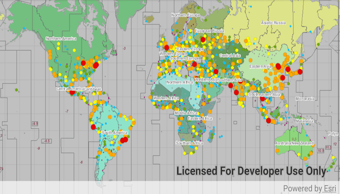
The map visualizes world time zones.
Tags
layer, OGC, raster, tiled, web map tile service
Sample Code
MainActivity.java
/* Copyright 2018 Esri
*
* Licensed under the Apache License, Version 2.0 (the "License");
* you may not use this file except in compliance with the License.
* You may obtain a copy of the License at
*
* http://www.apache.org/licenses/LICENSE-2.0
*
* Unless required by applicable law or agreed to in writing, software
* distributed under the License is distributed on an "AS IS" BASIS,
* WITHOUT WARRANTIES OR CONDITIONS OF ANY KIND, either express or implied.
* See the License for the specific language governing permissions and
* limitations under the License.
*
*/
package com.esri.arcgisruntime.sample.wmtslayer;
import java.util.List;
import androidx.appcompat.app.AppCompatActivity;
import android.os.Bundle;
import android.util.Log;
import android.widget.Toast;
import com.esri.arcgisruntime.layers.WmtsLayer;
import com.esri.arcgisruntime.loadable.LoadStatus;
import com.esri.arcgisruntime.mapping.ArcGISMap;
import com.esri.arcgisruntime.mapping.Basemap;
import com.esri.arcgisruntime.mapping.view.MapView;
import com.esri.arcgisruntime.ogc.wmts.WmtsLayerInfo;
import com.esri.arcgisruntime.ogc.wmts.WmtsService;
import com.esri.arcgisruntime.ogc.wmts.WmtsServiceInfo;
public class MainActivity extends AppCompatActivity {
private final String TAG = MainActivity.class.getSimpleName();
private MapView mMapView;
// objects that implement Loadable must be class fields to prevent being garbage collected before loading
private WmtsService mWmtsService;
@Override
protected void onCreate(Bundle savedInstanceState) {
super.onCreate(savedInstanceState);
setContentView(R.layout.activity_main);
// inflate MapView from layout
mMapView = findViewById(R.id.mapView);
// create an ArcGIS map
ArcGISMap map = new ArcGISMap();
mMapView.setMap(map);
// create wmts service from url string
mWmtsService = new WmtsService(getString(R.string.wmts_url));
mWmtsService.addDoneLoadingListener(() -> {
if (mWmtsService.getLoadStatus() == LoadStatus.LOADED) {
// get service info
WmtsServiceInfo wmtsServiceInfo = mWmtsService.getServiceInfo();
// get the first layer id
List<WmtsLayerInfo> layerInfoList = wmtsServiceInfo.getLayerInfos();
// create WMTS layer from layer info
WmtsLayer wmtsLayer = new WmtsLayer(layerInfoList.get(0));
// set the basemap of the map with WMTS layer
map.setBasemap(new Basemap(wmtsLayer));
} else {
String error = "Error loading WMTS Service: " + mWmtsService.getLoadError();
Log.e(TAG, error);
Toast.makeText(this, error, Toast.LENGTH_LONG).show();
}
});
mWmtsService.loadAsync();
}
@Override
protected void onPause() {
super.onPause();
mMapView.pause();
}
@Override
protected void onResume() {
super.onResume();
mMapView.resume();
}
@Override
protected void onDestroy() {
super.onDestroy();
mMapView.dispose();
}
}