import { getLabelSchemes } from "@arcgis/core/smartMapping/labels/clusters.js";const { getLabelSchemes } = await $arcgis.import("@arcgis/core/smartMapping/labels/clusters.js");- Since
- ArcGIS Maps SDK for JavaScript 4.16
This object contains a helper method for generating default labels to be set on
a layer's cluster configuration.
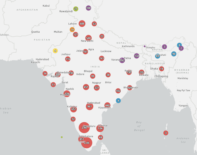
The default label is based on the layer's renderer. In most cases the default label configuration will
be the total number of features in the cluster. This value will be rounded and formatted (e.g. instead of 2385, the
cluster label will display 2.4k). In some cases, such as renderers with a SizeVariable,
the default label will display the average value of the attribute represented by the size variable.
This includes secondary labeling schemes you can experiment with in your clusters. This module only applies to layers with a point geometry type.
Functions
getLabelSchemes
Generates default FeatureReductionCluster.labelingInfo schemes to be set on a FeatureLayer's FeatureLayer.featureReduction configuration. Returns one or more suggested LabelClasses for a given layer based on its renderer. It also returns a suggested FeatureReductionCluster.clusterMinSize to ensure labels fit inside clusters.
If a renderer has a non-scale dependent SizeVariable, then the average value of the field or expression used to determine the cluster size will be suggested as the default label value. In all other scenarios, the suggested label will display the cluster count in the center of the label.
- Signature
-
getLabelSchemes (parameters: SchemeParameters): Promise<Schemes | null | undefined>
Parameters
| Parameter | Type | Description | Required |
|---|---|---|---|
| parameters | The function parameters. | |
Example
// Sets suggested labels on the clusters based on the underlying rendererclusterLabelCreator.getLabelSchemes({  layer: featureLayer,  view: view}).then(function(labelSchemes){  const featureReduction = featureLayer.featureReduction.clone();  const { labelingInfo, clusterMinSize } = labelSchemes.primaryScheme;  featureReduction.labelingInfo = labelingInfo;  featureReduction.clusterMinSize = clusterMinSize;
  featureLayer.featureReduction = featureReduction;}).catch(function(error){  console.error(error);});
Type definitions
SchemeParameters
field
The name of the AggregateField.name to use in the primary label scheme. If not specified, then the label will be based on the data used to vary cluster size.
renderer
- Type
- ClusterableRenderer | undefined
The renderer to set on the input layer when clustering is enabled. Specify this parameter if the layer's renderer does not match the renderer that will be used when clustering is enabled. This cannot be a HeatmapRenderer.
Scheme
Contains a suggested labelingInfo to be set on the layer's featureReduction.labelingInfo.
name
- Type
- string
The name of the generated cluster labeling scheme. This can be used in the UI of web map authoring apps.
labelingInfo
- Type
- LabelClass[]
An array of LabelClass objects to set on the layer's featureReduction.labelingInfo property.
clusterMinSize
- Type
- number
The suggested featureReduction.clusterMinSize required to fit labels within clusters.
fieldName
- Type
- string
The name of the aggregate field the labeling scheme is based on. This can be used in the UI of web map authoring apps.
Schemes
The return object of the getLabelSchemes() method.
primaryScheme
- Type
- Scheme
Includes the primary labeling scheme suggested for the input layer's clusters.
secondarySchemes
- Type
- Scheme[]
Includes secondary labeling schemes suggested for the input layer's clusters.