import Edges3D from "@arcgis/core/symbols/edges/Edges3D.js";const Edges3D = await $arcgis.import("@arcgis/core/symbols/edges/Edges3D.js");- Inheritance:
- Edges3D→
Accessor
- Subclasses:
- SketchEdges3D, SolidEdges3D
- Since
- ArcGIS Maps SDK for JavaScript 4.7
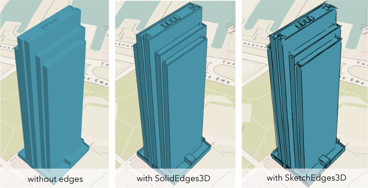
Edges3D is the base class for symbol classes that add edge rendering visualization to existing symbols. Edge rendering visualization is specific for 3D visualizations and can only be applied to FillSymbol3DLayer on MeshSymbol3D or ExtrudeSymbol3DLayer on PolygonSymbol3D.
Currently only edges of type solid and sketch are supported. See SolidEdges3D and SketchEdges3D.
Constructors
Constructor
Parameters
| Parameter | Type | Description | Required |
|---|---|---|---|
| properties | | |
Properties
Methods
fromJSON
- Signature
-
fromJSON (json: any): any
Creates a new instance of this class and initializes it with values from a JSON object
generated from an ArcGIS product. The object passed into the input json
parameter often comes from a response to a query operation in the REST API or a
toJSON()
method from another ArcGIS product. See the Using fromJSON()
topic in the Guide for details and examples of when and how to use this function.
Parameters
| Parameter | Type | Description | Required |
|---|---|---|---|
| json | A JSON representation of the instance in the ArcGIS format. See the ArcGIS REST API documentation for examples of the structure of various input JSON objects. | |
- Returns
- any
Returns a new instance of this class.
clone
- Signature
-
clone (): Edges3D
Creates a deep clone of the edges.
- Returns
- Edges3D
A deep clone of the object that invoked this method.
toJSON
- Signature
-
toJSON (): any
Converts an instance of this class to its ArcGIS portal JSON representation. See the Using fromJSON() guide topic for more information.
- Returns
- any
The ArcGIS portal JSON representation of an instance of this class.