Select features in a feature layer.
Use case
Selecting features, whether by query or identify, can be an important step both in editing data and visualizing results. One possible use case would be to query a feature layer containing street furniture. A query might look for type “bench” and return a list of bench features contained in the features with an attribute of type bench. These might be selected for further editing (see FeatureQueryResult) or may just be highlighted visually.
How to use the sample
Tap on a feature in the map. All features within a given tolerance (in pixels) of the tap will be selected.
How it works
- Create a
ServiceFeatureTablefrom a feature service URL. - Create a
FeatureLayerfrom the service feature table. - Identify nearby features at the clicked location using
mapView.identifyLayer(featureLayer, screenCoordinate, tolerance, returnPopupsOnly, maxResults)on the map view. - Select all identified features in the feature layer with
identifyLayerResult.geoElements.filterIsInstance<Feature>().
Relevant API
- Feature
- FeatureLayer
- ServiceFeatureTable
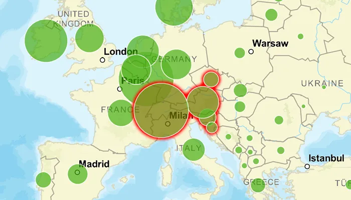
About the data
This sample uses the Gross Domestic Product, 1960-2016 feature service. Only the 2016 GDP values are shown.
Tags
features, layers, select, selection, tolerance
Sample code
MainActivity.kt
/* Copyright 2022 Esri * * Licensed under the Apache License, Version 2.0 (the "License"); * you may not use this file except in compliance with the License. * You may obtain a copy of the License at * *    http://www.apache.org/licenses/LICENSE-2.0 * * Unless required by applicable law or agreed to in writing, software * distributed under the License is distributed on an "AS IS" BASIS, * WITHOUT WARRANTIES OR CONDITIONS OF ANY KIND, either express or implied. * See the License for the specific language governing permissions and * limitations under the License. * */
package com.esri.arcgismaps.sample.selectfeaturesinfeaturelayer
import android.os.Bundleimport android.util.Logimport androidx.databinding.DataBindingUtilimport androidx.lifecycle.lifecycleScopeimport com.arcgismaps.ApiKeyimport com.arcgismaps.ArcGISEnvironmentimport com.arcgismaps.Colorimport com.arcgismaps.data.Featureimport com.arcgismaps.data.ServiceFeatureTableimport com.arcgismaps.geometry.Envelopeimport com.arcgismaps.mapping.ArcGISMapimport com.arcgismaps.mapping.BasemapStyleimport com.arcgismaps.mapping.Viewpointimport com.arcgismaps.mapping.layers.FeatureLayerimport com.arcgismaps.mapping.view.ScreenCoordinateimport com.esri.arcgismaps.sample.sampleslib.EdgeToEdgeCompatActivityimport com.esri.arcgismaps.sample.selectfeaturesinfeaturelayer.databinding.SelectFeaturesInFeatureLayerActivityMainBindingimport com.google.android.material.snackbar.Snackbarimport kotlinx.coroutines.launch
class MainActivity : EdgeToEdgeCompatActivity() {
    // set up data binding for the activity    private val activityMainBinding: SelectFeaturesInFeatureLayerActivityMainBinding by lazy {        DataBindingUtil.setContentView(this, R.layout.select_features_in_feature_layer_activity_main)    }
    private val mapView by lazy {        activityMainBinding.mapView    }
    private val gdbPerCapitalURL =        "https://services1.arcgis.com/4yjifSiIG17X0gW4/arcgis/rest/services/GDP_per_capita_1960_2016/FeatureServer/0"
    // create service feature table and a feature layer from it    private val serviceFeatureTable = ServiceFeatureTable(gdbPerCapitalURL)    private val featureLayer = FeatureLayer.createWithFeatureTable(serviceFeatureTable)
    override fun onCreate(savedInstanceState: Bundle?) {        super.onCreate(savedInstanceState)
        // authentication with an API key or named user is        // required to access basemaps and other location services        ArcGISEnvironment.apiKey = ApiKey.create(BuildConfig.ACCESS_TOKEN)        lifecycle.addObserver(mapView)
        // create a map with the streets base map type        val streetsMap = ArcGISMap(BasemapStyle.ArcGISStreets).apply {            // add the feature layer to the map's operational layers            operationalLayers.add(featureLayer)        }
        mapView.apply {            // set the map to be displayed in the layout's map view            map = streetsMap            // set an initial view point            setViewpoint(                Viewpoint(                    Envelope(                        -1131596.019761,                        3893114.069099,                        3926705.982140,                        7977912.461790                    )                )            )            // give any item selected on the map view a red selection halo            selectionProperties.color = Color.red            // set an on touch listener on the map view            lifecycleScope.launch {                onSingleTapConfirmed.collect { tapEvent ->                    // get the tapped coordinate                    val screenCoordinate = tapEvent.screenCoordinate                    getSelectedFeatureLayer(screenCoordinate)                }            }        }    }
    /**     * Displays the number of features selected on the given [screenCoordinate]     */    private suspend fun getSelectedFeatureLayer(screenCoordinate: ScreenCoordinate) {        // clear the previous selection        featureLayer.clearSelection()        // set a tolerance for accuracy of returned selections from point tapped        val tolerance = 25.0        // create a IdentifyLayerResult using the screen coordinate        val identifyLayerResult =            mapView.identifyLayer(featureLayer, screenCoordinate, tolerance, false, -1)        // handle the result's onSuccess and onFailure        identifyLayerResult.apply {            onSuccess { identifyLayerResult ->                // get the elements in the selection that are features                val features = identifyLayerResult.geoElements.filterIsInstance<Feature>()                // add the features to the current feature layer selection                featureLayer.selectFeatures(features)                Snackbar.make(mapView, "${features.size} features selected", Snackbar.LENGTH_SHORT).show()            }            onFailure {                val errorMessage = "Select feature failed: " + it.message                Log.e(localClassName, errorMessage)                Snackbar.make(mapView, errorMessage, Snackbar.LENGTH_SHORT).show()            }        }    }}