A renderer allows you to change the style of all graphics in a graphics overlay by referencing a single symbol style. A renderer will only effect graphics that do not specify their own symbol style.
Use case
A renderer allows you to change the style of all graphics in an overlay by only changing one copy of the symbol. For example, a user may wish to display a number of graphics on a map of a parkland which represents trees, all sharing a common symbol.
How to use the sample
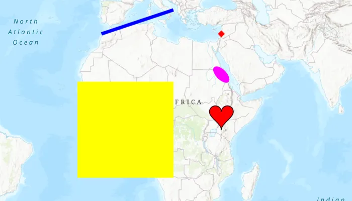
Run the sample and view graphics for points, lines, and polygons, which are stylized using renderers.
How it works
- Create a
GraphicsOverlayand add it to theMapView. - Create a
Graphic, specifying only aGeometry. - Create a single
Symbolsuch as aSimpleMarkerSymbol. - Create a renderer with the
Symbolsuch as aSimpleRenderer(symbol). - Set the renderer on the
GraphicsOverlaywithgraphicsOverlay.renderer = renderer.
Relevant API
- CubicBezierSegment
- EllipticArcSegment
- GeodesicEllipseParameters
- Geometry
- GeometryEngine
- Graphic
- GraphicsOverlay
- MutablePart
- PolygonBuilder
- PolylineBuilder
- SimpleFillSymbol
- SimpleLineSymbol
- SimpleMarkerSymbol
- SimpleRenderer
Additional information
To set unique symbols across a number of graphics (e.g. showing graphics of individual landmarks) see “Add graphics with symbols” sample.
Tags
arc, bezier, curve, display, ellipse, graphics, marker, overlay, renderer, segment, symbol, true curve
Sample code
/* Copyright 2022 Esri * * Licensed under the Apache License, Version 2.0 (the "License"); * you may not use this file except in compliance with the License. * You may obtain a copy of the License at * *    http://www.apache.org/licenses/LICENSE-2.0 * * Unless required by applicable law or agreed to in writing, software * distributed under the License is distributed on an "AS IS" BASIS, * WITHOUT WARRANTIES OR CONDITIONS OF ANY KIND, either express or implied. * See the License for the specific language governing permissions and * limitations under the License. * */
package com.esri.arcgismaps.sample.stylegraphicswithrenderer
import android.os.Bundleimport com.esri.arcgismaps.sample.sampleslib.EdgeToEdgeCompatActivityimport androidx.databinding.DataBindingUtilimport com.arcgismaps.ApiKeyimport com.arcgismaps.ArcGISEnvironmentimport com.arcgismaps.Colorimport com.arcgismaps.geometry.AngularUnitimport com.arcgismaps.geometry.CubicBezierSegmentimport com.arcgismaps.geometry.EllipticArcSegmentimport com.arcgismaps.geometry.GeodesicEllipseParametersimport com.arcgismaps.geometry.Geometryimport com.arcgismaps.geometry.GeometryEngineimport com.arcgismaps.geometry.LinearUnitimport com.arcgismaps.geometry.MutablePartimport com.arcgismaps.geometry.Pointimport com.arcgismaps.geometry.Polygonimport com.arcgismaps.geometry.PolygonBuilderimport com.arcgismaps.geometry.PolylineBuilderimport com.arcgismaps.geometry.SpatialReferenceimport com.arcgismaps.mapping.ArcGISMapimport com.arcgismaps.mapping.BasemapStyleimport com.arcgismaps.mapping.Viewpointimport com.arcgismaps.mapping.symbology.SimpleFillSymbolimport com.arcgismaps.mapping.symbology.SimpleFillSymbolStyleimport com.arcgismaps.mapping.symbology.SimpleLineSymbolimport com.arcgismaps.mapping.symbology.SimpleLineSymbolStyleimport com.arcgismaps.mapping.symbology.SimpleMarkerSymbolimport com.arcgismaps.mapping.symbology.SimpleMarkerSymbolStyleimport com.arcgismaps.mapping.symbology.SimpleRendererimport com.arcgismaps.mapping.view.Graphicimport com.arcgismaps.mapping.view.GraphicsOverlayimport com.esri.arcgismaps.sample.stylegraphicswithrenderer.databinding.StyleGraphicsWithRendererActivityMainBinding
class MainActivity : EdgeToEdgeCompatActivity() {
    // set up data binding for the activity    private val activityMainBinding: StyleGraphicsWithRendererActivityMainBinding by lazy {        DataBindingUtil.setContentView(this, R.layout.style_graphics_with_renderer_activity_main)    }
    private val mapView by lazy {        activityMainBinding.mapView    }
    override fun onCreate(savedInstanceState: Bundle?) {        super.onCreate(savedInstanceState)
        // authentication with an API key or named user is        // required to access basemaps and other location services        ArcGISEnvironment.apiKey = ApiKey.create(BuildConfig.ACCESS_TOKEN)        lifecycle.addObserver(mapView)
        //  add a map with a topographic basemap style        mapView.map = ArcGISMap(BasemapStyle.ArcGISTopographic)        mapView.setViewpoint(Viewpoint(15.169193, 16.333479, 100_000_000.0))
        // add graphics overlays        mapView.graphicsOverlays.addAll(            listOf(                makeRenderedPointGraphicsOverlay(),                makeRenderedLineGraphicsOverlay(),                makeRenderedPolygonGraphicsOverlay(),                makeRenderedCurvedPolygonGraphicsOverlay(),                makeRenderedEllipseGraphicsOverlay()            )        )    }
    /**     * Make a point, its graphic, a graphics overlay for it, and add it to the map view.     */    private fun makeRenderedPointGraphicsOverlay(): GraphicsOverlay {        // create point        val pointGeometry = Point(40e5, 40e5, SpatialReference.webMercator())        // create graphic for point        val pointGraphic = Graphic(pointGeometry)        // red diamond point symbol        val pointSymbol =            SimpleMarkerSymbol(SimpleMarkerSymbolStyle.Diamond, Color.red, 10f)        // create simple renderer        val pointRenderer = SimpleRenderer(pointSymbol)        // create a new graphics overlay with these settings and add it to the map view        return GraphicsOverlay().apply {            // add graphic to overlay            graphics.add(pointGraphic)            // set the renderer on the graphics overlay to the new renderer            renderer = pointRenderer        }    }
    /**     * Create a polyline, its graphic, a graphics overlay for it, and add it to the map view.     */    private fun makeRenderedLineGraphicsOverlay(): GraphicsOverlay {        // create line        val lineBuilder = PolylineBuilder(SpatialReference.webMercator()) {            addPoint(-10e5, 40e5)            addPoint(20e5, 50e5)        }        // create graphic for polyline        val lineGraphic = Graphic(lineBuilder.toGeometry())        // solid blue line symbol        val lineSymbol =            SimpleLineSymbol(SimpleLineSymbolStyle.Solid, Color.blue, 5f)        // create simple renderer        val lineRenderer = SimpleRenderer(lineSymbol)
        // create graphic overlay for polyline and add it to the map view        return GraphicsOverlay().apply {            // add graphic to overlay            graphics.add(lineGraphic)            // set the renderer on the graphics overlay to the new renderer            renderer = lineRenderer        }    }
    /**     * Create a polygon, its graphic, a graphics overlay for it, and add it to the map view.     */    private fun makeRenderedPolygonGraphicsOverlay(): GraphicsOverlay {        // create polygon        val polygonBuilder = PolygonBuilder(SpatialReference.webMercator()) {            addPoint(-20e5, 20e5)            addPoint(20e5, 20e5)            addPoint(20e5, -20e5)            addPoint(-20e5, -20e5)        }        // create graphic for polygon        val polygonGraphic = Graphic(polygonBuilder.toGeometry())        // solid yellow polygon symbol        val polygonSymbol =            SimpleFillSymbol(SimpleFillSymbolStyle.Solid, Color.yellow, null)        // create simple renderer        val polygonRenderer = SimpleRenderer(polygonSymbol)
        // create graphic overlay for polygon and add it to the map view        return GraphicsOverlay().apply {            // add graphic to overlay            graphics.add(polygonGraphic)            // set the renderer on the graphics overlay to the new renderer            renderer = polygonRenderer        }    }
    /**     * Create a curved polygon, its graphic, a graphics overlay for it, and add it to the map view.     */    private fun makeRenderedCurvedPolygonGraphicsOverlay(): GraphicsOverlay {        // create a point for the center of the geometry        val originPoint = Point(40e5, 5e5, SpatialReference.webMercator())        // create polygon        val curvedPolygonGeometry = makeHeartGeometry(originPoint, 10e5)        // create graphic for polygon        val polygonGraphic = Graphic(curvedPolygonGeometry)        // create a simple fill symbol with outline        val curvedLineSymbol = SimpleLineSymbol(SimpleLineSymbolStyle.Solid, Color.black, 1f)        val curvedFillSymbol =            SimpleFillSymbol(SimpleFillSymbolStyle.Solid, Color.red, curvedLineSymbol)        // create simple renderer        val polygonRenderer = SimpleRenderer(curvedFillSymbol)
        // create graphic overlay for polygon and add it to the map view        return GraphicsOverlay().apply {            // add graphic to overlay            graphics.add(polygonGraphic)            // set the renderer on the graphics overlay to the new renderer            renderer = polygonRenderer        }    }
    /**     * Create a heart-shape geometry with Bezier and elliptic arc segments from a given [center]     * point and [sideLength].     */    private fun makeHeartGeometry(center: Point, sideLength: Double): Geometry {        val spatialReference = center.spatialReference        // the x and y coordinates to simplify the calculation        val minX = center.x - 0.5 * sideLength        val minY = center.y - 0.5 * sideLength        // the radius of the arcs        val arcRadius = sideLength * 0.25
        // bottom left curve        val leftCurveStart = Point(center.x, minY, spatialReference)        val leftCurveEnd = Point(minX, minY + 0.75 * sideLength, spatialReference)        val leftControlPoint1 = Point(center.x, minY + 0.25 * sideLength, spatialReference)        val leftControlPoint2 = Point(minX, center.y, spatialReference)        val leftCurve = CubicBezierSegment(            leftCurveStart,            leftControlPoint1,            leftControlPoint2,            leftCurveEnd,            spatialReference        )
        // top left arc        val leftArcCenter =            Point(minX + 0.25 * sideLength, minY + 0.75 * sideLength, spatialReference)        val leftArc = EllipticArcSegment.createCircularEllipticArc(            leftArcCenter,            arcRadius,            Math.PI,            -Math.PI,            spatialReference        )
        // top right arc        val rightArcCenter =            Point(minX + 0.75 * sideLength, minY + 0.75 * sideLength, spatialReference)        val rightArc = EllipticArcSegment.createCircularEllipticArc(            rightArcCenter,            arcRadius,            Math.PI,            -Math.PI,            spatialReference        )
        // bottom right curve        val rightCurveStart = Point(minX + sideLength, minY + 0.75 * sideLength, spatialReference)        val rightControlPoint1 = Point(minX + sideLength, center.y, spatialReference)        val rightCurve = CubicBezierSegment(            rightCurveStart,            rightControlPoint1,            leftControlPoint1,            leftCurveStart,            spatialReference        )
        // create a mutable part list        val heartParts = MutablePart.createWithSegments(            listOf(leftCurve, leftArc, rightArc, rightCurve),            spatialReference        )        // return the heart        return Polygon(listOf(heartParts).asIterable())    }
    /**     * Create an ellipse, its graphic, a graphics overlay for it, and add it to the map view.     */    private fun makeRenderedEllipseGraphicsOverlay(): GraphicsOverlay {        // create and set all the parameters so that the ellipse has a major axis of 400 kilometres,        // a minor axis of 200 kilometres and is rotated at an angle of -45 degrees        val parameters = GeodesicEllipseParameters.createForPolygon().apply {            axisDirection = -45.0            angularUnit = AngularUnit.degrees            center = Point(40e5, 23e5, SpatialReference.webMercator())            linearUnit = LinearUnit.kilometers            maxPointCount = 100L            maxSegmentLength = 20.0            semiAxis1Length = 200.0            semiAxis2Length = 400.0        }
        // define the ellipse parameters to a polygon geometry        val polygon = GeometryEngine.ellipseGeodesicOrNull(parameters)        // set the ellipse fill color        val ellipseSymbol = SimpleFillSymbol(SimpleFillSymbolStyle.Solid, Color.magenta, null)        // return the purple ellipse        return GraphicsOverlay().apply {            // add the symbol to the renderer and add it to the graphic overlay            renderer = SimpleRenderer(ellipseSymbol)            graphics.add(Graphic(polygon))        }    }}