Skip to content

Change language labels

Learn how to change language labels in a map.

Change language labels using API key authentication

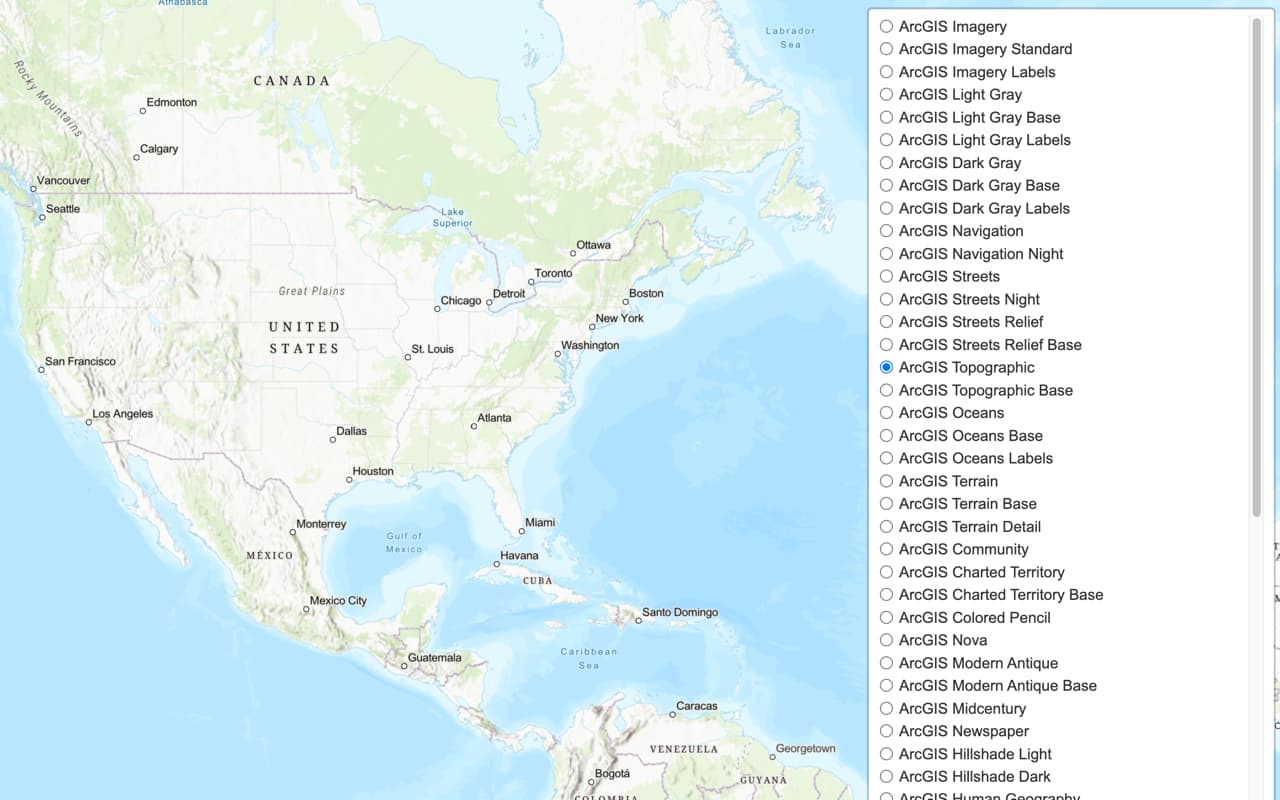
The ArcGIS Basemap Styles service provides a number of different styles that you can use in your OpenLayers applications. Each style accepts a language parameter, which allows you to localize place labels. There are currently over 30 different languages available.

In this tutorial, you use a <select> dropdown menu to toggle between a number of different place label languages.

Prerequisites

You need an ArcGIS Location Platform or ArcGIS Online account.

Steps

Get the starter app

Select a type of authentication and follow the steps to create a new app.

You can choose one of the following to create a new CodePen:

  • Option 1: Complete the Display a map tutorial; or,
  • Option 2: Start from the Display a map tutorial .

Set up authentication

Create a new API key credential with the correct privileges to get an access token.

  1. Go to the Create an API key tutorial and create an API key with the following privilege(s):
    • Privileges
      • Location services > Basemaps

Set developer credentials

Use the API key or OAuth developer credentials so your application can access ArcGIS services.

  1. Update the accessToken variable to use your API key.

    Expand
    Use dark colors for code blocks
    1
    2
    3
    4
    5
    6
    7
    8
    9
    10
    11
    12
    13
    14
    15
    16
    17
    18
    19
    20
    21
    22
    23
    24
    25
    26
    27
    28
    29
    30
    31
    32
    33
    34
    35
    36
    37
    38
    39
    40
    41
    42
    43
    44
    45
    46
    47
    48
    49
    50
    51
    52
    53
    54
    55
    56
    57
    58
    59
    60
    61
    62
    63
    64
    65
    66
    67
    68
    69
    70
    71
    72
    73
    74
    75
    76
    77
    78
    79
    80
    81
    82
    83
        /* Use for API key authentication */
        const accessToken = "YOUR_ACCESS_TOKEN";
    
    Expand

Remove basemap references

  1. Remove the basemapId, basemapURL, and the olms function.

    Expand
    Use dark colors for code blocks
    1
    2
    3
    4
    5
    6
    7
    8
    9
    10
    11
    12
    13
    14
    15
    16
    17
    18
    19
    20
    21
    22
    23
    24
    25
    26
    27
    28
    29
    30
    31
    32
    33
    34
    35
    36
    37
    38
    39
    40
    41
    42
    43
    44
    45
    46
    47
    48
    49
    50
    51
    52
    53
    54
    55
    56
    57
    58
    59
    60
    61
    62
    63
    64
    65
    66
    67
    68
    69
    70
    71
    72
    73
    74
    75
    76
    77
    78
    79
    80
    81
    82
    83
        <script>
    
        /* Use for API key authentication */
        const accessToken = "YOUR_ACCESS_TOKEN";
    
        // or
    
        /* Use for user authentication */
        // const session = await arcgisRest.ArcGISIdentityManager.beginOAuth2({
        //   clientId: "YOUR_CLIENT_ID", // Your client ID from OAuth credentials
        //   redirectUri: "YOUR_REDIRECT_URI", // The redirect URL registered in your OAuth credentials
        //   portal: "https://www.arcgis.com/sharing/rest" // Your portal URL
        // })
    
        // const accessToken = session.token;
    
        const map = new ol.Map({ target: "map" });
    
        map.setView(
          new ol.View({
            center: ol.proj.fromLonLat([-20, 30]),
            zoom: 3
          })
        );
    
        const basemapId = "arcgis/outdoor";
    
        const basemapURL = `https://basemapstyles-api.arcgis.com/arcgis/rest/services/styles/v2/styles/${basemapId}?token=${accessToken}`;
    
        olms.apply(map, basemapURL)
    
          .then(() => {
            // Add Esri attribution
            // Learn more in https://esriurl.com/attribution
            const source = map.getLayers().item(0).getSource();
            const poweredByEsriString = "Powered by <a href='https://www.esri.com/en-us/home' target='_blank'>Esri</a> | ";
    
            const attributionFn = source.getAttributions();
            if (attributionFn) {
              source.setAttributions((ViewStateLayerStateExtent) => {
                return [poweredByEsriString, ...attributionFn(ViewStateLayerStateExtent)];
              });
            } else source.setAttributions(poweredByEsriString);
    
          });
    
        </script>
    
    Expand

Add a language selector

Add a menu that allows users to change the display language of your map. OpenLayers does not have a built-in selector widget, so you will create an HTML <select> element.

  1. In the <head> tag, add CSS that will position the <select> menu wrapper element in the upper right corner and provide styling.

    Expand
    Use dark colors for code blocks
    1
    2
    3
    4
    5
    6
    7
    8
    9
    10
    11
    12
    13
    14
    15
    16
    17
    18
    19
    20
    21
    22
    23
    24
    25
    26
    27
    28
    29
    30
    31
    32
    33
    34
    35
    36
    37
    38
    39
    40
    41
    42
    43
    44
    45
    46
    47
    48
    49
    50
    51
    52
    53
    54
    55
    56
    57
    58
    59
    60
    61
    62
    63
    64
    65
    66
    67
    68
    69
    70
    71
    72
    73
    74
    75
    76
    77
    78
    79
    80
    81
    82
    83
    84
    85
    86
    87
    88
    89
    90
    91
    92
    93
    94
    95
    96
    97
    98
    99
    100
    101
    102
    103
    104
    105
    106
    107
    108
    109
    110
    111
    112
    113
    114
    115
    116
    117
    118
    119
    120
    121
    122
    123
    124
    125
    126
    127
        <style>
        html,
        body,
        #map {
          padding: 0;
          margin: 0;
          height: 100%;
          width: 100%;
          font-family: Arial, Helvetica, sans-serif;
          font-size: 14px;
          color: #323232;
        }
    
    
        #languages-wrapper {
          position: absolute;
          top: 20px;
          right: 20px;
        }
    
        #languages {
          font-size: 16px;
          padding: 4px 8px;
        }
    
    
        </style>
    
    Expand
  2. In the <body> element, add the wrapper tag with an id of languages-wrapper.

    Expand
    Use dark colors for code blocks
    1
    2
    3
    4
    5
    6
    7
    8
    9
    10
    11
    12
    13
    14
    15
    16
    17
    18
    19
    20
    21
    22
    23
    24
    25
    26
    27
    28
    29
    30
    31
    32
    33
    34
    35
    36
    37
    38
    39
    40
    41
    42
    43
    44
    45
    46
    47
    48
    49
    50
    51
    52
    53
    54
    55
    56
    57
    58
    59
    60
    61
    62
    63
    64
    65
    66
    67
    68
    69
    70
    71
    72
    73
    74
    75
    76
    77
    78
    79
    80
    81
    82
    83
    84
    85
    86
    87
    88
    89
    90
    91
    92
    93
    94
    95
    96
    97
    98
    99
    100
    101
    102
    103
    104
    105
    106
    107
    108
    109
    110
    111
    112
    113
    114
    115
    116
    117
    118
    119
    120
    121
    122
    123
    124
    125
    126
    127
    
      <body>
        <div id="map"></div>
    
        <div id="languages-wrapper">
    
        </div>
    
    Expand
  3. In the wrapper element, add a <select> element, which you will populate in a later step.

    Expand
    Use dark colors for code blocks
    1
    2
    3
    4
    5
    6
    7
    8
    9
    10
    11
    12
    13
    14
    15
    16
    17
    18
    19
    20
    21
    22
    23
    24
    25
    26
    27
    28
    29
    30
    31
    32
    33
    34
    35
    36
    37
    38
    39
    40
    41
    42
    43
    44
    45
    46
    47
    48
    49
    50
    51
    52
    53
    54
    55
    56
    57
    58
    59
    60
    61
    62
    63
    64
    65
    66
    67
    68
    69
    70
    71
    72
    73
    74
    75
    76
    77
    78
    79
    80
    81
    82
    83
    84
    85
    86
    87
    88
    89
    90
    91
    92
    93
    94
    95
    96
    97
    98
    99
    100
    101
    102
    103
    104
    105
    106
    107
    108
    109
    110
    111
    112
    113
    114
    115
    116
    117
    118
    119
    120
    121
    122
    123
    124
    125
    126
    127
        <div id="languages-wrapper">
    
          <select id="languages"></select>
    
        </div>
    
    Expand

Set the initial language

When the page loads, initialize the app to initially display in Ukrainian.

  1. Create a function called url that creates the URL for a basemap style.

    Expand
    Use dark colors for code blocks
    1
    2
    3
    4
    5
    6
    7
    8
    9
    10
    11
    12
    13
    14
    15
    16
    17
    18
    19
    20
    21
    22
    23
    24
    25
    26
    27
    28
    29
    30
    31
    32
    33
    34
    35
    36
    37
    38
    39
    40
    41
    42
    43
    44
    45
    46
    47
    48
    49
    50
    51
    52
    53
    54
    55
    56
    57
    58
    59
    60
    61
    62
    63
    64
    65
    66
    67
    68
    69
    70
    71
    72
    73
    74
    75
    76
    77
    78
    79
    80
    81
    82
    83
    84
    85
    86
    87
    88
    89
    90
    91
    92
    93
    94
    95
    96
    97
    98
    99
    100
    101
    102
    103
    104
    105
    106
    107
    108
    109
    110
    111
    112
    113
    114
    115
    116
    117
    118
    119
    120
    121
    122
    123
    124
    125
    126
    127
        <script>
        /* Use for API key authentication */
        const accessToken = "YOUR_ACCESS_TOKEN";
    
        // or
    
        /* Use for user authentication */
        // const session = await arcgisRest.ArcGISIdentityManager.beginOAuth2({
        //   clientId: "YOUR_CLIENT_ID", // Your client ID from OAuth credentials
        //   redirectUri: "YOUR_REDIRECT_URI", // The redirect URL registered in your OAuth credentials
        //   portal: "YOUR_PORTAL_URL" // Your portal URL
        // })
    
        // const accessToken = session.token;
    
        const map = new ol.Map({ target: "map" });
        map.setView(
          new ol.View({
            center: ol.proj.fromLonLat([48.8790, 35.7088]),
            zoom: 3
          })
        );
    
        const baseUrl = "https://basemapstyles-api.arcgis.com/arcgis/rest/services/styles/v2/styles";
        const url = (language) => `${baseUrl}/arcgis/outdoor?token=${accessToken}&language=${language}`;
    
    Expand
  2. Create a function called setLanguage that will clear existing basemap layers and use olms to instantiate a basemap layer in the new language.

    Expand
    Use dark colors for code blocks
    1
    2
    3
    4
    5
    6
    7
    8
    9
    10
    11
    12
    13
    14
    15
    16
    17
    18
    19
    20
    21
    22
    23
    24
    25
    26
    27
    28
    29
    30
    31
    32
    33
    34
    35
    36
    37
    38
    39
    40
    41
    42
    43
    44
    45
    46
    47
    48
    49
    50
    51
    52
    53
    54
    55
    56
    57
    58
    59
    60
    61
    62
    63
    64
    65
    66
    67
    68
    69
    70
    71
    72
    73
    74
    75
    76
    77
    78
    79
    80
    81
    82
    83
    84
    85
    86
    87
    88
    89
    90
    91
    92
    93
    94
    95
    96
    97
    98
    99
    100
    101
    102
    103
    104
    105
    106
    107
    108
    109
    110
    111
    112
    113
    114
    115
    116
    117
    118
    119
    120
    121
    122
    123
    124
    125
    126
    127
        const baseUrl = "https://basemapstyles-api.arcgis.com/arcgis/rest/services/styles/v2/styles";
        const url = (language) => `${baseUrl}/arcgis/outdoor?token=${accessToken}&language=${language}`;
    
        const setLanguage = (language) => {
          // Clear out existing layers.
          map.setLayerGroup(new ol.layer.Group());
          // Instantiate the given basemap layer.
          olms.apply(map, url(language))
            .then(() => {
              // Add Esri attribution
              // Learn more in https://esriurl.com/attribution
              const source = map.getLayers().item(0).getSource();
              const poweredByEsriString = "Powered by <a href='https://www.esri.com/en-us/home' target='_blank'>Esri</a> | ";
    
              const attributionFn = source.getAttributions();
              if (attributionFn) {
                source.setAttributions((ViewStateLayerStateExtent) => {
                  return [poweredByEsriString, ...attributionFn(ViewStateLayerStateExtent)];
                });
              } else source.setAttributions(poweredByEsriString);
    
            });
        };
    
    Expand
  3. Access the <select> element using its id.

    Expand
    Use dark colors for code blocks
    1
    2
    3
    4
    5
    6
    7
    8
    9
    10
    11
    12
    13
    14
    15
    16
    17
    18
    19
    20
    21
    22
    23
    24
    25
    26
    27
    28
    29
    30
    31
    32
    33
    34
    35
    36
    37
    38
    39
    40
    41
    42
    43
    44
    45
    46
    47
    48
    49
    50
    51
    52
    53
    54
    55
    56
    57
    58
    59
    60
    61
    62
    63
    64
    65
    66
    67
    68
    69
    70
    71
    72
    73
    74
    75
    76
    77
    78
    79
    80
    81
    82
    83
    84
    85
    86
    87
    88
    89
    90
    91
    92
    93
    94
    95
    96
    97
    98
    99
    100
    101
    102
    103
    104
    105
    106
    107
    108
    109
    110
    111
    112
    113
    114
    115
    116
    117
    118
    119
    120
    121
    122
    123
    124
    125
    126
    127
        const basemapsSelectElement = document.querySelector("#languages");
    
    Expand
  4. Import arcgisRest.request() to make a request to the Basemap Styles service. This dynamically fetches the available basemap languages and populates the select element.

    Use dark colors for code blocks
    1
    2
    3
    4
    5
    6
    7
    8
    9
    10
    11
    12
    13
    14
    15
    16
    17
    18
    19
    20
    21
    22
    23
    24
    25
    26
    27
    28
    29
    30
    31
    32
    33
    34
    35
    36
    37
    38
    39
    40
    41
    42
    43
    44
    45
    46
    47
    48
    49
    50
    51
    52
    53
    54
    55
    56
    57
    58
    59
    60
    61
    62
    63
    64
    65
    66
    67
    68
    69
    70
    71
    72
    73
    74
    75
    76
    77
    78
    79
    80
    81
    82
    83
    84
    85
    86
    87
    88
    89
    90
    91
    92
    93
    94
    95
    96
    97
    98
    99
    100
    101
    102
    103
    104
    105
    106
    107
    108
    109
    110
    111
    112
    113
    114
    115
    116
    117
    118
    119
    120
    121
    122
    123
    124
    125
    126
    127
        <!-- REST JS -->
        <script src="https://unpkg.com/@esri/arcgis-rest-request@4/dist/bundled/request.umd.js"></script>
    
    Expand
    Use dark colors for code blocks
    1
    2
    3
    4
    5
    6
    7
    8
    9
    10
    11
    12
    13
    14
    15
    16
    17
    18
    19
    20
    21
    22
    23
    24
    25
    26
    27
    28
    29
    30
    31
    32
    33
    34
    35
    36
    37
    38
    39
    40
    41
    42
    43
    44
    45
    46
    47
    48
    49
    50
    51
    52
    53
    54
    55
    56
    57
    58
    59
    60
    61
    62
    63
    64
    65
    66
    67
    68
    69
    70
    71
    72
    73
    74
    75
    76
    77
    78
    79
    80
    81
    82
    83
    84
    85
    86
    87
    88
    89
    90
    91
    92
    93
    94
    95
    96
    97
    98
    99
    100
    101
    102
    103
    104
    105
    106
    107
    108
    109
    110
    111
    112
    113
    114
    115
    116
    117
    118
    119
    120
    121
    122
    123
    124
    125
    126
    127
        arcgisRest.request(`${baseUrl}/self`, {
          httpMethod: "GET"
        }).then((response) => {
          response.languages.forEach((language) => {
            const option = document.createElement("option");
            option.value = language.code;
            option.textContent = language.name;
            basemapsSelectElement.appendChild(option);
          });
    
        });
    
    Expand
  1. Call setLanguage to initialize the basemap layer to the Ukrainian (uk) enumeration.

    Expand
    Use dark colors for code blocks
    1
    2
    3
    4
    5
    6
    7
    8
    9
    10
    11
    12
    13
    14
    15
    16
    17
    18
    19
    20
    21
    22
    23
    24
    25
    26
    27
    28
    29
    30
    31
    32
    33
    34
    35
    36
    37
    38
    39
    40
    41
    42
    43
    44
    45
    46
    47
    48
    49
    50
    51
    52
    53
    54
    55
    56
    57
    58
    59
    60
    61
    62
    63
    64
    65
    66
    67
    68
    69
    70
    71
    72
    73
    74
    75
    76
    77
    78
    79
    80
    81
    82
    83
    84
    85
    86
    87
    88
    89
    90
    91
    92
    93
    94
    95
    96
    97
    98
    99
    100
    101
    102
    103
    104
    105
    106
    107
    108
    109
    110
    111
    112
    113
    114
    115
    116
    117
    118
    119
    120
    121
    122
    123
    124
    125
    126
    127
        arcgisRest.request(`${baseUrl}/self`, {
          httpMethod: "GET"
        }).then((response) => {
          response.languages.forEach((language) => {
            const option = document.createElement("option");
            option.value = language.code;
            option.textContent = language.name;
            basemapsSelectElement.appendChild(option);
          });
    
          setLanguage(response.languages[0].code);
    
        });
    
    Expand

Add an event listener

Call setLanguage when the user selects an option in the <select> menu.

  1. Add an event listener that calls setLanguage when the <select> element is changed.

    Expand
    Use dark colors for code blocks
    1
    2
    3
    4
    5
    6
    7
    8
    9
    10
    11
    12
    13
    14
    15
    16
    17
    18
    19
    20
    21
    22
    23
    24
    25
    26
    27
    28
    29
    30
    31
    32
    33
    34
    35
    36
    37
    38
    39
    40
    41
    42
    43
    44
    45
    46
    47
    48
    49
    50
    51
    52
    53
    54
    55
    56
    57
    58
    59
    60
    61
    62
    63
    64
    65
    66
    67
    68
    69
    70
    71
    72
    73
    74
    75
    76
    77
    78
    79
    80
    81
    82
    83
    84
    85
    86
    87
    88
    89
    90
    91
    92
    93
    94
    95
    96
    97
    98
    99
    100
    101
    102
    103
    104
    105
    106
    107
    108
    109
    110
    111
    112
    113
    114
    115
    116
    117
    118
    119
    120
    121
    122
    123
    124
    125
    126
    127
        const basemapsSelectElement = document.querySelector("#languages");
    
        arcgisRest.request(`${baseUrl}/self`, {
          httpMethod: "GET"
        }).then((response) => {
          response.languages.forEach((language) => {
            const option = document.createElement("option");
            option.value = language.code;
            option.textContent = language.name;
            basemapsSelectElement.appendChild(option);
          });
    
          setLanguage(response.languages[0].code);
    
        });
    
        basemapsSelectElement.addEventListener("change", (e) => {
          setLanguage(e.target.value);
        });
    
    Expand

Run the app

Run the app.

Use the layer switcher menu at the top right to select and explore different basemap layer styles.

What's Next?

Learn how to use additional location services in these tutorials:

Your browser is no longer supported. Please upgrade your browser for the best experience. See our browser deprecation post for more details.