Tutorial: Query features (SQL)

Learn how to execute a SQL query to access polygon features in a feature service.

A feature service hosted in ArcGIS can contain a large number of features. To access a subset of the features, you can execute a SQL or spatial query, or both at the same time. Your query can return the attributes, geometry, or both attributes and geometry for each record. SQL and spatial queries are useful when a feature layer is very large and you just want to access a subset of the data.

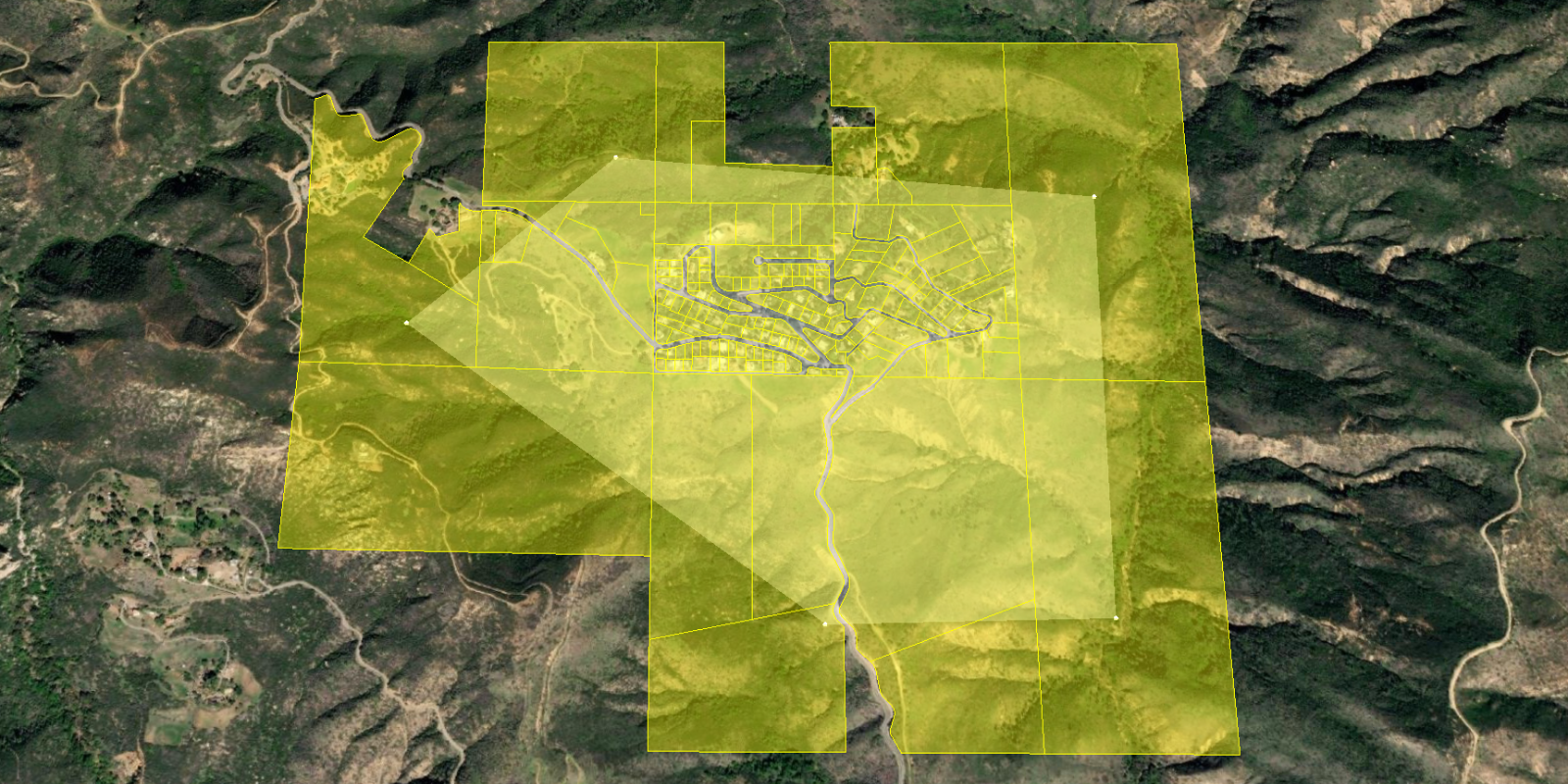
In this tutorial, you perform server-side SQL queries to return a subset of the features from the LA County Parcels feature service. The feature service contains over 2.4 million features. The resulting features are displayed as a GeoJsonDataSource using CesiumJS.

Prerequisites

You need an ArcGIS Developer or ArcGIS Online account to access the developer dashboard and create an API key.

Steps

Create a new pen

  1. To get started, either complete the Display a scene tutorial or .

Set the API key

To access location services, you need an API key or OAuth 2.0 access token. To learn how to create and scope your key, visit the Create an API key tutorial.

  1. Go to your dashboard to get an API key. The API key must be scoped to access the services used in this tutorial.

  2. In CodePen, update apiKey to use your key. Update cesiumAccessToken to use your Cesium ion access token.

    Use dark colors for code blocks
    1
    2
    3
    4
    5
    6
    7
    8
    9
    10
    11
    12
    13
    14
    15
    16
    17
    18
    19
    20
    21
    22
    23
    24
    25
    26
    27
    28
    29
    30
    31
    32
    33
    34
    35
    36
    37
    38
    39
    40
    41
    42
    43
    44
    45
    46
    47
    48
    49
    50
    51
    52
    53
    54
    55
    56
    57
    58
    59
          const apiKey = "YOUR_API_KEY";
    
          Cesium.ArcGisMapService.defaultAccessToken = apiKey;
    
          const cesiumAccessToken = "YOUR_CESIUM_ACCESS_TOKEN";
    
          Cesium.Ion.defaultAccessToken = cesiumAccessToken;
    
          const arcGisImagery = Cesium.ArcGisMapServerImageryProvider.fromBasemapType(Cesium.ArcGisBaseMapType.SATELLITE);
    
          const viewer = new Cesium.Viewer("cesiumContainer", {
    
            baseLayer: Cesium.ImageryLayer.fromProviderAsync(arcGisImagery),
    
          });
    

Add references to ArcGIS REST JS

  1. In the <head> element, reference the feature-service and request packages from ArcGIS REST JS.

    Use dark colors for code blocks
    1
    2
    3
    4
    5
    6
    7
    8
    9
    10
    11
    12
    13
    14
    15
    16
    17
    18
    19
    20
    21
    22
    23
    24
    25
    26
    27
    28
    29
    30
    31
    32
    33
    34
    35
    36
    37
    38
    39
    40
    41
    42
    43
    44
    45
    46
    47
    48
    49
    50
    51
    52
    53
    54
    55
    56
    57
    58
    59
    60
    61
    62
        <script src="https://cesium.com/downloads/cesiumjs/releases/1.107/Build/Cesium/Cesium.js"></script>
        <link href="https://cesium.com/downloads/cesiumjs/releases/1.107/Build/Cesium/Widgets/widgets.css" rel="stylesheet">
    
        <script src="https://unpkg.com/@esri/arcgis-rest-request@4.0.0/dist/bundled/request.umd.js"></script>
        <script src="https://unpkg.com/@esri/arcgis-rest-feature-service@4.0.0/dist/bundled/feature-service.umd.js"></script>
    
    
  2. In the <body>, create an arcgisRest.ApiKeyManager using your API key to authenticate requests to the feature service.

    Use dark colors for code blocks
    1
    2
    3
    4
    5
    6
    7
    8
    9
    10
    11
    12
    13
    14
    15
    16
    17
    18
    19
    20
    21
    22
    23
    24
    25
    26
    27
    28
    29
    30
    31
    32
    33
    34
    35
    36
    37
    38
    39
    40
    41
    42
    43
    44
    45
    46
    47
    48
    49
    50
    51
    52
    53
    54
    55
    56
    57
    58
    59
    60
    61
    62
    63
    64
    65
    66
    67
    68
    69
    70
    71
    72
    73
    74
    75
    76
    77
    78
    79
    80
    81
    82
    83
    84
    85
    86
    87
    88
    89
    90
    91
    92
    93
    94
    95
    96
    97
    98
    99
    100
    101
    102
    103
    104
    105
    106
    107
    108
    109
    110
    111
        const apiKey = "YOUR_API_KEY";
    
        Cesium.ArcGisMapService.defaultAccessToken = apiKey;
    
        const authentication = arcgisRest.ApiKeyManager.fromKey(apiKey);
    

Create a query selector

ArcGIS feature layers support a standard SQL query where clause. Use a drop-down <select> element to provide a list of SQL queries for the LA County Parcels feature layer.

  1. Create a <select> HTML element that allows the user to select different SQL queries. Construct each SQL query based on the values of attributes in the LA County Parcels layer, such as UseType and TaxRateArea.

    Expand
    Use dark colors for code blocks
    1
    2
    3
    4
    5
    6
    7
    8
    9
    10
    11
    12
    13
    14
    15
    16
    17
    18
    19
    20
    21
    22
    23
    24
    25
    26
    27
    28
    29
    30
    31
    32
    33
    34
    35
    36
    37
    38
    39
    40
    41
    42
    43
    44
    45
    46
    47
    48
    49
    50
    51
    52
    53
    54
    55
    56
    57
    58
    59
    60
    61
    62
    63
    64
    65
    66
    67
    68
    69
    70
    71
    72
    73
    74
    75
    76
    77
    78
    79
    80
    81
    82
    83
    84
    85
    86
    87
    88
    89
    90
    91
    92
    93
    94
    95
    96
    97
    98
    99
    100
    101
    102
    103
    104
    105
    106
    107
    108
    109
    110
    111
    112
    113
    114
    115
    116
    117
    118
    119
    120
    121
    122
    123
    124
    125
    126
    127
    128
    129
    130
    131
    132
    133
    134
    135
    136
    137
    138
    139
    140
    141
    <body>
      <div id="cesiumContainer"></div>
    
      <select id="query-select">
        <option value="">Choose a WHERE clause...</option>
        <option value="UseType = 'Residential'">UseType = 'Residential'</option>
        <option value="UseType = 'Government'">UseType = 'Government'</option>
        <option value="UseType = 'Irrigated Farm'">UseType = 'Irrigated Farm'</option>
        <option value="TaxRateArea = 10853">TaxRateArea = 10853</option>
        <option value="TaxRateArea = 10860" selected>TaxRateArea = 10860</option>
        <option value="TaxRateArea = 08637">TaxRateArea = 08637</option>
        <option value="Roll_LandValue > 1000000">Roll_LandValue &gt; 1000000</option>
        <option value="Roll_LandValue < 1000000">Roll_LandValue &lt; 1000000</option>
      </select>
    
      <script>
    
    Expand
  2. Style the <select> element so that it displays properly in your application.

    Expand
    Use dark colors for code blocks
    1
    2
    3
    4
    5
    6
    7
    8
    9
    10
    11
    12
    13
    14
    15
    16
    17
    18
    19
    20
    21
    22
    23
    24
    25
    26
    27
    28
    29
    30
    31
    32
    33
    34
    35
    36
    37
    38
    39
    40
    41
    42
    43
    44
    45
    46
    47
    48
    49
    50
    51
    52
    53
    54
    55
    56
    57
    58
    59
    60
    61
    62
    63
    64
    65
    66
    67
    68
    69
    70
    71
    72
    73
    74
    75
    76
    77
    78
    79
    80
    81
    82
    83
    84
    85
    86
    87
    88
    89
    90
    91
    92
    93
    94
    95
    96
    97
    98
    99
    100
    101
    102
    103
    104
    105
    106
    107
    108
    109
    110
    111
    112
    113
    114
    115
    116
    117
    118
    119
    120
    121
    122
    123
    124
    125
    126
    127
    128
    129
    130
    131
    132
    133
    134
    135
    136
    137
    138
    139
    140
    141
      <style>
        html, body, #cesiumContainer {
          width:100%;
          height:100%;
          padding:0px;
          margin:0px;
        }
    
        #query-select {
              position: absolute;
              top: 8px;
              left: 8px;
              padding: 4px 8px;
              font-size: 16px;
              border-radius: 0;
          }
    
      </style>
    
    Expand

Query the parcel layer

When the user selects a SQL query, use the ArcGIS REST JS queryFeatures operation to query the LA County Parcels feature layer.

  1. Copy the URL of the LA County Parcels feature layer. Define a new performQuery function that takes a SQL query string as input.

    Expand
    Use dark colors for code blocks
    1
    2
    3
    4
    5
    6
    7
    8
    9
    10
    11
    12
    13
    14
    15
    16
    17
    18
    19
    20
    21
    22
    23
    24
    25
    26
    27
    28
    29
    30
    31
    32
    33
    34
    35
    36
    37
    38
    39
    40
    41
    42
    43
    44
    45
    46
    47
    48
    49
    50
    51
    52
    53
    54
    55
    56
    57
    58
    59
    60
    61
    62
    63
    64
    65
    66
    67
    68
    69
    70
    71
    72
    73
    74
    75
    76
    77
    78
    79
    80
    81
    82
    83
    84
    85
    86
    87
    88
    89
    90
    91
    92
    93
    94
    95
    96
    97
    98
    99
    100
    101
    102
    103
    104
    105
    106
    107
    108
    109
    110
    111
    112
    113
    114
    115
    116
    117
    118
    119
    120
    121
    122
    123
    124
    125
    126
    127
    128
    129
    130
    131
    132
    133
    134
    135
    136
    137
    138
    139
    140
    141
        const layerName = "LA_County_Parcels";
        const layerURL = "https://services3.arcgis.com/GVgbJbqm8hXASVYi/arcgis/rest/services/"+layerName+"/FeatureServer/0";
    
        function performQuery(whereClause) {
    
        }
    
    Expand
  2. Query the feature layer using the queryFeatures operation. Pass the whereClause paramater as well as your authentication object. Format results as geojson.

    Expand
    Use dark colors for code blocks
    1
    2
    3
    4
    5
    6
    7
    8
    9
    10
    11
    12
    13
    14
    15
    16
    17
    18
    19
    20
    21
    22
    23
    24
    25
    26
    27
    28
    29
    30
    31
    32
    33
    34
    35
    36
    37
    38
    39
    40
    41
    42
    43
    44
    45
    46
    47
    48
    49
    50
    51
    52
    53
    54
    55
    56
    57
    58
    59
    60
    61
    62
    63
    64
    65
    66
    67
    68
    69
    70
    71
    72
    73
    74
    75
    76
    77
    78
    79
    80
    81
    82
    83
    84
    85
    86
    87
    88
    89
    90
    91
    92
    93
    94
    95
    96
    97
    98
    99
    100
    101
    102
    103
    104
    105
    106
    107
    108
    109
    110
    111
    112
    113
    114
    115
    116
    117
    118
    119
    120
    121
    122
    123
    124
    125
    126
    127
    128
    129
    130
    131
    132
    133
    134
    135
    136
    137
    138
    139
    140
    141
        const layerName = "LA_County_Parcels";
        const layerURL = "https://services3.arcgis.com/GVgbJbqm8hXASVYi/arcgis/rest/services/"+layerName+"/FeatureServer/0";
    
        function performQuery(whereClause) {
    
          arcgisRest.queryFeatures({
            url: layerURL,
            authentication,
            f:"geojson",
            returnGeometry:true,
    
            where: whereClause,
    
          })
    
        }
    
    Expand
  3. Add an event listener to your <select> HTML element. When the selected value changes, call the performQuery function.

    Expand
    Use dark colors for code blocks
    1
    2
    3
    4
    5
    6
    7
    8
    9
    10
    11
    12
    13
    14
    15
    16
    17
    18
    19
    20
    21
    22
    23
    24
    25
    26
    27
    28
    29
    30
    31
    32
    33
    34
    35
    36
    37
    38
    39
    40
    41
    42
    43
    44
    45
    46
    47
    48
    49
    50
    51
    52
    53
    54
    55
    56
    57
    58
    59
    60
    61
    62
    63
    64
    65
    66
    67
    68
    69
    70
    71
    72
    73
    74
    75
    76
    77
    78
    79
    80
    81
    82
    83
    84
    85
    86
    87
    88
    89
    90
    91
    92
    93
    94
    95
    96
    97
    98
    99
    100
    101
    102
    103
    104
    105
    106
    107
    108
    109
    110
    111
    112
    113
    114
    115
    116
    117
    118
    119
    120
    121
    122
    123
    124
    125
    126
    127
    128
    129
    130
    131
    132
    133
    134
    135
    136
    137
    138
    139
    140
    141
        const layerName = "LA_County_Parcels";
        const layerURL = "https://services3.arcgis.com/GVgbJbqm8hXASVYi/arcgis/rest/services/"+layerName+"/FeatureServer/0";
    
        function performQuery(whereClause) {
    
          arcgisRest.queryFeatures({
            url: layerURL,
            authentication,
            f:"geojson",
            returnGeometry:true,
    
            where: whereClause,
    
          })
    
        }
    
        const select = document.getElementById("query-select");
        select.addEventListener("change", () => {
    
            if (select.value !== "") {
                const whereClause = select.value;
                performQuery(whereClause);
            }
    
        });
    
    Expand

Set the query extent

The set of features returned by ArcGIS REST JS may not be visible from the current camera position. Add the camera position to the REST request as a geometry object to only return features that intersect the current viewable extent.

  1. Calculate the current viewable extent using the computeViewRectangle() function. Convert the result from radians to latitude and longitude in degrees.

    Expand
    Use dark colors for code blocks
    1
    2
    3
    4
    5
    6
    7
    8
    9
    10
    11
    12
    13
    14
    15
    16
    17
    18
    19
    20
    21
    22
    23
    24
    25
    26
    27
    28
    29
    30
    31
    32
    33
    34
    35
    36
    37
    38
    39
    40
    41
    42
    43
    44
    45
    46
    47
    48
    49
    50
    51
    52
    53
    54
    55
    56
    57
    58
    59
    60
    61
    62
    63
    64
    65
    66
    67
    68
    69
    70
    71
    72
    73
    74
    75
    76
    77
    78
    79
    80
    81
    82
    83
    84
    85
    86
    87
    88
    89
    90
    91
    92
    93
    94
    95
    96
    97
    98
    99
    100
    101
    102
    103
    104
    105
    106
    107
    108
    109
    110
    111
    112
    113
    114
    115
    116
    117
    118
    119
    120
    121
    122
    123
    124
    125
    126
    127
    128
    129
    130
    131
    132
    133
    134
    135
    136
    137
    138
    139
    140
    141
        function performQuery(whereClause) {
    
          const rect = viewer.camera.computeViewRectangle();
    
          const boundsRadian = [rect.east,rect.south,rect.west,rect.north];
          const boundsDegree = [];
    
          for (coordinate of boundsRadian) {
              boundsDegree.push(Cesium.Math.toDegrees(coordinate));
          }
    
          arcgisRest.queryFeatures({
            url: layerURL,
            authentication,
            f:"geojson",
            returnGeometry:true,
    
            where: whereClause,
    
          })
    
        }
    
    Expand
  2. Set the geometry parameter of your query to the extent, and specify the geometry type as esriGeometryEnvelope. Perform a spatial intersection to only return features that overlap with the extent.

    Expand
    Use dark colors for code blocks
    1
    2
    3
    4
    5
    6
    7
    8
    9
    10
    11
    12
    13
    14
    15
    16
    17
    18
    19
    20
    21
    22
    23
    24
    25
    26
    27
    28
    29
    30
    31
    32
    33
    34
    35
    36
    37
    38
    39
    40
    41
    42
    43
    44
    45
    46
    47
    48
    49
    50
    51
    52
    53
    54
    55
    56
    57
    58
    59
    60
    61
    62
    63
    64
    65
    66
    67
    68
    69
    70
    71
    72
    73
    74
    75
    76
    77
    78
    79
    80
    81
    82
    83
    84
    85
    86
    87
    88
    89
    90
    91
    92
    93
    94
    95
    96
    97
    98
    99
    100
    101
    102
    103
    104
    105
    106
    107
    108
    109
    110
    111
    112
    113
    114
    115
    116
    117
    118
    119
    120
    121
    122
    123
    124
    125
    126
    127
    128
    129
    130
    131
    132
    133
    134
    135
    136
    137
    138
    139
    140
    141
          arcgisRest.queryFeatures({
            url: layerURL,
            authentication,
            f:"geojson",
            returnGeometry:true,
    
            where: whereClause,
    
            geometry: boundsDegree,
            geometryType: "esriGeometryEnvelope",
            spatialRel: "esriSpatialRelIntersects",
            inSR:4326,
    
          })
    
    Expand

Display results

After you perform a SQL query, add the resulting features to the scene as GeoJSON.

  1. Add the service response service to the scene as a GeoJsonDataSource.

    Expand
    Use dark colors for code blocks
    1
    2
    3
    4
    5
    6
    7
    8
    9
    10
    11
    12
    13
    14
    15
    16
    17
    18
    19
    20
    21
    22
    23
    24
    25
    26
    27
    28
    29
    30
    31
    32
    33
    34
    35
    36
    37
    38
    39
    40
    41
    42
    43
    44
    45
    46
    47
    48
    49
    50
    51
    52
    53
    54
    55
    56
    57
    58
    59
    60
    61
    62
    63
    64
    65
    66
    67
    68
    69
    70
    71
    72
    73
    74
    75
    76
    77
    78
    79
    80
    81
    82
    83
    84
    85
    86
    87
    88
    89
    90
    91
    92
    93
    94
    95
    96
    97
    98
    99
    100
    101
    102
    103
    104
    105
    106
    107
    108
    109
    110
    111
    112
    113
    114
    115
    116
    117
    118
    119
    120
    121
    122
    123
    124
    125
    126
    127
    128
    129
    130
    131
    132
    133
    134
    135
    136
    137
    138
    139
    140
    141
          arcgisRest.queryFeatures({
            url: layerURL,
            authentication,
            f:"geojson",
            returnGeometry:true,
    
            where: whereClause,
    
            geometry: boundsDegree,
            geometryType: "esriGeometryEnvelope",
            spatialRel: "esriSpatialRelIntersects",
            inSR:4326,
    
          })
    
          .then((response) => {
    
              console.log(response)
              Cesium.GeoJsonDataSource.load(response,{
                  outline:true,
              }).then((data)=>{
                  viewer.dataSources.add(data);
              })
    
          })
    
    Expand
  2. In the event listener, remove all previous query results by calling dataSources.removeAll.

    Expand
    Use dark colors for code blocks
    1
    2
    3
    4
    5
    6
    7
    8
    9
    10
    11
    12
    13
    14
    15
    16
    17
    18
    19
    20
    21
    22
    23
    24
    25
    26
    27
    28
    29
    30
    31
    32
    33
    34
    35
    36
    37
    38
    39
    40
    41
    42
    43
    44
    45
    46
    47
    48
    49
    50
    51
    52
    53
    54
    55
    56
    57
    58
    59
    60
    61
    62
    63
    64
    65
    66
    67
    68
    69
    70
    71
    72
    73
    74
    75
    76
    77
    78
    79
    80
    81
    82
    83
    84
    85
    86
    87
    88
    89
    90
    91
    92
    93
    94
    95
    96
    97
    98
    99
    100
    101
    102
    103
    104
    105
    106
    107
    108
    109
    110
    111
    112
    113
    114
    115
    116
    117
    118
    119
    120
    121
    122
    123
    124
    125
    126
    127
    128
    129
    130
    131
    132
    133
    134
    135
    136
    137
    138
    139
    140
    141
        const select = document.getElementById("query-select");
        select.addEventListener("change", () => {
    
            viewer.dataSources.removeAll();
    
            if (select.value !== "") {
                const whereClause = select.value;
                performQuery(whereClause);
            }
    
        });
    
    Expand

Run the app

In CodePen, run your code to display the map.

When the scene loads, you should be able to use the query selector to display parcels. Click on a parcel to show a pop-up with the feature's attributes.

What's next?

Learn how to use additional ArcGIS location services in these tutorials:

Your browser is no longer supported. Please upgrade your browser for the best experience. See our browser deprecation post for more details.