A utility network is the main component users work with when managing utility and telecom networks in ArcGIS, providing a comprehensive framework for the modeling of utility systems such as electric, gas, water, storm water, wastewater, and telecommunications. It is designed to model all of the components that make up your system—such as wires, pipes, valves, zones, devices, and circuits—and allows you to build real-world behavior into the network features you model.
You must use ArcGIS Pro to create a utility network. Build your utility network within an enterprise geodatabase then publish it using ArcGIS Enterprise. Once it's available as a feature service, a utility network can be used in your ArcGIS Maps SDK for Java app.
See the following topics in the ArcGIS Pro documentation for more information about utility networks:
Using ArcGIS Maps SDK for Java, you can add the following utility network capabilities to your app:
- Display a utility network—Visualize assets on a map and see how assets are connected.
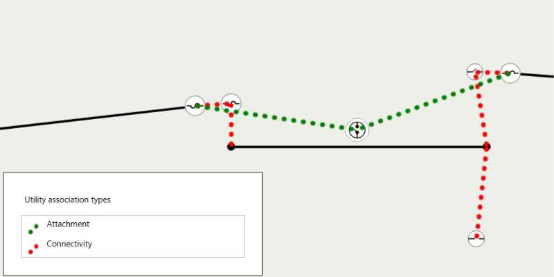
- Get associated utility elements—Explore associations that model connectivity, containment, and attachment between utility elements.
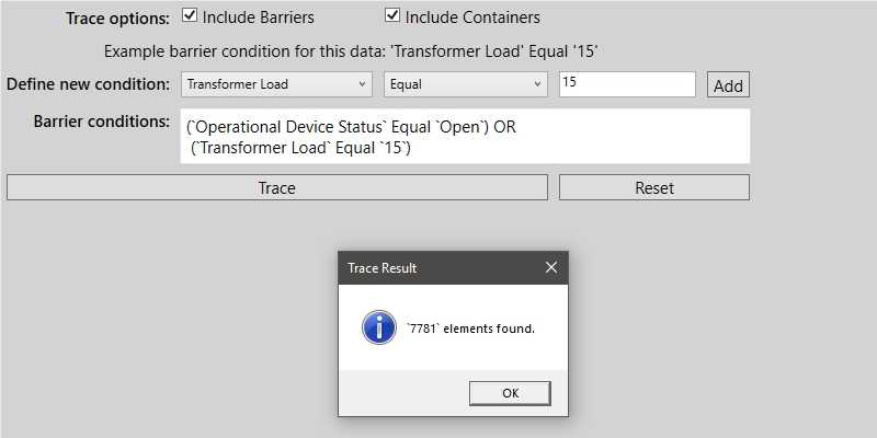
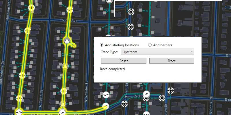
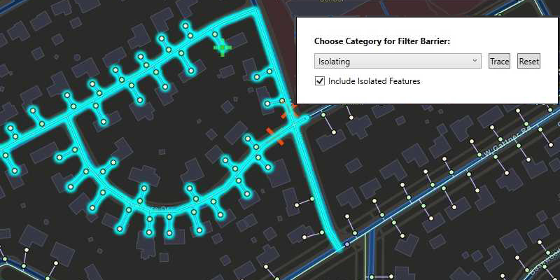
- Perform utility network traces—Analyze how resources, such as gas, water, or electricity flow through the network.
- Take a utility network offline—Take utility network information offline and work with it while disconnected. Display and query associations, make simple edits to utility network features, and synchronize edits with ArcGIS Enterprise.
Consult the Licensing levels and capabilities topic to help determine how your app must be licensed when working with a utility network.