Create a raster layer from a raster image service.
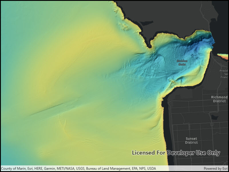
Use case
Accessing a raster image from an online service can be useful for analyzing the most up-to-date data available for an area. For example, retrieving recent results of bathymetry surveys within a shipping channel monitored for its sediment build-up would allow planners to assess dredging needs.
How to use the sample
Simply launch the sample to see a raster from an image service being used on a map.
How it works
- Create an using the service’s URL.
- Create a from the image service raster.
- Add the raster layer the the map.
Relevant API
- ImageServiceRaster
- RasterLayer
About the data
This sample uses a NOAA raster image service. The service computes a hillshade image from the depth (in meters) of U.S. coastal waters.
Tags
image service, raster
Sample Code
<UserControl x:Class="ArcGIS.WinUI.Samples.RasterLayerImageServiceRaster.RasterLayerImageServiceRaster" xmlns="http://schemas.microsoft.com/winfx/2006/xaml/presentation" xmlns:x="http://schemas.microsoft.com/winfx/2006/xaml" xmlns:esriUI="using:Esri.ArcGISRuntime.UI.Controls"> <Grid> <esriUI:MapView x:Name="MyMapView" /> </Grid></UserControl>// Copyright 2017 Esri.//// Licensed under the Apache License, Version 2.0 (the "License"); you may not use this file except in compliance with the License.// You may obtain a copy of the License at: http://www.apache.org/licenses/LICENSE-2.0//// Unless required by applicable law or agreed to in writing, software distributed under the License is distributed on an// "AS IS" BASIS, WITHOUT WARRANTIES OR CONDITIONS OF ANY KIND, either express or implied. See the License for the specific// language governing permissions and limitations under the License.
using Esri.ArcGISRuntime.Geometry;using Esri.ArcGISRuntime.Mapping;using Esri.ArcGISRuntime.Rasters;using System;
namespace ArcGIS.WinUI.Samples.RasterLayerImageServiceRaster{ [ArcGIS.Samples.Shared.Attributes.Sample( name: "Raster layer (service)", category: "Layers", description: "Create a raster layer from a raster image service.", instructions: "Simply launch the sample to see a raster from an image service being used on a map.", tags: new[] { "image service", "raster" })] public partial class RasterLayerImageServiceRaster { public RasterLayerImageServiceRaster() { InitializeComponent(); Initialize(); }
private void Initialize() { // Create new map with the dark gray canvas basemap. Map myMap = new Map(BasemapStyle.ArcGISDarkGray);
// Create a Uri to the image service raster. Uri myUri = new Uri("https://gis.ngdc.noaa.gov/arcgis/rest/services/bag_hillshades_subsets/ImageServer");
// Create new image service raster from the Uri. ImageServiceRaster myImageServiceRaster = new ImageServiceRaster(myUri);
// Create a new raster layer from the image service raster. RasterLayer myRasterLayer = new RasterLayer(myImageServiceRaster);
// Add the raster layer to the maps layer collection. myMap.OperationalLayers.Add(myRasterLayer);
// Assign the map to the map view. MyMapView.Map = myMap;
// Zoom in to the San Francisco Bay. MyMapView.SetViewpointCenterAsync(new MapPoint(-13643095.660131, 4550009.846004, SpatialReferences.WebMercator), 100000); } }}