Learn how to search for businesses, POIs, and geographic locations with the geocoding service
Place finding is the process of searching for a place name
In this tutorial, you will use a locator to access the Geocoding service
Prerequisites
Steps
Create a new pen
- To get started, either complete the Display a map tutorial or
.
Get an access token
You need an access token
- Go to the Create an API key tutorial and create an API key
An API key is a long-lived access token created using API key credentials. They are valid for up to one year and are typically embedded directly into client applications. with the following privilege(s)Privileges are a set of permissions assigned to ArcGIS accounts, developer credentials, and applications that grant access to secure resources and functionality in ArcGIS. :
- Privileges
- Location services > Basemaps
- Location services > Geocoding
- Privileges
- In CodePen, set the
apiKeyproperty on the globalesriConfigvariable to your access token.var esriConfig = {apiKey: "YOUR_ACCESS_TOKEN",};
To learn about other ways to get an access token, go to Types of authentication.
Update the map
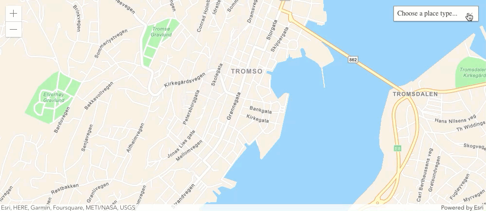
A streets basemap layerbasemap attribute to use the arcgis/navigation basemap layer and change the position of the map to center on Tromso.
-
Update the
basemapattribute fromarcgis/topographictoarcgis/navigationand the center to18.9553,69.6492.29 collapsed lines<html><head><meta charset="utf-8" /><meta name="viewport" content="width=device-width, initial-scale=1, shrink-to-fit=no" /><title>ArcGIS Maps SDK for JavaScript Tutorials: Find places</title><style>html,body {height: 100%;margin: 0;}</style><script>var esriConfig = {apiKey: "YOUR_ACCESS_TOKEN",};</script><!-- Load the ArcGIS Maps SDK for JavaScript from CDN --><script type="module" src="https://js.arcgis.com/5.0/"></script></head><body><arcgis-map basemap="arcgis/navigation" center="18.9553,69.6492" zoom="13"><arcgis-zoom slot="top-left"></arcgis-zoom></arcgis-map>5 collapsed lines</body></html>
Create a place category selector
You filter place search results by providing a location
-
Inside a Calcite Block component, add a Calcite Select component with an id of
places-selectand a Label ofChoose a place type.29 collapsed lines<html><head><meta charset="utf-8" /><meta name="viewport" content="width=device-width, initial-scale=1, shrink-to-fit=no" /><title>ArcGIS Maps SDK for JavaScript Tutorials: Find places</title><style>html,body {height: 100%;margin: 0;}</style><script>var esriConfig = {apiKey: "YOUR_ACCESS_TOKEN",};</script><!-- Load the ArcGIS Maps SDK for JavaScript from CDN --><script type="module" src="https://js.arcgis.com/5.0/"></script></head><body><arcgis-map basemap="arcgis/navigation" center="18.9553,69.6492" zoom="13"><arcgis-zoom slot="top-left"></arcgis-zoom><calcite-block expanded slot="top-right"><calcite-label id="places-select-label">Choose a place type<calcite-select id="places-select"></calcite-select></calcite-label></calcite-block></arcgis-map>5 collapsed lines</body></html> -
Create an option component for each category and add it to the Select component.
29 collapsed lines<html><head><meta charset="utf-8" /><meta name="viewport" content="width=device-width, initial-scale=1, shrink-to-fit=no" /><title>ArcGIS Maps SDK for JavaScript Tutorials: Find places</title><style>html,body {height: 100%;margin: 0;}</style><script>var esriConfig = {apiKey: "YOUR_ACCESS_TOKEN",};</script><!-- Load the ArcGIS Maps SDK for JavaScript from CDN --><script type="module" src="https://js.arcgis.com/5.0/"></script></head><body><arcgis-map basemap="arcgis/navigation" center="18.9553,69.6492" zoom="13"><arcgis-zoom slot="top-left"></arcgis-zoom><calcite-block expanded slot="top-right"><calcite-label id="places-select-label">Choose a place type<calcite-select id="places-select"><calcite-option value="Parks and Outdoors">Parks and Outdoors</calcite-option><calcite-option value="Coffee shop">Coffee shop</calcite-option><calcite-option value="Gas station">Gas station</calcite-option><calcite-option value="Food">Food</calcite-option><calcite-option value="Hotel">Hotel</calcite-option></calcite-select></calcite-label></calcite-block></arcgis-map>5 collapsed lines</body></html>
Add a script
-
Add a script tag with the type attribute set to module, to the bottom of the body.
26 collapsed lines<html><head><meta charset="utf-8" /><meta name="viewport" content="width=device-width, initial-scale=1, shrink-to-fit=no" /><title>ArcGIS Maps SDK for JavaScript Tutorials: Find places</title><style>html,body {height: 100%;margin: 0;}</style><script>var esriConfig = {apiKey: "YOUR_ACCESS_TOKEN",};</script><!-- Load the ArcGIS Maps SDK for JavaScript from CDN --><script type="module" src="https://js.arcgis.com/5.0/"></script></head><body><arcgis-map basemap="arcgis/navigation" center="18.9553,69.6492" zoom="13"><arcgis-zoom slot="top-left"></arcgis-zoom><calcite-block expanded slot="top-right"><calcite-label id="places-select-label">Choose a place type<calcite-select id="places-select"><calcite-option value="Parks and Outdoors">Parks and Outdoors</calcite-option><calcite-option value="Coffee shop">Coffee shop</calcite-option><calcite-option value="Gas station">Gas station</calcite-option><calcite-option value="Food">Food</calcite-option><calcite-option value="Hotel">Hotel</calcite-option></calcite-select></calcite-label></calcite-block></arcgis-map><script type="module"></script></body>3 collapsed lines</html> -
Using
$arcgis.import, add theGraphicandlocatormodules.The ArcGIS Maps SDK for JavaScript
ArcGIS Maps SDK for JavaScript, previously known as ArcGIS API for JavaScript, is a developer product for building mapping and spatial analysis applications for the web. is available via CDN and npm, but this tutorial is based on CDN. The$arcgis.importglobal function accepts a module path or array of module paths, and returns a promise that resolves with the requested modules. This function can only be used when working with the CDN; otherwise, use the standard import syntax. To learn more about the SDK’s different modules, visit the References page.50 collapsed lines<html><head><meta charset="utf-8" /><meta name="viewport" content="width=device-width, initial-scale=1, shrink-to-fit=no" /><title>ArcGIS Maps SDK for JavaScript Tutorials: Find places</title><style>html,body {height: 100%;margin: 0;}</style><script>var esriConfig = {apiKey: "YOUR_ACCESS_TOKEN",};</script><!-- Load the ArcGIS Maps SDK for JavaScript from CDN --><script type="module" src="https://js.arcgis.com/5.0/"></script></head><body><arcgis-map basemap="arcgis/navigation" center="18.9553,69.6492" zoom="13"><arcgis-zoom slot="top-left"></arcgis-zoom><calcite-block expanded slot="top-right"><calcite-label id="places-select-label">Choose a place type<calcite-select id="places-select"><calcite-option value="Parks and Outdoors">Parks and Outdoors</calcite-option><calcite-option value="Coffee shop">Coffee shop</calcite-option><calcite-option value="Gas station">Gas station</calcite-option><calcite-option value="Food">Food</calcite-option><calcite-option value="Hotel">Hotel</calcite-option></calcite-select></calcite-label></calcite-block></arcgis-map><script type="module">const [Graphic, locator] = await $arcgis.import(["@arcgis/core/Graphic","@arcgis/core/rest/locator",]);</script>5 collapsed lines</body></html>
Define variables for the components
Define variables for the components you will use in the app. You will use these variables to access the components and their properties.
-
Define variables for the
mapandplacesSelectcomponents.50 collapsed lines<html><head><meta charset="utf-8" /><meta name="viewport" content="width=device-width, initial-scale=1, shrink-to-fit=no" /><title>ArcGIS Maps SDK for JavaScript Tutorials: Find places</title><style>html,body {height: 100%;margin: 0;}</style><script>var esriConfig = {apiKey: "YOUR_ACCESS_TOKEN",};</script><!-- Load the ArcGIS Maps SDK for JavaScript from CDN --><script type="module" src="https://js.arcgis.com/5.0/"></script></head><body><arcgis-map basemap="arcgis/navigation" center="18.9553,69.6492" zoom="13"><arcgis-zoom slot="top-left"></arcgis-zoom><calcite-block expanded slot="top-right"><calcite-label id="places-select-label">Choose a place type<calcite-select id="places-select"><calcite-option value="Parks and Outdoors">Parks and Outdoors</calcite-option><calcite-option value="Coffee shop">Coffee shop</calcite-option><calcite-option value="Gas station">Gas station</calcite-option><calcite-option value="Food">Food</calcite-option><calcite-option value="Hotel">Hotel</calcite-option></calcite-select></calcite-label></calcite-block></arcgis-map><script type="module">const [Graphic, locator] = await $arcgis.import(["@arcgis/core/Graphic","@arcgis/core/rest/locator",]);const placesSelectElement = document.querySelector("#places-select");const viewElement = document.querySelector("arcgis-map");</script>5 collapsed lines</body></html>
Define the service url
You can use a locator to access the Geocoding service
- Define a variable,
locatorUrl, to the URL for the Geocoding serviceA geocoding service is a service that can search for addresses, place addresses, businesses, reverse geocode coordinates to addresses, provide suggestions for places, and perform bulk geocoding. It is hosted by Esri as the ArcGIS Geocoding service and can also be hosted in ArcGIS Enterprise. .50 collapsed lines<html><head><meta charset="utf-8" /><meta name="viewport" content="width=device-width, initial-scale=1, shrink-to-fit=no" /><title>ArcGIS Maps SDK for JavaScript Tutorials: Find places</title><style>html,body {height: 100%;margin: 0;}</style><script>var esriConfig = {apiKey: "YOUR_ACCESS_TOKEN",};</script><!-- Load the ArcGIS Maps SDK for JavaScript from CDN --><script type="module" src="https://js.arcgis.com/5.0/"></script></head><body><arcgis-map basemap="arcgis/navigation" center="18.9553,69.6492" zoom="13"><arcgis-zoom slot="top-left"></arcgis-zoom><calcite-block expanded slot="top-right"><calcite-label id="places-select-label">Choose a place type<calcite-select id="places-select"><calcite-option value="Parks and Outdoors">Parks and Outdoors</calcite-option><calcite-option value="Coffee shop">Coffee shop</calcite-option><calcite-option value="Gas station">Gas station</calcite-option><calcite-option value="Food">Food</calcite-option><calcite-option value="Hotel">Hotel</calcite-option></calcite-select></calcite-label></calcite-block></arcgis-map><script type="module">const [Graphic, locator] = await $arcgis.import(["@arcgis/core/Graphic","@arcgis/core/rest/locator",]);const placesSelectElement = document.querySelector("#places-select");const viewElement = document.querySelector("arcgis-map");const locatorUrl = "http://geocode-api.arcgis.com/arcgis/rest/services/World/GeocodeServer";</script>5 collapsed lines</body></html>
Search for places
To find placeslocator addressToLocations function. Performing a local search based on a category requires a location
-
Create a
findPlacesfunction and calladdressToLocations. Set thelocation,categoriesandoutFieldsproperties.50 collapsed lines<html><head><meta charset="utf-8" /><meta name="viewport" content="width=device-width, initial-scale=1, shrink-to-fit=no" /><title>ArcGIS Maps SDK for JavaScript Tutorials: Find places</title><style>html,body {height: 100%;margin: 0;}</style><script>var esriConfig = {apiKey: "YOUR_ACCESS_TOKEN",};</script><!-- Load the ArcGIS Maps SDK for JavaScript from CDN --><script type="module" src="https://js.arcgis.com/5.0/"></script></head><body><arcgis-map basemap="arcgis/navigation" center="18.9553,69.6492" zoom="13"><arcgis-zoom slot="top-left"></arcgis-zoom><calcite-block expanded slot="top-right"><calcite-label id="places-select-label">Choose a place type<calcite-select id="places-select"><calcite-option value="Parks and Outdoors">Parks and Outdoors</calcite-option><calcite-option value="Coffee shop">Coffee shop</calcite-option><calcite-option value="Gas station">Gas station</calcite-option><calcite-option value="Food">Food</calcite-option><calcite-option value="Hotel">Hotel</calcite-option></calcite-select></calcite-label></calcite-block></arcgis-map><script type="module">const [Graphic, locator] = await $arcgis.import(["@arcgis/core/Graphic","@arcgis/core/rest/locator",]);const placesSelectElement = document.querySelector("#places-select");const viewElement = document.querySelector("arcgis-map");const locatorUrl = "http://geocode-api.arcgis.com/arcgis/rest/services/World/GeocodeServer";async function findPlaces(category, point) {const results = await locator.addressToLocations(locatorUrl, {location: point,categories: [category],maxLocations: 25,outFields: ["Place_addr", "PlaceName"],});}</script>5 collapsed lines</body></html> -
Clear the view
A view is a UI component that draws the layers in a map or scene and controls their extent (area) and geographic features. of existing pop-ups and graphicsA graphic is a visual element composed of a geometry, symbol, and attributes that is displayed on a map or scene. .62 collapsed lines<html><head><meta charset="utf-8" /><meta name="viewport" content="width=device-width, initial-scale=1, shrink-to-fit=no" /><title>ArcGIS Maps SDK for JavaScript Tutorials: Find places</title><style>html,body {height: 100%;margin: 0;}</style><script>var esriConfig = {apiKey: "YOUR_ACCESS_TOKEN",};</script><!-- Load the ArcGIS Maps SDK for JavaScript from CDN --><script type="module" src="https://js.arcgis.com/5.0/"></script></head><body><arcgis-map basemap="arcgis/navigation" center="18.9553,69.6492" zoom="13"><arcgis-zoom slot="top-left"></arcgis-zoom><calcite-block expanded slot="top-right"><calcite-label id="places-select-label">Choose a place type<calcite-select id="places-select"><calcite-option value="Parks and Outdoors">Parks and Outdoors</calcite-option><calcite-option value="Coffee shop">Coffee shop</calcite-option><calcite-option value="Gas station">Gas station</calcite-option><calcite-option value="Food">Food</calcite-option><calcite-option value="Hotel">Hotel</calcite-option></calcite-select></calcite-label></calcite-block></arcgis-map><script type="module">const [Graphic, locator] = await $arcgis.import(["@arcgis/core/Graphic","@arcgis/core/rest/locator",]);const placesSelectElement = document.querySelector("#places-select");const viewElement = document.querySelector("arcgis-map");const locatorUrl = "http://geocode-api.arcgis.com/arcgis/rest/services/World/GeocodeServer";async function findPlaces(category, point) {const results = await locator.addressToLocations(locatorUrl, {location: point,categories: [category],maxLocations: 25,outFields: ["Place_addr", "PlaceName"],});viewElement.closePopup();viewElement.graphics.removeAll();}7 collapsed lines</script></body></html> -
Create a
Graphicfor each result returned. Set theattributes,geometry,symbolandpopupTemplateproperties for each. Add each graphic to theviewElement.62 collapsed lines<html><head><meta charset="utf-8" /><meta name="viewport" content="width=device-width, initial-scale=1, shrink-to-fit=no" /><title>ArcGIS Maps SDK for JavaScript Tutorials: Find places</title><style>html,body {height: 100%;margin: 0;}</style><script>var esriConfig = {apiKey: "YOUR_ACCESS_TOKEN",};</script><!-- Load the ArcGIS Maps SDK for JavaScript from CDN --><script type="module" src="https://js.arcgis.com/5.0/"></script></head><body><arcgis-map basemap="arcgis/navigation" center="18.9553,69.6492" zoom="13"><arcgis-zoom slot="top-left"></arcgis-zoom><calcite-block expanded slot="top-right"><calcite-label id="places-select-label">Choose a place type<calcite-select id="places-select"><calcite-option value="Parks and Outdoors">Parks and Outdoors</calcite-option><calcite-option value="Coffee shop">Coffee shop</calcite-option><calcite-option value="Gas station">Gas station</calcite-option><calcite-option value="Food">Food</calcite-option><calcite-option value="Hotel">Hotel</calcite-option></calcite-select></calcite-label></calcite-block></arcgis-map><script type="module">const [Graphic, locator] = await $arcgis.import(["@arcgis/core/Graphic","@arcgis/core/rest/locator",]);const placesSelectElement = document.querySelector("#places-select");const viewElement = document.querySelector("arcgis-map");const locatorUrl = "http://geocode-api.arcgis.com/arcgis/rest/services/World/GeocodeServer";async function findPlaces(category, point) {const results = await locator.addressToLocations(locatorUrl, {location: point,categories: [category],maxLocations: 25,outFields: ["Place_addr", "PlaceName"],});viewElement.closePopup();viewElement.graphics.removeAll();results.forEach((result) => {viewElement.graphics.add(new Graphic({attributes: result.attributes,geometry: result.location,symbol: {type: "simple-marker",color: "#000000",size: "12px",outline: {color: "#ffffff",width: "2px",},},popupTemplate: {title: "{PlaceName}",content: "{Place_addr}",},}),);});}7 collapsed lines</script></body></html> -
Call the
findPlacesfunction when the Map loads and each time the Map changes and becomes stationary by listening to the arcgisViewChange event.62 collapsed lines<html><head><meta charset="utf-8" /><meta name="viewport" content="width=device-width, initial-scale=1, shrink-to-fit=no" /><title>ArcGIS Maps SDK for JavaScript Tutorials: Find places</title><style>html,body {height: 100%;margin: 0;}</style><script>var esriConfig = {apiKey: "YOUR_ACCESS_TOKEN",};</script><!-- Load the ArcGIS Maps SDK for JavaScript from CDN --><script type="module" src="https://js.arcgis.com/5.0/"></script></head><body><arcgis-map basemap="arcgis/navigation" center="18.9553,69.6492" zoom="13"><arcgis-zoom slot="top-left"></arcgis-zoom><calcite-block expanded slot="top-right"><calcite-label id="places-select-label">Choose a place type<calcite-select id="places-select"><calcite-option value="Parks and Outdoors">Parks and Outdoors</calcite-option><calcite-option value="Coffee shop">Coffee shop</calcite-option><calcite-option value="Gas station">Gas station</calcite-option><calcite-option value="Food">Food</calcite-option><calcite-option value="Hotel">Hotel</calcite-option></calcite-select></calcite-label></calcite-block></arcgis-map><script type="module">const [Graphic, locator] = await $arcgis.import(["@arcgis/core/Graphic","@arcgis/core/rest/locator",]);const placesSelectElement = document.querySelector("#places-select");const viewElement = document.querySelector("arcgis-map");const locatorUrl = "http://geocode-api.arcgis.com/arcgis/rest/services/World/GeocodeServer";viewElement.addEventListener("arcgisViewChange", () => {if (viewElement.stationary) {findPlaces(placesSelectElement.value, viewElement.center);}});41 collapsed linesasync function findPlaces(category, point) {const results = await locator.addressToLocations(locatorUrl, {location: point,categories: [category],maxLocations: 25,outFields: ["Place_addr", "PlaceName"],});viewElement.closePopup();viewElement.graphics.removeAll();results.forEach((result) => {viewElement.graphics.add(new Graphic({attributes: result.attributes,geometry: result.location,symbol: {type: "simple-marker",color: "#000000",size: "12px",outline: {color: "#ffffff",width: "2px",},},popupTemplate: {title: "{PlaceName}",content: "{Place_addr}",},}),);});}</script></body></html> -
Places
A place, also known as a point of interest (POI), is a location that represents a business, administrative entity, or geographic feature around the world. A place can also have attributes associated with it, such as a name, address, category, and ID. for parks should be displayed on the map. By dragging the map, you will see new places populate the viewA view is a UI component that draws the layers in a map or scene and controls their extent (area) and geographic features. .
Add a handler to select a category
Use an event handler to call the findPlaces function when the category is changed.
- Add a
calciteSelectChangeevent listener to listen for category changes.62 collapsed lines<html><head><meta charset="utf-8" /><meta name="viewport" content="width=device-width, initial-scale=1, shrink-to-fit=no" /><title>ArcGIS Maps SDK for JavaScript Tutorials: Find places</title><style>html,body {height: 100%;margin: 0;}</style><script>var esriConfig = {apiKey: "YOUR_ACCESS_TOKEN",};</script><!-- Load the ArcGIS Maps SDK for JavaScript from CDN --><script type="module" src="https://js.arcgis.com/5.0/"></script></head><body><arcgis-map basemap="arcgis/navigation" center="18.9553,69.6492" zoom="13"><arcgis-zoom slot="top-left"></arcgis-zoom><calcite-block expanded slot="top-right"><calcite-label id="places-select-label">Choose a place type<calcite-select id="places-select"><calcite-option value="Parks and Outdoors">Parks and Outdoors</calcite-option><calcite-option value="Coffee shop">Coffee shop</calcite-option><calcite-option value="Gas station">Gas station</calcite-option><calcite-option value="Food">Food</calcite-option><calcite-option value="Hotel">Hotel</calcite-option></calcite-select></calcite-label></calcite-block></arcgis-map><script type="module">const [Graphic, locator] = await $arcgis.import(["@arcgis/core/Graphic","@arcgis/core/rest/locator",]);const placesSelectElement = document.querySelector("#places-select");const viewElement = document.querySelector("arcgis-map");const locatorUrl = "http://geocode-api.arcgis.com/arcgis/rest/services/World/GeocodeServer";viewElement.addEventListener("arcgisViewChange", () => {if (viewElement.stationary) {findPlaces(placesSelectElement.value, viewElement.center);}});placesSelectElement.addEventListener("calciteSelectChange", () => {findPlaces(placesSelectElement.value, viewElement.center);});42 collapsed linesasync function findPlaces(category, point) {const results = await locator.addressToLocations(locatorUrl, {location: point,categories: [category],maxLocations: 25,outFields: ["Place_addr", "PlaceName"],});viewElement.closePopup();viewElement.graphics.removeAll();results.forEach((result) => {viewElement.graphics.add(new Graphic({attributes: result.attributes,geometry: result.location,symbol: {type: "simple-marker",color: "#000000",size: "12px",outline: {color: "#ffffff",width: "2px",},},popupTemplate: {title: "{PlaceName}",content: "{Place_addr}",},}),);});}</script></body></html>
Run the app
In CodePen, run your code to display the map.
When you select a category, you should see places
What’s next?
Learn how to use additional SDK features and ArcGIS services in these tutorials: