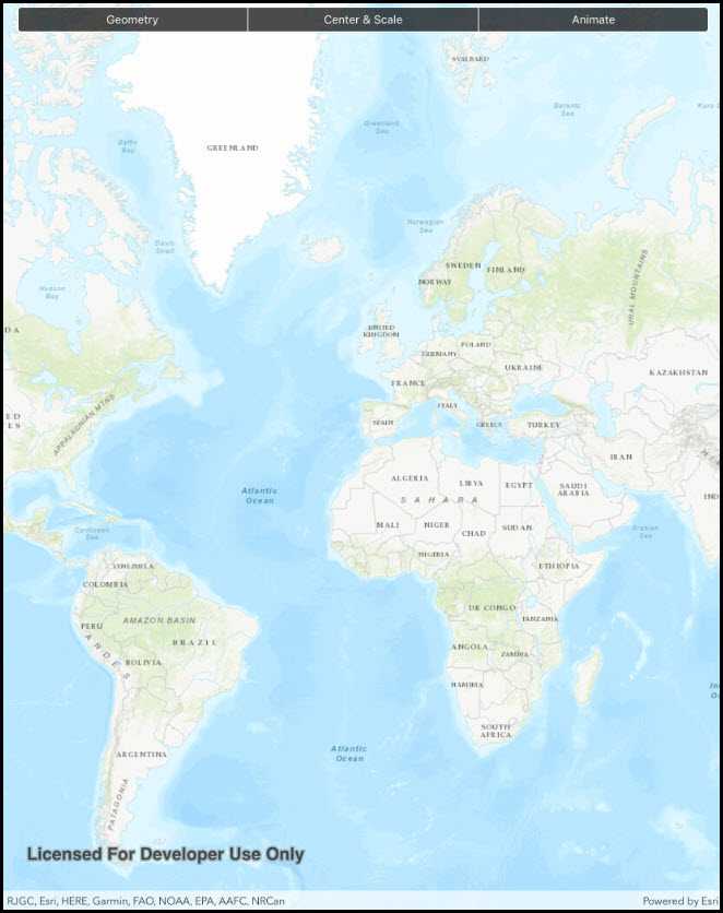
Set the map view to a new viewpoint.
Use case
Programatically navigate to a specified location in the map or scene. Use this to focus on a particular point or area of interest.
How to use the sample
The map view has several methods for setting its current viewpoint. Select a viewpoint from the UI to see the viewpoint changed using that method.
How it works
- Create a new
Mapobject and set it to theMapViewobject. - Change the map's
Viewpointusing one of the available methods:
- Use
MapView.SetViewpointAsync()to pan to a viewpoint. - Use
MapView.SetViewpointCenterAsync()to center the viewpoint on aPoint. - Use
MyMapView.SetViewpointScaleAsync()to set a distance from the ground using a scale. - Use
MapView.SetViewpointGeometryAsync()to set the viewpoint to a givenGeometry.
Relevant API
- Geometry
- Map
- MapView
- Point
- Viewpoint
Additional information
Below are some other ways to set a viewpoint:
- SetViewpoint
- SetViewpointAsync
- SetViewpointCenterAsync
- SetViewpointGeometryAsync
- SetViewpointRotationAsync
- SetViewpointScaleAsync
Tags
animate, extent, pan, rotate, scale, view, zoom
Sample Code
ChangeViewpoint.cs
// Copyright 2016 Esri.
//
// Licensed under the Apache License, Version 2.0 (the "License"); you may not use this file except in compliance with the License.
// You may obtain a copy of the License at: http://www.apache.org/licenses/LICENSE-2.0
//
// Unless required by applicable law or agreed to in writing, software distributed under the License is distributed on an
// "AS IS" BASIS, WITHOUT WARRANTIES OR CONDITIONS OF ANY KIND, either express or implied. See the License for the specific
// language governing permissions and limitations under the License.
using System;
using System.Collections.Generic;
using System.Linq;
using Esri.ArcGISRuntime.Geometry;
using Esri.ArcGISRuntime.Mapping;
using Esri.ArcGISRuntime.UI.Controls;
using Foundation;
using UIKit;
namespace ArcGISRuntime.Samples.ChangeViewpoint
{
[Register("ChangeViewpoint")]
[ArcGISRuntime.Samples.Shared.Attributes.Sample(
name: "Change viewpoint",
category: "MapView",
description: "Set the map view to a new viewpoint.",
instructions: "The map view has several methods for setting its current viewpoint. Select a viewpoint from the UI to see the viewpoint changed using that method.",
tags: new[] { "animate", "extent", "pan", "rotate", "scale", "view", "zoom" })]
public class ChangeViewpoint : UIViewController
{
// Hold references to UI controls.
private MapView _myMapView;
private UISegmentedControl _viewpointsButton;
// Coordinates for London.
private readonly MapPoint _londonCoords = new MapPoint(-13881.7678417696, 6710726.57374296, SpatialReferences.WebMercator);
private const double LondonScale = 8762.7156655228955;
// Coordinates for Redlands.
private readonly Polygon _redlandsEnvelope = new Polygon(
new List<MapPoint>
{
new MapPoint(-13049785.1566222, 4032064.6003424),
new MapPoint(-13049785.1566222, 4040202.42595729),
new MapPoint(-13037033.5780234, 4032064.6003424),
new MapPoint(-13037033.5780234, 4040202.42595729)
},
SpatialReferences.WebMercator);
// Coordinates for Edinburgh.
private readonly Polygon _edinburghEnvelope = new Polygon(
new List<MapPoint>
{
new MapPoint(-354262.156621384, 7548092.94093301),
new MapPoint(-354262.156621384, 7548901.50684376),
new MapPoint(-353039.164455303, 7548092.94093301),
new MapPoint(-353039.164455303, 7548901.50684376)
},
SpatialReferences.WebMercator);
public ChangeViewpoint()
{
Title = "Change viewpoint";
}
private void Initialize()
{
// Show a topographic basemap.
_myMapView.Map = new Map(BasemapStyle.ArcGISTopographic);
}
private async void ViewpointButton_ValueChanged(object sender, EventArgs e)
{
try
{
switch (_viewpointsButton.SelectedSegment)
{
case 0:
// Set Viewpoint using Redlands envelope defined above and a padding of 20.
await _myMapView.SetViewpointGeometryAsync(_redlandsEnvelope, 20);
break;
case 1:
// Set Viewpoint so that it is centered on the London coordinates defined above.
await _myMapView.SetViewpointCenterAsync(_londonCoords);
// Set the Viewpoint scale to match the specified scale.
await _myMapView.SetViewpointScaleAsync(LondonScale);
break;
case 2:
// Navigate to full extent of the first base layer before animating to specified geometry.
await _myMapView.SetViewpointAsync(new Viewpoint(_myMapView.Map.Basemap.BaseLayers.First().FullExtent));
// Create a new Viewpoint using the specified geometry.
Viewpoint viewpoint = new Viewpoint(_edinburghEnvelope);
// Set Viewpoint of MapView to the Viewpoint created above and animate to it using a timespan of 5 seconds.
await _myMapView.SetViewpointAsync(viewpoint, TimeSpan.FromSeconds(5));
break;
}
}
catch (Exception ex)
{
new UIAlertView("Error", ex.ToString(), (IUIAlertViewDelegate) null, "OK", null).Show();
}
// Reset the segment button.
_viewpointsButton.SelectedSegment = -1;
}
public override void ViewDidLoad()
{
base.ViewDidLoad();
Initialize();
}
public override void LoadView()
{
// Create the views.
View = new UIView { BackgroundColor = ApplicationTheme.BackgroundColor };
_myMapView = new MapView();
_myMapView.TranslatesAutoresizingMaskIntoConstraints = false;
_viewpointsButton = new UISegmentedControl("Geometry", "Center & Scale", "Animate")
{
BackgroundColor = ApplicationTheme.BackgroundColor,
TranslatesAutoresizingMaskIntoConstraints = false,
// Clean up borders of segmented control - avoid corner pixels.
ClipsToBounds = true,
Layer = {CornerRadius = 5}
};
// Add the views.
View.AddSubviews(_myMapView, _viewpointsButton);
// Lay out the views.
NSLayoutConstraint.ActivateConstraints(new[]
{
_myMapView.TopAnchor.ConstraintEqualTo(View.TopAnchor),
_myMapView.LeadingAnchor.ConstraintEqualTo(View.LeadingAnchor),
_myMapView.TrailingAnchor.ConstraintEqualTo(View.TrailingAnchor),
_myMapView.BottomAnchor.ConstraintEqualTo(View.BottomAnchor),
_viewpointsButton.LeadingAnchor.ConstraintEqualTo(View.LayoutMarginsGuide.LeadingAnchor),
_viewpointsButton.TrailingAnchor.ConstraintEqualTo(View.LayoutMarginsGuide.TrailingAnchor),
_viewpointsButton.TopAnchor.ConstraintEqualTo(View.SafeAreaLayoutGuide.TopAnchor, 8)
});
}
public override void ViewWillAppear(bool animated)
{
base.ViewWillAppear(animated);
// Subscribe to events.
_viewpointsButton.ValueChanged += ViewpointButton_ValueChanged;
}
public override void ViewDidDisappear(bool animated)
{
base.ViewDidDisappear(animated);
// Unsubscribe from events, per best practice.
_viewpointsButton.ValueChanged -= ViewpointButton_ValueChanged;
}
}
}