Open a shapefile stored on the device and display it as a feature layer with default symbology.
Use case
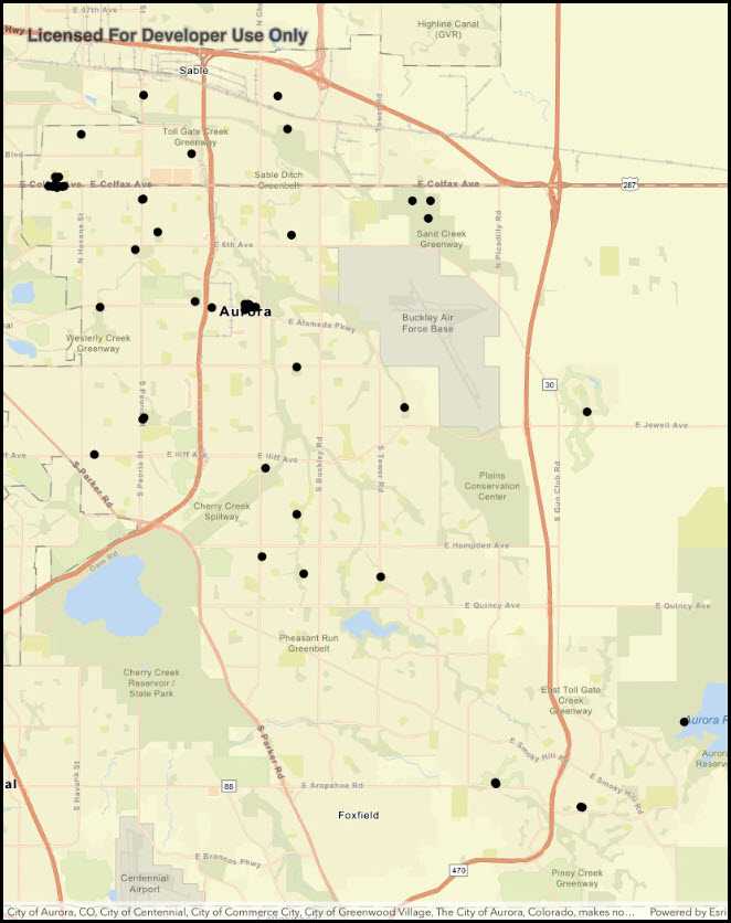
Shapefiles store location, shape and attributes of geospatial vector data. Shapefiles can be loaded directly into ArcGIS Runtime.
How to use the sample
Pan and zoom around the map to observe the data from the shapefile.
How it works
- Create a
ShapefileFeatureTablepassing in the URL of a shapefile. - Create a
FeatureLayerusing the shapefile feature table. - Add the layer to the map's operation layers.
Relevant API
- FeatureLayer
- ShapefileFeatureTable
Offline data
This sample downloads the following items from ArcGIS Online automatically:
- Public Art Shapefile - Shapefiles that cover Aurora Colorado: Public art (points), Bike trails (lines), and Subdivisions (polygons).
Tags
layers, shapefile, shp, vector
Sample Code
FeatureLayerShapefile.cs
// Copyright 2017 Esri.
//
// Licensed under the Apache License, Version 2.0 (the "License"); you may not use this file except in compliance with the License.
// You may obtain a copy of the License at: http://www.apache.org/licenses/LICENSE-2.0
//
// Unless required by applicable law or agreed to in writing, software distributed under the License is distributed on an
// "AS IS" BASIS, WITHOUT WARRANTIES OR CONDITIONS OF ANY KIND, either express or implied. See the License for the specific
// language governing permissions and limitations under the License.
using System;
using ArcGISRuntime.Samples.Managers;
using Esri.ArcGISRuntime.Data;
using Esri.ArcGISRuntime.Mapping;
using Esri.ArcGISRuntime.UI.Controls;
using Foundation;
using UIKit;
namespace ArcGISRuntime.Samples.FeatureLayerShapefile
{
[Register("FeatureLayerShapefile")]
[ArcGISRuntime.Samples.Shared.Attributes.OfflineData("d98b3e5293834c5f852f13c569930caa")]
[ArcGISRuntime.Samples.Shared.Attributes.Sample(
name: "Feature layer (shapefile)",
category: "Data",
description: "Open a shapefile stored on the device and display it as a feature layer with default symbology.",
instructions: "Pan and zoom around the map to observe the data from the shapefile.",
tags: new[] { "layers", "shapefile", "shp", "vector" })]
public class FeatureLayerShapefile : UIViewController
{
// Hold references to UI controls.
private MapView _myMapView;
public FeatureLayerShapefile()
{
Title = "Feature layer (shapefile)";
}
private async void Initialize()
{
// Create a new map to display in the map view with a streets basemap.
_myMapView.Map = new Map(BasemapStyle.ArcGISStreets);
// Get the path to the downloaded shapefile.
string filepath = DataManager.GetDataFolder("d98b3e5293834c5f852f13c569930caa", "Public_Art.shp");
try
{
// Open the shapefile.
ShapefileFeatureTable myShapefile = await ShapefileFeatureTable.OpenAsync(filepath);
// Create a feature layer to display the shapefile.
FeatureLayer newFeatureLayer = new FeatureLayer(myShapefile);
// Add the feature layer to the map.
_myMapView.Map.OperationalLayers.Add(newFeatureLayer);
// Zoom the map to the extent of the shapefile.
await _myMapView.SetViewpointGeometryAsync(newFeatureLayer.FullExtent, 50);
}
catch (Exception e)
{
new UIAlertView("Error", e.ToString(), (IUIAlertViewDelegate) null, "OK", null).Show();
}
}
public override void ViewDidLoad()
{
base.ViewDidLoad();
Initialize();
}
public override void LoadView()
{
// Create the views.
View = new UIView() { BackgroundColor = ApplicationTheme.BackgroundColor };
_myMapView = new MapView();
_myMapView.TranslatesAutoresizingMaskIntoConstraints = false;
// Add the views.
View.AddSubviews(_myMapView);
// Lay out the views.
NSLayoutConstraint.ActivateConstraints(new[]
{
_myMapView.TopAnchor.ConstraintEqualTo(View.SafeAreaLayoutGuide.TopAnchor),
_myMapView.BottomAnchor.ConstraintEqualTo(View.BottomAnchor),
_myMapView.LeadingAnchor.ConstraintEqualTo(View.LeadingAnchor),
_myMapView.TrailingAnchor.ConstraintEqualTo(View.TrailingAnchor)
});
}
}
}