Find the location for an address.
Use case
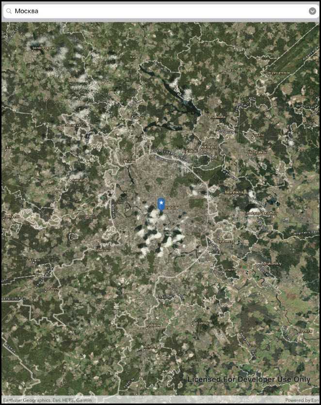
A user can input a raw address into your app's search bar and zoom to the address location.
How to use the sample
For simplicity, the sample comes loaded with a set of suggested addresses. Choose an address from the suggestions or submit your own address to show its location on the map in a callout.
How it works
- Create a
LocatorTaskusing the URL to a locator service. - Set the
GeocodeParametersfor the locator task and specify the geocode's attributes. - Get the matching results from the
GeocodeResultusinglocatorTask.GeocodeAsync(addressString, geocodeParameters). - Create a
Graphicwith the geocode result's location and store the geocode result's attributes in the graphic's attributes. - Show the graphic in a
GraphicsOverlay.
Additional information
This sample uses the World Geocoding Service. For more information, see the Geocoding service help topic on the ArcGIS Developer website.
Relevant API
- GeocodeParameters
- GeocodeResult
- LocatorTask
Tags
address, geocode, locator, search
Sample Code
FindAddress.cs
// Copyright 2017 Esri.
//
// Licensed under the Apache License, Version 2.0 (the "License"); you may not use this file except in compliance with the License.
// You may obtain a copy of the License at: http://www.apache.org/licenses/LICENSE-2.0
//
// Unless required by applicable law or agreed to in writing, software distributed under the License is distributed on an
// "AS IS" BASIS, WITHOUT WARRANTIES OR CONDITIONS OF ANY KIND, either express or implied. See the License for the specific
// language governing permissions and limitations under the License.
using System;
using System.Collections.Generic;
using System.IO;
using System.Linq;
using System.Reflection;
using System.Threading.Tasks;
using Esri.ArcGISRuntime.Data;
using Esri.ArcGISRuntime.Geometry;
using Esri.ArcGISRuntime.Mapping;
using Esri.ArcGISRuntime.Symbology;
using Esri.ArcGISRuntime.Tasks.Geocoding;
using Esri.ArcGISRuntime.UI;
using Esri.ArcGISRuntime.UI.Controls;
using Foundation;
using UIKit;
namespace ArcGISRuntime.Samples.FindAddress
{
[Register("FindAddress")]
[ArcGISRuntime.Samples.Shared.Attributes.Sample(
name: "Find address",
category: "Search",
description: "Find the location for an address.",
instructions: "For simplicity, the sample comes loaded with a set of suggested addresses. Choose an address from the suggestions or submit your own address to show its location on the map in a callout.",
tags: new[] { "address", "geocode", "locator", "search" })]
[ArcGISRuntime.Samples.Shared.Attributes.EmbeddedResource(@"PictureMarkerSymbols\pin_star_blue.png")]
public class FindAddress : UIViewController
{
// Hold references to UI controls.
private MapView _myMapView;
private UISearchBar _addressSearchBar;
// Addresses for suggestion.
private readonly string[] _addresses =
{
"277 N Avenida Caballeros, Palm Springs, CA",
"380 New York St, Redlands, CA 92373",
"Београд",
"Москва",
"北京"
};
// The LocatorTask provides geocoding services.
private LocatorTask _geocoder;
// Service URI to be provided to the LocatorTask (geocoder).
private readonly Uri _serviceUri = new Uri("https://geocode-api.arcgis.com/arcgis/rest/services/World/GeocodeServer");
public FindAddress()
{
Title = "Find address";
}
private async void Initialize()
{
// Show a labeled imagery basemap.
_myMapView.Map = new Map(BasemapStyle.ArcGISImagery);
try
{
// Initialize the geocoder with the provided service URL.
_geocoder = await LocatorTask.CreateAsync(_serviceUri);
// Enable controls now that the geocoder is ready.
_addressSearchBar.UserInteractionEnabled = true;
}
catch (Exception e)
{
new UIAlertView("Error", e.ToString(), (IUIAlertViewDelegate) null, "OK", null).Show();
}
}
private void AddressSearchBar_Clicked(object sender, EventArgs e)
{
UpdateSearch();
// Dismiss the keyboard.
_addressSearchBar.ResignFirstResponder();
}
private async void UpdateSearch()
{
// Get the text in the search bar.
string enteredText = _addressSearchBar.Text;
// Clear existing marker.
_myMapView.GraphicsOverlays.Clear();
// Return gracefully if the textbox is empty or the geocoder isn't ready.
if (String.IsNullOrWhiteSpace(enteredText) || _geocoder == null)
{
return;
}
try
{
// Get suggestions based on the input text.
IReadOnlyList<SuggestResult> suggestions = await _geocoder.SuggestAsync(enteredText);
// Stop gracefully if there are no suggestions.
if (suggestions.Count < 1)
{
return;
}
// Get the full address for the first suggestion.
SuggestResult firstSuggestion = suggestions.First();
IReadOnlyList<GeocodeResult> addresses = await _geocoder.GeocodeAsync(firstSuggestion.Label);
// Stop gracefully if the geocoder does not return a result.
if (addresses.Count < 1)
{
return;
}
// Place a marker on the map - 1. Create the overlay.
GraphicsOverlay resultOverlay = new GraphicsOverlay();
// 2. Get the Graphic to display.
Graphic point = await GraphicForPoint(addresses.First().DisplayLocation);
// 3. Add the Graphic to the GraphicsOverlay.
resultOverlay.Graphics.Add(point);
// 4. Add the GraphicsOverlay to the MapView.
_myMapView.GraphicsOverlays.Add(resultOverlay);
// Update the map extent to show the marker.
_myMapView.SetViewpoint(new Viewpoint(addresses.First().Extent));
}
catch (Exception e)
{
new UIAlertView("Error", e.ToString(), (IUIAlertViewDelegate) null, "OK", null).Show();
}
}
/// <summary>
/// Creates and returns a Graphic associated with the given MapPoint.
/// </summary>
private async Task<Graphic> GraphicForPoint(MapPoint point)
{
// Get current assembly that contains the image.
Assembly currentAssembly = Assembly.GetExecutingAssembly();
// Get image as a stream from the resources.
// Picture is defined as EmbeddedResource and DoNotCopy.
Stream resourceStream = currentAssembly.GetManifestResourceStream(
"ArcGISRuntime.Resources.PictureMarkerSymbols.pin_star_blue.png");
// Create new symbol using asynchronous factory method from stream.
PictureMarkerSymbol pinSymbol = await PictureMarkerSymbol.CreateAsync(resourceStream);
pinSymbol.Width = 60;
pinSymbol.Height = 60;
// The image is a pin; offset the image so that the pinpoint
// is on the point rather than the image's true center.
pinSymbol.LeaderOffsetX = 30;
pinSymbol.OffsetY = 14;
return new Graphic(point, pinSymbol);
}
private void AddressSearch_ListButtonClicked(object sender, EventArgs e)
{
// Create the alert view.
UIAlertController alert = UIAlertController.Create("Suggestions", "Location searches to try", UIAlertControllerStyle.Alert);
// Populate the view with one action per address suggestion.
foreach (string address in _addresses)
{
alert.AddAction(UIAlertAction.Create(address, UIAlertActionStyle.Default, obj =>
{
_addressSearchBar.Text = address;
UpdateSearch();
}));
}
// Show the alert view.
PresentViewController(alert, true, null);
}
/// <summary>
/// Handle tap event on the map; displays callouts showing the address for a tapped search result.
/// </summary>
private async void MyMapView_GeoViewTapped(object sender, GeoViewInputEventArgs e)
{
// Search for the graphics underneath the user's tap.
try
{
IReadOnlyList<IdentifyGraphicsOverlayResult> results = await _myMapView.IdentifyGraphicsOverlaysAsync(e.Position, 12, false);
// Return gracefully if there was no result.
if (results.Count < 1 || results.First().Graphics.Count < 1)
{
return;
}
// Reverse geocode to get addresses.
IReadOnlyList<GeocodeResult> addresses = await _geocoder.ReverseGeocodeAsync(e.Location);
// Get the first result.
GeocodeResult address = addresses.First();
// Use the city and region for the Callout Title.
string calloutTitle = address.Attributes["City"] + ", " + address.Attributes["Region"];
// Use the metro area for the Callout Detail.
string calloutDetail = address.Attributes["MetroArea"].ToString();
// Define the callout.
CalloutDefinition calloutBody = new CalloutDefinition(calloutTitle, calloutDetail);
// Show the callout on the map at the tapped location.
_myMapView.ShowCalloutAt(e.Location, calloutBody);
}
catch (Exception ex)
{
new UIAlertView("Error", ex.ToString(), (IUIAlertViewDelegate) null, "OK", null).Show();
}
}
public override void ViewDidLoad()
{
base.ViewDidLoad();
Initialize();
}
public override void LoadView()
{
// Create the views.
View = new UIView {BackgroundColor = ApplicationTheme.BackgroundColor};
_myMapView = new MapView();
_myMapView.TranslatesAutoresizingMaskIntoConstraints = false;
_addressSearchBar = new UISearchBar();
_addressSearchBar.TranslatesAutoresizingMaskIntoConstraints = false;
_addressSearchBar.UserInteractionEnabled = false;
_addressSearchBar.ShowsSearchResultsButton = true;
// Add the views.
View.AddSubviews(_myMapView, _addressSearchBar);
// Lay out the views.
NSLayoutConstraint.ActivateConstraints(new[]
{
_addressSearchBar.LeadingAnchor.ConstraintEqualTo(View.LeadingAnchor),
_addressSearchBar.TrailingAnchor.ConstraintEqualTo(View.TrailingAnchor),
_addressSearchBar.TopAnchor.ConstraintEqualTo(View.SafeAreaLayoutGuide.TopAnchor),
_myMapView.LeadingAnchor.ConstraintEqualTo(View.LeadingAnchor),
_myMapView.TrailingAnchor.ConstraintEqualTo(View.TrailingAnchor),
_myMapView.BottomAnchor.ConstraintEqualTo(View.BottomAnchor),
_myMapView.TopAnchor.ConstraintEqualTo(_addressSearchBar.BottomAnchor)
});
}
public override void ViewWillAppear(bool animated)
{
base.ViewWillAppear(animated);
// Subscribe to events.
_addressSearchBar.ListButtonClicked += AddressSearch_ListButtonClicked;
_addressSearchBar.SearchButtonClicked += AddressSearchBar_Clicked;
_myMapView.GeoViewTapped += MyMapView_GeoViewTapped;
}
public override void ViewDidDisappear(bool animated)
{
base.ViewDidDisappear(animated);
// Unsubscribe from events, per best practice.
_myMapView.GeoViewTapped -= MyMapView_GeoViewTapped;
_addressSearchBar.ListButtonClicked -= AddressSearch_ListButtonClicked;
_addressSearchBar.SearchButtonClicked -= AddressSearchBar_Clicked;
}
}
}