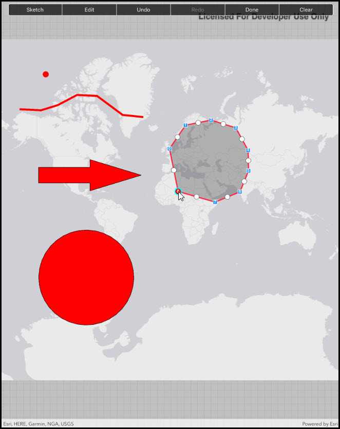
Use the Sketch Editor to edit or sketch a new point, line, or polygon geometry on to a map.
Use case
A field worker could annotate features of interest on a map (via the GUI) such as location of dwellings (marked as points), geological features (polylines), or areas of glaciation (polygons).
How to use the sample
Choose which geometry type to sketch from one of the available buttons. Choose from points, multipoints, polylines, polygons, freehand polylines, and freehand polygons.
Use the control panel to cancel the sketch, undo or redo changes made to the sketch and to save the sketch to the graphics overlay. There is also the option to select a saved graphic and edit its geometry using the Sketch Editor. The graphics overlay can be cleared using the clear all button.
How it works
- Use
SketchEditor.StartAsync()to start sketching. If editing an existing graphic's geometry, useSketchEditor.StartAsync(graphic.Geometry). - Use the
UndoCommandandRedoCommandto undo and redo edits in the sketch. - Use a
CompleteCommandto finish the sketch and get theGeometryresult. Use theCancelCommandto cancel the sketch. - Create a
Graphicfor the geometry and add it to theGraphicsOverlayin the map view.
Relevant API
- Geometry
- Graphic
- GraphicsOverlay
- MapView
- SketchCreationMode
- SketchEditor
Tags
draw, edit
Sample Code
// Copyright 2017 Esri.
//
// Licensed under the Apache License, Version 2.0 (the "License"); you may not use this file except in compliance with the License.
// You may obtain a copy of the License at: http://www.apache.org/licenses/LICENSE-2.0
//
// Unless required by applicable law or agreed to in writing, software distributed under the License is distributed on an
// "AS IS" BASIS, WITHOUT WARRANTIES OR CONDITIONS OF ANY KIND, either express or implied. See the License for the specific
// language governing permissions and limitations under the License.
using Esri.ArcGISRuntime.Data;
using Esri.ArcGISRuntime.Geometry;
using Esri.ArcGISRuntime.Mapping;
using Esri.ArcGISRuntime.Symbology;
using Esri.ArcGISRuntime.UI;
using Esri.ArcGISRuntime.UI.Controls;
using Foundation;
using System;
using System.Collections.Generic;
using System.Drawing;
using System.Linq;
using System.Threading.Tasks;
using System.Windows.Input;
using UIKit;
namespace ArcGISRuntime.Samples.SketchOnMap
{
[Register("SketchOnMap")]
[ArcGISRuntime.Samples.Shared.Attributes.Sample(
name: "Sketch on map",
category: "GraphicsOverlay",
description: "Use the Sketch Editor to edit or sketch a new point, line, or polygon geometry on to a map.",
instructions: "Choose which geometry type to sketch from one of the available buttons. Choose from points, multipoints, polylines, polygons, freehand polylines, and freehand polygons.",
tags: new[] { "draw", "edit" })]
public class SketchOnMap : UIViewController
{
// Hold references to UI controls.
private MapView _myMapView;
private UISegmentedControl _segmentButton;
// Dictionary associates SketchCreationMode names with values.
private Dictionary<string, int> _sketchModeDictionary;
// Graphics overlay to host sketch graphics.
private GraphicsOverlay _sketchOverlay;
public SketchOnMap()
{
Title = "Sketch on map";
}
private void Initialize()
{
// Create and show a light gray canvas basemap.
_myMapView.Map = new Map(BasemapStyle.ArcGISLightGray);
// Create graphics overlay to display sketch geometry.
_sketchOverlay = new GraphicsOverlay();
_myMapView.GraphicsOverlays.Add(_sketchOverlay);
}
private void GraphicsChanged(object sender, System.Collections.Specialized.NotifyCollectionChangedEventArgs e)
{
// Enable or disable the clear and edit buttons depending on whether or not graphics exist.
_segmentButton.SetEnabled(_sketchOverlay.Graphics.Count > 0, 1);
_segmentButton.SetEnabled(_sketchOverlay.Graphics.Count > 0, 5);
}
private void CanExecuteChanged(object sender, EventArgs e)
{
// Enable or disable the corresponding command for the sketch editor.
ICommand command = (ICommand)sender;
if (command == _myMapView.SketchEditor.UndoCommand)
{
_segmentButton.SetEnabled(command.CanExecute(null), 2);
}
else if (command == _myMapView.SketchEditor.RedoCommand)
{
_segmentButton.SetEnabled(command.CanExecute(null), 3);
}
else if (command == _myMapView.SketchEditor.CompleteCommand)
{
_segmentButton.SetEnabled(command.CanExecute(null), 4);
}
}
private async void SegmentButtonClicked(object sender, EventArgs e)
{
// Get the segmented button control that raised the event.
UISegmentedControl buttonControl = (UISegmentedControl)sender;
// Execute the appropriate action for the control
switch (buttonControl.SelectedSegment)
{
case 0: // Sketch.
// Show the sketch modes to choose from.
ShowSketchModeList();
break;
case 1:
await EditGraphicAsync();
break;
case 2: // Undo.
if (_myMapView.SketchEditor.UndoCommand.CanExecute(null))
{
_myMapView.SketchEditor.UndoCommand.Execute(null);
}
break;
case 3: // Redo.
if (_myMapView.SketchEditor.RedoCommand.CanExecute(null))
{
_myMapView.SketchEditor.RedoCommand.Execute(null);
}
break;
case 4: // Done.
if (_myMapView.SketchEditor.CompleteCommand.CanExecute(null))
{
_myMapView.SketchEditor.CompleteCommand.Execute(null);
}
break;
case 5: // Clear.
// Remove all graphics from the graphics overlay.
_sketchOverlay.Graphics.Clear();
// Cancel any uncompleted sketch.
if (_myMapView.SketchEditor.CancelCommand.CanExecute(null))
{
_myMapView.SketchEditor.CancelCommand.Execute(null);
}
break;
}
// Deselect all segments (user might want to click the same control twice).
buttonControl.SelectedSegment = -1;
}
#region Graphic and symbol helpers
private Graphic CreateGraphic(Geometry geometry)
{
// Create a graphic to display the specified geometry.
Symbol symbol = null;
switch (geometry.GeometryType)
{
// Symbolize with a fill symbol.
case GeometryType.Envelope:
case GeometryType.Polygon:
{
symbol = new SimpleFillSymbol
{
Color = Color.Red,
Style = SimpleFillSymbolStyle.Solid
};
break;
}
// Symbolize with a line symbol.
case GeometryType.Polyline:
{
symbol = new SimpleLineSymbol
{
Color = Color.Red,
Style = SimpleLineSymbolStyle.Solid,
Width = 5d
};
break;
}
// Symbolize with a marker symbol.
case GeometryType.Point:
case GeometryType.Multipoint:
{
symbol = new SimpleMarkerSymbol
{
Color = Color.Red,
Style = SimpleMarkerSymbolStyle.Circle,
Size = 15d
};
break;
}
}
// Pass back a new graphic with the appropriate symbol.
return new Graphic(geometry, symbol);
}
private async Task<Graphic> GetGraphicAsync()
{
// Wait for the user to click a location on the map.
MapPoint mapPoint = (MapPoint)await _myMapView.SketchEditor.StartAsync(SketchCreationMode.Point, false);
// Convert the map point to a screen point.
var screenCoordinate = _myMapView.LocationToScreen(mapPoint);
// Identify graphics in the graphics overlay using the point.
IReadOnlyList<IdentifyGraphicsOverlayResult> results = await _myMapView.IdentifyGraphicsOverlaysAsync(screenCoordinate, 2, false);
// If results were found, get the first graphic.
Graphic graphic = null;
IdentifyGraphicsOverlayResult idResult = results.FirstOrDefault();
if (idResult != null && idResult.Graphics.Count > 0)
{
graphic = idResult.Graphics.FirstOrDefault();
}
// Return the graphic (or null if none were found).
return graphic;
}
#endregion Graphic and symbol helpers
private void ShowSketchModeList()
{
// Create a new Alert Controller.
UIAlertController sketchModeActionSheet = UIAlertController.Create("Sketch Modes", "Choose a sketch mode", UIAlertControllerStyle.ActionSheet);
// Create a dictionary that associates SketchCreationMode names with values.
IEnumerable<int> enumValues = Enum.GetValues(typeof(SketchCreationMode)).Cast<int>();
_sketchModeDictionary = enumValues.ToDictionary(v => Enum.GetName(typeof(SketchCreationMode), v), v => v);
// Add sketch modes to the action sheet.
foreach (KeyValuePair<string, int> mode in _sketchModeDictionary)
{
UIAlertAction actionItem = UIAlertAction.Create(mode.Key, UIAlertActionStyle.Default, action => SketchGeometry(action.Title));
sketchModeActionSheet.AddAction(actionItem);
}
// Required for iPad - You must specify a source for the Action Sheet since it is displayed as a popover.
UIPopoverPresentationController presentationPopover = sketchModeActionSheet.PopoverPresentationController;
if (presentationPopover != null)
{
presentationPopover.SourceView = _segmentButton;
presentationPopover.PermittedArrowDirections = UIPopoverArrowDirection.Any;
}
// Display the list of sketch modes.
PresentViewController(sketchModeActionSheet, true, null);
}
private async void SketchGeometry(string sketchModeName)
{
try
{
// Let the user draw on the map view using the chosen sketch mode.
SketchCreationMode creationMode = (SketchCreationMode)_sketchModeDictionary[sketchModeName];
Geometry geometry = await _myMapView.SketchEditor.StartAsync(creationMode, true);
// Create and add a graphic from the geometry the user drew.
Graphic graphic = CreateGraphic(geometry);
_sketchOverlay.Graphics.Add(graphic);
}
catch (TaskCanceledException)
{
// Ignore ... let the user cancel drawing.
}
catch (Exception ex)
{
// Report exceptions.
new UIAlertView("Error", "Error drawing graphic shape: " + ex.Message, (IUIAlertViewDelegate)null, "OK", null).Show();
}
}
private async Task EditGraphicAsync()
{
try
{
// Allow the user to select a graphic.
Graphic editGraphic = await GetGraphicAsync();
if (editGraphic == null)
{
return;
}
// Let the user make changes to the graphic's geometry, await the result (updated geometry).
editGraphic.Geometry = await _myMapView.SketchEditor.StartAsync(editGraphic.Geometry);
}
catch (TaskCanceledException)
{
// Ignore ... let the user cancel editing.
}
catch (Exception ex)
{
// Report exceptions.
new UIAlertView("Error", "Error editing shape: " + ex.Message, (IUIAlertViewDelegate)null, "OK", null).Show();
}
}
public override void ViewDidLoad()
{
base.ViewDidLoad();
Initialize();
}
public override void LoadView()
{
// Create the views.
View = new UIView() { BackgroundColor = ApplicationTheme.BackgroundColor };
_myMapView = new MapView();
_myMapView.TranslatesAutoresizingMaskIntoConstraints = false;
_segmentButton = new UISegmentedControl("Sketch", "Edit", "Undo", "Redo", "Done", "Clear")
{
BackgroundColor = ApplicationTheme.BackgroundColor,
TranslatesAutoresizingMaskIntoConstraints = false
};
// Clean up borders of segmented control - avoid corner pixels.
_segmentButton.ClipsToBounds = true;
_segmentButton.Layer.CornerRadius = 5;
// Add the views.
View.AddSubviews(_myMapView, _segmentButton);
// Lay out the views.
NSLayoutConstraint.ActivateConstraints(new[]
{
_myMapView.TopAnchor.ConstraintEqualTo(View.TopAnchor),
_myMapView.LeadingAnchor.ConstraintEqualTo(View.LeadingAnchor),
_myMapView.TrailingAnchor.ConstraintEqualTo(View.TrailingAnchor),
_myMapView.BottomAnchor.ConstraintEqualTo(View.BottomAnchor),
_segmentButton.LeadingAnchor.ConstraintEqualTo(View.LayoutMarginsGuide.LeadingAnchor),
_segmentButton.TrailingAnchor.ConstraintEqualTo(View.LayoutMarginsGuide.TrailingAnchor),
_segmentButton.TopAnchor.ConstraintEqualTo(View.SafeAreaLayoutGuide.TopAnchor, 8)
});
}
public override void ViewWillAppear(bool animated)
{
base.ViewWillAppear(animated);
// Subscribe to events.
_segmentButton.ValueChanged += SegmentButtonClicked;
_myMapView.SketchEditor.UndoCommand.CanExecuteChanged += CanExecuteChanged; // CanExecuteChanged events used to enable/disable controls.
_myMapView.SketchEditor.RedoCommand.CanExecuteChanged += CanExecuteChanged;
_myMapView.SketchEditor.CompleteCommand.CanExecuteChanged += CanExecuteChanged;
_sketchOverlay.Graphics.CollectionChanged += GraphicsChanged;
}
public override void ViewDidDisappear(bool animated)
{
base.ViewDidDisappear(animated);
try
{
// Unsubscribe from events, per best practice.
if (_myMapView.SketchEditor.CancelCommand.CanExecute(null))
{
_myMapView.SketchEditor.CancelCommand.Execute(null);
}
_myMapView.SketchEditor.UndoCommand.CanExecuteChanged -= CanExecuteChanged;
_myMapView.SketchEditor.RedoCommand.CanExecuteChanged -= CanExecuteChanged;
_myMapView.SketchEditor.CompleteCommand.CanExecuteChanged -= CanExecuteChanged;
_sketchOverlay.Graphics.CollectionChanged -= GraphicsChanged;
_segmentButton.ValueChanged -= SegmentButtonClicked;
}
catch (Exception ex)
{
System.Diagnostics.Debug.WriteLine(ex);
}
}
}
}