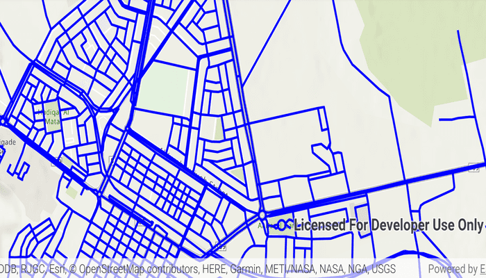
Display an OGC API feature collection and query features while navigating the map view.
Use case
When panning the map view, it may be necessary to query the OGC API feature table for additional features within the new visible extent.
How to use the sample
Pan the map and observe how new features are loaded from the OGC API feature service.
How it works
- Create an
OgcFeatureCollectionTableusing a URL to an OGC API feature service and a collection ID. - Set the feature table's
FeatureRequestModeproperty toFeatureRequestMode.MANUAL_CACHE. - Call
OgcFeatureCollectionTable.loadAsync(). - Create a
FeatureLayerusing the feature collection table and add it to the map view. - Every time the map view navigation completes:
- Create
QueryParameters. - Set the parameter's
Geometryto the current extent of the map view. - Set the parameter's
SpatialRelationshipproperty toSpatialRelationship.INTERSECTS. - Set the
MaxFeaturesproperty to 5000 (some services have a low default value for maximum features). - Call
OgcFeatureCollectionTable.populateFromServiceAsync()using the query parameters from the previous steps.
- Create
Relevant API
- OgcFeatureCollectionTable
- QueryParameters
About the data
The Daraa, Syria test data is OpenStreetMap data converted to the Topographic Data Store schema of NGA.
Additional information
See the OGC API website for more information on the OGC API family of standards.
Tags
feature, feature layer, feature table, OGC, OGC API, service, table, web
Sample Code
MainActivity.kt
/* Copyright 2021 Esri
*
* Licensed under the Apache License, Version 2.0 (the "License");
* you may not use this file except in compliance with the License.
* You may obtain a copy of the License at
*
* http://www.apache.org/licenses/LICENSE-2.0
*
* Unless required by applicable law or agreed to in writing, software
* distributed under the License is distributed on an "AS IS" BASIS,
* WITHOUT WARRANTIES OR CONDITIONS OF ANY KIND, either express or implied.
* See the License for the specific language governing permissions and
* limitations under the License.
*
*/
package com.esri.arcgisruntime.sample.displayogcapicollection
import android.graphics.Color
import android.os.Bundle
import android.util.Log
import android.widget.Toast
import androidx.appcompat.app.AppCompatActivity
import com.esri.arcgisruntime.ArcGISRuntimeEnvironment
import com.esri.arcgisruntime.data.OgcFeatureCollectionTable
import com.esri.arcgisruntime.data.QueryParameters
import com.esri.arcgisruntime.data.ServiceFeatureTable
import com.esri.arcgisruntime.geometry.Envelope
import com.esri.arcgisruntime.layers.FeatureLayer
import com.esri.arcgisruntime.loadable.LoadStatus
import com.esri.arcgisruntime.mapping.ArcGISMap
import com.esri.arcgisruntime.mapping.BasemapStyle
import com.esri.arcgisruntime.mapping.view.MapView
import com.esri.arcgisruntime.sample.displayogcapicollection.databinding.ActivityMainBinding
import com.esri.arcgisruntime.symbology.SimpleLineSymbol
import com.esri.arcgisruntime.symbology.SimpleRenderer
class MainActivity : AppCompatActivity() {
// define strings for the service URL and collection id
// note that the service defines the collection id which can be accessed
// via OgcFeatureCollectionInfo.getCollectionId()
private val serviceUrl = "https://demo.ldproxy.net/daraa"
private val collectionId = "TransportationGroundCrv"
// create an OGC feature collection table from the service url and collection id
// keep loadable in scope to avoid garbage collection
private var ogcFeatureCollectionTable: OgcFeatureCollectionTable =
OgcFeatureCollectionTable(serviceUrl, collectionId)
private val activityMainBinding by lazy {
ActivityMainBinding.inflate(layoutInflater)
}
private val mapView: MapView by lazy {
activityMainBinding.mapView
}
override fun onCreate(savedInstanceState: Bundle?) {
super.onCreate(savedInstanceState)
setContentView(activityMainBinding.root)
// authentication with an API key or named user is required to access basemaps and other
// location services
ArcGISRuntimeEnvironment.setApiKey(BuildConfig.API_KEY)
// create a map with the BasemapStyle topographic
val map = ArcGISMap(BasemapStyle.ARCGIS_TOPOGRAPHIC)
// set the map to be displayed in the layout's MapView
mapView.map = map
// set the feature request mode to manual (only manual is currently supported).
// in this mode, the table must be manually populated - panning and zooming won't request features automatically
ogcFeatureCollectionTable.featureRequestMode =
ServiceFeatureTable.FeatureRequestMode.MANUAL_CACHE
// load the table
ogcFeatureCollectionTable.loadAsync()
// ensure the feature collection table has loaded successfully before creating a feature layer from it to display on the map
ogcFeatureCollectionTable.addDoneLoadingListener {
if (ogcFeatureCollectionTable.loadStatus == LoadStatus.LOADED) {
// create a feature layer and set a renderer to it to visualize the OGC API features
val featureLayer = FeatureLayer(ogcFeatureCollectionTable)
val simpleRenderer =
SimpleRenderer(SimpleLineSymbol(SimpleLineSymbol.Style.SOLID, Color.BLUE, 3F))
featureLayer.renderer = simpleRenderer
// add the layer to the map
map.operationalLayers.add(featureLayer)
// zoom to a small area within the dataset by default
val datasetExtent = ogcFeatureCollectionTable.extent
if (datasetExtent != null && !datasetExtent.isEmpty) {
mapView.setViewpointGeometryAsync(
Envelope(
datasetExtent.center,
datasetExtent.width / 3,
datasetExtent.height / 3
)
)
}
} else {
// show an alert if there is a loading failure
Log.e(
ogcFeatureCollectionTable.loadError.message,
ogcFeatureCollectionTable.loadError.additionalMessage
)
Toast.makeText(
applicationContext,
"Failed to load OGC Feature Collection Table",
Toast.LENGTH_SHORT
).show()
}
}
// once the map view navigation has completed, query the OGC API feature table for
// additional features within the new visible extent
mapView.addNavigationChangedListener {
if (!it.isNavigating) {
// get the current extent
val currentExtent = mapView.visibleArea.extent
// create a query based on the current visible extent
val visibleExtentQuery = QueryParameters().apply {
geometry = currentExtent
spatialRelationship =
QueryParameters.SpatialRelationship.INTERSECTS
// set a limit of 5000 on the number of returned features per request, the default on some services
// could be as low as 10
maxFeatures = 5000
}
visibleExtentQuery.maxFeatures = 5000
try {
// populate the table with the query, leaving existing table entries intact
// setting the outfields parameter to null requests all fields
ogcFeatureCollectionTable.populateFromServiceAsync(
visibleExtentQuery,
false,
null
)
} catch (e: Exception) {
Toast.makeText(
applicationContext,
"Error populating from service: " + e.message,
Toast.LENGTH_SHORT
).show()
}
}
}
}
override fun onPause() {
mapView.pause()
super.onPause()
}
override fun onResume() {
super.onResume()
mapView.resume()
}
override fun onDestroy() {
mapView.dispose()
super.onDestroy()
}
}