Show a callout with the latitude and longitude of user-tapped points.
Use case
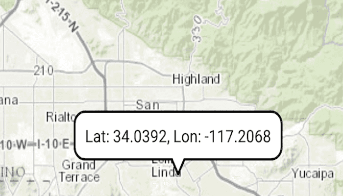
Callouts are used to display temporary detail content on a map. You can display text and arbitrary UI controls in callouts.
How to use the sample
Tap anywhere on the map. A callout showing the WGS84 coordinates for the tapped point will appear.
How it works
- When the user taps, get the tapped location and create a map
Pointfrom it usingMapView.screenToLocation(tappedLocation). - Project the point's geometry to WGS84 using
GeometryEngine.project(mapPoint, SpatialReferences.getWgs84()). - Create a new Android TextView object and set its text to the coordinate string from the point.
- Create a new
CalloutwithMapView.getCalloutand set its location on the map withcallout.location = mapPoint. - Set the callout's content with
callout.content = textViewand display it on the map view withcallout.show.
Relevant API
- Callout
- MapView
- Point
Tags
balloon, bubble, callout, flyout, flyover, info window, popup, tap
Sample Code
MainActivity.kt
/*
* Copyright 2020 Esri
*
* Licensed under the Apache License, Version 2.0 (the "License");
* you may not use this file except in compliance with the License.
* You may obtain a copy of the License at
*
* http://www.apache.org/licenses/LICENSE-2.0
*
* Unless required by applicable law or agreed to in writing, software
* distributed under the License is distributed on an "AS IS" BASIS,
* WITHOUT WARRANTIES OR CONDITIONS OF ANY KIND, either express or implied.
* See the License for the specific language governing permissions and
* limitations under the License.
*
*/
package com.esri.arcgisruntime.sample.showcallout
import android.graphics.Color
import android.os.Bundle
import android.view.MotionEvent
import android.widget.TextView
import androidx.appcompat.app.AppCompatActivity
import com.esri.arcgisruntime.ArcGISRuntimeEnvironment
import com.esri.arcgisruntime.geometry.GeometryEngine
import com.esri.arcgisruntime.geometry.Point
import com.esri.arcgisruntime.geometry.SpatialReferences
import com.esri.arcgisruntime.mapping.ArcGISMap
import com.esri.arcgisruntime.mapping.BasemapStyle
import com.esri.arcgisruntime.mapping.Viewpoint
import com.esri.arcgisruntime.mapping.view.DefaultMapViewOnTouchListener
import com.esri.arcgisruntime.mapping.view.MapView
import com.esri.arcgisruntime.sample.showcallout.databinding.ActivityMainBinding
import kotlin.math.roundToInt
class MainActivity : AppCompatActivity() {
private val activityMainBinding by lazy {
ActivityMainBinding.inflate(layoutInflater)
}
private val mapView: MapView by lazy {
activityMainBinding.mapView
}
override fun onCreate(savedInstanceState: Bundle?) {
super.onCreate(savedInstanceState)
setContentView(activityMainBinding.root)
// authentication with an API key or named user is required to access basemaps and other
// location services
ArcGISRuntimeEnvironment.setApiKey(BuildConfig.API_KEY)
// create a map with a topographic basemap
val map = ArcGISMap(BasemapStyle.ARCGIS_TOPOGRAPHIC)
// set the map to be displayed in the layout's map view
mapView.map = map
// set an initial viewpoint on the map view
mapView.setViewpoint(Viewpoint(34.056295, -117.195800, 100000.0))
mapView.onTouchListener = object : DefaultMapViewOnTouchListener(this, mapView) {
override fun onSingleTapConfirmed(motionEvent: MotionEvent): Boolean {
// get the point that was tapped on the screen
val screenPoint =
android.graphics.Point(motionEvent.x.roundToInt(), motionEvent.y.roundToInt())
// create a map point from that screen point
val mapPoint = mapView.screenToLocation(screenPoint)
// convert the point to WGS84 for obtaining lat/lon format
val wgs84Point =
GeometryEngine.project(mapPoint, SpatialReferences.getWgs84()) as Point
// create a textview for the callout
val calloutContent = TextView(applicationContext).apply {
setTextColor(Color.BLACK)
setSingleLine()
// format coordinates to 4 decimal places and display lat long read out
text = getString(R.string.callout_text, wgs84Point.y, wgs84Point.x)
}
// get the callout, set its content and show it and the tapped location
mapView.callout.apply {
location = mapPoint
content = calloutContent
show()
}
// center the map on the tapped location
mapView.setViewpointCenterAsync(mapPoint)
return true
}
}
}
override fun onResume() {
super.onResume()
mapView.resume()
}
override fun onPause() {
mapView.pause()
super.onPause()
}
override fun onDestroy() {
mapView.dispose()
super.onDestroy()
}
}