Create graphics from an XML file with key-value pairs for each graphic, and display the military symbols using a MIL-STD-2525D web style in 2D.
Use case
Use a dictionary renderer on a graphics overlay to display more transient data, such as military messages coming through a local tactical network.
How to use the sample
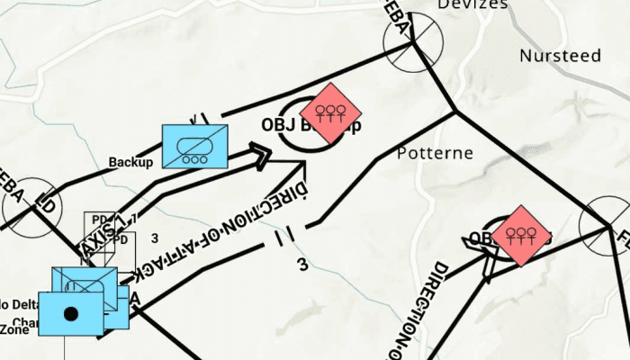
Run the sample and view the military symbols on the map.
How it works
- Create a new
DictionarySymbolStyle(portalItem)with a portal item containing a MIL-STD-2525D dictionary web style. - Create a new
DictionaryRendererfrom the dictionary symbol style. - Create a new
GraphicsOverlay. - Set the dictionary renderer to the graphics overlay.
- Parse through the local XML file creating a map of key/value pairs for each block of attributes.
- Create a
Graphicfor each attribute. - Use the
_wkidkey to get the geometry's spatial reference. - Use the
_control_pointskey to get the geometry's shape. - Add the graphic to the graphics overlay.
Relevant API
- DictionaryRenderer
- DictionarySymbolStyle
- GraphicsOverlay
Offline Data
- Download the data Mil2525DMessages.zip
- Extract the downloaded zip file to retrieve the file "Mil2525DMessages.xml".
- Open your command prompt and navigate to the folder where you extracted the contents of the data from step 1.
- Push the data into the scoped storage of the sample app:
adb push Mil2525DMessages.xml /Android/data/com.esri.arcgisruntime.sample.dictionaryrendererwithgraphicsoverlay/files/Mil2525DMessages.xml
About the data
The dictionary symbol style in this sample is constructed from a portal item containing a MIL-STD-2525D symbol dictionary web style. This ArcGIS Web Style is used to build custom applications that incorporate the MIL-STD-2525D symbol dictionary. This style supports a configuration for modeling locations as ordered anchor points or full geometries.
Tags
defense, military, situational awareness, tactical, visualization
Sample Code
/* Copyright 2022 Esri
*
* Licensed under the Apache License, Version 2.0 (the "License");
* you may not use this file except in compliance with the License.
* You may obtain a copy of the License at
*
* http://www.apache.org/licenses/LICENSE-2.0
*
* Unless required by applicable law or agreed to in writing, software
* distributed under the License is distributed on an "AS IS" BASIS,
* WITHOUT WARRANTIES OR CONDITIONS OF ANY KIND, either express or implied.
* See the License for the specific language governing permissions and
* limitations under the License.
*
*/
package com.esri.arcgisruntime.sample.dictionaryrendererwithgraphicsoverlay
import android.os.Bundle
import android.util.Log
import android.widget.Toast
import androidx.appcompat.app.AppCompatActivity
import com.esri.arcgisruntime.ArcGISRuntimeEnvironment
import com.esri.arcgisruntime.geometry.Multipoint
import com.esri.arcgisruntime.geometry.Point
import com.esri.arcgisruntime.geometry.PointCollection
import com.esri.arcgisruntime.geometry.SpatialReference
import com.esri.arcgisruntime.loadable.LoadStatus
import com.esri.arcgisruntime.mapping.ArcGISMap
import com.esri.arcgisruntime.mapping.BasemapStyle
import com.esri.arcgisruntime.mapping.view.Graphic
import com.esri.arcgisruntime.mapping.view.GraphicsOverlay
import com.esri.arcgisruntime.mapping.view.MapView
import com.esri.arcgisruntime.portal.Portal
import com.esri.arcgisruntime.portal.PortalItem
import com.esri.arcgisruntime.sample.dictionaryrendererwithgraphicsoverlay.databinding.ActivityMainBinding
import com.esri.arcgisruntime.symbology.DictionaryRenderer
import com.esri.arcgisruntime.symbology.DictionarySymbolStyle
import org.w3c.dom.Document
import org.w3c.dom.Node
import org.w3c.dom.NodeList
import java.io.File
import javax.xml.parsers.DocumentBuilder
import javax.xml.parsers.DocumentBuilderFactory
class MainActivity : AppCompatActivity() {
private val TAG = MainActivity::class.java.simpleName
private val graphicsOverlay: GraphicsOverlay = GraphicsOverlay()
private val activityMainBinding by lazy {
ActivityMainBinding.inflate(layoutInflater)
}
private val mapView: MapView by lazy {
activityMainBinding.mapView
}
override fun onCreate(savedInstanceState: Bundle?) {
super.onCreate(savedInstanceState)
setContentView(activityMainBinding.root)
// authentication with an API key or named user is required to access basemaps and other
// location services
ArcGISRuntimeEnvironment.setApiKey(BuildConfig.API_KEY)
// create a map with the BasemapStyle topographic
val map = ArcGISMap(BasemapStyle.ARCGIS_TOPOGRAPHIC)
// graphics no longer show after zooming passed this scale
graphicsOverlay.minScale = 1000000.0
mapView.graphicsOverlays.add(graphicsOverlay)
// create the dictionary symbol style from the Joint Military Symbology MIL-STD-2525D portal item
val portalItem =
PortalItem(Portal("https://www.arcgis.com/", false), "d815f3bdf6e6452bb8fd153b654c94ca")
val dictionarySymbolStyle = DictionarySymbolStyle(portalItem)
// add done loading listeners to the map and dictionary symbol style and check they have loaded
map.addDoneLoadingListener {
dictionarySymbolStyle.addDoneLoadingListener {
if (dictionarySymbolStyle.loadStatus == LoadStatus.LOADED) {
// find the first configuration setting which has the property name "model",
// and set its value to "ORDERED ANCHOR POINTS"
dictionarySymbolStyle.configurations
.first { it.name.equals("model") }.value = "ORDERED ANCHOR POINTS"
// create a new dictionary renderer from the dictionary symbol style to render graphics
// with symbol dictionary attributes and set it to the graphics overlay renderer
val dictionaryRenderer = DictionaryRenderer(dictionarySymbolStyle)
graphicsOverlay.renderer = dictionaryRenderer
// parse graphic attributes from an XML file following the mil2525d specification
try {
val messages: List<Map<String, Any>> = parseMessages()
val graphics: MutableList<Graphic> = mutableListOf()
// create graphics with attributes and add to graphics overlay
messages.mapTo(graphics) { createGraphic(it) }
graphicsOverlay.graphics.addAll(graphics)
// set the viewpoint to the extent of the graphics overlay
mapView.setViewpointGeometryAsync(graphicsOverlay.extent)
} catch (e: Exception) {
val message = "Error parsing messages: ${e.message}"
Log.e(TAG, message)
Toast.makeText(this, message, Toast.LENGTH_SHORT).show()
}
} else {
val message =
"Failed to load symbol style: ${dictionarySymbolStyle.loadError.cause?.message}"
Log.e(TAG, message)
Toast.makeText(this, message, Toast.LENGTH_SHORT).show()
}
}
// load the dictionary symbol style once the map has loaded
dictionarySymbolStyle.loadAsync()
}
// set the map to be displayed in the layout's MapView
mapView.map = map
}
/**
* Parses a XML file following the mil2525d specification and creates a message for each block of attributes found.
*/
private fun parseMessages(): List<Map<String, Any>> {
val mil2525dFile = File(getExternalFilesDir(null)?.path + "/Mil2525DMessages.xml")
val documentBuilderFactory: DocumentBuilderFactory? = DocumentBuilderFactory.newInstance()
val documentBuilder: DocumentBuilder? = documentBuilderFactory?.newDocumentBuilder()
val document: Document? = documentBuilder?.parse(mil2525dFile)
document?.documentElement?.normalize()
val messages: MutableList<Map<String, Any>> = ArrayList()
if (document != null) {
for (i in 0 until document.getElementsByTagName("message").length) {
val message: Node = document.getElementsByTagName("message").item(i)
val attributes: MutableMap<String, Any> = HashMap()
val childNodes: NodeList = message.childNodes
for (j in 0 until childNodes.length) {
attributes[childNodes.item(j).nodeName] = childNodes.item(j).textContent
}
messages.add(attributes)
}
}
return messages
}
/**
* Creates a graphic using a symbol dictionary and the attributes that were passed.
* [attributes] tells symbol dictionary what symbol to apply to graphic
*/
private fun createGraphic(attributes: Map<String, Any>): Graphic {
// get spatial reference
val sr = SpatialReference.create((attributes["_wkid"] as String).toInt())
// get points from the coordinate string in the "_control_points" attribute (delimited with ';')
val points = PointCollection(sr)
val coordinates = (attributes["_control_points"] as String).split(";").toMutableList()
// if the "_control_points" ends with ';' then a blank coordinate is created, it needs to be removed
if (coordinates.last().trim() == "")
coordinates.removeAt(coordinates.lastIndex)
// split the coordinates and assign them to each point using the spatial reference
coordinates
.asSequence()
.map { it.split(",").toTypedArray() }
.mapTo(points) { Point(it[0].toDouble(), it[1].toDouble(), sr) }
// return a graphic with multipoint geometry
return Graphic(Multipoint(points), attributes)
}
override fun onPause() {
mapView.pause()
super.onPause()
}
override fun onResume() {
super.onResume()
mapView.resume()
}
override fun onDestroy() {
mapView.dispose()
super.onDestroy()
}
}