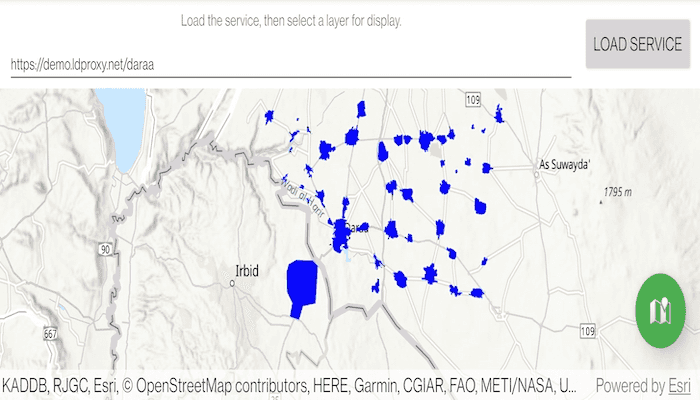
Browse an OGC API feature service for layers and add them to the map.
Use case
OGC API standards are used for sharing geospatial data on the web. As an open standard, the OGC API aims to improve access to geospatial or location information and could be a good choice for sharing data internationally or between organizations. That data could be of any type, including, for example, transportation layers shared between government organizations and private businesses.
How to use the sample
Select a layer to display from the list of layers shown in an OGC API service.
How it works
- Create an
OgcFeatureServiceobject with a URL to an OGC API feature service. - Obtain the
OgcFeatureServiceInfofromOgcFeatureService.serviceInfo. - Create a list of feature collections from the
OgcFeatureServiceInfo.featureCollectionInfos - When a feature collection is selected, create an
OgcFeatureCollectionTablefrom theOgcFeatureCollectionInfo. - Populate the
OgcFeatureCollectionTableusingpopulateFromServiceAsync(...)withQueryParametersthat contain amaxFeaturesproperty. - Create a feature layer from the feature table.
- Add the feature layer to the map.
Relevant API
- OgcFeatureCollectionInfo
- OgcFeatureCollectionTable
- OgcFeatureService
- OgcFeatureServiceInfo
About the data
The Daraa, Syria test data is OpenStreetMap data converted to the Topographic Data Store schema of NGA.
Additional information
See the OGC API website for more information on the OGC API family of standards.
Tags
browse, catalog, feature, layers, OGC, OGC API, service, web
Sample Code
/*
* Copyright 2021 Esri
*
* Licensed under the Apache License, Version 2.0 (the "License");
* you may not use this file except in compliance with the License.
* You may obtain a copy of the License at
*
* http://www.apache.org/licenses/LICENSE-2.0
*
* Unless required by applicable law or agreed to in writing, software
* distributed under the License is distributed on an "AS IS" BASIS,
* WITHOUT WARRANTIES OR CONDITIONS OF ANY KIND, either express or implied.
* See the License for the specific language governing permissions and
* limitations under the License.
*
*/
package com.esri.arcgisruntime.sample.browseogcapifeatureservice
import android.graphics.Color
import android.os.Bundle
import android.util.Log
import android.view.MotionEvent
import android.view.View
import android.widget.ArrayAdapter
import android.widget.EditText
import android.widget.ListView
import android.widget.Toast
import androidx.appcompat.app.AppCompatActivity
import androidx.coordinatorlayout.widget.CoordinatorLayout
import com.esri.arcgisruntime.ArcGISRuntimeEnvironment
import com.esri.arcgisruntime.data.FeatureTable
import com.esri.arcgisruntime.data.OgcFeatureCollectionTable
import com.esri.arcgisruntime.data.QueryParameters
import com.esri.arcgisruntime.data.ServiceFeatureTable
import com.esri.arcgisruntime.geometry.GeometryType
import com.esri.arcgisruntime.layers.FeatureLayer
import com.esri.arcgisruntime.layers.OgcFeatureCollectionInfo
import com.esri.arcgisruntime.layers.OgcFeatureService
import com.esri.arcgisruntime.loadable.LoadStatus
import com.esri.arcgisruntime.mapping.ArcGISMap
import com.esri.arcgisruntime.mapping.BasemapStyle
import com.esri.arcgisruntime.mapping.view.DefaultMapViewOnTouchListener
import com.esri.arcgisruntime.mapping.view.MapView
import com.esri.arcgisruntime.sample.browseogcapifeatureservice.databinding.ActivityMainBinding
import com.esri.arcgisruntime.symbology.Renderer
import com.esri.arcgisruntime.symbology.SimpleFillSymbol
import com.esri.arcgisruntime.symbology.SimpleLineSymbol
import com.esri.arcgisruntime.symbology.SimpleMarkerSymbol
import com.esri.arcgisruntime.symbology.SimpleRenderer
import com.google.android.material.floatingactionbutton.FloatingActionButton
// URL to the OAFeat service
private const val serviceUrl = "https://demo.ldproxy.net/daraa"
class MainActivity : AppCompatActivity() {
private val TAG = this::class.java.simpleName
private val activityMainBinding by lazy {
ActivityMainBinding.inflate(layoutInflater)
}
private val mapView: MapView by lazy {
activityMainBinding.mapView
}
private val serviceEditText: EditText by lazy {
activityMainBinding.serviceEditText
}
private val featureCollectionTitleListView: ListView by lazy {
activityMainBinding.featureCollectionTitleListView
}
private val layerFAB: FloatingActionButton by lazy {
activityMainBinding.layerFAB
}
override fun onCreate(savedInstanceState: Bundle?) {
super.onCreate(savedInstanceState)
setContentView(activityMainBinding.root)
// authentication with an API key or named user is required to access basemaps and other
// location services
ArcGISRuntimeEnvironment.setApiKey(BuildConfig.API_KEY)
// initialize the text box with a service URL
serviceEditText.setText(serviceUrl)
// create a map with topographic basemap
mapView.map = ArcGISMap(BasemapStyle.ARCGIS_TOPOGRAPHIC)
// load the OGC feature service
loadOgcFeatureService()
// set up ui behavior
setupUI()
}
/**
* Loads a new OGC Feature Service with the URL in the edit text box. Use the service's info to
* get titles for all feature collections. Add those titles to the list view and on tap call
* loadLayer.
*/
private fun loadOgcFeatureService() {
// create the OGC API - Features service using the landing URL
val service = OgcFeatureService(serviceEditText.text.toString())
// load the OAFeat service
service.addDoneLoadingListener {
if (service.loadStatus == LoadStatus.LOADED) {
// get the service metadata
val serviceInfo = service.serviceInfo
// get a list of available collections
val featureCollectionInfos = serviceInfo.featureCollectionInfos
// get a list of the collection titles
val featureCollectionTitles = featureCollectionInfos.map { it.title }
// create an adapter to show the feature collection titles
val featureCollectionTitleAdapter = ArrayAdapter(
this,
R.layout.feature_collection_title_list_item,
featureCollectionTitles
)
featureCollectionTitleListView.apply {
// add the adapter to the list view
adapter = featureCollectionTitleAdapter
// set an on item click listener for items in the list view
setOnItemClickListener { _, _, position, _ ->
// load the selected collection
loadLayer(featureCollectionInfos[position])
}
}
// expand the layers list
layerFAB.isExpanded = true
} else {
val error = "Error loading OGC feature service: " + service.loadError.message
Toast.makeText(this, error, Toast.LENGTH_LONG).show()
Log.e(TAG, error)
}
}
service.loadAsync()
}
/**
* Load and query features from the given OGC Feature Collection. Create a Feature Layer from
* the OGC feature collection table and add it to the map's operational layers.
*
* @param selectedCollectionInfo used to create an OgcFeatureCollectionTable
*/
private fun loadLayer(selectedCollectionInfo: OgcFeatureCollectionInfo) {
// create the OGC feature collection table
val ogcFeatureCollectiontable = OgcFeatureCollectionTable(selectedCollectionInfo)
// populate the OGC feature collection table
val queryParameters = QueryParameters().apply {
maxFeatures = 1000
}
ogcFeatureCollectiontable.apply {
// set the feature request mode to manual (only manual is currently supported). In this mode,
// you must manually populate the table - panning and zooming won't request features
// automatically
featureRequestMode = ServiceFeatureTable.FeatureRequestMode.MANUAL_CACHE
// populate the table from the service
populateFromServiceAsync(queryParameters, false, null)
addDoneLoadingListener {
if (ogcFeatureCollectiontable.loadStatus == LoadStatus.LOADED) {
// create a feature layer from the OGC feature collection table
val ogcFeatureLayer = FeatureLayer(ogcFeatureCollectiontable).apply {
// Choose a renderer for the layer based on the table.
renderer = getRendererForTable(ogcFeatureCollectiontable) ?: this.renderer
}
mapView.map.operationalLayers.apply {
// clear previous layers from the map
clear()
// add the layer to the map
add(ogcFeatureLayer)
}
// zoom to the extent of the selected collection
val collectionExtent = selectedCollectionInfo.extent
if (!collectionExtent.isEmpty) {
mapView.setViewpointGeometryAsync(collectionExtent, 100.0)
}
// hide the layer list
layerFAB.isExpanded = false
} else {
val error =
"Error loading OGC Feature Collection table: " + ogcFeatureCollectiontable.loadError.message
Toast.makeText(this@MainActivity, error, Toast.LENGTH_LONG).show()
Log.e(TAG, error)
}
}
}
}
/**
* Return a simple renderer for points, lines and polygons.
*
* @param featureTable of features to return simple renderer for
*/
private fun getRendererForTable(featureTable: FeatureTable): Renderer? {
return when (featureTable.geometryType) {
GeometryType.POINT, GeometryType.MULTIPOINT -> return SimpleRenderer(
SimpleMarkerSymbol(
SimpleMarkerSymbol.Style.CIRCLE,
Color.BLUE,
5f
)
)
GeometryType.POLYGON, GeometryType.ENVELOPE -> return SimpleRenderer(
SimpleFillSymbol(
SimpleFillSymbol.Style.SOLID,
Color.BLUE,
null
)
)
GeometryType.POLYLINE -> return SimpleRenderer(
SimpleLineSymbol(
SimpleLineSymbol.Style.SOLID,
Color.BLUE,
1f
)
)
else -> null
}
}
/**
* Sets up UI behavior. Closes expandable floating action button on touching the map view.
* Moves floating action button on attribution view expanded. Expands floating action button on
* tap.
*/
private fun setupUI() {
mapView.apply {
// create a touch listener
onTouchListener = object : DefaultMapViewOnTouchListener(applicationContext, mapView) {
// close the options sheet when the map is tapped
override fun onTouch(view: View?, motionEvent: MotionEvent?): Boolean {
if (layerFAB.isExpanded) {
layerFAB.isExpanded = false
}
return super.onTouch(view, motionEvent)
}
}
// ensure the floating action button moves to be above the attribution view
addAttributionViewLayoutChangeListener { _, _, _, _, bottom, _, _, _, oldBottom ->
val heightDelta = bottom - oldBottom
(layerFAB.layoutParams as CoordinatorLayout.LayoutParams).bottomMargin += heightDelta
}
}
// show the options sheet when the floating action button is clicked
layerFAB.setOnClickListener {
layerFAB.isExpanded = !layerFAB.isExpanded
}
}
override fun onPause() {
mapView.pause()
super.onPause()
}
override fun onResume() {
super.onResume()
mapView.resume()
}
override fun onDestroy() {
mapView.dispose()
super.onDestroy()
}
}