Set the map view to a new viewpoint.
Use case
Programmatically navigate to a specified location in the map or scene. Use this to focus on a particular point or area of interest.
How to use the sample
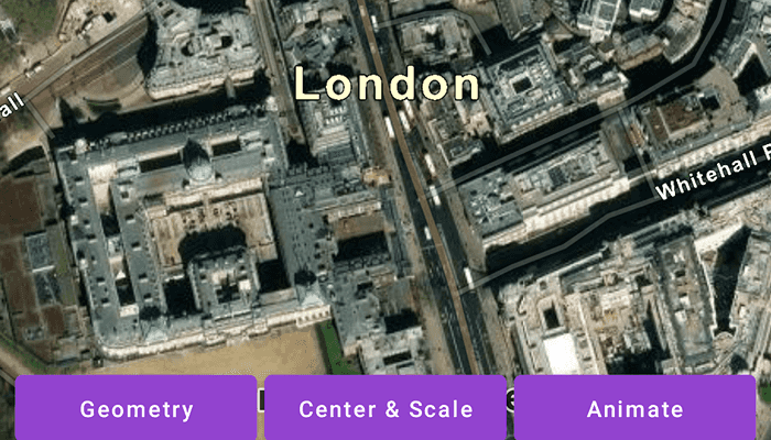
Select a viewpoint option to see the map view move to that location.
How it works
- Create a new
ArcGISMapobject and set it to theMapViewobject. - Change the map's
Viewpointusing one of the available methods:- Use
MapView.setViewpointAnimated(...)to pan to a viewpoint over the specified length of time. - Use
MapView.setViewpointCenter(...)to center the viewpoint on aPointand set a distance from the ground using a scale. - Use
MapView.setViewpointGeometry(...)to set the viewpoint to a givenGeometry.
- Use
Relevant API
- ArcGISMap
- Geometry
- MapView
- Point
- Viewpoint
Additional information
Below are multiple ways to set a viewpoint:
mapView.setViewpoint(...)
mapView.setViewpointCenter(...)
mapView.setViewpointGeometry(...)
mapView.setViewpointRotation(...)
mapView.setViewpointScale(...)
mapView.setViewpointAnimated(...)
Tags
animate, extent, pan, rotate, scale, view, zoom
Sample Code
MainActivity.kt
/* Copyright 2022 Esri
*
* Licensed under the Apache License, Version 2.0 (the "License");
* you may not use this file except in compliance with the License.
* You may obtain a copy of the License at
*
* http://www.apache.org/licenses/LICENSE-2.0
*
* Unless required by applicable law or agreed to in writing, software
* distributed under the License is distributed on an "AS IS" BASIS,
* WITHOUT WARRANTIES OR CONDITIONS OF ANY KIND, either express or implied.
* See the License for the specific language governing permissions and
* limitations under the License.
*
*/
package com.esri.arcgismaps.sample.changeviewpoint
import android.os.Bundle
import android.view.View
import com.esri.arcgismaps.sample.sampleslib.EdgeToEdgeCompatActivity
import androidx.databinding.DataBindingUtil
import androidx.lifecycle.lifecycleScope
import com.arcgismaps.ApiKey
import com.arcgismaps.ArcGISEnvironment
import com.arcgismaps.geometry.Point
import com.arcgismaps.geometry.PolylineBuilder
import com.arcgismaps.geometry.SpatialReference
import com.arcgismaps.mapping.ArcGISMap
import com.arcgismaps.mapping.BasemapStyle
import com.arcgismaps.mapping.Viewpoint
import com.esri.arcgismaps.sample.changeviewpoint.databinding.ChangeViewpointActivityMainBinding
import kotlinx.coroutines.launch
class MainActivity : EdgeToEdgeCompatActivity() {
private val viewpointScale = 5000.0
// set up data binding for the activity
private val activityMainBinding: ChangeViewpointActivityMainBinding by lazy {
DataBindingUtil.setContentView(this, R.layout.change_viewpoint_activity_main)
}
private val mapView by lazy {
activityMainBinding.mapView
}
override fun onCreate(savedInstanceState: Bundle?) {
super.onCreate(savedInstanceState)
// authentication with an API key or named user is
// required to access basemaps and other location services
ArcGISEnvironment.apiKey = ApiKey.create(BuildConfig.ACCESS_TOKEN)
// add the MapView to the lifecycle
lifecycle.addObserver(mapView)
// create and add a map with a imagery basemap style
mapView.map = ArcGISMap(BasemapStyle.ArcGISImagery)
// set the start point of the ViewPoint
val startPoint = Point(-14093.0, 6711377.0, SpatialReference.webMercator())
lifecycleScope.launch {
// set viewpoint of map view to starting point and scale
mapView.setViewpointCenter(startPoint, viewpointScale)
}
}
fun onGeometryClicked(view: View) {
// create a collection of points around Westminster
val westminsterPolylineBuilder = PolylineBuilder(SpatialReference.webMercator()) {
addPoint(Point(-13823.0, 6710390.0))
addPoint(Point(-13823.0, 6710150.0))
addPoint(Point(-14680.0, 6710390.0))
addPoint(Point(-14680.0, 6710150.0))
}
val geometry = westminsterPolylineBuilder.toGeometry()
// set the map view's viewpoint to Westminster
lifecycleScope.launch {
mapView.setViewpointGeometry(geometry)
}
}
fun onCenterClicked(view: View) {
// create the Waterloo location point
val waterlooPoint = Point(-12153.0, 6710527.0, SpatialReference.webMercator())
// set the map view's viewpoint centered on Waterloo and scaled
lifecycleScope.launch {
mapView.setViewpointCenter(waterlooPoint, viewpointScale)
}
}
fun onAnimateClicked(view: View) {
// create the London location point
val londonPoint = Point(-14093.0, 6711377.0, SpatialReference.webMercator())
// create the viewpoint with the London point and scale
val viewpoint = Viewpoint(londonPoint, viewpointScale)
// set the map view's viewpoint to London with a seven second animation duration
lifecycleScope.launch {
mapView.setViewpointAnimated(viewpoint, 7f)
}
}
}