Add OpenStreetMap as a basemap layer.
Use case
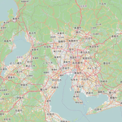
OpenStreetMap is a free community-edited basemap.
How to use the sample
When the sample opens, it will automatically display the map with the OpenStreetMap basemap. Pan and zoom to observe the basemap.
How it works
- Create a basemap using
BasemapStyle::OsmStandard. - Create a map with that basemap.
- Show the map in a map view.
Relevant API
- Basemap
- Map
- MapView
- OpenStreetMapLayer
Additional information
The attribution text will be set to the required OpenStreetMap attribution automatically.
Apps that expect to make many requests to OpenStreetMap should consider using an alternative tile server via the WebTiledLayer class.
Esri now hosts an OpenStreetMap vector layer on ArcGIS Online that uses recent OpenStreetMap data in conjunction with a style matching the default OpenStreetMap style. This layer is not subject to the tile access restrictions that apply to tiles fetched from OpenStreetMap.org.
Tags
basemap, layers, map, open, OpenStreetMap, OSM, street
Sample code
// [WriteFile Name=OSM_Layer, Category=Layers]// [Legal]// Copyright 2017 Esri.//// Licensed under the Apache License, Version 2.0 (the "License");// you may not use this file except in compliance with the License.// You may obtain a copy of the License at// http://www.apache.org/licenses/LICENSE-2.0//// Unless required by applicable law or agreed to in writing, software// distributed under the License is distributed on an "AS IS" BASIS,// WITHOUT WARRANTIES OR CONDITIONS OF ANY KIND, either express or implied.// See the License for the specific language governing permissions and// limitations under the License.// [Legal]
#ifdef PCH_BUILD#include "pch.hpp"#endif // PCH_BUILD
// sample headers#include "OSM_Layer.h"
// ArcGIS Maps SDK headers#include "Basemap.h"#include "LayerListModel.h"#include "Map.h"#include "MapQuickView.h"#include "OpenStreetMapLayer.h"
using namespace Esri::ArcGISRuntime;
OSM_Layer::OSM_Layer(QQuickItem* parent /* = nullptr */) :  QQuickItem(parent){}
void OSM_Layer::init(){  // Register the map view for QML  qmlRegisterType<MapQuickView>("Esri.Samples", 1, 0, "MapView");  qmlRegisterType<OSM_Layer>("Esri.Samples", 1, 0, "OSM_LayerSample");}
void OSM_Layer::componentComplete(){  QQuickItem::componentComplete();
  // find QML MapView component  m_mapView = findChild<MapQuickView*>("mapView");
  // Create a map  m_map = new Map(this);
  // Create a new OpenStreetMapLayer and add it to the list of basemap layers  OpenStreetMapLayer* osm = new OpenStreetMapLayer(this);  m_map->basemap()->baseLayers()->append(osm);
  // Set map to map view  m_mapView->setMap(m_map);}
// [WriteFile Name=OSM_Layer, Category=Layers]// [Legal]// Copyright 2017 Esri.//// Licensed under the Apache License, Version 2.0 (the "License");// you may not use this file except in compliance with the License.// You may obtain a copy of the License at// http://www.apache.org/licenses/LICENSE-2.0//// Unless required by applicable law or agreed to in writing, software// distributed under the License is distributed on an "AS IS" BASIS,// WITHOUT WARRANTIES OR CONDITIONS OF ANY KIND, either express or implied.// See the License for the specific language governing permissions and// limitations under the License.// [Legal]
#ifndef OSM_LAYER_H#define OSM_LAYER_H
// Qt headers#include <QQuickItem>
namespace Esri::ArcGISRuntime{ class Map; class MapQuickView;} // namespace Esri::ArcGISRuntime
class OSM_Layer : public QQuickItem{ Q_OBJECT
public: explicit OSM_Layer(QQuickItem* parent = nullptr); ~OSM_Layer() override = default;
void componentComplete() override; static void init();
private: Esri::ArcGISRuntime::Map* m_map = nullptr; Esri::ArcGISRuntime::MapQuickView* m_mapView = nullptr;};
#endif // OSM_LAYER_H// [WriteFile Name=OSM_Layer, Category=Layers]// [Legal]// Copyright 2017 Esri.//// Licensed under the Apache License, Version 2.0 (the "License");// you may not use this file except in compliance with the License.// You may obtain a copy of the License at// http://www.apache.org/licenses/LICENSE-2.0//// Unless required by applicable law or agreed to in writing, software// distributed under the License is distributed on an "AS IS" BASIS,// WITHOUT WARRANTIES OR CONDITIONS OF ANY KIND, either express or implied.// See the License for the specific language governing permissions and// limitations under the License.// [Legal]
import QtQuickimport QtQuick.Controlsimport Esri.Samples
OSM_LayerSample { id: rootRectangle clip: true width: 800 height: 600
// add a mapView component MapView { anchors.fill: parent objectName: "mapView"
Component.onCompleted: { // Set the focus on MapView to initially enable keyboard navigation forceActiveFocus(); } }}