Display a layer from a Web Map Tile Service.
Use case
WMTS services can have several layers. You can use the ArcGIS Maps SDK for Qt to explore the layers available from a service. This would commonly be used to enable a browsing experience where users can choose which layers they want to display at run time.
How to use the sample
The layer will be displayed automatically. Pan and zoom to explore the map.
How it works
To display a WMTS layer directly from a URL:
- Create a
WmtsServiceobject using the URL of the WMTS service. - Create a
WmtsLayerobject with the ID of the layer to display.
To explore layers from a WMTS service:
- Create a
WmtsServiceobject using the URL of the WMTS service. - After loading the WMTS service, get the list of
WmtsLayerInfoobjects from the service info of the WMTS service. - Use one of the layer infos to create the WMTS layer.
- Create a basemap with the WMTS layer and set it to the map.
Relevant API
- WmtsLayer
- WmtsLayerInfo
- WmtsService
- WmtsServiceInfo
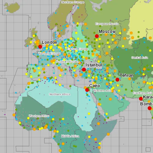
About the data
The map visualizes world time zones.
Tags
layer, OGC, raster, tiled, web map tile service
Sample code
// [WriteFile Name=WMTS_Layer, Category=Layers]// [Legal]// Copyright 2017 Esri.//// Licensed under the Apache License, Version 2.0 (the "License");// you may not use this file except in compliance with the License.// You may obtain a copy of the License at// http://www.apache.org/licenses/LICENSE-2.0//// Unless required by applicable law or agreed to in writing, software// distributed under the License is distributed on an "AS IS" BASIS,// WITHOUT WARRANTIES OR CONDITIONS OF ANY KIND, either express or implied.// See the License for the specific language governing permissions and// limitations under the License.// [Legal]
#ifdef PCH_BUILD#include "pch.hpp"#endif // PCH_BUILD
// sample headers#include "WMTS_Layer.h"
// ArcGIS Maps SDK headers#include "Basemap.h"#include "Error.h"#include "Map.h"#include "MapQuickView.h"#include "WmtsLayer.h"#include "WmtsLayerInfo.h"#include "WmtsService.h"#include "WmtsServiceInfo.h"
using namespace Esri::ArcGISRuntime;
WMTS_Layer::WMTS_Layer(QQuickItem* parent /* = nullptr */) :  QQuickItem(parent){}
void WMTS_Layer::init(){  // Register the map view for QML  qmlRegisterType<MapQuickView>("Esri.Samples", 1, 0, "MapView");  qmlRegisterType<WMTS_Layer>("Esri.Samples", 1, 0, "WMTS_LayerSample");}
void WMTS_Layer::componentComplete(){  QQuickItem::componentComplete();
  // find QML MapView component  m_mapView = findChild<MapQuickView*>("mapView");
  // create the WMTS layer  createWmtsLayer();}
void WMTS_Layer::createWmtsLayer(){  // create the service  m_service = new WmtsService(m_wmtsServiceUrl, this);
  // connect to the doneLoading signal of the service  connect(m_service, &WmtsService::doneLoading, this, [this](const Error& loadError)  {    if (!loadError.isEmpty())    {      qDebug() << "Error:" << loadError.message();      return;    }
    // get the layer info list    WmtsServiceInfo serviceInfo = m_service->serviceInfo();    QList<WmtsLayerInfo> layerInfos = serviceInfo.layerInfos();    // get the first layer ID from the list    QString layerId = layerInfos.at(0).wmtsLayerId();    // create the WMTS layer    WmtsLayer* wmtsLayer = new WmtsLayer(m_wmtsServiceUrl, layerId, this);    // create a basemap from the layer    Basemap* basemap = new Basemap(wmtsLayer, this);    // create a map    Map* map = new Map(basemap, this);    // set the map on the mapview    m_mapView->setMap(map);  });
  // load the service  m_service->load();}
// [WriteFile Name=WMTS_Layer, Category=Layers]// [Legal]// Copyright 2017 Esri.//// Licensed under the Apache License, Version 2.0 (the "License");// you may not use this file except in compliance with the License.// You may obtain a copy of the License at// http://www.apache.org/licenses/LICENSE-2.0//// Unless required by applicable law or agreed to in writing, software// distributed under the License is distributed on an "AS IS" BASIS,// WITHOUT WARRANTIES OR CONDITIONS OF ANY KIND, either express or implied.// See the License for the specific language governing permissions and// limitations under the License.// [Legal]
#ifndef WMTS_LAYER_H#define WMTS_LAYER_H
// Qt headers#include <QQuickItem>
namespace Esri::ArcGISRuntime{ class MapQuickView; class WmtsService;} // namespace Esri::ArcGISRuntime
class WMTS_Layer : public QQuickItem{ Q_OBJECT
public: explicit WMTS_Layer(QQuickItem* parent = nullptr); ~WMTS_Layer() override = default;
void componentComplete() override; static void init();
private: void createWmtsLayer();
private: Esri::ArcGISRuntime::MapQuickView* m_mapView = nullptr; Esri::ArcGISRuntime::WmtsService* m_service = nullptr; const QUrl m_wmtsServiceUrl = QUrl("https://sampleserver6.arcgisonline.com/arcgis/rest/services/WorldTimeZones/MapServer/WMTS");};
#endif // WMTS_LAYER_H// [WriteFile Name=WMTS_Layer, Category=Layers]// [Legal]// Copyright 2017 Esri.//// Licensed under the Apache License, Version 2.0 (the "License");// you may not use this file except in compliance with the License.// You may obtain a copy of the License at// http://www.apache.org/licenses/LICENSE-2.0//// Unless required by applicable law or agreed to in writing, software// distributed under the License is distributed on an "AS IS" BASIS,// WITHOUT WARRANTIES OR CONDITIONS OF ANY KIND, either express or implied.// See the License for the specific language governing permissions and// limitations under the License.// [Legal]
import QtQuickimport QtQuick.Controlsimport Esri.Samples
WMTS_LayerSample { id: rootRectangle clip: true width: 800 height: 600
// add a mapView component MapView { anchors.fill: parent objectName: "mapView"
Component.onCompleted: { // Set the focus on MapView to initially enable keyboard navigation forceActiveFocus(); } }}