Find the union, intersection, or difference of two geometries.
Use case
The different spatial operations (union, difference, symmetric difference, and intersection) can be used for a variety of spatial analyses. For example, government authorities may use the intersect operation to determine whether a proposed road cuts through a restricted piece of land such as a nature reserve or a private property. When these operations are chained together, they become even more powerful. An analysis of food deserts within an urban area might begin by union-ing service areas of grocery stores, farmer’s markets, and food co-ops. Taking the difference between this single geometry of all services areas and that of a polygon delineating a neighborhood would reveal the areas within that neighborhood where access to healthy, whole foods may not exist.
How to use the sample
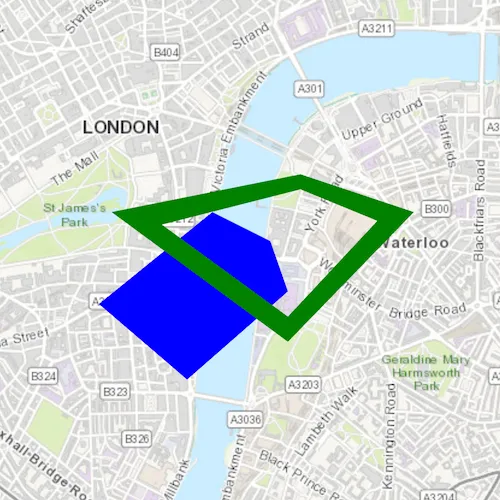
The sample provides an option to select a spatial operation. When an operation is selected, the resulting geometry is shown in red.
How it works
- Create a
GraphicsOverlayand add it to theMapView. - Use
PolygonBuilderto create two polygons. - Add the overlapping polygons to the graphics overlay.
- Perform spatial relationships between the polygons by using the appropriate operation:
GeometryEngine::union(geometry1, geometry2)- This method returns the two geometries united together as one geometry.GeometryEngine::difference(geometry1, geometry2)- This method returns any part of Geometry2 that does not intersect Geometry1.GeometryEngine::symmetricDifference(geometry1, geometry2)- This method returns any part of Geometry1 or Geometry2 which do not intersect.GeometryEngine::intersection(geometry1, geometry2)- This method returns the intersection of Geometry1 and Geometry2.
- Use the geometry that is returned from the method call to create a new
Graphicand add it to the graphics overlay for it to be displayed.
Relevant API
- Geometry
- GeometryEngine
- GeometryEngine::difference
- GeometryEngine::intersection
- GeometryEngine::symmetricDifference
- GeometryEngine::union
- Graphic
- GraphicsOverlay
Tags
analysis, combine, difference, geometry, intersection, merge, polygon, union
Sample code
// [WriteFile Name=SpatialOperations, Category=Geometry]// [Legal]// Copyright 2018 Esri.//// Licensed under the Apache License, Version 2.0 (the "License");// you may not use this file except in compliance with the License.// You may obtain a copy of the License at// http://www.apache.org/licenses/LICENSE-2.0//// Unless required by applicable law or agreed to in writing, software// distributed under the License is distributed on an "AS IS" BASIS,// WITHOUT WARRANTIES OR CONDITIONS OF ANY KIND, either express or implied.// See the License for the specific language governing permissions and// limitations under the License.// [Legal]
#ifdef PCH_BUILD#include "pch.hpp"#endif // PCH_BUILD
// sample headers#include "SpatialOperations.h"
// ArcGIS Maps SDK headers#include "Basemap.h"#include "GeometryEngine.h"#include "Graphic.h"#include "GraphicListModel.h"#include "GraphicsOverlay.h"#include "GraphicsOverlayListModel.h"#include "Map.h"#include "MapQuickView.h"#include "MapTypes.h"#include "Part.h"#include "PartCollection.h"#include "Point.h"#include "PolygonBuilder.h"#include "SimpleFillSymbol.h"#include "SpatialReference.h"#include "SymbolTypes.h"#include "Viewpoint.h"
using namespace Esri::ArcGISRuntime;
SpatialOperations::SpatialOperations(QQuickItem* parent /* = nullptr */) :  QQuickItem(parent),  m_polygon1(Geometry()),  m_polygon2(Geometry()),  m_inputsOverlay(new GraphicsOverlay(this)),  m_outputsOverlay(new GraphicsOverlay(this)),  m_geometryOperations{QStringLiteral("None"), QStringLiteral("Union"), QStringLiteral("Difference"), QStringLiteral("Symmetric difference"),                       QStringLiteral("Intersection")}{}
void SpatialOperations::init(){  // Register the map view for QML  qmlRegisterType<MapQuickView>("Esri.Samples", 1, 0, "MapView");  qmlRegisterType<SpatialOperations>("Esri.Samples", 1, 0, "SpatialOperationsSample");}
void SpatialOperations::componentComplete(){  QQuickItem::componentComplete();
  m_map = new Map(BasemapStyle::ArcGISTopographic, this);  m_mapView->setMap(m_map);
  addPolygons();  m_mapView->graphicsOverlays()->append(m_inputsOverlay);  m_mapView->graphicsOverlays()->append(m_outputsOverlay);  m_map->setInitialViewpoint(Viewpoint(Point(-13453, 6710127, SpatialReference::webMercator()), 30000));}
void SpatialOperations::addPolygons(){  // create blue polygon  PolygonBuilder polygonBuilder1(SpatialReference::webMercator());  polygonBuilder1.addPoint(-13960, 6709400);  polygonBuilder1.addPoint(-14660, 6710000);  polygonBuilder1.addPoint(-13760, 6710730);  polygonBuilder1.addPoint(-13300, 6710500);  polygonBuilder1.addPoint(-13160, 6710100);
  SimpleFillSymbol* fillSymbol1 = new SimpleFillSymbol(SimpleFillSymbolStyle::Solid, QColor("blue"), this);  m_polygon1 = polygonBuilder1.toGeometry();  m_inputsOverlay->graphics()->append(new Graphic(m_polygon1, fillSymbol1, this));
  // create green polygon  // outer ring  Part* outerRing = new Part(SpatialReference::webMercator(), this);  outerRing->addPoint(-13060, 6711030);  outerRing->addPoint(-12160, 6710730);  outerRing->addPoint(-13160, 6709700);  outerRing->addPoint(-14560, 6710730);  outerRing->addPoint(-13060, 6711030);
  // inner ring  Part* innerRing = new Part(SpatialReference::webMercator(), this);  innerRing->addPoint(-13060, 6710910);  innerRing->addPoint(-14160, 6710630);  innerRing->addPoint(-13160, 6709900);  innerRing->addPoint(-12450, 6710660);  innerRing->addPoint(-13060, 6710910);
  PolygonBuilder polygonBuilder2(SpatialReference::webMercator());  polygonBuilder2.parts()->addPart(outerRing);  polygonBuilder2.parts()->addPart(innerRing);  m_polygon2 = polygonBuilder2.toGeometry();  SimpleFillSymbol* fillSymbol2 = new SimpleFillSymbol(SimpleFillSymbolStyle::Solid, QColor("green"), this);  m_inputsOverlay->graphics()->append(new Graphic(m_polygon2, fillSymbol2, this));}
MapQuickView* SpatialOperations::mapQuickView() const{  return m_mapView;}
void SpatialOperations::setMapQuickView(MapQuickView* mapQuickView){  m_mapView = mapQuickView;  emit mapQuickViewChanged();}
void SpatialOperations::applyGeometryOperation(int index){  if (!m_map || m_map->loadStatus() != LoadStatus::Loaded)  {    return;  }
  // Perform geometry calculations  Geometry resultPolygon;  switch (index)  {    case 1:      resultPolygon = GeometryEngine::unionOf(m_polygon1, m_polygon2);      break;    case 2:      resultPolygon = GeometryEngine::difference(m_polygon1, m_polygon2);      break;    case 3:      resultPolygon = GeometryEngine::symmetricDifference(m_polygon1, m_polygon2);      break;    case 4:      resultPolygon = GeometryEngine::intersection(m_polygon1, m_polygon2);      break;    case 0:    default:      break;  }
  // Clear previous results  m_outputsOverlay->graphics()->clear();  if (resultPolygon.isEmpty())  {    return;  }
  // Add the resulting polygon as a Graphic  SimpleFillSymbol* fillSymbol = new SimpleFillSymbol(SimpleFillSymbolStyle::Solid, QColor("red"), this);  Graphic* graphic = new Graphic(resultPolygon, fillSymbol, this);  m_outputsOverlay->graphics()->append(graphic);}
// [WriteFile Name=SpatialOperations, Category=Geometry]// [Legal]// Copyright 2018 Esri.//// Licensed under the Apache License, Version 2.0 (the "License");// you may not use this file except in compliance with the License.// You may obtain a copy of the License at// http://www.apache.org/licenses/LICENSE-2.0//// Unless required by applicable law or agreed to in writing, software// distributed under the License is distributed on an "AS IS" BASIS,// WITHOUT WARRANTIES OR CONDITIONS OF ANY KIND, either express or implied.// See the License for the specific language governing permissions and// limitations under the License.// [Legal]
#ifndef SpatialOperations_H#define SpatialOperations_H
// ArcGIS Maps SDK headers#include "Geometry.h"
// Qt headers#include <QQuickItem>#include <QStringList>
namespace Esri::ArcGISRuntime{ class Map; class MapQuickView; class GraphicsOverlay;} // namespace Esri::ArcGISRuntime
Q_MOC_INCLUDE("MapQuickView.h")
class SpatialOperations : public QQuickItem{ Q_OBJECT Q_PROPERTY(Esri::ArcGISRuntime::MapQuickView* mapView READ mapQuickView WRITE setMapQuickView NOTIFY mapQuickViewChanged) Q_PROPERTY(QStringList geometryOperations MEMBER m_geometryOperations CONSTANT)
public: explicit SpatialOperations(QQuickItem* parent = nullptr); ~SpatialOperations() override = default;
static void init(); void componentComplete() override; Q_INVOKABLE void applyGeometryOperation(int index);
signals: void mapQuickViewChanged();
private: void addPolygons(); void addOutput(const Esri::ArcGISRuntime::Geometry& geometry);
Esri::ArcGISRuntime::MapQuickView* mapQuickView() const; void setMapQuickView(Esri::ArcGISRuntime::MapQuickView* mapQuickView);
private: Esri::ArcGISRuntime::Map* m_map = nullptr; Esri::ArcGISRuntime::MapQuickView* m_mapView = nullptr; Esri::ArcGISRuntime::Geometry m_polygon1; Esri::ArcGISRuntime::Geometry m_polygon2; Esri::ArcGISRuntime::GraphicsOverlay* m_inputsOverlay = nullptr; Esri::ArcGISRuntime::GraphicsOverlay* m_outputsOverlay = nullptr; QStringList m_geometryOperations;};
#endif // SpatialOperations_H// [WriteFile Name=SpatialOperations, Category=Geometry]// [Legal]// Copyright 2018 Esri.//// Licensed under the Apache License, Version 2.0 (the "License");// you may not use this file except in compliance with the License.// You may obtain a copy of the License at// http://www.apache.org/licenses/LICENSE-2.0//// Unless required by applicable law or agreed to in writing, software// distributed under the License is distributed on an "AS IS" BASIS,// WITHOUT WARRANTIES OR CONDITIONS OF ANY KIND, either express or implied.// See the License for the specific language governing permissions and// limitations under the License.// [Legal]
import QtQuickimport QtQuick.Layoutsimport QtQuick.Controlsimport Esri.Samples
SpatialOperationsSample { id: rootRectangle clip: true width: 800 height: 600
// add a mapView component MapView { id: mapQuickView anchors.fill: parent
Component.onCompleted: { // Set the focus on MapView to initially enable keyboard navigation forceActiveFocus(); } } mapView: mapQuickView
// Display a ComboBox with options for each operation ComboBox { id: comboBox anchors { left: parent.left top: parent.top margins: 10 }
property int modelWidth: 0 width: modelWidth + leftPadding + rightPadding + (indicator ? indicator.width : 10) model: geometryOperations onCurrentIndexChanged: applyGeometryOperation(currentIndex); Component.onCompleted : { for (let i = 0; i < model.length; ++i) { metrics.text = model[i]; modelWidth = Math.max(modelWidth, metrics.width); } } TextMetrics { id: metrics font: comboBox.font } }}