Download tiles to a local tile cache file stored on the device.
Use case
Field workers with limited network connectivity can use exported tiles as a basemap for use offline.
How to use the sample
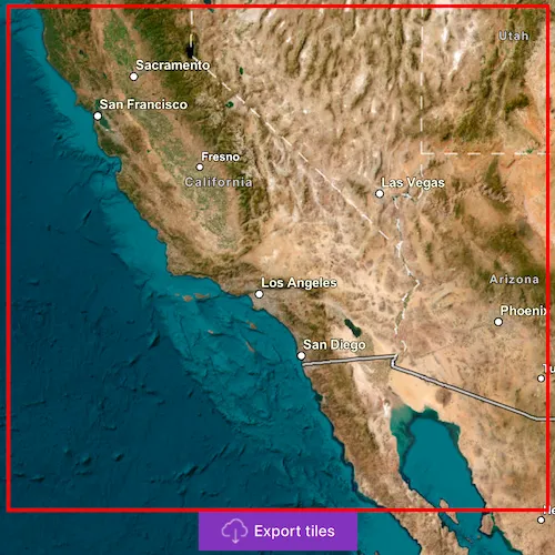
Pan and zoom into the desired area, making sure the area is within the red boundary. Click ‘Export tiles’ to start the process. The application will export tiles from the raster imagery baselayer and not include the vector labels baselayer from the Imagery BasemapStyle. On successful completion you will see a preview of the downloaded tile package.
How it works
- Create an
ArcGISTiledLayerfrom a raster baselayer of a basemap style. - Create an
ExportTileCacheTask, passing in the URL of the tiled layer. - Create default
ExportTileCacheParametersfor the task, specifying extent, minimum scale and maximum scale. Limiting the difference between the minimum and maximum scales will decrease the size of the resulting tile package and the time it takes to create. - Use the parameters and a path to create an
ExportTileCacheJobfrom the task. - Start the job, and when it completes successfully, get the resulting
TileCache. - Use the tile cache to create an
ArcGISTiledLayer, and display it in the map.
Relevant API
- ArcGISTiledLayer
- ExportTileCacheJob
- ExportTileCacheParameters
- ExportTileCacheTask
- TileCache
Additional information
ArcGIS tiled layers do not support reprojection, query, select, identify, or editing. See the Layer types discussion in the developers guide to learn more about the characteristics of ArcGIS tiled layers.
At this time, ExportTileCacheTask only supports raster layers.
Tags
cache, download, offline
Sample code
// [WriteFile Name=ExportTiles, Category=Layers]// [Legal]// Copyright 2016 Esri.//// Licensed under the Apache License, Version 2.0 (the "License");// you may not use this file except in compliance with the License.// You may obtain a copy of the License at// http://www.apache.org/licenses/LICENSE-2.0//// Unless required by applicable law or agreed to in writing, software// distributed under the License is distributed on an "AS IS" BASIS,// WITHOUT WARRANTIES OR CONDITIONS OF ANY KIND, either express or implied.// See the License for the specific language governing permissions and// limitations under the License.// [Legal]
#ifdef PCH_BUILD#include "pch.hpp"#endif // PCH_BUILD
// sample headers#include "ExportTiles.h"
// ArcGIS Maps SDK headers#include "ArcGISTiledLayer.h"#include "Basemap.h"#include "Envelope.h"#include "Error.h"#include "ExportTileCacheJob.h"#include "ExportTileCacheParameters.h"#include "ExportTileCacheTask.h"#include "GeometryEngine.h"#include "LayerListModel.h"#include "Map.h"#include "MapQuickView.h"#include "MapTypes.h"#include "Point.h"#include "SpatialReference.h"#include "TaskTypes.h"#include "TileCache.h"#include "Viewpoint.h"
// Qt headers#include <QFuture>#include <QUrl>#include <QUuid>
using namespace Esri::ArcGISRuntime;
ExportTiles::ExportTiles(QQuickItem* parent) :  QQuickItem(parent){}
ExportTiles::~ExportTiles() = default;
void ExportTiles::init(){  qmlRegisterType<MapQuickView>("Esri.Samples", 1, 0, "MapView");  qmlRegisterType<ExportTiles>("Esri.Samples", 1, 0, "ExportTilesSample");}
void ExportTiles::componentComplete(){  QQuickItem::componentComplete();
  // find QML MapView component  m_mapView = findChild<MapQuickView*>("mapView");
  // create a tiled basemap  Basemap* basemap = new Basemap(BasemapStyle::ArcGISImagery, this);
  // create an export tile cache task when basemap has finished loading  connect(basemap, &Basemap::doneLoading, this, [this]()  {    if (!m_map->basemap()->baseLayers()->isEmpty())    {      createExportTileCacheTask();    }  });
  // create a new map instance  m_map = new Map(basemap, this);
  // set an initial viewpoint  m_map->setInitialViewpoint(Viewpoint(35, -117, 1e7));
  // set map on the map view  m_mapView->setMap(m_map);}
void ExportTiles::createExportTileCacheTask(){  // Get a tile layer from the basemap  ArcGISTiledLayer* tiledLayer = dynamic_cast<ArcGISTiledLayer*>(m_map->basemap()->baseLayers()->at(0));
  // create the task with the url and load it  m_exportTileCacheTask = new ExportTileCacheTask(tiledLayer->url(), this);
  connect(m_exportTileCacheTask, &ExportTileCacheTask::doneLoading, this, [this](const Error& error)  {    if (!error.isEmpty())    {      emit updateStatus("Export failed");      emit hideWindow(5000, false);    }  });
  m_exportTileCacheTask->load();}
void ExportTiles::exportTileCacheFromCorners(double xCorner1, double yCorner1, double xCorner2, double yCorner2){  // create an envelope from the QML rectangle corners  const Point corner1 = m_mapView->screenToLocation(xCorner1, yCorner1);  const Point corner2 = m_mapView->screenToLocation(xCorner2, yCorner2);  const Envelope extent(corner1, corner2);  const Geometry tileCacheExtent = GeometryEngine::project(extent, SpatialReference::webMercator());
  // generate parameters  m_exportTileCacheTask->createDefaultExportTileCacheParametersAsync(tileCacheExtent, m_mapView->mapScale(), m_mapView->mapScale() * 0.1)    .then(this, [this](const ExportTileCacheParameters& parameters)  {    onDefaultExportTileCacheParametersCompleted_(parameters);  });}
void ExportTiles::onDefaultExportTileCacheParametersCompleted_(const ExportTileCacheParameters& parameters){  //! [ExportTiles start job]  // execute the task and obtain the job  ExportTileCacheJob* exportJob = m_exportTileCacheTask->exportTileCache(parameters, m_tempPath.path() + "/offlinemap.tpkx");
  // check if there is a valid job  if (exportJob)  {    connect(exportJob, &ExportTileCacheJob::progressChanged, this, [this, exportJob]()    {      m_exportTilesProgress = exportJob->progress();      emit exportTilesProgressChanged();    });
    // connect to the job's status changed signal    connect(exportJob, &ExportTileCacheJob::statusChanged, this, [this, exportJob](JobStatus jobStatus)    {      // connect to the job's status changed signal to know once it is done      switch (jobStatus)      {        case JobStatus::Failed:          emit updateStatus("Export failed");          emit hideWindow(5000, false);          break;        case JobStatus::NotStarted:          emit updateStatus("Job not started");          break;        case JobStatus::Paused:          emit updateStatus("Job paused");          break;        case JobStatus::Started:          emit updateStatus("In progress...");          break;        case JobStatus::Succeeded:          emit updateStatus("Adding TPKX...");          emit hideWindow(1500, true);          displayOutputTileCache(exportJob->result());          break;        default:          break;      }    });
    // start the export job    exportJob->start();  }  //! [ExportTiles start job]  else  {    emit updateStatus("Export failed");    emit hideWindow(5000, false);  }}
// display the tile cache once the task is completevoid ExportTiles::displayOutputTileCache(TileCache* tileCache){  // create a new tiled layer from the output tile cache  ArcGISTiledLayer* tiledLayer = new ArcGISTiledLayer(tileCache, this);
  // add the new layer to a basemap  Basemap* basemap = new Basemap(tiledLayer, this);
  // set the new basemap on the map  m_map->setBasemap(basemap);
  // zoom to the new layer and hide window once loaded  connect(tiledLayer, &ArcGISTiledLayer::doneLoading, this, [this, tiledLayer]()  {    if (tiledLayer->loadStatus() == LoadStatus::Loaded)    {      const double prevMapScale = m_mapView->mapScale();      m_map->setMinScale(prevMapScale);      m_map->setMaxScale(prevMapScale * 0.1);      m_mapView->setViewpointScaleAsync(prevMapScale * 0.5);    }  });}
// [WriteFile Name=ExportTiles, Category=Layers]// [Legal]// Copyright 2016 Esri.//// Licensed under the Apache License, Version 2.0 (the "License");// you may not use this file except in compliance with the License.// You may obtain a copy of the License at// http://www.apache.org/licenses/LICENSE-2.0//// Unless required by applicable law or agreed to in writing, software// distributed under the License is distributed on an "AS IS" BASIS,// WITHOUT WARRANTIES OR CONDITIONS OF ANY KIND, either express or implied.// See the License for the specific language governing permissions and// limitations under the License.// [Legal]
#ifndef EXPORT_TILES#define EXPORT_TILES
// Qt headers#include <QQuickItem>#include <QTemporaryDir>
namespace Esri::ArcGISRuntime{ class ExportTileCacheParameters; class ExportTileCacheTask; class Map; class MapQuickView; class TileCache;} // namespace Esri::ArcGISRuntime
class ExportTiles : public QQuickItem{ Q_OBJECT
public: explicit ExportTiles(QQuickItem* parent = nullptr); ~ExportTiles() override;
void componentComplete() override; static void init(); Q_INVOKABLE void exportTileCacheFromCorners(double xCorner1, double yCorner1, double xCorner2, double yCorner2); Q_PROPERTY(int exportTilesProgress READ exportTilesProgress NOTIFY exportTilesProgressChanged)
signals: void updateStatus(QString status); void hideWindow(int time, bool success); void exportTilesProgressChanged();
private: void createExportTileCacheTask(); void displayOutputTileCache(Esri::ArcGISRuntime::TileCache* tileCache);
inline int exportTilesProgress() { return m_exportTilesProgress; }
void onDefaultExportTileCacheParametersCompleted_(const Esri::ArcGISRuntime::ExportTileCacheParameters& parameters);
Esri::ArcGISRuntime::ExportTileCacheTask* m_exportTileCacheTask = nullptr; Esri::ArcGISRuntime::Map* m_map = nullptr; Esri::ArcGISRuntime::MapQuickView* m_mapView = nullptr; QTemporaryDir m_tempPath; int m_exportTilesProgress = 0;};
#endif // EXPORT_TILES// [WriteFile Name=ExportTiles, Category=Layers]// [Legal]// Copyright 2016 Esri.//// Licensed under the Apache License, Version 2.0 (the "License");// you may not use this file except in compliance with the License.// You may obtain a copy of the License at// http://www.apache.org/licenses/LICENSE-2.0//// Unless required by applicable law or agreed to in writing, software// distributed under the License is distributed on an "AS IS" BASIS,// WITHOUT WARRANTIES OR CONDITIONS OF ANY KIND, either express or implied.// See the License for the specific language governing permissions and// limitations under the License.// [Legal]
import QtQuickimport QtQuick.Controlsimport Esri.Samples
ExportTilesSample { id: exportTilesSample width: 800 height: 600
property string statusText: ""
// add a mapView component MapView { id: mapView anchors.fill: parent objectName: "mapView"
Component.onCompleted: { // Set the focus on MapView to initially enable keyboard navigation forceActiveFocus(); }
// Create the download button to export tile cache Button { id: exportTilesButton anchors { horizontalCenter: parent.horizontalCenter bottom: mapView.attributionTop margins: 5 }
text: qsTr("Export tiles") leftPadding: 20 rightPadding: 20 hoverEnabled: !exportWindow.visible icon { source: "qrc:/Samples/Layers/ExportTiles/download-24.svg" width: 24 height: 24 color: palette.buttonText }
onClicked: { // call the C++ invokable function to export tile cache from the input screen coordinates exportTilesSample.exportTileCacheFromCorners(extentRectangle.x, extentRectangle.y, (extentRectangle.x + extentRectangle.width), (extentRectangle.y + extentRectangle.height)); exportWindow.visible = true; } } }
onHideWindow: (time, success) => { exportWindow.hideWindow(time);
if (success) { extentRectangle.visible = false; exportTilesButton.visible = false; } }
onUpdateStatus: status => statusText = status;
Rectangle { id: extentRectangle anchors.centerIn: parent width: parent.width - 50 height: parent.height - 125 color: "transparent" border { color: "red" width: 3 } }
// Create a window to display the export window Rectangle { id: exportWindow anchors.fill: parent color: "transparent" visible: false clip: true
Rectangle { anchors.fill: parent color: "#60000000" }
MouseArea { anchors.fill: parent acceptedButtons: Qt.LeftButton | Qt.RightButton onClicked: mouse => mouse.accepted = true onDoubleClicked: mouse => mouse.accepted = true onWheel: wheel => wheel.accepted = true }
Rectangle { anchors.centerIn: parent width: 140 height: 145 color: palette.base opacity: 0.8 radius: 5 border { color: "#4D4D4D" width: 1 }
Column { anchors { fill: parent margins: 10 } spacing: 10
BusyIndicator { anchors.horizontalCenter: parent.horizontalCenter }
Label { anchors.horizontalCenter: parent.horizontalCenter text: qsTr(statusText) font.pixelSize: 16 }
Label { anchors.horizontalCenter: parent.horizontalCenter text: qsTr(exportTilesSample.exportTilesProgress + "% Completed") font.pixelSize: 16 } } }
Timer { id: hideWindowTimer
onTriggered: exportWindow.visible = false; }
function hideWindow(time) { hideWindowTimer.interval = time; hideWindowTimer.restart(); } }}