Load a WFS feature table using an XML query.
Use case
QueryParameters objects can’t represent all possible queries that can be made against a WFS feature service. For example, query parameters don’t support wildcard searches. You can provide queries as raw XML strings, allowing you to access query functionality not available with QueryParameters.
How to use the sample
Run the sample and view the data loaded from the the WFS feature table.
How it works
- Create a
WfsFeatureTableand aFeatureLayerto visualize the table. - Set the feature request mode to
ManualCache. - Call
populateFromServiceAsyncto populate the table with only those features returned by the XML query.
Relevant API
- FeatureLayer
- WfsFeatureTable
- WfsFeatureTable::axisOrder
- WfsFeatureTable::populateFromServiceAsync
About the data
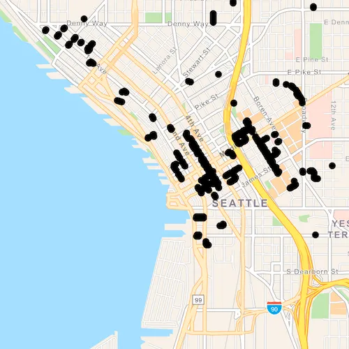
This service shows trees in downtown Seattle and the surrounding area. An XML-encoded GetFeature request is used to limit results to only trees of the genus Tilia.
For additional information, see the underlying service on ArcGIS Online.
Tags
feature, OGC, query, service, web, WFS, XML
Sample code
// [WriteFile Name=LoadWfsXmlQuery, Category=Layers]// [Legal]// Copyright 2019 Esri.//// Licensed under the Apache License, Version 2.0 (the "License");// you may not use this file except in compliance with the License.// You may obtain a copy of the License at// http://www.apache.org/licenses/LICENSE-2.0//// Unless required by applicable law or agreed to in writing, software// distributed under the License is distributed on an "AS IS" BASIS,// WITHOUT WARRANTIES OR CONDITIONS OF ANY KIND, either express or implied.// See the License for the specific language governing permissions and// limitations under the License.// [Legal]
#ifdef PCH_BUILD#include "pch.hpp"#endif // PCH_BUILD
// sample headers#include "LoadWfsXmlQuery.h"
// ArcGIS Maps SDK headers#include "Envelope.h"#include "Error.h"#include "FeatureLayer.h"#include "GeodatabaseTypes.h"#include "LayerListModel.h"#include "Map.h"#include "MapQuickView.h"#include "MapTypes.h"#include "WfsFeatureTable.h"
// Qt headers#include <QFuture>
using namespace Esri::ArcGISRuntime;
namespace{  const QString xmlQueryString = R"(    <wfs:GetFeature service="WFS" version="2.0.0"      xmlns:Seattle_Downtown_Features="https://dservices2.arcgis.com/ZQgQTuoyBrtmoGdP/arcgis/services/Seattle_Downtown_Features/WFSServer"      xmlns:wfs="http://www.opengis.net/wfs/2.0"      xmlns:fes="http://www.opengis.net/fes/2.0"      xmlns:gml="http://www.opengis.net/gml/3.2">      <wfs:Query typeNames="Seattle_Downtown_Features:Trees">        <fes:Filter>        <fes:PropertyIsLike wildCard="*" escapeChar="\">        <fes:ValueReference>Trees:SCIENTIFIC</fes:ValueReference>        <fes:Literal>Tilia *</fes:Literal>        </fes:PropertyIsLike>        </fes:Filter>      </wfs:Query>    </wfs:GetFeature>)";}
LoadWfsXmlQuery::LoadWfsXmlQuery(QObject* parent /* = nullptr */) :  QObject(parent),  m_map(new Map(BasemapStyle::ArcGISNavigation, this)){  // create WFS Feature Table  const QUrl featureTableUrl(    "https://dservices2.arcgis.com/ZQgQTuoyBrtmoGdP/arcgis/services/Seattle_Downtown_Features/WFSServer?service=wfs&request=getcapabilities");  WfsFeatureTable* wfsFeatureTable = new WfsFeatureTable(featureTableUrl, "Seattle_Downtown_Features:Trees", this);  wfsFeatureTable->setFeatureRequestMode(FeatureRequestMode::ManualCache);
  // connect to feature table doneLoading signal  connect(wfsFeatureTable, &WfsFeatureTable::doneLoading, this, [wfsFeatureTable, this](const Error& e)  {    if (!e.isEmpty())    {      return;    }
    // populate the table with XML Query    auto future = wfsFeatureTable->populateFromServiceAsync(xmlQueryString, true);    Q_UNUSED(future)
    // set the viewpoint to the center of the extent    m_mapView->setViewpointGeometryAsync(wfsFeatureTable->extent(), 50);  });
  // create Feature Layer  FeatureLayer* featureLayer = new FeatureLayer(wfsFeatureTable, this);
  // add layer to the map  m_map->operationalLayers()->append(featureLayer);}
LoadWfsXmlQuery::~LoadWfsXmlQuery() = default;
void LoadWfsXmlQuery::init(){  // Register the map view for QML  qmlRegisterType<MapQuickView>("Esri.Samples", 1, 0, "MapView");  qmlRegisterType<LoadWfsXmlQuery>("Esri.Samples", 1, 0, "LoadWfsXmlQuerySample");}
MapQuickView* LoadWfsXmlQuery::mapView() const{  return m_mapView;}
// Set the view (created in QML)void LoadWfsXmlQuery::setMapView(MapQuickView* mapView){  if (!mapView || mapView == m_mapView)  {    return;  }
  m_mapView = mapView;  m_mapView->setMap(m_map);
  emit mapViewChanged();}
// [WriteFile Name=LoadWfsXmlQuery, Category=Layers]// [Legal]// Copyright 2019 Esri.//// Licensed under the Apache License, Version 2.0 (the "License");// you may not use this file except in compliance with the License.// You may obtain a copy of the License at// http://www.apache.org/licenses/LICENSE-2.0//// Unless required by applicable law or agreed to in writing, software// distributed under the License is distributed on an "AS IS" BASIS,// WITHOUT WARRANTIES OR CONDITIONS OF ANY KIND, either express or implied.// See the License for the specific language governing permissions and// limitations under the License.// [Legal]
#ifndef LOADWFSXMLQUERY_H#define LOADWFSXMLQUERY_H
// Qt headers#include <QObject>
namespace Esri::ArcGISRuntime{ class Map; class MapQuickView;} // namespace Esri::ArcGISRuntime
Q_MOC_INCLUDE("MapQuickView.h")
class LoadWfsXmlQuery : public QObject{ Q_OBJECT
Q_PROPERTY(Esri::ArcGISRuntime::MapQuickView* mapView READ mapView WRITE setMapView NOTIFY mapViewChanged)
public: explicit LoadWfsXmlQuery(QObject* parent = nullptr); ~LoadWfsXmlQuery();
static void init();
signals: void mapViewChanged();
private: Esri::ArcGISRuntime::MapQuickView* mapView() const; void setMapView(Esri::ArcGISRuntime::MapQuickView* mapView);
Esri::ArcGISRuntime::Map* m_map = nullptr; Esri::ArcGISRuntime::MapQuickView* m_mapView = nullptr;};
#endif // LOADWFSXMLQUERY_H// [WriteFile Name=LoadWfsXmlQuery, Category=Layers]// [Legal]// Copyright 2019 Esri.//// Licensed under the Apache License, Version 2.0 (the "License");// you may not use this file except in compliance with the License.// You may obtain a copy of the License at// http://www.apache.org/licenses/LICENSE-2.0//// Unless required by applicable law or agreed to in writing, software// distributed under the License is distributed on an "AS IS" BASIS,// WITHOUT WARRANTIES OR CONDITIONS OF ANY KIND, either express or implied.// See the License for the specific language governing permissions and// limitations under the License.// [Legal]
import QtQuickimport QtQuick.Controlsimport Esri.Samples
Item {
// add a mapView component MapView { id: view anchors.fill: parent
Component.onCompleted: { // Set the focus on MapView to initially enable keyboard navigation forceActiveFocus(); } }
// Declare the C++ instance which creates the map etc. and supply the view LoadWfsXmlQuerySample { id: model mapView: view }}