Find features in a feature table which match an SQL query.
Use case
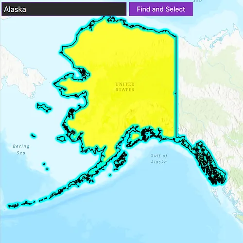
Query expressions can be used in ArcGIS to select a subset of features from a feature table. This is most useful in large or complicated data sets. A possible use case might be on a feature table marking the location of street furniture through a city. A user may wish to query by a TYPE column to return “benches”. In this sample, we query a U.S. state by STATE_NAME from a feature table containing all U.S. states.
How to use the sample
Input the name of a U.S. state into the text field. When you click “search”, a query is performed and the matching features are highlighted or an error is returned.
How it works
- Create a
ServiceFeatureTableusing the URL of a feature service. - Create a
QueryParameterswith a where clause specified usingsetWhereClause(). - Perform the query using
queryFeaturesAsync(query)on the service feature table. - When complete, the query will return a
FeatureQueryResultwhich can be iterated over to get the matching features.
About the data
This sample uses U.S. State polygon features from the USA 2016 Daytime Population feature service.
Relevant API
- FeatureLayer
- FeatureQueryResult
- QueryParameters
- ServiceFeatureTable
Tags
Search and Query
Sample code
// [WriteFile Name=FeatureLayerQuery, Category=Features]// [Legal]// Copyright 2016 Esri.//// Licensed under the Apache License, Version 2.0 (the "License");// you may not use this file except in compliance with the License.// You may obtain a copy of the License at// http://www.apache.org/licenses/LICENSE-2.0//// Unless required by applicable law or agreed to in writing, software// distributed under the License is distributed on an "AS IS" BASIS,// WITHOUT WARRANTIES OR CONDITIONS OF ANY KIND, either express or implied.// See the License for the specific language governing permissions and// limitations under the License.// [Legal]
#ifdef PCH_BUILD#include "pch.hpp"#endif // PCH_BUILD
// sample headers#include "FeatureLayerQuery.h"
// ArcGIS Maps SDK headers#include "Basemap.h"#include "Feature.h"#include "FeatureIterator.h"#include "FeatureLayer.h"#include "FeatureQueryResult.h"#include "LayerListModel.h"#include "Map.h"#include "MapQuickView.h"#include "MapTypes.h"#include "MapViewTypes.h"#include "Point.h"#include "QueryParameters.h"#include "ServiceFeatureTable.h"#include "SimpleFillSymbol.h"#include "SimpleLineSymbol.h"#include "SimpleRenderer.h"#include "SpatialReference.h"#include "SymbolTypes.h"#include "Viewpoint.h"
// Qt headers#include <QColor>#include <QFuture>#include <QList>#include <QUrl>#include <QUuid>
// STL headers#include <memory>
using namespace Esri::ArcGISRuntime;
FeatureLayerQuery::FeatureLayerQuery(QQuickItem* parent) :  QQuickItem(parent){}
FeatureLayerQuery::~FeatureLayerQuery() = default;
void FeatureLayerQuery::init(){  qmlRegisterType<MapQuickView>("Esri.Samples", 1, 0, "MapView");  qmlRegisterType<FeatureLayerQuery>("Esri.Samples", 1, 0, "FeatureLayerQuerySample");}
void FeatureLayerQuery::componentComplete(){  QQuickItem::componentComplete();
  // find QML MapView component  m_mapView = findChild<MapQuickView*>("mapView");  m_mapView->setWrapAroundMode(WrapAroundMode::Disabled);
  // Create a map using the topographic basemap  m_map = new Map(BasemapStyle::ArcGISTopographic, this);  m_map->setInitialViewpoint(Viewpoint(Point(-11e6, 5e6, SpatialReference(102100)), 9e7));
  // Set map to map view  m_mapView->setMap(m_map);
  // create the feature table  m_featureTable = new ServiceFeatureTable(    QUrl("https://services.arcgis.com/jIL9msH9OI208GCb/arcgis/rest/services/USA_Daytime_Population_2016/FeatureServer/0"), this);  // create the feature layer using the feature table  m_featureLayer = new FeatureLayer(m_featureTable, this);
  // line symbol for the outline  SimpleLineSymbol* outline = new SimpleLineSymbol(SimpleLineSymbolStyle::Solid, QColor("black"), 2.0f, this);  // fill symbol  SimpleFillSymbol* sfs = new SimpleFillSymbol(SimpleFillSymbolStyle::Solid, QColor(255, 255, 0, 153), outline, this);  // create the renderer using the symbology created above  SimpleRenderer* renderer = new SimpleRenderer(sfs, this);  // set the renderer for the feature layer  m_featureLayer->setRenderer(renderer);  m_featureLayer->setMaxScale(10000);
  // add the feature layer to the map  m_map->operationalLayers()->append(m_featureLayer);
  connect(m_featureTable, &ServiceFeatureTable::loadStatusChanged, this, [this](LoadStatus loadStatus)  {    loadStatus == LoadStatus::Loaded ? m_initialized = true : m_initialized = false;    emit layerInitializedChanged();  });}
bool FeatureLayerQuery::layerInitialized() const{  return m_initialized;}
void FeatureLayerQuery::runQuery(const QString& stateName){  // create a query parameter object and set the where clause  QueryParameters queryParams;  queryParams.setWhereClause(QString("STATE_NAME LIKE '" + formatStateNameForQuery(stateName) + "%'"));  m_featureTable->queryFeaturesAsync(queryParams)    .then(this, [this](FeatureQueryResult* rawQueryResult)  {    auto queryResult = std::unique_ptr<FeatureQueryResult>(rawQueryResult);
    if (queryResult && !queryResult->iterator().hasNext())    {      m_queryResultsCount = 0;      emit queryResultsCountChanged();      return;    }
    // clear any existing selection    m_featureLayer->clearSelection();    QList<Feature*> features;
    // iterate over the result object    while (queryResult->iterator().hasNext())    {      Feature* feature = queryResult->iterator().next(this);      // add each feature to the list      features.append(feature);    }
    // select the feature    m_featureLayer->selectFeatures(features);    // zoom to the first feature    m_mapView->setViewpointGeometryAsync(features.at(0)->geometry(), 30);    // set the count for QML property    m_queryResultsCount = static_cast<int>(features.count());    emit queryResultsCountChanged();  });}
QString FeatureLayerQuery::formatStateNameForQuery(const QString& stateName) const{  // format state names as expected by the service, for instance "Rhode Island"  if (stateName.isEmpty())  {    return QString();  }
  const QStringList words = stateName.split(" ", Qt::SkipEmptyParts);  QStringList formattedWords;
  for (const QString& word : words)  {    QString formattedWord = word.toLower();    formattedWord[0] = formattedWord[0].toUpper();    formattedWords.append(formattedWord);  }
  return QString(formattedWords.join(" "));}
int FeatureLayerQuery::queryResultsCount() const{  return m_queryResultsCount;}
// [WriteFile Name=FeatureLayerQuery, Category=Features]// [Legal]// Copyright 2016 Esri.//// Licensed under the Apache License, Version 2.0 (the "License");// you may not use this file except in compliance with the License.// You may obtain a copy of the License at// http://www.apache.org/licenses/LICENSE-2.0//// Unless required by applicable law or agreed to in writing, software// distributed under the License is distributed on an "AS IS" BASIS,// WITHOUT WARRANTIES OR CONDITIONS OF ANY KIND, either express or implied.// See the License for the specific language governing permissions and// limitations under the License.// [Legal]
#ifndef FEATURE_LAYER_QUERY_H#define FEATURE_LAYER_QUERY_H
// Qt headers#include <QQuickItem>
namespace Esri::ArcGISRuntime{ class Map; class MapQuickView; class FeatureLayer; class ServiceFeatureTable;} // namespace Esri::ArcGISRuntime
class FeatureLayerQuery : public QQuickItem{ Q_OBJECT
Q_PROPERTY(bool layerInitialized READ layerInitialized NOTIFY layerInitializedChanged) Q_PROPERTY(int queryResultsCount READ queryResultsCount NOTIFY queryResultsCountChanged)
public: explicit FeatureLayerQuery(QQuickItem* parent = nullptr); ~FeatureLayerQuery() override;
void componentComplete() override; static void init(); Q_INVOKABLE void runQuery(const QString& stateName);
signals: void layerInitializedChanged(); void queryResultsCountChanged();
private: bool layerInitialized() const; int queryResultsCount() const;
private: QString formatStateNameForQuery(const QString& stateName) const;
Esri::ArcGISRuntime::Map* m_map = nullptr; Esri::ArcGISRuntime::MapQuickView* m_mapView = nullptr; Esri::ArcGISRuntime::FeatureLayer* m_featureLayer = nullptr; Esri::ArcGISRuntime::ServiceFeatureTable* m_featureTable = nullptr; bool m_initialized = false; int m_queryResultsCount = 0;};
#endif // FEATURE_LAYER_QUERY_H// [WriteFile Name=FeatureLayerQuery, Category=Features]// [Legal]// Copyright 2016 Esri.//// Licensed under the Apache License, Version 2.0 (the "License");// you may not use this file except in compliance with the License.// You may obtain a copy of the License at// http://www.apache.org/licenses/LICENSE-2.0//// Unless required by applicable law or agreed to in writing, software// distributed under the License is distributed on an "AS IS" BASIS,// WITHOUT WARRANTIES OR CONDITIONS OF ANY KIND, either express or implied.// See the License for the specific language governing permissions and// limitations under the License.// [Legal]
import QtQuickimport QtQuick.Controlsimport Esri.Samples
FeatureLayerQuerySample { id: featureLayerQuerySample width: 800 height: 600
// add a mapView component MapView { id: mapView anchors.fill: parent objectName: "mapView"
Component.onCompleted: { // Set the focus on MapView to initially enable keyboard navigation forceActiveFocus(); } }
Row { id: findRow
anchors { top: parent.top bottom: mapView.top left: parent.left right: parent.right margins: 5 } spacing: 5
TextField { id: findText color: palette.text
width: parent.width * 0.25 placeholderText: qsTr("Enter a state name to select") inputMethodHints: Qt.ImhNoPredictiveText selectByMouse: true validator: RegularExpressionValidator{ regularExpression: /^[a-zA-Z ]*$/ } Keys.onReturnPressed: { // Call C++ invokable function to run the query featureLayerQuerySample.runQuery(findText.text); } }
Button { text: qsTr("Find and Select") enabled: featureLayerQuerySample.layerInitialized onClicked: { // Call C++ invokable function to run the query featureLayerQuerySample.runQuery(findText.text); } } }
Dialog { id: errorMsgDialog modal: true x: Math.round(parent.width - width) / 2 y: Math.round(parent.height - height) / 2 standardButtons: Dialog.Ok property alias text : textLabel.text Label { id: textLabel text: qsTr("No state named " + findText.text.toUpperCase() + " exists.") } }
onQueryResultsCountChanged: { // Use the C++ property to determine if no features were returned if (featureLayerQuerySample.queryResultsCount === 0) errorMsgDialog.visible = true; }}