Maps
See Scenes (3D) in this guide for more information about working with scenes.
You can use a map to:
- Display a basemap layer
A basemap layer is the layer in a map or scene that displays basemap data. The data source for a basemap layer is typically a basemap service. such as streets or satellite imagery. - Access and display data layers
A data layer is a layer that references geographic data from a file or a service and is used to visualize the data in a map or scene. based on files or services, including data you have authored. - Provide context for temporary points, lines, polygons, or text displayed as graphics
A graphic is a visual element composed of a geometry, symbol, and attributes that is displayed on a map or scene. . - Inspect data layers and display information from attributes
Attributes are fields and values for a single feature or non-spatial record. They are typically stored in a database or service such as a feature service. . - Measure distance and explore spatial relationships between geometries
A geometry is a geometric shape, such as a point, polyline, or polygon, that contains one or more coordinates and a spatial reference. . - Save a collection of layers as a web map
A web map is a map stored as a JSON object that defines properties such as the basemap layer, data layers, layer styles, and pop-up styles. Its JSON structure is defined by the web map specification. to be shared across ArcGIS.
How a map works
A map
For offline
Map
A map contains a collection of layers
You can open an existing map or create one entirely with code. To create a map, you typically first add a basemap layer
    // Set the ArcGIS runtime environment Api Key to your access token.    ArcGISRuntimeEnvironment::setApiKey("YOUR_ACCESS_TOKEN");
    // Set the base map for for the map to be the basemap style of ArcGISNavigation.    Map* map = new Map(BasemapStyle::ArcGISNavigation, this);
You can also open a map stored in a portal
    // Define the Url for the ArcGIS portal item.    const QUrl portal_url("https://www.arcgis.com/home/item.html?id=41281c51f9de45edaf1c8ed44bb10e30");
    // Create a new map from the portal Url.    m_map = new Map(portal_url, this);
Layer
Each layer
The Layer class is the base class for all types of layers. The type of layer you create depends on the type of data you want to display. For example, to display feature data you can create a FeatureLayer that references an online service (such as a feature service
void Layers::loadMapLayers(){    // Set the access token.    const QString accessToken = QStringLiteral("YOUR_ACCESS_TOKEN");
    // Set the ArcGIS runtime environment Api Key with your access token.    ArcGISRuntimeEnvironment::setApiKey(accessToken);
    // Create a new "trail heads" feature layer based on a service feature table (using the Url provided).    FeatureLayer* trailheadsLayer = new FeatureLayer(        new ServiceFeatureTable(QUrl("https://services3.arcgis.com/GVgbJbqm8hXASVYi/arcgis/rest/services/Trailheads_Styled/FeatureServer/0"), this),        this        );
    // Create a new "trails" feature layer based on a service feature table (using the Url provided).    FeatureLayer* trailsLayer = new FeatureLayer(        new ServiceFeatureTable(QUrl("https://services3.arcgis.com/GVgbJbqm8hXASVYi/arcgis/rest/services/Trails_Styled/FeatureServer/0"), this),        this        );
    // Create a new "open spaces" feature layer based on a service feature table (using the Url provided).    FeatureLayer* openSpacesLayer = new FeatureLayer(        new ServiceFeatureTable(QUrl("https://services3.arcgis.com/GVgbJbqm8hXASVYi/arcgis/rest/services/Parks_and_Open_Space_Styled/FeatureServer/0"), this),        this        );
    // Add the three feature layers to the map's operating layers list model collection.    m_map->operationalLayers()->append(trailheadsLayer);    m_map->operationalLayers()->append(trailsLayer);    m_map->operationalLayers()->append(openSpacesLayer);}
MapView
A map view
A map view
- Access data for data layers and graphics.
- Display the current location as a point on the map.
- Identify and select features at a specified location.
- Export an image of the current display.
- Rotate the map display.
- Apply a time extent to filter the display of features.
- Filter layer data using attribute and spatial criteria.
- Display image overlays on the map view.
Display a mapMapView control. Changes you make to the map, such as adding, removing, or reordering layers, will immediately be reflected in the map view display. The Map::initialViewpoint() property will determine the area of the map shown when the map loads. You can also use MapView::setViewpointAsync() and MapView::setViewpointRotation() to programmatically change the map area or orientation shown in the display.
// Create a new map view with a map
MapQuickView* mapView = new MapQuickView(map);
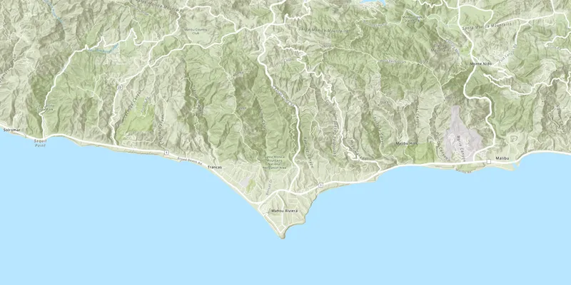
// Define a point using lat/long values and a spatial reference. const Point center(-118.805, 34.027, SpatialReference::wgs84());
// Asynchronously animate the map to the viewpoint. mapView->setViewpointAsync(center, 11);Examples
Create and display a map
You can display a basic map by creating one with a basemap layer, setting its initial extent, and adding it to a map view. To learn how to add additional data, see the Layers topic.
Steps
-
Create a new
Map, passing aBasemapStyleinto the constructor.This code is created by Qt Creator when you create the project and select the Qt Quick C++ app template. You select the basemap style in the dropdown menu.
// Template code generated for the Maps2d app.Maps2d::Maps2d(QObject* parent /* = nullptr */):QObject(parent),m_map(new Map(BasemapStyle::ArcGISTopographic, this)) -
Optionally, add one or more data layers to the map.
-
Assign the map to a
MapViewto render the map. -
Set the map view
Viewpointto focus on a specified area of the map.// Set the map functionvoid Maps2d::setupMap(){// Define a point on the map using lat/long coordinates and a spatial reference.const Point center(-118.805, 34.027, SpatialReference::wgs84());// Define a view point using the point and a scale.const Viewpoint viewpoint(center, 72223.819286);// Asynchronously animate the map to the viewpoint.m_mapView->setViewpointAsync(viewpoint);}// Set the view function (created in QML).void Maps2d::setMapView(MapQuickView* mapView){// Test if the map view has not been previously setif (!mapView || mapView == m_mapView)return;// Set the member variable for the map view to the local scope map view.m_mapView = mapView;// Set the map on the map view.m_mapView->setMap(m_map);// Call the setupMap function.setupMap();// Emit the mapViewChanged signal.emit mapViewChanged();}
You can also create and save a web map
Display a web map
You can open a web map
Steps
-
Create a
QStringand set it to the item IDAn item ID is a unique identifier representing a single item stored, managed, and accessed in a portal, such as a web map, hosted layer, or file. for the item that stores the web map. -
Create a
QUrlthat appends the item ID to the ArcGIS Online base URL. -
Create a new map, passing the
QUrlto the constructor. -
Set the map to a
MapViewto render the map.// Define the Url for the ArcGIS portal item.const QUrl portal_url("https://www.arcgis.com/home/item.html?id=41281c51f9de45edaf1c8ed44bb10e30");// Create a new map from the portal Url.m_map = new Map(portal_url, this);// Set the map on the map view.m_mapView->setMap(m_map);
Display a mobile map
This example displays a map
Steps
- Create a
MobileMapPackageusing the path to a local .mmpk file. - Use
connectto signal when the package is done loading. - Load the mobile map package.
- After the package loads, get the first map from the package using the
MobileMapPackage::maps()property. - Display the map in a
MapView.
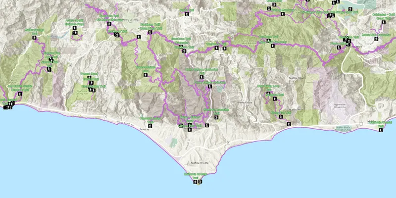
    // Create a new mobile map package from the path provided.    MobileMapPackage* m_mobileMapPackage = new MobileMapPackage(QDir::homePath() +        "/ArcGIS/Runtime/Data/mmpk/MahouRivieraTrails.mmpk", this);
    // Get the first map (i.e. 0) in the mobile map package and set that as the map in the map view.    connect(m_mobileMapPackage, &MobileMapPackage::doneLoading, this, [this, m_mobileMapPackage](Error)        {            m_mapView->setMap(m_mobileMapPackage->maps().at(0));        });
    // Load the mobile map package, which call the doneLoading event.    m_mobileMapPackage->load();
Use API key access tokens
An API key access tokenApiKeyResource.
Tutorials
Samples
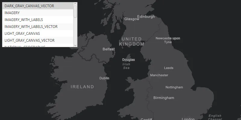
Change basemap
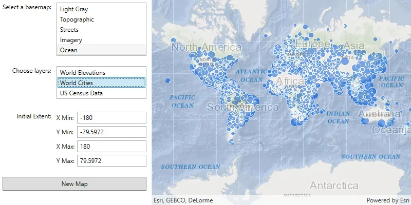
Create and save a map
Open mobile map package

Create geometries

Display device location with autopan modes
