Maps
Each layer
Basemap layers
A basemap is the foundational layer and data that provides the overall visual and geographic context for a map
A basemap is composed of a collection of base layers and reference layers
The basemap styles service
// Provide an access token for your app (usually when the app starts).//Esri.ArcGISRuntime.ArcGISRuntimeEnvironment.ApiKey = "YOUR_ACCESS_TOKEN";
var map = new Map(BasemapStyle.ArcGISNavigation);// Use any of the available BasemapStyle values ...//    var map = new Map(BasemapStyle.ArcGISTopographic);//    var map = new Map(BasemapStyle.ArcGISLightGray);//    var map = new Map(BasemapStyle.OpenLightGray);// ... several others.
// If preferred, you can provide a key directly for the basemap.//map.Basemap.ApiKey = "YOUR_ACCESS_TOKEN";// Provide an access token for your app (usually when the app starts).//Esri.ArcGISRuntime.ArcGISRuntimeEnvironment.ApiKey = "YOUR_ACCESS_TOKEN";
var map = new Map(BasemapStyle.ArcGISImagery);// Use any of the available BasemapStyle values ...// var map = new Map(BasemapStyle.ArcGISHillshadeLight);// var map = new Map(BasemapStyle.ArcGISHillshadeDark);// ... several others.
// If preferred, you can provide a key directly for the basemap.//map.Basemap.ApiKey = "YOUR_ACCESS_TOKEN";Data layers
A data layer
A data layer
The data for a data layer
A data layer can also be created from a dataset stored on the device
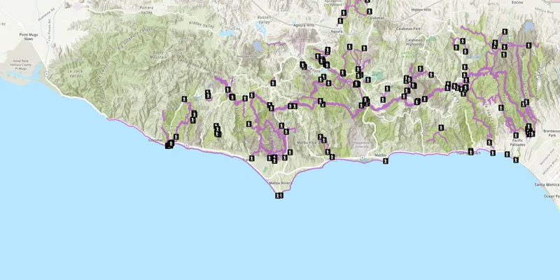
To add a data layer
// Provide an access token for your app (usually when the app starts).//Esri.ArcGISRuntime.ArcGISRuntimeEnvironment.ApiKey = "YOUR_ACCESS_TOKEN";
var map = new Map(BasemapStyle.ArcGISTopographic);
// Create tables for feature data hosted in ArcGIS Online.var trailheadsTable = new ServiceFeatureTable(new Uri("https://services3.arcgis.com/GVgbJbqm8hXASVYi/arcgis/rest/services/Trailheads_Styled/FeatureServer/0"));var trailsTable = new ServiceFeatureTable(new Uri("https://services3.arcgis.com/GVgbJbqm8hXASVYi/arcgis/rest/services/Trails_Styled/FeatureServer/0"));var openSpacesTable = new ServiceFeatureTable(new Uri("https://services3.arcgis.com/GVgbJbqm8hXASVYi/arcgis/rest/services/Parks_and_Open_Space_Styled/FeatureServer/0"));
// Create feature layers to show the tables, add them to the map's collection of data layers.map.OperationalLayers.Add(new FeatureLayer(trailheadsTable));map.OperationalLayers.Add(new FeatureLayer(trailsTable));map.OperationalLayers.Add(new FeatureLayer(openSpacesTable));
MainView.Map = map;
Use API keys
Tutorials

Samples

Feature layer (feature service)
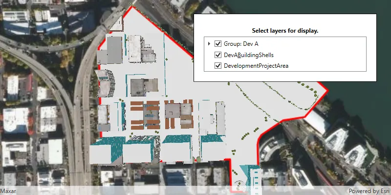
Group layers
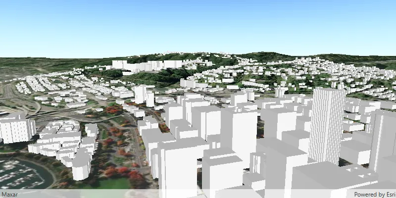
Add scene layer with elevation

Manage operational layers
