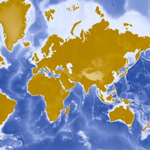
Display a layer from an ArcGIS map image layer service.
Use case
Map image layers are also referred to as dynamic map services. These services generate images dynamically on the server and send the resulting image to the requesting client. This is useful when rendering complex cartography or large amounts of data in a connected environment, as the client simply displays the image that the server returns. This can result in more accurate and faster-performing layers.
How to use the sample
Run the sample and view the map image layer. As you navigate the map, the layer issues image requests for the new map extent. The resulting images are rendered on the screen.
How it works
- Create an instance of
ArcGISMap. - Create an
ArcGISMapImageLayerwith the URL to a map image service. - Create a
Basemapwith the map image layer. - Add the basemap to the
Map.
Relevant API
- ArcGISMapImageLayer
Tags
display, image, layer, map
Sample code
// [WriteFile Name=ArcGISMapImageLayerUrl, Category=Layers]// [Legal]// Copyright 2016 Esri.//// Licensed under the Apache License, Version 2.0 (the "License");// you may not use this file except in compliance with the License.// You may obtain a copy of the License at// http://www.apache.org/licenses/LICENSE-2.0//// Unless required by applicable law or agreed to in writing, software// distributed under the License is distributed on an "AS IS" BASIS,// WITHOUT WARRANTIES OR CONDITIONS OF ANY KIND, either express or implied.// See the License for the specific language governing permissions and// limitations under the License.// [Legal]
#ifdef PCH_BUILD#include "pch.hpp"#endif // PCH_BUILD
// sample headers#include "ArcGISMapImageLayerUrl.h"
// ArcGIS Maps SDK headers#include "ArcGISMapImageLayer.h"#include "Basemap.h"#include "Map.h"#include "MapQuickView.h"
// Qt headers#include <QUrl>
using namespace Esri::ArcGISRuntime;
ArcGISMapImageLayerUrl::ArcGISMapImageLayerUrl(QQuickItem* parent) :  QQuickItem(parent){}
ArcGISMapImageLayerUrl::~ArcGISMapImageLayerUrl() = default;
void ArcGISMapImageLayerUrl::init(){  qmlRegisterType<MapQuickView>("Esri.Samples", 1, 0, "MapView");  qmlRegisterType<ArcGISMapImageLayerUrl>("Esri.Samples", 1, 0, "ArcGISMapImageLayerUrlSample");}
void ArcGISMapImageLayerUrl::componentComplete(){  QQuickItem::componentComplete();
  // find QML MapView component  m_mapView = findChild<MapQuickView*>("mapView");
  // create a new map image layer  ArcGISMapImageLayer* mapImageLayer = new ArcGISMapImageLayer(QUrl("https://sampleserver5.arcgisonline.com/arcgis/rest/services/Elevation/WorldElevations/MapServer"), this);
  // create a new basemap from the layer  Basemap* basemap = new Basemap(mapImageLayer, this);
  // create a new map instance  m_map = new Map(basemap, this);
  // set map on the map view  m_mapView->setMap(m_map);}
// [WriteFile Name=ArcGISMapImageLayerUrl, Category=Layers]// [Legal]// Copyright 2016 Esri.//// Licensed under the Apache License, Version 2.0 (the "License");// you may not use this file except in compliance with the License.// You may obtain a copy of the License at// http://www.apache.org/licenses/LICENSE-2.0//// Unless required by applicable law or agreed to in writing, software// distributed under the License is distributed on an "AS IS" BASIS,// WITHOUT WARRANTIES OR CONDITIONS OF ANY KIND, either express or implied.// See the License for the specific language governing permissions and// limitations under the License.// [Legal]
#ifndef ARCGIS_MAP_IMAGE_LAYER_URL_H#define ARCGIS_MAP_IMAGE_LAYER_URL_H
// Qt headers#include <QQuickItem>
namespace Esri::ArcGISRuntime{ class Map; class MapQuickView;}
class ArcGISMapImageLayerUrl : public QQuickItem{ Q_OBJECT
public: explicit ArcGISMapImageLayerUrl(QQuickItem* parent = nullptr); ~ArcGISMapImageLayerUrl() override;
void componentComplete() override; static void init();
private: Esri::ArcGISRuntime::Map* m_map = nullptr; Esri::ArcGISRuntime::MapQuickView* m_mapView = nullptr;};
#endif // ARCGIS_MAP_IMAGE_LAYER_URL_H// [WriteFile Name=ArcGISMapImageLayerUrl, Category=Layers]// [Legal]// Copyright 2016 Esri.//// Licensed under the Apache License, Version 2.0 (the "License");// you may not use this file except in compliance with the License.// You may obtain a copy of the License at// http://www.apache.org/licenses/LICENSE-2.0//// Unless required by applicable law or agreed to in writing, software// distributed under the License is distributed on an "AS IS" BASIS,// WITHOUT WARRANTIES OR CONDITIONS OF ANY KIND, either express or implied.// See the License for the specific language governing permissions and// limitations under the License.// [Legal]
import QtQuickimport QtQuick.Controlsimport Esri.Samples
ArcGISMapImageLayerUrlSample { width: 800 height: 600
// add a mapView component MapView { anchors.fill: parent objectName: "mapView"
Component.onCompleted: { // Set the focus on MapView to initially enable keyboard navigation forceActiveFocus(); } }}