Load an offline copy of a tiled map service as a basemap.
Use case
Constructing an ArcGISTiledLayer from a local tile package (.tpk & .tpkx) allows you to use that basemap tiled service when the application is offline. Dividing a raster into tiles allows the map to provide relevant tiles and level of detail to the user when panning and zooming. For example, when working in an environment that has no connectivity, this could provide access to a map for navigating your surroundings.
How to use the sample
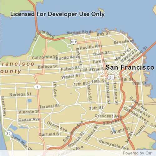
Launch the app to view the “San Francisco offline tile package” as the basemap.
How it works
- Create a
TileCache, specifying the path to the local tile package. - Create an
ArcGISTiledLayerwith the tile cache. - Create a
Basemapwith the tiled layer. - Create a
Mapwith the basemap and set it to a MapView.
Relevant API
- ArcGISTiledLayer
- Basemap
- Map
- TileCache
Offline Data
Read more about how to set up the sample’s offline data here.
| Link | Local Location |
|---|---|
| San Francisco Streets TPKX | <userhome>/ArcGIS/Runtime/Data/tpkx/SanFrancisco.tpkx |
About the data
The map opens to a view of the city of San Francisco, CA. In a disconnected environment, this basemap tile service would be fully accessible to zoom and pan as if you were connected to a online service.
Additional information
ArcGISTiledLayer and TileCache supports both .tpk and .tpkx file formats.
Tags
cache, layers, offline, tile
Sample code
// [WriteFile Name=TileCacheLayer, Category=Layers]// [Legal]// Copyright 2020 Esri.//// Licensed under the Apache License, Version 2.0 (the "License");// you may not use this file except in compliance with the License.// You may obtain a copy of the License at// http://www.apache.org/licenses/LICENSE-2.0//// Unless required by applicable law or agreed to in writing, software// distributed under the License is distributed on an "AS IS" BASIS,// WITHOUT WARRANTIES OR CONDITIONS OF ANY KIND, either express or implied.// See the License for the specific language governing permissions and// limitations under the License.// [Legal]
#ifdef PCH_BUILD#include "pch.hpp"#endif // PCH_BUILD
// sample headers#include "TileCacheLayer.h"
// ArcGIS Maps SDK headers#include "ArcGISTiledLayer.h"#include "Basemap.h"#include "Map.h"#include "MapQuickView.h"#include "TileCache.h"
// Qt headers#include <QStandardPaths>
using namespace Esri::ArcGISRuntime;
// helper method to get cross platform data pathnamespace{  QString defaultDataPath()  {    QString dataPath;
  #ifdef Q_OS_IOS    dataPath = QStandardPaths::writableLocation(QStandardPaths::DocumentsLocation);  #else    dataPath = QStandardPaths::writableLocation(QStandardPaths::HomeLocation);  #endif
    return dataPath;  }} // namespace
TileCacheLayer::TileCacheLayer(QObject* parent /* = nullptr */):  QObject(parent){  const QString fileLocation = QString("%1/ArcGIS/Runtime/Data/tpkx/SanFrancisco.tpkx").arg(defaultDataPath());  TileCache* tileCache = new TileCache(fileLocation, this);  ArcGISTiledLayer* tiledLayer = new ArcGISTiledLayer(tileCache, this);  Basemap* basemap = new Basemap(tiledLayer, this);  m_map = new Map(basemap, this);  m_map->setMinScale(110000);}
TileCacheLayer::~TileCacheLayer() = default;
void TileCacheLayer::init(){  // Register the map view for QML  qmlRegisterType<MapQuickView>("Esri.Samples", 1, 0, "MapView");  qmlRegisterType<TileCacheLayer>("Esri.Samples", 1, 0, "TileCacheLayerSample");}
MapQuickView* TileCacheLayer::mapView() const{  return m_mapView;}
// Set the view (created in QML)void TileCacheLayer::setMapView(MapQuickView* mapView){  if (!mapView || mapView == m_mapView)    return;
  m_mapView = mapView;  m_mapView->setMap(m_map);
  emit mapViewChanged();}
// [WriteFile Name=TileCacheLayer, Category=Layers]// [Legal]// Copyright 2020 Esri.//// Licensed under the Apache License, Version 2.0 (the "License");// you may not use this file except in compliance with the License.// You may obtain a copy of the License at// http://www.apache.org/licenses/LICENSE-2.0//// Unless required by applicable law or agreed to in writing, software// distributed under the License is distributed on an "AS IS" BASIS,// WITHOUT WARRANTIES OR CONDITIONS OF ANY KIND, either express or implied.// See the License for the specific language governing permissions and// limitations under the License.// [Legal]
#ifndef TILECACHELAYER_H#define TILECACHELAYER_H
// Qt headers#include <QObject>
namespace Esri::ArcGISRuntime{class Map;class MapQuickView;}
Q_MOC_INCLUDE("MapQuickView.h")
class TileCacheLayer : public QObject{ Q_OBJECT
Q_PROPERTY(Esri::ArcGISRuntime::MapQuickView* mapView READ mapView WRITE setMapView NOTIFY mapViewChanged)
public: explicit TileCacheLayer(QObject* parent = nullptr); ~TileCacheLayer();
static void init();
signals: void mapViewChanged();
private: Esri::ArcGISRuntime::MapQuickView* mapView() const; void setMapView(Esri::ArcGISRuntime::MapQuickView* mapView);
Esri::ArcGISRuntime::Map* m_map = nullptr; Esri::ArcGISRuntime::MapQuickView* m_mapView = nullptr;};
#endif // TILECACHELAYER_H// [WriteFile Name=TileCacheLayer, Category=Layers]// [Legal]// Copyright 2020 Esri.//// Licensed under the Apache License, Version 2.0 (the "License");// you may not use this file except in compliance with the License.// You may obtain a copy of the License at// http://www.apache.org/licenses/LICENSE-2.0//// Unless required by applicable law or agreed to in writing, software// distributed under the License is distributed on an "AS IS" BASIS,// WITHOUT WARRANTIES OR CONDITIONS OF ANY KIND, either express or implied.// See the License for the specific language governing permissions and// limitations under the License.// [Legal]
import QtQuickimport QtQuick.Controlsimport Esri.Samples
Item {
// add a mapView component MapView { id: view anchors.fill: parent
Component.onCompleted: { // Set the focus on MapView to initially enable keyboard navigation forceActiveFocus(); } }
// Declare the C++ instance which creates the map etc. and supply the view TileCacheLayerSample { id: model mapView: view }}