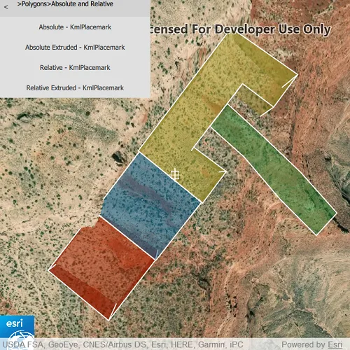
List the contents of a KML file.
Use case
KML files can contain a hierarchy of features, including network links to other KML content. A user may wish to traverse through the contents of KML nodes to know what data is contained within each node and, recursively, their children.
How to use the sample
The contents of the KML file are shown in a list of buttons. Select a node to zoom to that node and see its child nodes, if it has any. Not all nodes can be zoomed to (e.g. screen overlays).
How it works
- Add the KML file to the scene as a layer.
- Explore the root nodes of the
KmlDatasetrecursively to create a view model.
- Each node is enabled for display at this step. KML files may include nodes that are turned off by default.
- When a node is selected, use the node’s
Extentto determine a viewpoint and set theSceneViewobject’s viewpoint to it.
Relevant API
- KmlContainer
- KmlDataset
- KmlDocument
- KmlFolder
- KmlGroundOverlay
- KmlLayer
- KmlNetworkLink
- KmlNode
- KmlPlacemark
- KmlScreenOverlay
Offline data
To set up the sample’s offline data, see the Use offline data in the samples section of the Qt Samples repository overview.
| Link | Local Location |
|---|---|
| ESRI test data | <userhome>/ArcGIS/Runtime/Data/kml/esri_test_data.kmz |
About the data
This is an example KML file meant to demonstrate how the ArcGIS Maps SDK for Native Apps supports several common features.
Tags
Keyhole, KML, KMZ, layers, OGC
Sample code
// [WriteFile Name=ListKmlContents, Category=Layers]// [Legal]// Copyright 2020 Esri.//// Licensed under the Apache License, Version 2.0 (the "License");// you may not use this file except in compliance with the License.// You may obtain a copy of the License at// http://www.apache.org/licenses/LICENSE-2.0//// Unless required by applicable law or agreed to in writing, software// distributed under the License is distributed on an "AS IS" BASIS,// WITHOUT WARRANTIES OR CONDITIONS OF ANY KIND, either express or implied.// See the License for the specific language governing permissions and// limitations under the License.// [Legal]
#ifdef PCH_BUILD#include "pch.hpp"#endif // PCH_BUILD
// sample headers#include "ListKmlContents.h"
// ArcGIS Maps SDK headers#include "ArcGISTiledElevationSource.h"#include "Camera.h"#include "ElevationSourceListModel.h"#include "Envelope.h"#include "Error.h"#include "KmlContainer.h"#include "KmlDataset.h"#include "KmlLayer.h"#include "KmlNetworkLink.h"#include "KmlNode.h"#include "KmlNodeListModel.h"#include "KmlViewpoint.h"#include "LayerListModel.h"#include "MapTypes.h"#include "Point.h"#include "Scene.h"#include "SceneQuickView.h"#include "SpatialReference.h"#include "Surface.h"
// Qt headers#include <QFuture>#include <QStandardPaths>#include <QUuid>
// STL headers#include <algorithm>
using namespace Esri::ArcGISRuntime;
// helper method to get cross platform data pathnamespace{QString defaultDataPath(){  QString dataPath;
#ifdef Q_OS_IOS  dataPath = QStandardPaths::writableLocation(QStandardPaths::DocumentsLocation);#else  dataPath = QStandardPaths::writableLocation(QStandardPaths::HomeLocation);#endif
  return dataPath;}} // namespace
ListKmlContents::ListKmlContents(QObject* parent /* = nullptr */):  QObject(parent),  m_scene(new Scene(BasemapStyle::ArcGISImagery, this)){  // create a new elevation source from Terrain3D REST service  ArcGISTiledElevationSource* elevationSource = new ArcGISTiledElevationSource(        QUrl("https://elevation3d.arcgis.com/arcgis/rest/services/WorldElevation3D/Terrain3D/ImageServer"), this);
  // add the elevation source to the scene to display elevation  m_scene->baseSurface()->elevationSources()->append(elevationSource);
  const QString filepath = defaultDataPath() + "/ArcGIS/Runtime/Data/kml/esri_test_data.kmz";
  // create new KML layer  m_kmlDataset = new KmlDataset(filepath, this);  KmlLayer* kmlLayer = new KmlLayer(m_kmlDataset, this);  m_scene->operationalLayers()->append(kmlLayer);
  connect(m_kmlDataset, &KmlDataset::doneLoading, this, [this](const Error& loadError)  {    if (!loadError.isEmpty())    {      qDebug() << loadError.message() << loadError.additionalMessage();      return;    }
    // recursively build tree to display KML contents    const auto nodes = m_kmlDataset->rootNodes();    for (KmlNode* node : nodes)    {      m_kmlNodesList << node;      buildTree(node);    }
    // if at top node, then display children    if (!m_kmlNodesList.isEmpty() && m_kmlNodesList[0]->parentNode() == nullptr)    {      m_currentNode = m_kmlNodesList[0];      emit currentNodeChanged();      emit levelNodeNamesChanged();    }  });}
QString ListKmlContents::getKmlNodeType(KmlNode *node){  if (node == nullptr)    return "";
  QString type = "";  switch (node->kmlNodeType()) {  case KmlNodeType::KmlDocument:    type = "KmlDocument";    break;  case KmlNodeType::KmlFolder:    type = "KmlFolder";    break;  case KmlNodeType::KmlNetworkLink:    type = "KmlNetworkLink";    break;  case KmlNodeType::KmlPlacemark:    type = "KmlPlacemark";    break;  case KmlNodeType::KmlPhotoOverlay:    type = "KmlPhotoOverlay";    break;  case KmlNodeType::KmlGroundOverlay:    type = "KmlGroundOverlay";    break;  case KmlNodeType::KmlScreenOverlay:    type = "KmlScreenOverlay";    break;  case KmlNodeType::KmlTour:    type = "KmlTour";    break;  default:    return "";  }  return type;}
// recursively build string to indicate node's ancestorsQStringList ListKmlContents::buildPathLabel(KmlNode* node) const{  if (node != nullptr)    return buildPathLabel(node->parentNode()) << node->name();  else    return QStringList {};}
void ListKmlContents::displayPreviousLevel(){  KmlNode* parentNode = m_currentNode->parentNode();  if (parentNode == nullptr)    return;
  KmlNode* grandparentNode = parentNode->parentNode();
  if (grandparentNode != nullptr)  {    m_currentNode = grandparentNode;    emit currentNodeChanged();    emit labelTextChanged();    emit levelNodeNamesChanged();  }  // if grandparent node is nullptr, then at top of tree  else  {    m_currentNode = parentNode;    emit currentNodeChanged();    emit labelTextChanged();    emit levelNodeNamesChanged();  }}
// display selected node on sceneview and show its childrenvoid ListKmlContents::processSelectedNode(const QString& nodeName){  // extract the node's name from the string, formatted "name - nodeType"  QString extractedNodeName = nodeName;  if (nodeName.contains(" - "))  {    int ind = nodeName.lastIndexOf(" - ");    extractedNodeName = nodeName.left(ind);  }
  // find node in the list  for (KmlNode* node : std::as_const(m_kmlNodesList))  {    if (extractedNodeName == node->name())    {      // update current node      m_currentNode = node;      emit currentNodeChanged();      emit labelTextChanged();
      m_viewpoint = Viewpoint();      getViewpointFromKmlViewpoint(node);      if (m_needsAltitudeFixed)      {        getAltitudeAdjustedViewpoint(node);      }      else      {        if (!m_viewpoint.isEmpty() && !m_viewpoint.targetGeometry().isEmpty())          m_sceneView->setViewpointAsync(m_viewpoint);      }
      // reset m_lastLevel before levelNodeNames() is called      emit levelNodeNamesChanged();
      // if displaying end-nodes, change m_currentNode to first end-node for correct behavior of back button      if (noGrandchildren(m_currentNode))      {        m_currentNode = static_cast<KmlContainer*>(m_currentNode)->childNodesListModel()->at(0);        emit currentNodeChanged();      }      break;    }  }}
void ListKmlContents::getViewpointFromKmlViewpoint(KmlNode* node){  const KmlViewpoint kmlViewpoint = node->viewpoint();
  if (!kmlViewpoint.isEmpty())  {    // altitude adjustment is needed for all but Absolute altitude mode    m_needsAltitudeFixed = (kmlViewpoint.altitudeMode() != KmlAltitudeMode::Absolute);
    switch (kmlViewpoint.type())    {    case KmlViewpointType::LookAt:      m_viewpoint = Viewpoint(kmlViewpoint.location(), Camera(kmlViewpoint.location(), kmlViewpoint.range(),                                                              kmlViewpoint.heading(), kmlViewpoint.pitch(), kmlViewpoint.roll()));      return;    case KmlViewpointType::Camera:      m_viewpoint = Viewpoint(kmlViewpoint.location(), Camera(kmlViewpoint.location(),                                                              kmlViewpoint.heading(), kmlViewpoint.pitch(), kmlViewpoint.roll()));      return;    default:      qWarning("Unexpected KmlViewpointType");      return;    }  }
  // if viewpoint was empty, then use node's extent  const Envelope nodeExtent = node->extent();  if (nodeExtent.isValid() && !nodeExtent.isEmpty())  {    // when no altitude is specified, assume elevation needs to be adjusted    m_needsAltitudeFixed = true;
    if (nodeExtent.width() == 0 && nodeExtent.height() == 0)    {      // default values: distance = 1000m, pitch = 45 degrees      m_viewpoint = Viewpoint(nodeExtent);      m_sceneView->setViewpointCameraAndWait(Camera(nodeExtent.center(), 1000, 0, 45, 0));      return;    }    else    {      // add padding to extent      double bufferDistance = qMax(nodeExtent.width(), nodeExtent.height()) / 20;      Envelope bufferedExtent = Envelope(nodeExtent.xMin() - bufferDistance, nodeExtent.yMin() - bufferDistance,                                         nodeExtent.xMax() + bufferDistance, nodeExtent.yMax() + bufferDistance,                                         nodeExtent.zMin() - bufferDistance, nodeExtent.zMax() + bufferDistance,                                         SpatialReference::wgs84());      m_viewpoint = Viewpoint(bufferedExtent);    }  }  else  {    // can't show viewpoint    m_needsAltitudeFixed = false;    m_viewpoint = Viewpoint();  }}
void ListKmlContents::getAltitudeAdjustedViewpoint(KmlNode* node){  // assume altitude mode is clamp-to-ground if not specified  KmlAltitudeMode altMode = KmlAltitudeMode::ClampToGround;  KmlViewpoint kmlViewpoint = node->viewpoint();
  if (!kmlViewpoint.isEmpty())  {    altMode = kmlViewpoint.altitudeMode();  }
  // if altitude mode is Absolute, viewpoint doesn't need adjustment  if (altMode == KmlAltitudeMode::Absolute)  {    m_sceneView->setViewpointAsync(m_viewpoint);    return;  }
  const Envelope lookAtExtent = geometry_cast<Envelope>(m_viewpoint.targetGeometry());  const Point lookAtPoint = geometry_cast<Point>(m_viewpoint.targetGeometry());
  if (lookAtExtent.isValid())  {    m_scene->baseSurface()->elevationAsync(lookAtExtent.center()).then(this, [this](double elevation)    {      onLocationToElevationCompleted_(elevation);    });  }  else if (lookAtPoint.isValid())  {    m_scene->baseSurface()->elevationAsync(lookAtPoint).then(this, [this](double elevation)    {      onLocationToElevationCompleted_(elevation);    });  }}
// recursively build list of all KML nodesvoid ListKmlContents::buildTree(KmlNode* parentNode){  auto addNode = [this](KmlNode* node)  {    // some nodes have default visibility set to false    node->setVisible(true);
    m_kmlNodesList << node;    buildTree(node);  };
  if (KmlContainer* container = dynamic_cast<KmlContainer*>(parentNode))  {    const KmlNodeListModel& childNodes = *container->childNodesListModel();    std::for_each(std::begin(childNodes), std::end(childNodes), addNode);  }  else if (KmlNetworkLink* networkLink = dynamic_cast<KmlNetworkLink*>(parentNode))  {    const QList<KmlNode*> childNodes = networkLink->childNodes();    std::for_each(std::begin(childNodes), std::end(childNodes), addNode);  }}
ListKmlContents::~ListKmlContents() = default;
void ListKmlContents::init(){  // Register classes for QML  qmlRegisterType<SceneQuickView>("Esri.Samples", 1, 0, "SceneView");  qmlRegisterType<ListKmlContents>("Esri.Samples", 1, 0, "ListKmlContentsSample");}
SceneQuickView* ListKmlContents::sceneView() const{  return m_sceneView;}
// Set the view (created in QML)void ListKmlContents::setSceneView(SceneQuickView* sceneView){  if (!sceneView || sceneView == m_sceneView)    return;
  m_sceneView = sceneView;  m_sceneView->setArcGISScene(m_scene);
  emit sceneViewChanged();}
void ListKmlContents::onLocationToElevationCompleted_(double elevation){  // assume altitude mode is clamp-to-ground if not specified  KmlAltitudeMode altMode = KmlAltitudeMode::ClampToGround;  KmlViewpoint kmlViewpoint = m_currentNode->viewpoint();
  if (!kmlViewpoint.isEmpty())  {    altMode = kmlViewpoint.altitudeMode();  }  // if altitude mode is Absolute, viewpoint doesn't need adjustment  if (altMode == KmlAltitudeMode::Absolute)    return;
  const Envelope lookAtExtent = geometry_cast<Envelope>(m_viewpoint.targetGeometry());  const Point lookAtPoint = geometry_cast<Point>(m_viewpoint.targetGeometry());
  if (lookAtExtent.isValid())  {    Envelope  target;    if (altMode == KmlAltitudeMode::ClampToGround)    {      // if depth of extent is 0, add 100m to the elevation to get zMax      if (lookAtExtent.depth() == 0)      {        target = Envelope(lookAtExtent.xMin(), lookAtExtent.yMin(),                          lookAtExtent.xMax(), lookAtExtent.yMax(),                          elevation, elevation + 100,                          lookAtExtent.spatialReference());      }      else      {        target = Envelope(lookAtExtent.xMin(), lookAtExtent.yMin(),                          lookAtExtent.xMax(), lookAtExtent.yMax(),                          // set the camera slightly above the placemark by adding one meter                          elevation, lookAtExtent.depth() + elevation + 1,                          lookAtExtent.spatialReference());      }    }    else    {      target = Envelope(lookAtExtent.xMin(), lookAtExtent.yMin(),                        lookAtExtent.xMax(), lookAtExtent.yMax(),                        lookAtExtent.zMin() + elevation, lookAtExtent.zMax() + elevation,                        lookAtExtent.spatialReference());    }
    // if node has viewpoint specified, return adjusted geometry with adjusted camera    if (!kmlViewpoint.isEmpty())    {      m_sceneView->setViewpointCameraAndWait(m_viewpoint.camera().elevate(elevation));      m_viewpoint = Viewpoint(target);      m_sceneView->setViewpointAsync(m_viewpoint);      return;    }    else    {      m_viewpoint = Viewpoint(target);      m_sceneView->setViewpointAsync(m_viewpoint);      return;    }  }  else if (lookAtPoint.isValid())  {    Point target;    if (altMode == KmlAltitudeMode::ClampToGround)    {      target = Point(lookAtPoint.x(), lookAtPoint.y(), elevation, lookAtPoint.spatialReference());    }    else    {      target = Point(lookAtPoint.x(), lookAtPoint.y(), lookAtPoint.z() + elevation, lookAtPoint.spatialReference());    }
    // set the viewpoint using the adjusted target    if (!kmlViewpoint.isEmpty())    {      m_sceneView->setViewpointCameraAndWait(m_viewpoint.camera().elevate(elevation));      m_viewpoint = Viewpoint(target);      m_sceneView->setViewpointAsync(m_viewpoint);      return;    }    else    {      // use default values to set camera: distance = 1000m, pitch = 45 degrees      m_viewpoint = Viewpoint(target);      m_sceneView->setViewpointAsync(m_viewpoint);      m_sceneView->setViewpointCameraAndWait(Camera(target, 1000, 0, 45, 0));      return;    }  }}
QStringList ListKmlContents::levelNodeNames(){  if (m_currentNode == nullptr)    return {};
  QStringList nodeNames = {};
  // if node is not a container, m_levelNodeNames will be unchanged  if (KmlContainer* container = dynamic_cast<KmlContainer*>(m_currentNode))  {    // for current level, get names of child nodes    for (KmlNode* node: *(container->childNodesListModel()))    {      QString str = node->name() + " - " + getKmlNodeType(node);
      // if node has children, add ">" to indicate further levels      if (!node->children().isEmpty())      {        str.append(" >");      }      nodeNames << str;    }    m_levelNodeNames = nodeNames;  }  return m_levelNodeNames;}
bool ListKmlContents::noGrandchildren(KmlNode *currentNode) const{  bool hasNoGrandchildren = false;
  if (KmlContainer* container = dynamic_cast<KmlContainer*>(currentNode))  {    hasNoGrandchildren = true;
    // for current level, get names of child nodes    for (KmlNode* node: *(container->childNodesListModel()))    {      // if node has children, add ">" to indicate further levels      if (!node->children().isEmpty())      {        hasNoGrandchildren = false;      }    }  }
  return hasNoGrandchildren;}
QString ListKmlContents::labelText() const{  return buildPathLabel(m_currentNode).join(" > ");}
bool ListKmlContents::isTopLevel() const{  if (m_currentNode == nullptr)    return true;  else if (m_currentNode->parentNode() == nullptr)    return true;  else if (m_currentNode->name() == "")    return true;  else    return false;}
// [WriteFile Name=ListKmlContents, Category=Layers]// [Legal]// Copyright 2020 Esri.//// Licensed under the Apache License, Version 2.0 (the "License");// you may not use this file except in compliance with the License.// You may obtain a copy of the License at// http://www.apache.org/licenses/LICENSE-2.0//// Unless required by applicable law or agreed to in writing, software// distributed under the License is distributed on an "AS IS" BASIS,// WITHOUT WARRANTIES OR CONDITIONS OF ANY KIND, either express or implied.// See the License for the specific language governing permissions and// limitations under the License.// [Legal]
#ifndef LISTKMLCONTENTS_H#define LISTKMLCONTENTS_H
// ArcGIS Maps SDK headers#include "Viewpoint.h"
// Qt headers#include <QList>#include <QObject>#include <QStringList>
namespace Esri::ArcGISRuntime{class KmlDataset;class KmlNode;class KmlNodeListModel;class Scene;class SceneQuickView;}
Q_MOC_INCLUDE("SceneQuickView.h")
class ListKmlContents : public QObject{ Q_OBJECT
Q_PROPERTY(Esri::ArcGISRuntime::SceneQuickView* sceneView READ sceneView WRITE setSceneView NOTIFY sceneViewChanged) Q_PROPERTY(QStringList levelNodeNames READ levelNodeNames NOTIFY levelNodeNamesChanged) Q_PROPERTY(bool isTopLevel READ isTopLevel NOTIFY currentNodeChanged) Q_PROPERTY(QString labelText READ labelText NOTIFY labelTextChanged)
public: explicit ListKmlContents(QObject* parent = nullptr); ~ListKmlContents();
static void init(); Q_INVOKABLE void processSelectedNode(const QString& nodeName); Q_INVOKABLE void displayPreviousLevel();
signals: void sceneViewChanged(); void levelNodeNamesChanged(); void labelTextChanged(); void currentNodeChanged();
private: Esri::ArcGISRuntime::SceneQuickView* sceneView() const; void setSceneView(Esri::ArcGISRuntime::SceneQuickView* sceneView); QStringList levelNodeNames(); QString labelText() const; bool isTopLevel() const;
void buildTree(Esri::ArcGISRuntime::KmlNode* parentNode); QStringList buildPathLabel(Esri::ArcGISRuntime::KmlNode* node) const; QString getKmlNodeType(Esri::ArcGISRuntime::KmlNode* node); bool noGrandchildren(Esri::ArcGISRuntime::KmlNode* node) const; void getViewpointFromKmlViewpoint(Esri::ArcGISRuntime::KmlNode* node); void getAltitudeAdjustedViewpoint(Esri::ArcGISRuntime::KmlNode* node); void onLocationToElevationCompleted_(double elevation);
Esri::ArcGISRuntime::Scene* m_scene = nullptr; Esri::ArcGISRuntime::SceneQuickView* m_sceneView = nullptr; Esri::ArcGISRuntime::KmlDataset* m_kmlDataset = nullptr; QStringList m_levelNodeNames = {}; QList<Esri::ArcGISRuntime::KmlNode*> m_kmlNodesList = {}; Esri::ArcGISRuntime::KmlNode* m_currentNode = nullptr; bool m_needsAltitudeFixed; Esri::ArcGISRuntime::Viewpoint m_viewpoint;};
#endif // LISTKMLCONTENTS_H// [WriteFile Name=ListKmlContents, Category=Layers]// [Legal]// Copyright 2020 Esri.//// Licensed under the Apache License, Version 2.0 (the "License");// you may not use this file except in compliance with the License.// You may obtain a copy of the License at// http://www.apache.org/licenses/LICENSE-2.0//// Unless required by applicable law or agreed to in writing, software// distributed under the License is distributed on an "AS IS" BASIS,// WITHOUT WARRANTIES OR CONDITIONS OF ANY KIND, either express or implied.// See the License for the specific language governing permissions and// limitations under the License.// [Legal]
import QtQuickimport QtQuick.Controlsimport QtQuick.Layoutsimport Esri.Samples
Item {
SceneView { id: view anchors.fill: parent
Component.onCompleted: { // Set the focus on SceneView to initially enable keyboard navigation forceActiveFocus(); }
// Create window for displaying the KML contents Control { width: 300 background : Rectangle { color: "lightgrey" } contentItem: GridLayout { columns: 2 Button { id: backButton Layout.margins: 3 text: "<" enabled: !sampleModel.isTopLevel flat: true highlighted: pressed onClicked: { sampleModel.displayPreviousLevel(); } } Text { Layout.fillWidth: true id: textLabel text: sampleModel.labelText wrapMode: Text.Wrap } ListView { id: myListView Layout.columnSpan: 2 Layout.fillWidth: true model: sampleModel.levelNodeNames Layout.preferredHeight: contentHeight delegate: Button { text: modelData anchors { left: parent.left right: parent.right } highlighted: pressed onClicked: { sampleModel.processSelectedNode(text); } } } } } }
// Declare the C++ instance which creates the scene etc. and supply the view ListKmlContentsSample { id: sampleModel sceneView: view }}