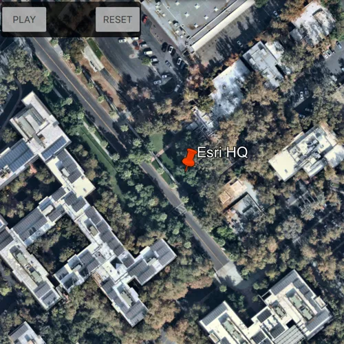
Play tours in KML files.
Use case
KML, the file format used by Google Earth, supports creating tours, which can control the viewpoint of the scene, hide and show content, and play audio. Tours allow you to easily share tours of geographic locations, which can be augmented with rich multimedia. The ArcGIS Maps SDK for Qt allows you to consume these tours using a simple API.
How to use the sample
The sample will load the KMZ file automatically. When a tour is found, the Play button will be enabled. Use Play and Pause to control the tour. When you’re ready to show the tour, use the reset button to return the tour to the unplayed state.
How it works
- Load the KML dataset and add it to a layer.
- Create the KML tour controller. Wire up the buttons to the
play(),pause(), andreset()methods. - Use a method to explore the tree of KML content and find the first KML tour. Once a tour is found, provide it to the KML tour controller.
- Enable the buttons to allow the user to play, pause, and reset the tour.
Relevant API
- KmlTour
- KmlTourController
Offline data
Read more about how to set up the sample’s offline data here.
| Link | Local Location |
|---|---|
| Esri tour KMZ | <userhome>/ArcGIS/Runtime/Data/kml/Esri_tour.kmz |
About the data
This sample uses a custom tour created by a member of the ArcGIS Maps SDK for Native Apps samples team. When you play the tour, you’ll see a narrated journey through some of Esri’s offices.
Additional information
See Google’s documentation for information about authoring KML tours.
Tags
animation, interactive, KML, narration, pause, play, story, tour
Sample code
// [WriteFile Name=PlayAKmlTour, Category=Layers]// [Legal]// Copyright 2019 Esri.//// Licensed under the Apache License, Version 2.0 (the "License");// you may not use this file except in compliance with the License.// You may obtain a copy of the License at// http://www.apache.org/licenses/LICENSE-2.0//// Unless required by applicable law or agreed to in writing, software// distributed under the License is distributed on an "AS IS" BASIS,// WITHOUT WARRANTIES OR CONDITIONS OF ANY KIND, either express or implied.// See the License for the specific language governing permissions and// limitations under the License.// [Legal]
#ifdef PCH_BUILD#include "pch.hpp"#endif // PCH_BUILD
// sample headers#include "PlayAKmlTour.h"
// ArcGIS Maps SDK headers#include "ArcGISTiledElevationSource.h"#include "ElevationSourceListModel.h"#include "Error.h"#include "KmlContainer.h"#include "KmlDataset.h"#include "KmlLayer.h"#include "KmlNodeListModel.h"#include "KmlTour.h"#include "KmlTourController.h"#include "LayerListModel.h"#include "MapTypes.h"#include "Scene.h"#include "SceneQuickView.h"#include "Surface.h"
// Qt headers#include <QStandardPaths>#include <QtCore/qglobal.h>
using namespace Esri::ArcGISRuntime;
// helper method to get cross platform data pathnamespace{  QString defaultDataPath()  {    QString dataPath;
  #ifdef Q_OS_IOS    dataPath = QStandardPaths::writableLocation(QStandardPaths::DocumentsLocation);  #else    dataPath = QStandardPaths::writableLocation(QStandardPaths::HomeLocation);  #endif
    return dataPath;  }} // namespace
PlayAKmlTour::PlayAKmlTour(QObject* parent /* = nullptr */):  QObject(parent),  m_scene(new Scene(BasemapStyle::ArcGISImageryStandard, this)),  m_dataPath(defaultDataPath() + "/ArcGIS/Runtime/Data"){  // create a new elevation source from Terrain3D REST service  ArcGISTiledElevationSource* elevationSource = new ArcGISTiledElevationSource(        QUrl("https://elevation3d.arcgis.com/arcgis/rest/services/WorldElevation3D/Terrain3D/ImageServer"), this);
  // add the elevation source to the scene to display elevation  m_scene->baseSurface()->elevationSources()->append(elevationSource);
  m_kmlDataset = new KmlDataset(QUrl::fromLocalFile(m_dataPath + "/kml/Esri_tour.kmz"), this);  m_kmlLayer = new KmlLayer(m_kmlDataset, this);
  connect(m_kmlLayer, &KmlLayer::doneLoading, this, [this](const Error& e)  {    if (!e.isEmpty())    {      qDebug() << e.message();      return;    }
    m_scene->operationalLayers()->append(m_kmlLayer);
    m_kmlTour = findFirstKMLTour(m_kmlDataset->rootNodes());    m_kmlTourController = new KmlTourController(this);
    if (m_kmlTour)    {      connect(m_kmlTour, &KmlTour::tourStatusChanged, this, [this](KmlTourStatus tourStatus)      {        switch (tourStatus) {          case KmlTourStatus::Completed:          case KmlTourStatus::Initialized:            m_playButtonEnabled = true;            m_pauseButtonEnabled = false;            m_resetButtonEnabled = true;            break;          case KmlTourStatus::Playing:            m_playButtonEnabled = false;            m_pauseButtonEnabled = true;            m_resetButtonEnabled = true;            break;          case KmlTourStatus::Paused:            m_playButtonEnabled = true;            m_pauseButtonEnabled = false;            m_resetButtonEnabled = true;            break;          case KmlTourStatus::Initializing:          case KmlTourStatus::NotInitialized:            break;        }
        emit playButtonEnabledChanged();        emit pauseButtonEnabledChanged();        emit resetButtonEnabledChanged();      });
      m_kmlTourController->setTour(m_kmlTour);    }  });
  m_kmlLayer->load();}
PlayAKmlTour::~PlayAKmlTour() = default;
void PlayAKmlTour::init(){  // Register classes for QML  qmlRegisterType<SceneQuickView>("Esri.Samples", 1, 0, "SceneView");  qmlRegisterType<PlayAKmlTour>("Esri.Samples", 1, 0, "PlayAKmlTourSample");}
SceneQuickView* PlayAKmlTour::sceneView() const{  return m_sceneView;}
// Set the view (created in QML)void PlayAKmlTour::setSceneView(SceneQuickView* sceneView){  if (!sceneView || sceneView == m_sceneView)    return;
  m_sceneView = sceneView;  m_sceneView->setArcGISScene(m_scene);
  emit sceneViewChanged();}
void PlayAKmlTour::playKmlTour(){  m_kmlTourController->play();}void PlayAKmlTour::pauseKmlTour(){  m_kmlTourController->pause();}void PlayAKmlTour::resetKmlTour(){  m_kmlTourController->reset();}
KmlTour* PlayAKmlTour::findFirstKMLTour(const QList<KmlNode*>& nodes){  for (KmlNode* node : nodes)  {    if (node->kmlNodeType() == KmlNodeType::KmlTour)      return dynamic_cast<KmlTour*>(node);    else if ((node->kmlNodeType() == KmlNodeType::KmlDocument) || (node->kmlNodeType() == KmlNodeType::KmlFolder))      return findFirstKMLTourFromListModel(*dynamic_cast<KmlContainer*>(node)->childNodesListModel());  }  return nullptr;}
KmlTour* PlayAKmlTour::findFirstKMLTourFromListModel(const KmlNodeListModel& nodes){  for (KmlNode* node : nodes)  {    if (node->kmlNodeType() == KmlNodeType::KmlTour)      return dynamic_cast<KmlTour*>(node);    else if ((node->kmlNodeType() == KmlNodeType::KmlDocument) || (node->kmlNodeType() == KmlNodeType::KmlFolder))      return findFirstKMLTourFromListModel(*dynamic_cast<KmlContainer*>(node)->childNodesListModel());  }  return nullptr;}
// [WriteFile Name=PlayAKmlTour, Category=Layers]// [Legal]// Copyright 2019 Esri.//// Licensed under the Apache License, Version 2.0 (the "License");// you may not use this file except in compliance with the License.// You may obtain a copy of the License at// http://www.apache.org/licenses/LICENSE-2.0//// Unless required by applicable law or agreed to in writing, software// distributed under the License is distributed on an "AS IS" BASIS,// WITHOUT WARRANTIES OR CONDITIONS OF ANY KIND, either express or implied.// See the License for the specific language governing permissions and// limitations under the License.// [Legal]
#ifndef PLAYAKMLTOUR_H#define PLAYAKMLTOUR_H
// Qt headers#include <QObject>
namespace Esri::ArcGISRuntime{class Scene;class SceneQuickView;class KmlTour;class KmlTourController;class KmlLayer;class KmlDataset;class KmlNode;class KmlNodeListModel;}
Q_MOC_INCLUDE("SceneQuickView.h")
class PlayAKmlTour : public QObject{ Q_OBJECT
Q_PROPERTY(Esri::ArcGISRuntime::SceneQuickView* sceneView READ sceneView WRITE setSceneView NOTIFY sceneViewChanged) Q_PROPERTY(bool playButtonEnabled MEMBER m_playButtonEnabled NOTIFY playButtonEnabledChanged()) Q_PROPERTY(bool pauseButtonEnabled MEMBER m_pauseButtonEnabled NOTIFY pauseButtonEnabledChanged()) Q_PROPERTY(bool resetButtonEnabled MEMBER m_resetButtonEnabled NOTIFY resetButtonEnabledChanged())
public: explicit PlayAKmlTour(QObject* parent = nullptr); ~PlayAKmlTour();
static void init();
Q_INVOKABLE void playKmlTour(); Q_INVOKABLE void pauseKmlTour(); Q_INVOKABLE void resetKmlTour();
signals: void sceneViewChanged(); void playButtonEnabledChanged(); void pauseButtonEnabledChanged(); void resetButtonEnabledChanged();
private: Esri::ArcGISRuntime::SceneQuickView* sceneView() const; void setSceneView(Esri::ArcGISRuntime::SceneQuickView* sceneView); Esri::ArcGISRuntime::KmlTour* findFirstKMLTour(const QList<Esri::ArcGISRuntime::KmlNode*>& nodes); Esri::ArcGISRuntime::KmlTour* findFirstKMLTourFromListModel(const Esri::ArcGISRuntime::KmlNodeListModel& nodes);
Esri::ArcGISRuntime::Scene* m_scene = nullptr; Esri::ArcGISRuntime::SceneQuickView* m_sceneView = nullptr; Esri::ArcGISRuntime::KmlTour* m_kmlTour = nullptr; Esri::ArcGISRuntime::KmlTourController* m_kmlTourController = nullptr; Esri::ArcGISRuntime::KmlLayer* m_kmlLayer = nullptr; Esri::ArcGISRuntime::KmlDataset* m_kmlDataset = nullptr;
QString m_dataPath; bool m_playButtonEnabled = false; bool m_pauseButtonEnabled = false; bool m_resetButtonEnabled = false;
};
#endif // PLAYAKMLTOUR_H// [WriteFile Name=PlayAKmlTour, Category=Layers]// [Legal]// Copyright 2019 Esri.//// Licensed under the Apache License, Version 2.0 (the "License");// you may not use this file except in compliance with the License.// You may obtain a copy of the License at// http://www.apache.org/licenses/LICENSE-2.0//// Unless required by applicable law or agreed to in writing, software// distributed under the License is distributed on an "AS IS" BASIS,// WITHOUT WARRANTIES OR CONDITIONS OF ANY KIND, either express or implied.// See the License for the specific language governing permissions and// limitations under the License.// [Legal]
import QtQuickimport QtQuick.Controlsimport QtQuick.Layoutsimport Esri.Samples
Item {
SceneView { id: view anchors.fill: parent
Component.onCompleted: { // Set the focus on SceneView to initially enable keyboard navigation forceActiveFocus(); } }
Rectangle { id: buttonBackground anchors { left: parent.left top: parent.top margins: 3 } width: childrenRect.width height: childrenRect.height color: "#000000" opacity: .75 radius: 5
// catch mouse signals from propagating to parent MouseArea { anchors.fill: parent onClicked: mouse => mouse.accepted = true onWheel: wheel => wheel.accepted = true }
RowLayout { spacing: 0 Button { id: playButton text: qsTr("Play") Layout.margins: 2 enabled: playAKmlTourSampleModel.playButtonEnabled onClicked: playAKmlTourSampleModel.playKmlTour(); }
Button { id: pauseButton text: qsTr("Pause") Layout.margins: 2 enabled: playAKmlTourSampleModel.pauseButtonEnabled onClicked: playAKmlTourSampleModel.pauseKmlTour(); }
Button { id: resetButton text: qsTr("Reset") Layout.margins: 2 enabled: playAKmlTourSampleModel.resetButtonEnabled onClicked: playAKmlTourSampleModel.resetKmlTour(); } } }
// Declare the C++ instance which creates the scene etc. and supply the view PlayAKmlTourSample { id: playAKmlTourSampleModel sceneView: view }}