This page provides details about enhancements in the 200.8 release of ArcGIS Maps SDK for Swift. It also lists deprecations, resolved issues, known issues, and more.
200.8.1
Support for iOS 26
Shortly after Apple announced iOS 26 at the WWDC conference in June 2025, we began testing with the developer and public betas to ensure apps built with the Maps SDK could adopt it quickly. Following the official release of iOS 26, we addressed a few isolated issues and certified 200.8.1 to support iOS/iPadOS/macOS/visionOS 26.
Issues resolved
-
BUG-000154800: Vertical labels overlap.
-
BUG-000161830: Change label ordering to account for layer draw order.
-
BUG-000164521: Labeling does not honor the z-index of graphics.
-
BUG-000170696:
Portalinitializer fails to get the correct item size for items larger than 2 GB.Item -
BUG-000175907:
Mapwith hidden fields fails to load.Image Sub Layer
-
BUG-000176452: Values of
doubledata type do not populate correctly when opening a mobile map package. -
BUG-000177036: A
Featurebacked by OGC API - Features or WFS cannot be cloned.Layer -
BUG-000179924:
applyonEdits() Servicefails when duplicate layers exist.Geodatabase -
BUG-000180102:
applyonEdits() Servicefails when a field named "edit_date" exists.Geodatabase -
Queryfails to return features from aRelated Features Servicein manual cache mode.Feature Table -
Local queries with CURRENT_TIMESTAMP or CURRENT_DATE return incorrect results.
-
Unable to load some KML datasets with custom namespaces.
-
Downloaded KML icons with unconventional filenames do not display correctly.
-
KML tracks in a multitrack don't honor its altitude mode property.
-
The
isandPartially Visible isproperties are not updated correctly when a child is removed from aVisible KML.Container -
The value of
Featureis returned as theType.name Popupfield value rather thanCoded.Value.name -
A dictionary renderer referenced from service metadata fails to render features.
-
Unable to add an on-demand map area when working with classic IPS maps that use an 'IPS_Positioning' feature table.
-
Improved positioning experience during transitions between indoors and outdoors when working with geometry-aided IPS.
-
Improved the geometry-aided positioning engine with a smarter step propagation logic, giving users more accurate positioning when standing still.
-
BLE position does not transition to outside with on-demand offline map.
-
Federated services fail to load if their server info is missing the token URL.
-
Percent along value is not populated with an offline
Utility.Association -
A deleted
Utilityisn't recognized as actually deleted.Association -
Geotriggernotifications are triggered repeatedly.Monitor -
Geotriggerstartup is noticeably slower.Monitor -
Identify operation for a
Graphicsdoes not return unclustered graphics whenOverlay Featureis enabled.Reduction -
Poor performance of
Identifyoperations when a map or scene contains many layers and features. -
An incorrect path is reported for projection engine data files.
-
Memory leak when projecting raster data.
-
Complex contingent values may cause a crash on low-memory devices.
-
Crash caused by concurrent
setoperations.Viewpoint() -
App crashes when
elevation(atis called with a point that lacks a spatial reference.:) -
Subtypes andFeature Layer Subtypes lose feature templates when they are stored in a web map.Sublayer
- Panning a
Geois sometimes misinterpreted as a content swipe gesture that dismisses theView Geoon iOS 26.View - Layer refresh issues sometimes cause a
Geotriggerto not fire when the app is in the background. Geo'sView onandZooming onclosure values do not get set to false when the number of touches changes during a gesture.Rotating - Redirect URL is not encoded in an OAuth authorize call.
- Portal fails to load if a helper services URL is invalid.
- Tap gesture on
WorldToolkit component is not recognized on iOS 26.Scale Scene View - Nested challenges are not possible while an OAuth WebView is presented.
- "Date Format" system setting is not honored when formatting dates.
- Cancellation error on initial load of
Attachments.Feature Element View - Symbolic links in file URL paths are not resolved before URL serialization.
- Identity Aware Proxy challenge is not issued if the device locale is not English.
Other improvements
- An Advanced Editing extension license is no longer required for creating versions or for editing non-utility network features in branch versioned data.
- Updates to 3rd party components:
- Harfbuzz to 11.4.5
- libexpat to 2.7.3
- LibTiff to 4.7.1
- OpenJPEG to 2.5.4: Fixes security vulnerability CVE-2025-54874
- SQLite to 3.50.4
Changes in samples
New samples
- Apply renderers to scene layer
- Query dynamic entities
- Set KML ground overlay properties
- Show viewshed from camera in scene
- Show WFS layer with XML query
- Simplify geometry
- Update related features
Enhancements
- Enhanced the Sample Viewer to include a page that allows downloading offline resources for multiple samples at once.
- Updated the authentication samples to use
Authenticationinstead of custom signout methods.Manager.sign Out() - Resolved an issue where offline data would fail to download when the Xcode project was first run under poor network conditions.
- Made other minor UI, code, documentation, and linting improvements and fixes.
200.8
Enhancements
Geometry editing
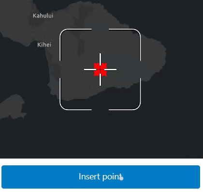
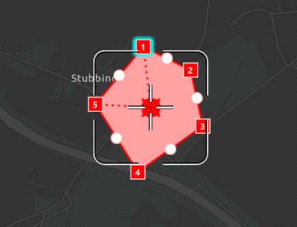
Customizable geometry editing workflows using the programmatic reticle tool
You can now configure your GeometryEditor to use the new ProgrammaticReticleTool to facilitate customized geometry editing workflows such as those using buttons rather than tap interactions. Unlike our existing tools the ProgrammaticReticleTool has no built in touch interaction. Instead, it is driven by programmatic operations allowing you to configure your own behavior and interaction using buttons or other triggers of your choosing.
Use ProgrammaticReticleTool.selectElementAtReticle() and ProgrammaticReticleTool.pickUpSelectedElement() to select and pick up the GeometryEditorVertex or GeometryEditorMidVertex at the reticle position. Then, drop a picked-up vertex or insert a new vertex using ProgrammaticReticleTool.placeElementAtReticle().
The ProgrammaticReticleTool.vertexCreationPreviewEnabled property can be used to enable or disable the appearance of vertex feedback and feedback lines that are drawn underneath the reticle. It can also be used to enable or disable both visual and haptic snap feedback. This is useful when implementing workflows that do not allow for vertex creation.
Hovered and picked up element changed events
The hoveredElement and GeometryEditor.pickedUpElement properties can be used in your app to react to state changes in the GeometryEditor, and are especially useful when working with the new ProgrammaticReticleTool.
For example, when hoveredElement updates, your app UI can display a button that selects and picks up the element currently underneath the reticle, as shown below. Similarly, when GeometryEditor.pickedUpElementupdates, your app UI can display a button that drops the GeometryEditor.pickedUpElement or places a new vertex, using ProgrammaticReticleTool.placeElementAtReticle(). You can check the GeometryEditor.pickedUpElement to indicate to the user whether or not they will be inserting a new vertex or dropping a currently picked up element.
Disable grow effect when hovering over geometry editor elements
Use the new GeometryEditorStyle.growEffect to enable and disable the visual effect of vertices and mid-vertices growing when hovered.
Vertices and mid-vertices can be separately configured using GeometryEditorGrowEffect.applyToVertices and GeometryEditorEffect.applyToMidVertices.
Identify geometry editor elements
Use the MapView.identifyGeometryEditor() method to identify elements at a given position when using the GeometryEditor. This allows you to implement workflows such as selecting geometry editor elements or updating the viewpoint to be centered at that element on a long press.
Customizable precision with tolerance and resolution
Use the new SpatialReferenceBuilder to create new SpatialReference objects with custom tolerance and resolution values for high accuracy workflows and GeometryEngine.
The SpatialReference class exposes new read-only properties for SpatialReference.tolerance, SpatialReference.verticalTolerance, SpatialReference.resolution, and SpatialReference.verticalResolution.
This resolves the following enhancement request: EN.
Authentication
Identity-Aware Proxy (IAP)
ArcGIS Maps SDKs now support accessing ArcGIS Enterprise Portal and Services behind Microsoft Entra Application Proxy via Microsoft Identity Platform.
An Identity-Aware Proxy (IAP) is a security feature that enables organizations to manage access to their on-premises web applications and services based on user identity. Typically, it functions as a reverse proxy, acting as a gatekeeper to ensure that only authenticated and authorized users can access specific resources. The authentication process for IAP occurs within a web session using protocols such as OAuth, SAML, or _OpenID Connect. During this session, security tokens and cookies are generated, which remain valid throughout the session until they are invalidated.
Please read the section on IAPCredential in the security guide to understand how to configure and work with Identity- in the SDK.
Enhancement to ArcGISAuthenticationChallenge
ArcGISAuthenticationChallenge now provides an enum to determine the type of authentication challenge Iap, OAuthOrToken, or Token. It helps to determine whether the authentication challenge is issued by the proxy, portal, or service.
Utility network
Utility Network creation and access
The UtilityNetwork object can now be created with a ServiceGeodatabase object. When these objects are created from the same feature service source, they share the same instances of FeatureTable. This new constructor emphasizes the explicit relationship between them. Similarly, when a Map object is created from a web map containing utility network data, the layers, tables, and utility networks all use the same underlying ServiceGeodatabase object. Instead of creating a standalone UtilityNetwork, consider accessing the Utility using the property. All public samples containing utility network data have been updated to align with this change. For more detailed information, refer to the API deprecations section.
Add title property to utility association result
This release adds a title property to UtilityAssociationResult. It provides a user-friendly name for UtilityAssociations shown in a FeatureForm or Popup. The title is derived from the title of the FeatureFormDefinition or PopupDefinition of the associated feature's layer or table, with a suitable fallback if no Feature or Popup has been created.
Indoor positioning
Support for on-demand and pre-planned offline map area workflows
It is now possible to create offline applications using an IPS-aware web map and implement the on-demand and pre-planned workflows. Indoor positioning data will be taken offline using ArcGIS Maps SDKs' offline jobs and the offline application will display a blue dot in the respective offline map area indoors.
Geometry-aided positioning
The indoor positioning engine is now enhanced by a new advanced algorithm that utilizes floor-plan geometries. It delivers smoother motion and reduces wall-crossing. This makes positioning feel more natural, especially when walking through complex indoor layouts. This feature is only supported with Indoor Positioning Data Services shared with ArcGIS Pro 3.6 or above.
Faster initialization
The required indoor positioning data can now be downloaded faster, ultimately resulting in a faster initialization time of the IndoorsLocationDataSource (ILDS). This feature is only supported with Indoor Positioning Data Services shared with ArcGIS Pro 3.6 or above.
Query and identify optimizations
ArcGISFeature access optimization
Accessing ArcGISFeatures by performing query operations on a ServiceFeatureTable or UtilityNetwork, as well as through the identify methods with FeatureLayers, has seen a significant boost in performance. This improvement is particularly evident when working with a map or scene that contains a large feature dataset, as these asynchronous operations now return results more efficiently, even while all features are still being rendered.
Layers
Improved performance and user experience of KML layers in a scene
In this release, performance and user experience for KML layers in 3D have been improved. The changes focus on line and polygon geometries. You'll notice the biggest improvements when a layer contains a large volume of data. Interaction with KML layers is now smoother, providing a much better user experience.
PDF Support
PDF files are now a supported raster file format, including GeoPDF® and geospatial PDFs using the ISO encoding. They can now be directly added to maps or scenes as raster layers or basemaps without the need to first convert them to another format. The first page of a PDF will be read and georeferenced according to optional embedded spatial reference information, and at a default DPI of 300.
Symbology
Support for fetching Model Symbols from a mobile Style file
This release adds support to fetch a Model Symbol from a mobile Style file. You can search for a model symbol in the mobile style or fetch a symbol by providing list of keys. The type of symbol returned is a MultilayerPointSymbol and model symbol layer object is returned as a generic SymbolLayer type object. This workflow is already supported for WebStyles.
Attribute editing with feature forms
Add JSONSerializable interface to feature form definition
This release adds JSONSerializable interface to FeatureFormDefinition to allow advanced clients to get access to the full JSON data.
Arcade
Support for new Arcade version
The SDK now supports Arcade 1.33
- Geotrigger notification profile now supports
$.Fence Layer Translatefunction is not yet supported and will be supported in a future release.Text
Projection Engine
Geographic (datum) transformations
- Added geographic (datum) transformation method Molodensky-Badekas (Position Vector). The existing Molodensky-Badekas method uses the Coordinate Frame version of the rotation matrix.
- Added geographic (datum) transformation method NTv2_Velocity. Although the method is designed to support datum anchor epochs and data epochs, only frame epochs of the geographic coordinate systems are currently supported for interframe conversions such as between NAD83(CSRS)v2 and NAD83(CSRS)v8.
SDK enhancements
JSON APIs
JSON APIs - from and to now work with Data instead of String, making JSON serialization and deserialization more streamlined using Swift's Codable protocol.
// Decoding is equivalent to using JSONDecoder
let json = #"{"x":-117,"y":34,"spatialReference":{"wkid":4326}}"#.data(using: .utf8)!
// let point = try JSONDecoder().decode(Point.self, from: json)
let point = try Point.fromJSON(json)
// Encoding is equivalent to using JSONEncoder
let point = Point(latitude: 34, longitude: -117)
// let json = try JSONEncoder().encode(point)
let json = point.toJSON()Download Task Response Details
ArcGISURLSession provides a new download async stream which provides information about file downloads such as the file size and download progress. This information is available for any file downloads initiated by the API, including OfflineMapTask, ExportTileCacheTask, ExportVectorTilesTask, etc.
for await response in ArcGISURLSession.downloadTaskResponseDetails {
Task {
for await progress in response.progress {
// Print the total amount of data downloaded.
print("-- progress: \(progress.totalDownloaded)")
}
}
}Authenticator
- Adds support for Identity-Aware Proxies (IAP). An Identity-Aware Proxy (IAP) is a security feature that enables organizations to manage access to their on-premises web applications and services based on user identity. Typically, it functions as a reverse proxy, acting as a gatekeeper to ensure that only authenticated and authorized users can access specific resources. The authentication process for IAP occurs within a web session using protocols such as OAuth, SAML, or OpenID Connect. During this session, security tokens and cookies are generated, which remain valid throughout the session until they are invalidated. This release adds support for Microsoft Entra Application Proxy.
init(promptis deprecated and replaced byFor Untrusted Hosts :o Auth User Configurations :) init(promptto support authenticating with IAP by optionally passing in configuration settings for the proxy.For Untrusted Hosts :o Auth User Configurations :iap Configurations :)
- Adds
ArcGISwhich allows the authenticator to better decide which type ofAuthentication Challenge Type ArcGISshould be created to handle the underlying authentication challenge.Credential oandAuth User Configurations iapare now public read-write properties to allow setting configurations more easily.Configurations
FeatureFormView
- The
Featureview adds support for viewing utility network associations. Associations model relationships between utility assets in the real world based on connectivity, containment, or structural attachment.Form - The view allows users to browse through associated features and return to previously viewed ones. The associations are filtered according to the settings described by the form's
Utilityconfiguration. No associations are displayed if the form doesn't contain the required settings. If the view is used without a form definition, all available associations are displayed without any filters.Associations Form Element init(featureis deprecated and replaced byForm :) init(root.:is Presented :) Featureuses aForm View Navigationinternally to support browsing utility network associations. The new initializer provides an isolated navigation context for the feature form.Stack
- Browse utility network associations in a feature form through the
Utility.Associations Form Element

editingis added to control the visibility of new built-in Save and Discard buttons.Buttons( _:) navigationis added to prevent users from navigating to other associations.Disabled( _:) onandFeature Form Changed(perform :) onare added to allow receiving change events from the form.Form Editing Event(perform :) - The feature form might change when navigating through the associations in a
Utility.Associations Form Element - You can run actions based on the form editing events, such as saving and discarding edits.
- The feature form might change when navigating through the associations in a
OfflineMapAreasView
- Fixes a crash when attempting to re-download a deleted preplanned map area while offline.
- Fixes a bug that stops the on-demand workflow from downloading an area. When the view first appears and the extent selector isn't moved, if the download button is tapped, the view behaved incorrectly.
- Fixes a bug when using the view in certain offline situations, the view doesn't show the "No Internet Connection" message.
- Changes the "Delete Map Area" button to "Remove Download" for ahead-of-time and "Delete Download" for on-demand workflows, to better reflect that the actions delete the downloaded data for the map area.
PopupView
- The
Popupadds support for viewing utility network associations. Associations model relationships between utility assets in the real world based on connectivity, containment, or structural attachment.View - The view allows users to browse through associated features and return to those previously viewed. The associations are filtered (e.g., by assembly layer) according to the settings described by the form's
Utilityconfiguration and presents results in collapsible groups by layer, table, or subtype. The view shows relevant association details - such as connected terminals or fraction along an edge - and supports navigation to the popup of an associated feature, whether spatial or non-spatial, with a back button to return to the previous view. It allows users to exit all associations at once, returning to the original feature, and only display associations that are currently available on the map.Associations Popup Element init(popupis deprecated and replaced by:is Presented :) init(rootto better support navigating between associated features.:is Presented :) Popupuses aView Navigationinternally to support browsing utility network associations, and the new initializer provides an isolated navigation context for the popup view.Stack
header(modifier is deprecated. With the new navigation context, the view owns and manages its own navigation stack, so there's no longer support for hiding the header._:) showmodifier is deprecated. With the new navigation context, the view decides whether or not to show the close button by theClose Button( _:) isinitializer parameter.Presented onis added to support custom actions when browsing between popups associated via aPopup Changed(perform :) Utility.Associations Popup Element
Breaking API changes
There are no breaking API changes with this release.
Behavior changes
- With this release,
GeometryEngine.reshape()now supports true curves. - With ArcGIS Online now supporting true curves, you can now apply edits to circular arcs in an ArcGIS Online hosted feature service.
- The
wkt2string description of aSpatialReferenceis now read in preference overwktforFeatureLayers andGeodatabases and is also contained in theirSpatial Referenceoutput json. JSONmethod now serializes properties from theSerializable.to JSO N() unknowncollection.JSON - This is the last release where creating an
IntegratedMeshLayerusing theArcGISSceneLayerconstructor workflow is supported. Starting from next release, it is recommended that you use theIntegratedconstructor to create a layer of that type.Mesh Layer
Deprecations
API deprecations
- The
UtilityNetworkconstructors withURIare deprecated and will be removed in a future release. Use the constructor that accepts aServiceGeodatabaseinstead. unknownandJSON unsupportedproperties have been deprecated from the JsonSerializableJSON JsonSerializableinterface and objects which follow a similar pattern. Use theJSONinstead to get all JSON data for an object. SinceSerializable.to JSO N() MapandSceneobjects can be large and expensive to parse and serialize, a newunusedproperty has been added specifically to those root objects.JSON
-
The
FeatureSubtype.domainsproperty is deprecated and will be removed in a future release. Use theField.domainin theFeatureSubtype.fieldOverridesinstead. -
Integratedenum value is deprecated fromMesh ArcGISSceneLayer.DataType. -
OpenStreetMap (OSM) basemaps are in mature support and will no longer be updated. They will be removed in a future version of the ArcGIS Maps SDK for Swift. For more information, see the Overture Maps Data in ArcGIS blog. We recommend that you replace your OSM
Basemap.Stylewith the equivalent Open Basemap styles, as follows:OSM Basemap style Open Basemap style OSMStandard openOSMStyle OSMStandardRelief openOSMStyleRelief OSMStandardReliefBase openOSMStyleReliefBase OSMStreets openStreets OSMStreetsRelief openStreetsRelief OSMLightGray openLightGray OSMLightGrayBase openLightGrayBase OSMLightGrayLabels openLightGrayLabels OSMDarkGray openDarkGray OSMDarkGrayBase openDarkGrayBase OSMDarkGrayLabels openDarkGrayLabels OSMStreetsReliefBase openStreetsReliefBase OSMBlueprint openBlueprint OSMHybrid openHybrid OSMHybridDetail openHybridDetail OSMNavigation openNavigation OSMNavigationDark openNavigationDark
BingMapsLayerandBingMapsLayer.Styleare now deprecated and will be removed in a future version of ArcGIS Maps SDK for Swift. Microsoft has deprecated Bing Maps for Enterprise, which will retire and be replaced by Azure Maps on June 30, 2028. As a result, use of Bing Maps in ArcGIS Maps SDK for Swift is also deprecated. You can migrate from Bing Maps to Azure Maps by following the instructions in the Microsoft Azure documentation.
OS and framework deprecations
There are no OS or framework deprecations with this release.
Issues resolved
Issues addressed in this release are listed below.
- Memory leak issues that occur when reloading a mobile map with a
UtilityNetworkcould lead to failures in trace operations. UtilityNetworkValidationJobdoes not propagate server errors when it is unable to acquire a lock.UtilityNetworkValidationJobencounters failures when provided with an extent that includes m-values.FeatureLayer.floorDefinitionproperty is not honored by a floor-awareSubtypewhen included in a web or mobile map.Feature Layer ContingentValuesDefinitionfails to load with version 11.5 ArcGIS Enterprise reference feature services- Issue reported on Esri Community: Rapid zooming in using the mouse wheel causes a much higher zoom level than expected.
- Unable to evaluate
FeatureArcade function referencing aSet By Name() SubtypeFeatureLayerin pop-ups. - The
ServiceFeatureTable.undoLocalEdits()andServiceGeodatabase.undoLocalEdits()methods fail to revert the addition of features in a change-tracked non-spatial table.
Layers configured with custom dictionaries do not display on the map when parsing dictionary version in a web style.- BUG-000174246 - When drawing a graphic line with static rendering mode, unnecessary graphics are drawn along with the graphic line in a 3D
SceneView.
PortalItemof image type fails to add or update when the filename contains the file extension- Vertex and lines doesn't follow the hover gesture for geometry editor on Mac Catalyst.
- Empty URL causes crash instead of throwing an
Invalid.Call Error NetworkAnalystErrormessage doesn't include localized error details.- When
PortalQueryParameters.searchPublicisFalse, non-public items from another organization that the user can access are not returned. - The
GeometryEditordrag gesture lags between finger and vertex. CustomTiledLayerdoesn't show as a basemap layer.
Known issues
There are no known issues or limitations for this release.
Changes in samples
New samples
- Add OpenStreetMap layer
- Add WFS layer
- Add WMTS layer
- Add feature collection layer from portal item
- Add feature collection layer from query
- Add feature collection layer from table
- Add feature layer with time offset
- Add integrated mesh layer
- Add items to portal
- Add rasters and feature tables from geopackage
- Analyze hotspots
- Apply RGB renderer
- Apply blend renderer to hillshade
- Apply class breaks renderer to sublayer
- Apply colormap renderer to raster
- Apply function to raster from file
- Apply function to raster from service
- Apply hillshade renderer to raster
- Apply scene property expressions
- Apply simple renderer to feature layer
- Apply simple renderer to graphics overlay
- Apply stretch renderer
- Apply style to WMS layer
- Apply symbology to shapefile
- Apply terrain exaggeration
- Authenticate with Integrated Windows Authentication
- Authenticate with PKI certificate
- Authenticate with token
- Browse WFS layers
- Browse WMS layers
- Control annotation sublayer visibility
- Create and save map
- Create geometries
- Display OGC API collection
- Display route layer
- Edit geometries with programmatic reticle tool
- Generate geodatabase replica from feature service
- List geodatabase versions
- Manage features
- Project with chosen transformation
- Query map image sublayer
- Query table statistics
- Query table statistics group and sort
- Query with time extent
- Search symbol style dictionary
- Set atmosphere effect in scene
- Set feature layer rendering mode on map
- Set feature layer rendering mode on scene
- Set initial map location
- Set map image layer sublayer visibility
- Show extruded graphics
- Show geodesic path between two points
- Show geodesic sector and ellipse
- Show labels on layer in 3D
- Show line of sight between geoelements
- Show magnifier
- Show portal user info
- Show service areas for multiple facilities
- Show shapefile metadata
- Take screenshot
Enhancements
Sample Viewer
- Increased the project's minimum deployment to
17.0. - Added App Store review requests.
Samples
- Simplified Add scene layer from service to better highlight adding scene layers.
- Enhanced the Set basemap README to include information on organizational basemaps.
- Replaced uses of deprecated APIs:
- Updated the
FeatureFormandPopupViewuses to support their new initializers. - Moved to using the new geodatabase
UtilityNetworkinitializer. - Replaced uses of the OpenStreetMap basemap styles.
- Added support for the new
DataJSON methods.
- Updated the
Bug fixes
- Fixed a bug where sample authentication teardown wouldn't always complete before another sample appeared.
- Resolved an issue where some sheets were displaying smaller than expected.
- Replaced KML data that was not working in Add KML layer sample.
Related topics
- System requirements for 200.8
- Install and set up
- Display a map (Tutorial)
- Product Life Cycle (Esri Support Site)