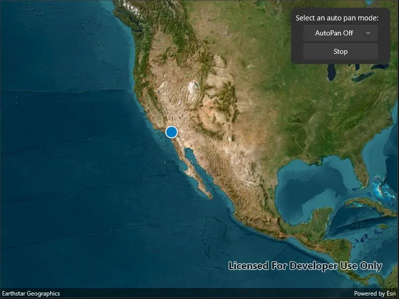
Display your current position on the map, as well as switch between different types of auto pan modes.
Use case
When using a map within a GIS, it may be helpful for a user to know their own location within a map, whether that’s to aid the user’s navigation or to provide an easy means of identifying/collecting geospatial information at their location.
How to use the sample
Select an autopan mode, then use the button to start and stop location display.
How it works
- Create a
MapView. - Set the
LocationDisplay.AutoPanModethat corresponds with the selected element of the combo box. - Set the
LocationDisplay.IsEnabledbool from theMapViewto true. - Set the
LocationDisplay.IsEnabledbool from theMapViewto false when the stop button is pressed.
Relevant API
- LocationDisplay
- LocationDisplay.AutoPanMode
- Map
- MapView
Additional information
Location permissions are required for this sample.
Tags
compass, GPS, location, map, mobile, navigation
Sample code
// Copyright 2022 Esri.//// Licensed under the Apache License, Version 2.0 (the "License"); you may not use this file except in compliance with the License.// You may obtain a copy of the License at: http://www.apache.org/licenses/LICENSE-2.0//// Unless required by applicable law or agreed to in writing, software distributed under the License is distributed on an// "AS IS" BASIS, WITHOUT WARRANTIES OR CONDITIONS OF ANY KIND, either express or implied. See the License for the specific// language governing permissions and limitations under the License.
using Esri.ArcGISRuntime.Mapping;using Esri.ArcGISRuntime.UI;using Microsoft.Maui.ApplicationModel;using System.ComponentModel;using System.Diagnostics;using Map = Esri.ArcGISRuntime.Mapping.Map;
namespace ArcGIS.Samples.DisplayDeviceLocation{    [ArcGIS.Samples.Shared.Attributes.Sample(        name: "Display device location with autopan modes",        category: "Location",        description: "Display your current position on the map, as well as switch between different types of auto pan modes.",        instructions: "Select an autopan mode, then use the button to start and stop location display.",        tags: new[] { "GPS", "compass", "location", "map", "mobile", "navigation" })]    public partial class DisplayDeviceLocation : ContentPage, IDisposable    {        // Dictionary to store the different auto pan modes.        private readonly Dictionary<string, LocationDisplayAutoPanMode> _autoPanModes = new()        {            { "AutoPan Off", LocationDisplayAutoPanMode.Off },            { "Re-Center", LocationDisplayAutoPanMode.Recenter },            { "Navigation", LocationDisplayAutoPanMode.Navigation },            { "Compass", LocationDisplayAutoPanMode.CompassNavigation }        };
        public DisplayDeviceLocation()        {            InitializeComponent();            Initialize();        }
        private void Initialize()        {            // Create new Map with basemap.            var myMap = new Map(BasemapStyle.ArcGISImageryStandard);
            // Assign the map to the MapView.            MyMapView.Map = myMap;
            // Populate the picker with different auto pan modes.            AutoPanModePicker.ItemsSource = _autoPanModes.Keys.ToList();
            // Keep listening to MapView property changed events until the location display has been initialized.            MyMapView.PropertyChanged += MyMapView_PropertyChanged;        }
        private void MyMapView_PropertyChanged(object sender, PropertyChangedEventArgs e)        {            // The map view's location display is initially null, so check for a location display property            // change before subscribing to auto pan mode change events.            if (e.PropertyName == nameof(LocationDisplay))            {                // Show in the UI that LocationDisplay.AutoPanMode is off by default.                AutoPanModePicker.SelectedItem = "AutoPan Off";
                // Update the UI when the user pans the view, disabling the auto pan mode.                MyMapView.LocationDisplay.AutoPanModeChanged += (sender, args) =>                {                    if (MyMapView.LocationDisplay.AutoPanMode == LocationDisplayAutoPanMode.Off)                    {                        AutoPanModePicker.SelectedItem = "AutoPan Off";                    }                };
                // No longer a need to listen for MapView property changes, just listen for auto pan mode changes.                MyMapView.PropertyChanged -= MyMapView_PropertyChanged;            }        }
        private void AutoPanModePicker_SelectedIndexChanged(object sender, EventArgs e)        {            // Change the auto pan mode based on the new selection.            MyMapView.LocationDisplay.AutoPanMode = _autoPanModes[AutoPanModePicker.SelectedItem.ToString()];        }
        private async void StartStopButton_Clicked(object sender, EventArgs e)        {            try            {                // Start or stop the location display data source.                if (MyMapView.LocationDisplay.IsEnabled)                {                    await MyMapView.LocationDisplay.DataSource.StopAsync();                }                else                {                    // Request access to device location.                    // When deploying to Android, iOS, and MacCatalyst, a permission prompt may appear.                    PermissionStatus status = await Permissions.RequestAsync<Permissions.LocationWhenInUse>();
                    // Start the location display if access to device location has been authorized.                    // Permission status will be restricted if the user approximates the device location.                    if (status == PermissionStatus.Granted || status == PermissionStatus.Restricted)                    {                        await MyMapView.LocationDisplay.DataSource.StartAsync();                    }                    else                    {                        await Application.Current.Windows[0].Page.DisplayAlert("Location not authorized", "Please allow access to the device location.", "OK");                    }                }            }            catch (Exception ex)            {                // Note for MacCatalyst: while on ethernet, without an external GPS device connected,                // location will be unknown.                Debug.WriteLine(ex);                await Application.Current.Windows[0].Page.DisplayAlert("Error", ex.Message, "OK");            }            finally            {                // Flip the button text if the LocationDisplay.IsEnabled property was changed.                // Button text won't change if start button was pressed but location access wasn't authorized.                StartStopButton.Text = MyMapView.LocationDisplay.IsEnabled ? "Stop" : "Start";            }        }
public void Dispose() { // Stop the location data source. MyMapView.LocationDisplay?.DataSource?.StopAsync(); } }}<?xml version="1.0" encoding="utf-8" ?><ContentPage x:Class="ArcGIS.Samples.DisplayDeviceLocation.DisplayDeviceLocation" xmlns="http://schemas.microsoft.com/dotnet/2021/maui" xmlns:x="http://schemas.microsoft.com/winfx/2009/xaml" xmlns:esriUI="clr-namespace:Esri.ArcGISRuntime.Maui;assembly=Esri.ArcGISRuntime.Maui"> <Grid Style="{DynamicResource EsriSampleContainer}"> <esriUI:MapView x:Name="MyMapView" Style="{DynamicResource EsriSampleGeoView}" /> <Border Style="{DynamicResource EsriSampleControlPanel}" WidthRequest="200"> <StackLayout Spacing="5"> <Label Text="Select an auto pan mode:" /> <Picker x:Name="AutoPanModePicker" HorizontalTextAlignment="Center" SelectedIndexChanged="AutoPanModePicker_SelectedIndexChanged" WidthRequest="150" /> <Button x:Name="StartStopButton" Clicked="StartStopButton_Clicked" Text="Start" WidthRequest="150" /> </StackLayout> </Border> </Grid></ContentPage>