The challenge of being in command is keeping an overview. Even in complex and confusing situations, the main objective is to maintain concentration on the core task, managing tactical units and making decisions. Therefore, Eurocommand provides with CommandX a modern and intuitive electronic command system based on ArcGIS.
Key features
Offline and sync
CommandX is fail-safe. When network connectivity is lost clients can continue to work without any problems. Data is synchronized when the connection returns. If service becomes unavailable, the system falls back to use backup services.
Advanced client features
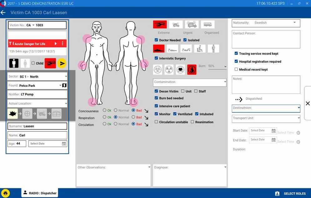
ArcGIS Maps SDK for .NET provides the client features, from simple situational mapping and geoanalysis to advanced analysis such as dispersion calculation.
Enterprise GIS
Mission-critical information is shared rapidly and securely with ArcGIS Enterprise, which lets users run enterprise GIS on their own infrastructure and behind firewalls.
Real-time
Real-time logging and event playback help understand the development and status of a situation. A tactical map film shows the historical process in real time and provides a court-relevant documentation of the operation.
App details
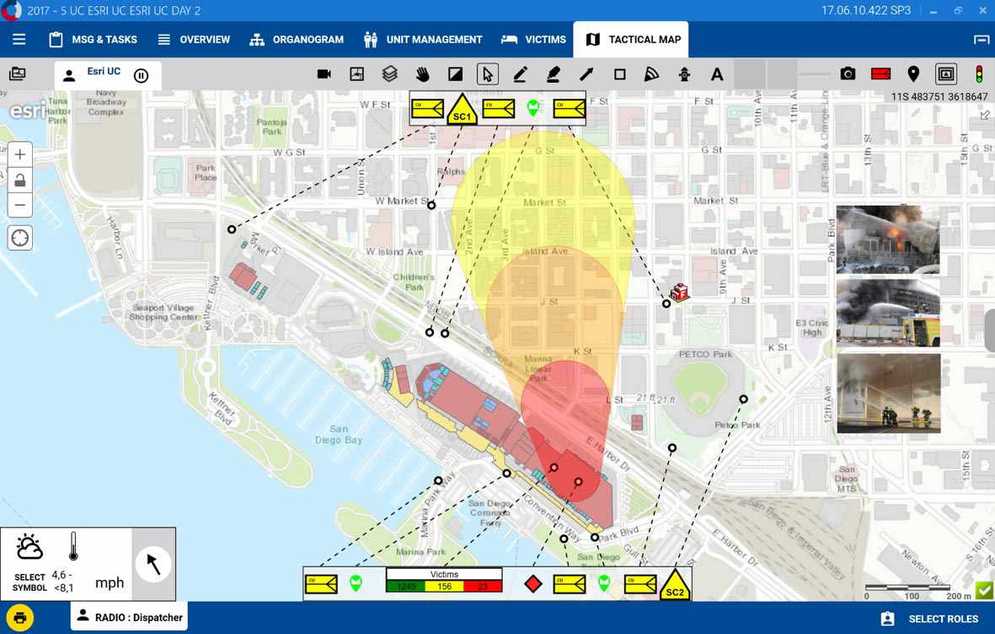
The management of tactical maps is now indispensable in modern emergency response management, as the recognition of spatial contexts is the basis for making important decisions. CommandX offers a wide range of possibilities for using geographic data and gaining insights.
CommandX uses basemap services from either ArcGIS Online or ArcGIS Enterprise as a basis for the tactical planning. The client front end is powered by ArcGIS Maps SDK for .NET, leveraging the fast-performing and reliable visualization of real-time data for vitally critical decision support. Complemented with location information, live data (weather, traffic, etc.) and geoanalysis (e.g. dispersion calculation), the application is an indispensable component for the operational support. To understand the development of the situation and the measures that have been initiated, it is possible to jump to any point in time during the emergency response process. A tactical map film shows the historical process in real time and thus provides a court-relevant documentation of the operation.