Vertically exaggerate terrain in a scene.
Use case
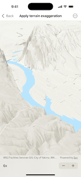
Vertical exaggeration can be used to emphasize subtle changes in a surface. This can be useful in creating visualizations of terrain where the horizontal extent of the surface is significantly greater than the amount of vertical change in the surface. A fractional vertical exaggeration can be used to flatten surfaces or features that have extreme vertical variation.
How to use the sample
Use the stepper to update terrain exaggeration.
How it works
- Create an
ArcGISTiledElevationSourceand add it to a newSurface.- An elevation source defines the terrain based on a digital elevation model (DEM) or digital terrain model (DTM).
- Add the surface to a
Scene.- The surface visualizes the elevation source.
- Set the surface's elevation exaggeration using
Surface.elevationExaggeration.
Relevant API
- ArcGISTiledElevationSource
- Scene
- Surface
Tags
3D, DEM, DTM, elevation, scene, surface, terrain
Sample Code
ApplyTerrainExaggerationView.swift
// Copyright 2025 Esri
//
// Licensed under the Apache License, Version 2.0 (the "License");
// you may not use this file except in compliance with the License.
// You may obtain a copy of the License at
//
// https://www.apache.org/licenses/LICENSE-2.0
//
// Unless required by applicable law or agreed to in writing, software
// distributed under the License is distributed on an "AS IS" BASIS,
// WITHOUT WARRANTIES OR CONDITIONS OF ANY KIND, either express or implied.
// See the License for the specific language governing permissions and
// limitations under the License.
import ArcGIS
import SwiftUI
struct ApplyTerrainExaggerationView: View {
/// A scene with an elevated surface and a topographic basemap.
@State private var scene: ArcGIS.Scene = {
// Creates a scene using a basemap style.
let scene = Scene(basemapStyle: .arcGISTopographic)
// Creates an elevation source and adds it to the scene's surface.
let elevationSource = ArcGISTiledElevationSource(url: .worldElevationService)
scene.baseSurface.addElevationSource(elevationSource)
// Sets the scene's initial viewpoint to center the scene view on Levering, WA, USA.
let point = Point(latitude: 46.75792, longitude: -119.9489)
let camera = Camera(lookingAt: point, distance: 15000, heading: 40, pitch: 60, roll: 0)
scene.initialViewpoint = Viewpoint(latitude: .nan, longitude: .nan, scale: .nan, camera: camera)
return scene
}()
/// The elevation exaggeration of the scene's surface.
@State private var elevationExaggeration: Float = 1
var body: some View {
// Displays the scene in a scene view.
SceneView(scene: scene)
.toolbar {
ToolbarItem(placement: .bottomBar) {
Stepper(value: $elevationExaggeration, in: 1...10) {
Text("\(elevationExaggeration, format: .number.rounded())x")
}
.onChange(of: elevationExaggeration) {
// Sets the surface's elevation exaggeration when the stepper value changes.
scene.baseSurface.elevationExaggeration = elevationExaggeration
}
}
}
}
}
private extension URL {
/// A web URL to the Terrain3D image server on ArcGIS REST.
static var worldElevationService: URL {
URL(string: "https://elevation3d.arcgis.com/arcgis/rest/services/WorldElevation3D/Terrain3D/ImageServer")!
}
}
#Preview {
ApplyTerrainExaggerationView()
}