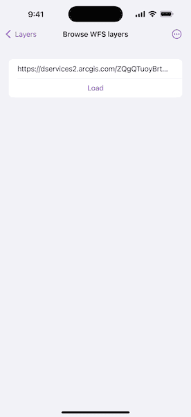
Browse a WFS service for layers and add them to the map.


Use case
Services often have multiple layers available for display. For example, a feature service for a city might have layers representing roads, landmasses, building footprints, parks, and facilities. A user can choose to only show the road network and parks for a park accessibility analysis.
How to use the sample
A list of layers in the WFS service will be shown. Select a layer to display.
Some WFS services return coordinates in X,Y order, while others return coordinates in lat/long (Y,X) order. If you don't see features rendered or you see features in the wrong location, use the checkbox to change the coordinate order and reload.
How it works
- Create a
WFSServiceobject with a URL to a WFS feature service. - Obtain an array of
WFSLayerInfoobjects usingWFSServiceInfo.layerInfos. - When a layer is selected, create a
WFSFeatureTableinstance with the selectedWFSLayerInfoobject.- Set the axis order if necessary.
- Create a feature layer from the feature table.
- Add the feature layer to the map.
Relevant API
- FeatureLayer
- WFSFeatureTable
- WFSFeatureTable.OGCAxisOrder
- WFSLayerInfo
- WFSService
- WFSServiceInfo
About the data
The sample is configured with a sample WFS service, but you can load other WFS services if desired. The default service shows Seattle downtown features hosted on ArcGIS Online.
Tags
browse, catalog, feature, layers, OGC, service, web, WFS
Sample Code
// Copyright 2025 Esri
//
// Licensed under the Apache License, Version 2.0 (the "License");
// you may not use this file except in compliance with the License.
// You may obtain a copy of the License at
//
// https://www.apache.org/licenses/LICENSE-2.0
//
// Unless required by applicable law or agreed to in writing, software
// distributed under the License is distributed on an "AS IS" BASIS,
// WITHOUT WARRANTIES OR CONDITIONS OF ANY KIND, either express or implied.
// See the License for the specific language governing permissions and
// limitations under the License.
import ArcGIS
import SwiftUI
/// The initial view of the Browse WFS Layers sample.
struct BrowseWFSLayersView: View {
/// The URL of the service to load.
@State private var serviceURL = URL(string: "https://dservices2.arcgis.com/ZQgQTuoyBrtmoGdP/arcgis/services/Seattle_Downtown_Features/WFSServer?service=wfs&request=getcapabilities")!
/// A Boolean value indicating whether the service view is pushed on the
/// navigation stack.
@State private var isServiceViewPresented = false
var body: some View {
Form {
Section {
TextField(
"WFS Service",
value: $serviceURL,
format: .url,
prompt: Text("WFS Service URL")
)
Button("Load") {
isServiceViewPresented = true
}
.containerRelativeFrame(.horizontal)
.multilineTextAlignment(.center)
}
}
.navigationDestination(isPresented: $isServiceViewPresented) {
WFSServiceView(serviceURL: serviceURL)
}
}
}
/// A view that loads a WFS service and lists its layers.
private struct WFSServiceView: View {
/// The URL of the WFS service to load.
let serviceURL: URL
@Environment(\.dismiss) private var dismiss
/// The loaded WFS service.
@State private var service: WFSService?
/// The error if the service failed to load, otherwise `nil`.
@State private var serviceLoadError: (any Error)?
/// A Boolean value indicating whether the service failed to load.
@State private var serviceLoadDidFail = false
var body: some View {
if let serviceInfo = service?.serviceInfo {
Form {
Section("Layers") {
ForEach(serviceInfo.layerInfos, id: \.name) { layerInfo in
NavigationLink(layerInfo.title) {
WFSServiceLayerView(layerInfo: layerInfo)
}
}
}
}
.navigationTitle(serviceInfo.title)
} else {
ProgressView()
.navigationTitle("Loading Service")
.task {
let service = WFSService(url: serviceURL)
do {
try await withTaskCancellationHandler {
try await service.load()
} onCancel: {
service.cancelLoad()
}
self.service = service
} catch {
serviceLoadError = error
serviceLoadDidFail = true
}
}
.alert("Error", isPresented: $serviceLoadDidFail, presenting: serviceLoadError) { _ in
Button("OK") {
dismiss()
}
} message: { error in
Text(String(reflecting: error))
}
}
}
}
/// A view that displays a layer of a WFS service.
private struct WFSServiceLayerView: View {
/// The metadata of the layer to display.
let layerInfo: WFSLayerInfo
/// The map that displays the layer.
@State private var map = Map(basemapStyle: .arcGISImageryStandard)
/// The area of the map to display.
@State private var viewpoint: Viewpoint?
/// The error if the populate operation failed, otherwise `nil`.
@State private var populateError: (any Error)?
/// A Boolean value indicating whether a query operation is in progress.
@State private var isQuerying = false
/// A Boolean value indicating whether the axis order should be swapped.
@State private var swapAxisOrder = false
var body: some View {
MapView(map: map, viewpoint: viewpoint)
.onViewpointChanged(kind: .boundingGeometry) { newViewpoint in
viewpoint = newViewpoint
}
.onAppear {
if let extent = layerInfo.extent {
viewpoint = Viewpoint(boundingGeometry: extent)
}
}
.task(id: swapAxisOrder) {
map.removeAllOperationalLayers()
let featureTable = WFSFeatureTable(layerInfo: layerInfo)
// Sets the feature request mode to 'manualCache'. In this mode,
// you must manually populate the table - panning and zooming
// won't request features automatically.
featureTable.featureRequestMode = .manualCache
featureTable.axisOrder = if swapAxisOrder {
.swap
} else {
.noSwap
}
do {
isQuerying = true
_ = try await featureTable.populateFromService(using: nil, clearCache: false, outFields: [])
let featureLayer = FeatureLayer(featureTable: featureTable)
if let geometryType = featureTable.geometryType,
let renderer = renderer(for: geometryType) {
featureLayer.renderer = renderer
}
map.addOperationalLayer(featureLayer)
isQuerying = false
} catch is CancellationError {
// Do nothing.
} catch {
self.populateError = error
isQuerying = false
}
}
.navigationTitle(layerInfo.title)
.toolbar {
if isQuerying {
ToolbarItem(placement: .topBarTrailing) {
ProgressView()
.progressViewStyle(.circular)
}
}
ToolbarItem(placement: .bottomBar) {
Toggle(isOn: $swapAxisOrder) {
Text("Swap Axis Order")
Text("Try if nothing appears after load.")
}
.toggleStyle(.switch)
}
}
.errorAlert(presentingError: $populateError)
}
/// Returns a renderer for the given geometry type.
/// - Parameter geometryType: The type of geometry to be rendered.
/// - Returns: A renderer.
func renderer(for geometryType: Geometry.Type) -> Renderer? {
let symbol: Symbol? = switch geometryType {
case is Point.Type, is Multipoint.Type:
SimpleMarkerSymbol(style: .circle, color: .blue, size: 4)
case is Envelope.Type, is ArcGIS.Polygon.Type:
SimpleFillSymbol(style: .solid, color: .blue)
case is Polyline.Type:
SimpleLineSymbol(style: .solid, color: .blue, width: 1)
default:
nil
}
return symbol.map(SimpleRenderer.init(symbol:))
}
}