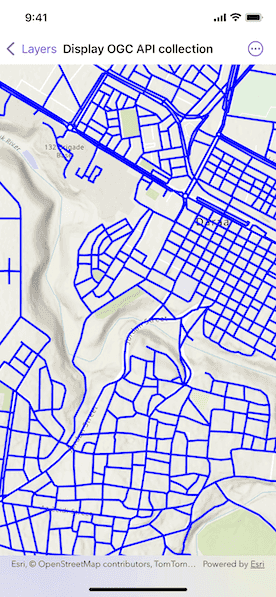
Display an OGC API feature collection and query features while navigating the map view.
Use case
When panning the map view, it may be necessary to query the OGC API feature table for additional features within the new visible extent.
How to use the sample
Pan the map and see how new features are loaded from the OGC API feature service.
How it works
- Create an
OGCFeatureCollectionTableobject using a URL to an OGC API feature service and a collection ID. - Set the feature table's
featureRequestModeproperty tomanualCache. - Create a
FeatureLayerusing the feature table and add it to the map view. - Create a default
QueryParametersobject.- Set the parameter's
spatialRelationshipproperty tointersects. - Set the
maxFeaturesproperty to5_000(some services have a low default value for maximum features).
- Set the parameter's
- Every time the map view navigation completes:
- Set the parameter's
geometryto the current extent of the map view. - Call
OGCFeatureCollectionTable.populateFromService(using:clearCache:outFields:queryLanguage:)using the query parameters.
- Set the parameter's
Relevant API
- OGCFeatureCollectionTable
- QueryParameters
About the data
The Daraa, Syria test data is OpenStreetMap data converted to the Topographic Data Store schema of NGA.
Additional information
See the OGC API website for more information on the OGC API family of standards.
Tags
feature, feature layer, feature table, OGC, OGC API, service, table, web
Sample Code
DisplayOGCAPICollectionView.swift
// Copyright 2025 Esri
//
// Licensed under the Apache License, Version 2.0 (the "License");
// you may not use this file except in compliance with the License.
// You may obtain a copy of the License at
//
// https://www.apache.org/licenses/LICENSE-2.0
//
// Unless required by applicable law or agreed to in writing, software
// distributed under the License is distributed on an "AS IS" BASIS,
// WITHOUT WARRANTIES OR CONDITIONS OF ANY KIND, either express or implied.
// See the License for the specific language governing permissions and
// limitations under the License.
import ArcGIS
import SwiftUI
struct DisplayOGCAPICollectionView: View {
/// A map with an OGC API collection feature layer.
@State private var map: Map = {
let map = Map(basemapStyle: .arcGISTopographic)
// Sets the viewpoint to Daraa, Syria.
map.initialViewpoint = Viewpoint(
latitude: 32.62,
longitude: 36.10,
scale: 20_000
)
// Note: The collection ID can be accessed later via
// `featureCollectionInfo.collectionID` property of the feature table.
let table = OGCFeatureCollectionTable(
url: URL(string: "https://demo.ldproxy.net/daraa")!,
collectionID: "TransportationGroundCrv"
)
// Sets the feature request mode to manual. In this mode, you must
// manually populate the table - panning and zooming won't request
// features automatically.
table.featureRequestMode = .manualCache
let featureLayer = FeatureLayer(featureTable: table)
let lineSymbol = SimpleLineSymbol(style: .solid, color: .blue, width: 3)
featureLayer.renderer = SimpleRenderer(symbol: lineSymbol)
map.addOperationalLayer(featureLayer)
return map
}()
/// The query parameters for the visible extent.
@State private var visibleExtentQueryParameters: QueryParameters = {
let queryParameters = QueryParameters()
queryParameters.spatialRelationship = .intersects
// Sets a limit of 5000 on the number of returned features per request,
// because the default on some services could be as low as 10.
queryParameters.maxFeatures = 5_000
return queryParameters
}()
/// A Boolean value indicating whether the map view is navigating.
@State private var isNavigating = false
/// The error if the populate operation failed, otherwise `nil`.
@State private var populateError: (any Error)?
/// The OGC feature collection table.
private var ogcFeatureTable: OGCFeatureCollectionTable {
(map.operationalLayers.first as! FeatureLayer).featureTable as! OGCFeatureCollectionTable
}
var body: some View {
MapView(map: map)
.onNavigatingChanged { isNavigating = $0 }
.onVisibleAreaChanged {
// Sets the query's geometry to the current visible extent.
visibleExtentQueryParameters.geometry = $0
}
.task(id: isNavigating) {
// Populates features when the map stops panning or zooming.
guard !isNavigating else { return }
do {
// Populates the feature table with the results of a query.
try await ogcFeatureTable.populateFromService(
using: visibleExtentQueryParameters,
clearCache: false
)
} catch {
populateError = error
}
}
.errorAlert(presentingError: $populateError)
}
}
#Preview {
DisplayOGCAPICollectionView()
}