You can build applications that use data services and data files without a network connection.

To display a map or scene in an offline application using data services or data files, you need to construct the map or scene in code.
Use data services
To use a data service in an offline application, you need to download offline data from the data service. Offline data is typically used in applications that have an occasional network connection.
Offline data can be downloaded from the following:
- The basemap styles service
- A custom basemap style
- Feature services
- Vector tile services
- Image tile services
There are two types of offline data that can be generated and downloaded:
- Feature data: A feature service can generate a geodatabase file containing offline feature and non-spatial data. This data can be edited and edits can be synchronized with the source feature service when a network connection is available.
- Tiled data: Other services listed above can generate a package file of read-only tiles, either a vector tile package (VTPK), or an image tile package (TPK).
To learn more, see Offline data.
Use data files
To use a data file in an offline application, you need to sideload or download the data file to the device. You can get data files from many sources, including desktop GIS tools such as ArcGIS Pro, data conversion scripts, and the internet. Data files are typically used in offline applications that are unable to use a network connection.
You can use the following types of data files:
| Data file type | Supports editing |
|---|---|
| Shapefile | Yes |
| Vector tile package | No |
| Image tile package | No |
| Scene Layer Package. For display in scenes only. | No |
| Local raster file. The following raster formats are supported: ASRP/USRP, CIB, CADRG/ECRG, DTED, GeoPackage Raster, GeoTIFF/TIFF, HFA, HRE, IMG, JPEG, JPEG2000, Mosaic Dataset in SQLite, NITF, PNG, RPF, SRTM, CRF, and MrSID. | No |
| OGC GeoPackage (feature data) | Yes |
| OGC GeoPackage (raster data) | No |
| OGC KML file | Yes |
| Electronic Nautical Chart (S-57). For display in maps only. | No |
| Other (e.g. GeoJSON) | Yes |
To learn more, see Data files.
Tutorials
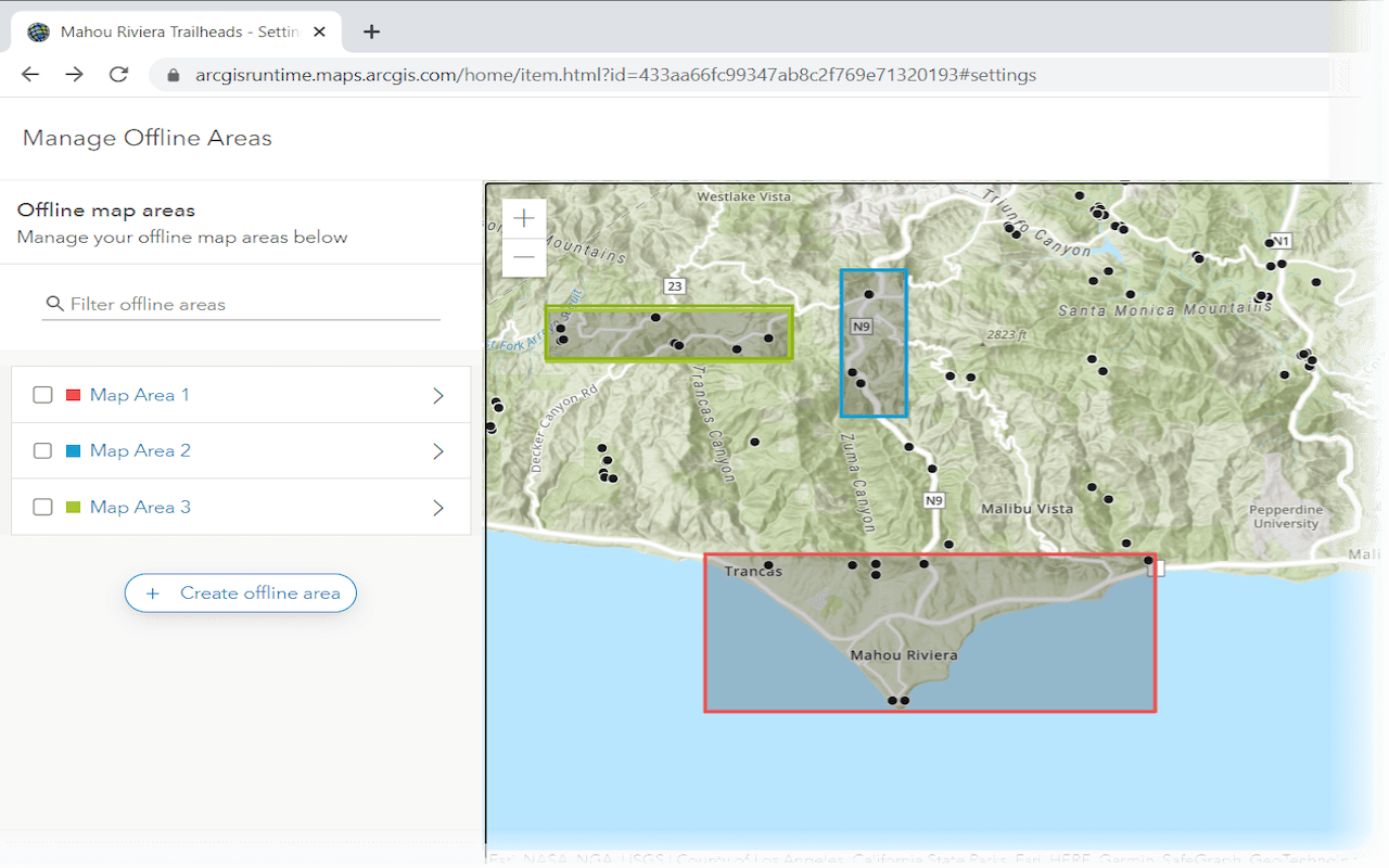
Create an offline map area
Use ArcGIS Online to create an offline map area that can be downloaded by any number of users.
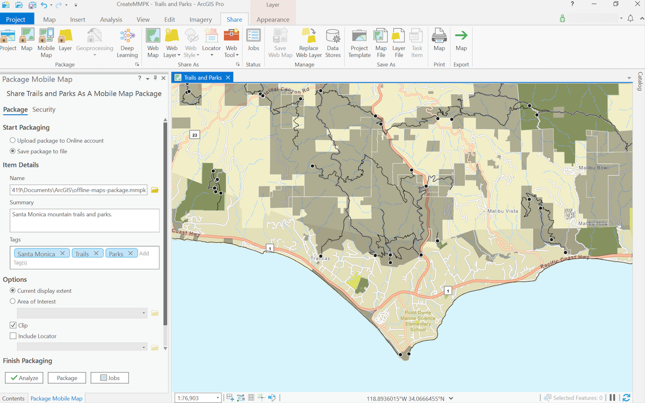
Create a mobile map package
Use ArcGIS Pro to create a mobile map package.
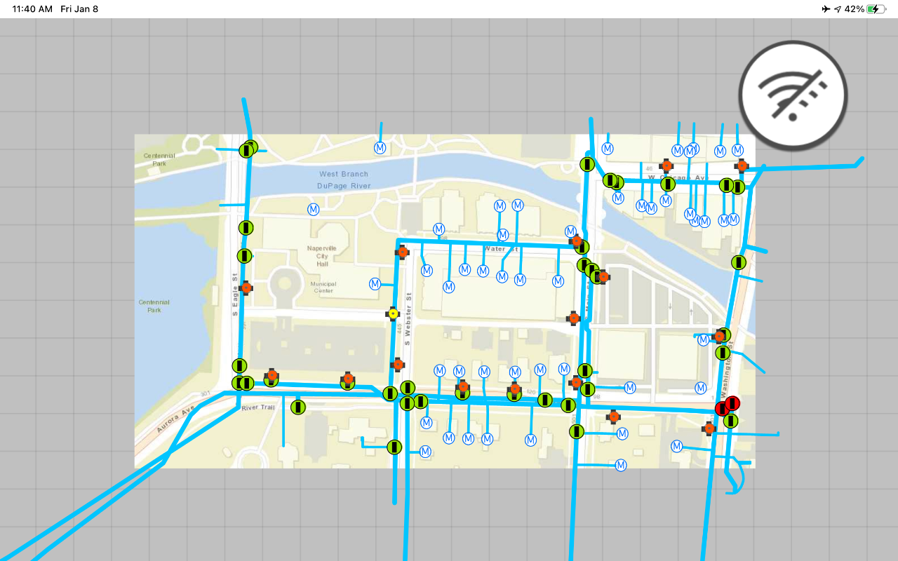
Display an offline map on demand
Download and display an offline map for a custom area of a web map stored in ArcGIS.
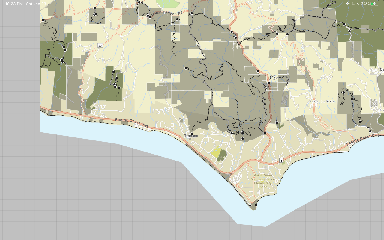
Display a map from a mobile map package
Access and display a map from a mobile map package for offline use.
API support
- 1. Geometry engine
- 2. Manage offline map areas