
What are data services?
Data services, also referred to as hosted data services
When you use ArcGIS to host your data as services, each service is assigned a unique URL by the system, and each service supports a well-defined ArcGIS REST API
The main types of data services covered in this section are feature services, vector tile services, map tile services, and image services. These are all supported by ArcGIS Location Platform
Why use data services?
Data services
Below is a list of the key features that data services
ArcGIS storage
- Store large spatial and non-spatial datasets using ArcGIS Location Platform
ArcGIS Location Platform, formerly known as ArcGIS Platform, is a Platform as a Service (PaaS) product that gives developers access to location services, APIs, and tools to build mapping and spatial analysis applications. It is subscription-based and requires an ArcGIS Location Platform account. , ArcGIS OnlineArcGIS Online is a GIS mapping, analytics, data hosting, and content management software as a service (SaaS) product. It includes applications, tools, APIs, and location services for users and developers. It is subscription-based and requires an ArcGIS Online account. , or ArcGIS EnterpriseArcGIS Enterprise is a GIS mapping, analytics, data hosting, and content management product that can be hosted on-premise or in a cloud infrastructure. It includes software, applications, tools, APIs, and services for users and developers. - Secure data with ArcGIS security and authentication
- Leverage spatial indexes and caching
- Scale storage services if required
- Premium and local storage options are also available to achieve maximum performance
Data management tools
- Use web browser and desktop data management tools
Data management tools are ArcGIS software applications and functionality in portal and ArcGIS Pro that can be used by developers to create, manage, and edit content and data such as web maps, hosted layers, and data services for their applications. to manage data in a portalArcGIS portal, also known as a portal, is a website with applications and tools that can be used to create, manage, access, and share geospatial content and data. It supports security and authentication, developer credentials, content and data service management, user and group management, and site administration. A portal can be hosted in Esri's infrastructure or your own infrastructure. - Import your data and create services dynamically
- Create new types of data services from existing services
- Update or replace your data
- Set sharing and security properties
- Control service capabilities available to clients
- Create and update spatial indexes
- Create and update tile caches
- Monitor all service usage
- Use ArcGIS API for Python
ArcGIS API for Python is a pythonic library for performing GIS visualization, analysis, data management, and GIS system administration tasks. or ArcGIS REST JSArcGIS REST JS is a collection of JavaScript modules that can access ArcGIS location services and ArcGIS Enterprise services. to automate management tasks
Data services
- Store your data securely as a feature service, vector tile service, map tile service, or image service.
- All services provide well-defined ArcGIS REST APIs
- Use built-in security, authentication, and sharing
- Optimize access with caching and indexing
- Perform SQL and spatial queries
- Edit, update, and append feature data dynamically
- Create and manage versions of data
- Support advanced data visualization
- Calculate statistics
- Export data
- Provide offline data support
API access
- Build applications with ArcGIS Maps SDKs (optimized to interact with data services)
- Access with open source libraries such as Leaflet, MapLibre GL JS, OpenLayers, and CesiumJS
- Use scripting languages such as ArcGIS API for Python and ArcGIS REST JS
- Interact with services through well-defined ArcGIS REST APIs
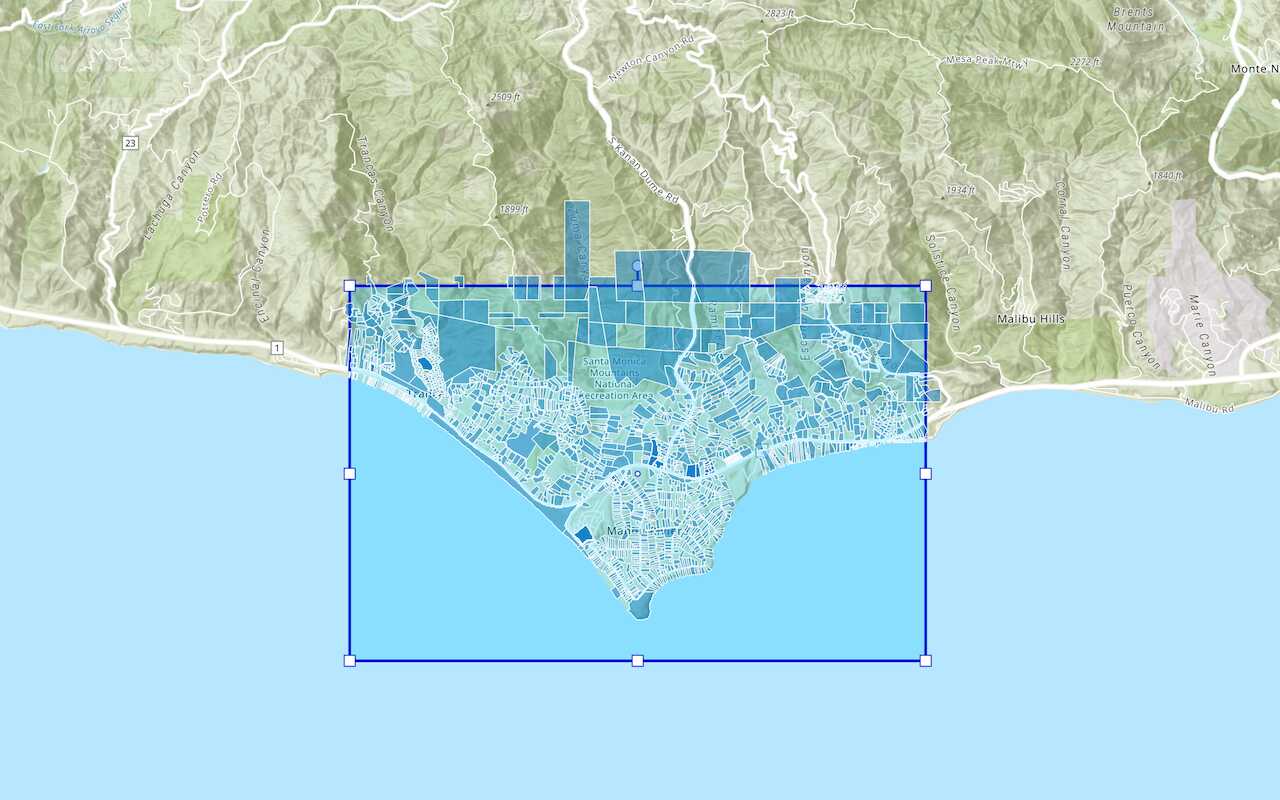
What kind of data can you host?
You can import and host many different types of geographic data as data services
Some examples of data you can host include the following:
- Points of interest, addresses, and attributes
- Trails, contours, lakes, and natural features
- Stores and business locations and attributes
- City, county, state, and country boundaries
- Land parcels and agriculture information
- Transportation and road networks
- Telecommunication infrastructure
- Gas, electric, water, and other utilities
- Health data
- Energy utilities
How to get started
The steps to create data services for your applications include the following:
- Create services with data management tools
- Manage and configure services
- Access services with an API
Tutorials

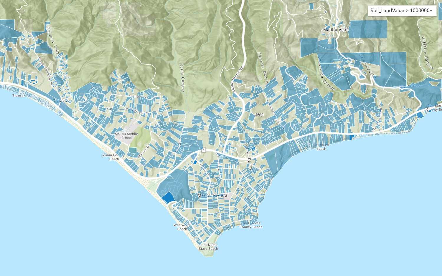
Import data to create a feature layer
Use data management tools to import files and create a feature layer in a feature service.
Define a new feature layer
Use data management tools to define and create a new empty feature layer in a feature service.

Manage a feature layer
Use a hosted feature layer item to set the properties and settings of a feature layer in a feature service.

Create a vector tile service
Use data management tools to create a new vector tile service from a feature service.

Create a map tile service
Use ArcGIS Online or scripting APIs to publish a map tile service.

Add a feature layer
Access and display point, line, and polygon features from a feature service.

Add a vector tile layer

Add a map tile layer
Style a feature layer
Use symbols and renderers to style feature layers.
Query a feature layer (spatial)
Execute a spatial query to get features from a feature layer.
Query a feature layer (SQL)
Execute a SQL query to access polygon features from a feature layer.

Edit feature data

Display a popup
Format a popup to show attributes in a feature layer.
Workflows
Create a feature service for an app
Learn how to import parcel data, create and style a feature layer, and then access the features in an app.

Create a feature layer view for an editor app
Learn how to import parcel data, create and style a feature layer view, and then access the features in an editing app.

Create a vector tile service for an app
Learn how to import parcel data, style a feature layer, and then create a vector tile service for an app.

Create a map tile service for an app
Learn how to import contour data, style a feature layer, and create a map tile service for an app.

Services
Feature service
Add, update, delete, and query feature data.
Vector tile service
Store and access vector tile data.
Map tile service
Store and access map tile data.
Image service
Store and access imagery and raster data.
API support
Use data management tools
- 1. Use portal class and direct REST API requests
- 2. Access via ArcGIS REST JS
- 3. Requires manually setting styles for renderers