Display a scene with a terrain surface and some imagery.
Use case
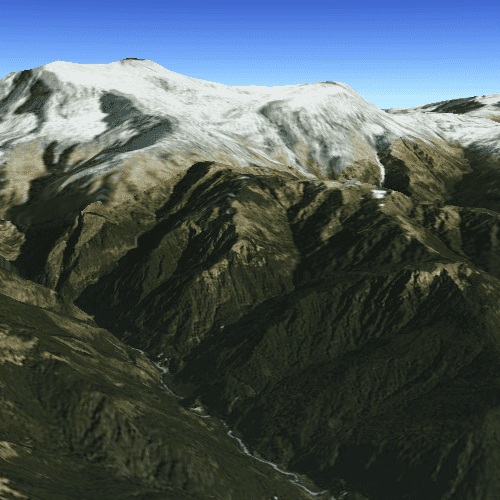
Scene views are 3D representations of real-world areas and objects. Scene views are helpful for visualizing complex datasets where 3D relationships, topography, and elevation of elements are important factors.
How to use the sample
When loaded, the sample will display a scene. Pan and zoom to explore the scene.
How it works
- Create a
Sceneobject with a basemap using theBasemapImageryWithLabels. - Create an
ArcGISTiledElevationSourceobject and add it to the scene's base surface. - Create a
SceneViewobject to display the map. - Set the scene to the scene view.
Relevant API
- ArcGISTiledElevationSource
- Scene
- SceneView
Tags
3D, basemap, elevation, scene, surface
Sample Code
BasicSceneView.qml
// [WriteFile Name=BasicSceneView, Category=Scenes]
// [Legal]
// Copyright 2016 Esri.
// Licensed under the Apache License, Version 2.0 (the "License");
// you may not use this file except in compliance with the License.
// You may obtain a copy of the License at
// http://www.apache.org/licenses/LICENSE-2.0
// Unless required by applicable law or agreed to in writing, software
// distributed under the License is distributed on an "AS IS" BASIS,
// WITHOUT WARRANTIES OR CONDITIONS OF ANY KIND, either express or implied.
// See the License for the specific language governing permissions and
// limitations under the License.
// [Legal]
import QtQuick
import QtQuick.Controls
import Esri.ArcGISRuntime
Rectangle {
width: 800
height: 600
//! [create the scene with a basemap and surface]
// Create a scene view
SceneView {
anchors.fill: parent
Component.onCompleted: {
// Set the focus on SceneView to initially enable keyboard navigation
forceActiveFocus();
// set viewpoint to the specified camera
setViewpointCameraAndWait(camera);
}
// create a scene...scene is a default property of sceneview
// and thus will get added to the sceneview
Scene {
// add a basemap
Basemap {
initStyle: Enums.BasemapStyleArcGISImagery
}
// add a surface...surface is a default property of scene
Surface {
// add an arcgis tiled elevation source...elevation source is a default property of surface
ArcGISTiledElevationSource {
url: "https://elevation3d.arcgis.com/arcgis/rest/services/WorldElevation3D/Terrain3D/ImageServer"
}
}
}
}
//! [create the scene with a basemap and surface]
//! [create the camera to be used as the scene view's viewpoint]
Camera {
id: camera
heading: 10.0
pitch: 80.0
roll: 0.0
Point {
x: 83.9
y: 28.4
z: 10010.0
spatialReference: SpatialReference { wkid: 4326 }
}
}
//! [create the camera to be used as the scene view's viewpoint]
}