Build a legend for all the operational layers in the map.
Use case
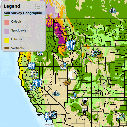
Legends are used to describe what each symbol on a map represents. A common format is to show an image of the symbol alongside of a text description of what that symbol represents. This sample demonstrates how a simple legend can be built up in code using the LayerContent interface.
How to use the sample
- Open the sample
- Flick through the legend control to see the various elements that represent features on the map.
How it works
- Layers implement the
LayerContentinterface, which contain a list ofLegendInfo.LegendInfocontains aSymboland a name string.Layer.autoFetchLegendInfosmust be called on eachLayerinstance to fetch the info from the data. - All of the resulting LegendInfo objects are passed into the
LegendInfoListModel. - A QML
ListViewdirectly consumes this model, and separates each item by using asection.
Relevant API
- Layer.autoFetchLegendInfos
- LayerContent
- LegendInfo
- LegendInfoListModel
Tags
legend, legend info, symbol swatch, toolkit
Sample Code
BuildLegend.qml
// [WriteFile Name=BuildLegend, Category=DisplayInformation]
// [Legal]
// Copyright 2016 Esri.
// Licensed under the Apache License, Version 2.0 (the "License");
// you may not use this file except in compliance with the License.
// You may obtain a copy of the License at
// http://www.apache.org/licenses/LICENSE-2.0
// Unless required by applicable law or agreed to in writing, software
// distributed under the License is distributed on an "AS IS" BASIS,
// WITHOUT WARRANTIES OR CONDITIONS OF ANY KIND, either express or implied.
// See the License for the specific language governing permissions and
// limitations under the License.
// [Legal]
import QtQuick
import QtQuick.Controls
import Esri.ArcGISRuntime
Rectangle {
width: 800
height: 600
// Create the MapView
MapView {
anchors.fill: parent
Component.onCompleted: {
// Set the focus on MapView to initially enable keyboard navigation
forceActiveFocus();
}
// Nest the Map as a child of the MapView
Map {
id: map
// automatically fetch the legend infos for all operational layers
autoFetchLegendInfos: true
// Nest the Basemap to add it as the Map's Basemap
Basemap {
initStyle: Enums.BasemapStyleArcGISTopographic
}
// Add a map image layer as an operational layer
ArcGISMapImageLayer {
id: mapImageLayer
url: "https://sampleserver6.arcgisonline.com/arcgis/rest/services/Census/MapServer"
}
// Add a feature layer as an operational layer
FeatureLayer {
id: featureLayer
featureTable: ServiceFeatureTable {
url: "https://sampleserver6.arcgisonline.com/arcgis/rest/services/Recreation/FeatureServer/0"
}
}
// Set the initial viewpoint
initialViewpoint: ViewpointCenter {
center: Point {
x: -11e6
y: 6e6
spatialReference: SpatialReference {wkid: 102100}
}
targetScale: 9e7
}
}
}
// Create outter rectangle for the legend
Rectangle {
id: legendRect
anchors {
margins: 10
left: parent.left
top: parent.top
}
property bool expanded: true
height: 200
width: 175
color: "lightgrey"
opacity: 0.95
radius: 10
clip: true
border {
color: "darkgrey"
width: 1
}
// Animate the expand and collapse of the legend
Behavior on height {
SpringAnimation {
spring: 3
damping: .4
}
}
// Catch mouse signals so they don't propagate to the map
MouseArea {
anchors.fill: parent
onClicked: mouse => mouse.accepted = true
onWheel: wheel => wheel.accepted = true
}
// Create UI for the user to select the layer to display
Column {
anchors {
fill: parent
margins: 10
}
spacing: 2
Row {
spacing: 55
Text {
text: qsTr("Legend")
font {
pixelSize: 18
bold: true
}
}
// Legend icon to allow expanding and collapsing
Image {
source: legendRect.expanded ? "qrc:/Samples/DisplayInformation/BuildLegend/ic_menu_legendpopover_light_d.png" : "qrc:/Samples/DisplayInformation/BuildLegend/ic_menu_legendpopover_light.png"
width: 28
height: width
MouseArea {
anchors.fill: parent
onClicked: {
if (legendRect.expanded) {
legendRect.height = 40;
legendRect.expanded = false;
} else {
legendRect.height = 200;
legendRect.expanded = true;
}
}
}
}
}
// Create a list view to display the legend
ListView {
id: legendListView
anchors.margins: 10
width: 165
height: 150
clip: true
model: map.legendInfos
// Create delegate to display the name with an image
delegate: Item {
width: parent ? parent.width : 0
height: 35
clip: true
Row {
spacing: 5
anchors.verticalCenter: parent.verticalCenter
Image {
anchors.verticalCenter: parent.verticalCenter
width: 24
height: width
source: symbolUrl
}
Text {
anchors.verticalCenter: parent.verticalCenter
width: 125
text: name
wrapMode: Text.WordWrap
font.pixelSize: 12
}
}
}
section {
property: "layerName"
criteria: ViewSection.FullString
labelPositioning: ViewSection.CurrentLabelAtStart | ViewSection.InlineLabels
delegate: Rectangle {
width: 180
height: childrenRect.height
color: "lightsteelblue"
Text {
text: section
font.bold: true
font.pixelSize: 13
}
}
}
}
}
}
}