Select features in a feature layer.
Use case
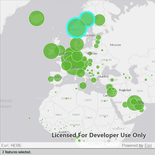
Selecting features, whether by query or identify, can be an important step both in editing data and visualizing results. One possible use case would be to query a feature layer containing street furniture. A query might look for type "bench" and return a list of bench features contained in the features with an attribute of type bench. These might be selected for further editing (see FeatureQueryResult) or may just be highlighted visually.
How to use the sample
Click on a feature in the map. All features within a given tolerance (in pixels) of the click will be selected.
How it works
- Create a
ServiceFeatureTablefrom a feature service URL. - Create a
FeatureLayerfrom the service feature table. - Identify nearby features at the clicked location using
identifyLayerWithMaxResults(featureLayer, mouse.x, mouse.y, tolerance, returnPopupsOnly, maxResults)on the map view. - Select all identified features in the feature layer with
selectFeatures(features).
Relevant API
- Feature
- FeatureLayer
- ServiceFeatureTable
About the data
This sample uses the Gross Domestic Product, 1960-2016 feature service. Only the 2016 GDP values are shown.
Tags
features, layers, select, selection, tolerance
Sample Code
// [WriteFile Name=FeatureLayer_Selection, Category=Features]
// [Legal]
// Copyright 2016 Esri.
// Licensed under the Apache License, Version 2.0 (the "License");
// you may not use this file except in compliance with the License.
// You may obtain a copy of the License at
// http://www.apache.org/licenses/LICENSE-2.0
// Unless required by applicable law or agreed to in writing, software
// distributed under the License is distributed on an "AS IS" BASIS,
// WITHOUT WARRANTIES OR CONDITIONS OF ANY KIND, either express or implied.
// See the License for the specific language governing permissions and
// limitations under the License.
// [Legal]
import QtQuick
import QtQuick.Controls
import Esri.ArcGISRuntime
Rectangle {
width: 800
height: 600
property string displayText: "Click or tap to select features."
// Map view UI presentation at top
MapView {
id: mapView
anchors {
left: parent.left
right: parent.right
top: parent.top
bottom: messageBar.top
}
wrapAroundMode: Enums.WrapAroundModeDisabled
Component.onCompleted: {
// Set the focus on MapView to initially enable keyboard navigation
forceActiveFocus();
}
Map {
id: map
Basemap {
initStyle: Enums.BasemapStyleArcGISLightGray
}
FeatureLayer {
id: featureLayer
// feature table
ServiceFeatureTable {
id: featureTable
url: "https://services1.arcgis.com/4yjifSiIG17X0gW4/arcgis/rest/services/GDP_per_capita_1960_2016/FeatureServer/0"
}
}
onLoadStatusChanged: {
if (loadStatus === Enums.LoadStatusLoaded) {
mapView.setViewpoint(viewPoint);
}
}
}
// initial viewpoint
ViewpointExtent {
id: viewPoint
Envelope {
xMin: -6603299.491810
yMin: 1679677.742046
xMax: 9002253.947487
yMax: 8691318.054732
SpatialReference {
wkid: 3857
}
}
}
//! [identify feature layer qml api snippet]
onMouseClicked: mouse => {
const tolerance = 22;
const returnPopupsOnly = false;
const maximumResults = 1000;
mapView.identifyLayerWithMaxResults(featureLayer, mouse.x, mouse.y, tolerance, returnPopupsOnly, maximumResults);
}
onIdentifyLayerStatusChanged: {
// When MapView.identifyLayerWithMaxResults completes,
// it will populate the MapView.identifyLayerResult property
// with an IdentifyLayerResult object that we can utilize
if (identifyLayerStatus === Enums.TaskStatusCompleted) {
// clear any previous selections
featureLayer.clearSelection();
// create an array to store the features
const identifiedObjects = [];
for (let i = 0; i < identifyLayerResult.geoElements.length; i++){
const elem = identifyLayerResult.geoElements[i];
identifiedObjects.push(elem);
}
// cache the number of identifyLayerResult
const count = identifyLayerResult.geoElements.length;
// select the features in the feature layer
featureLayer.selectFeatures(identifiedObjects);
displayText = "%1 %2 selected.".arg(count).arg(count > 1 ? "features" : "feature");
}
}
//! [identify feature layer qml api snippet]
}
Rectangle {
id: messageBar
anchors {
left: parent.left
right: parent.right
bottom: parent.bottom
}
height: 30
color: "lightgrey"
border {
width: 0.5
color: "black"
}
Text {
id: msgText
anchors {
verticalCenter: parent.verticalCenter
left: parent.left
leftMargin: 10
}
text: displayText
font.pixelSize: 14
}
}
}